Finally - Ben Cleuch and other throughts on life in Aberdeenshire in the past week!
9 minute film
Thursday 25th November 2021
Long awaited work meeting at an Edinburgh city centre hotel. I hadn’t seen any of my colleagues for two years! They headed off to the pub at 2200. I went to bed and set the alarm for 0600h
Friday 26th November
Woke up 0735h. Turns out I’d set the phone alarm for Saturday. Not the first time I’ve done this. By 0800 I’m boarding a bus heading for the Hermiston Gate Park and ride on the western limits of the city and by 0910 I’m parked up in Upper Mill Street, Tillicoultry. I had to skip the hotel breakfast, but grabbed some protein on the way. It was chicken on a lollipop.
Why the rush? Well Storm Arwen was on her way. If I got up and down before lunchtime, I’d enjoy sunshine and stiff winds. Any later than that and I’d risk foul weather on top and the risk of not getting home (100 miles north).
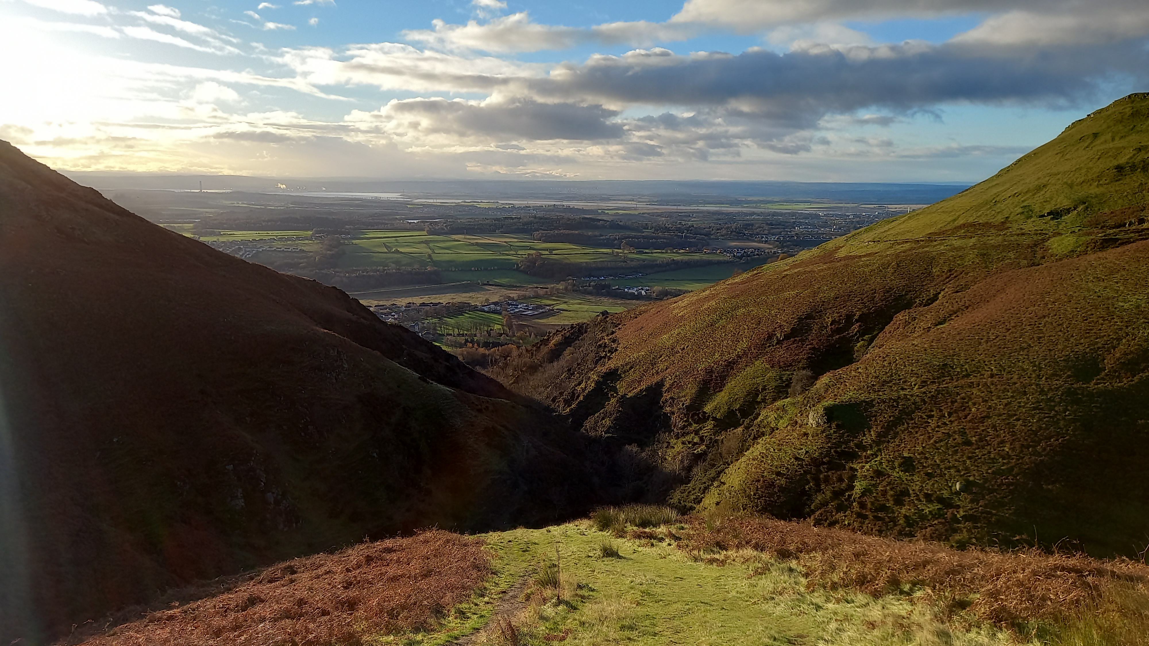
I lived in this area for five years a while back and it was great to be back in one of the numerous glens that cut northwards into the Ochil Hills from the various “Hillfoots” villages that hug the southern end of the range. The glens are are all unique and worth exploring in their own right.
Mill Glen
Looking back south down the glen
The tight rocky glen soon gave way to steep, open grassy slopes and I was soon atop The Law. That’s when the full force of the north wind hit. The steep part of the climb over, I decided to layer up with fleece, shell, hat, gloves and goggles, before plodding along more gentle slopes for the last 1.5km to Ben Cleuch.
Uploading: 20211126_093606 (2).jpg…
Up to The Law
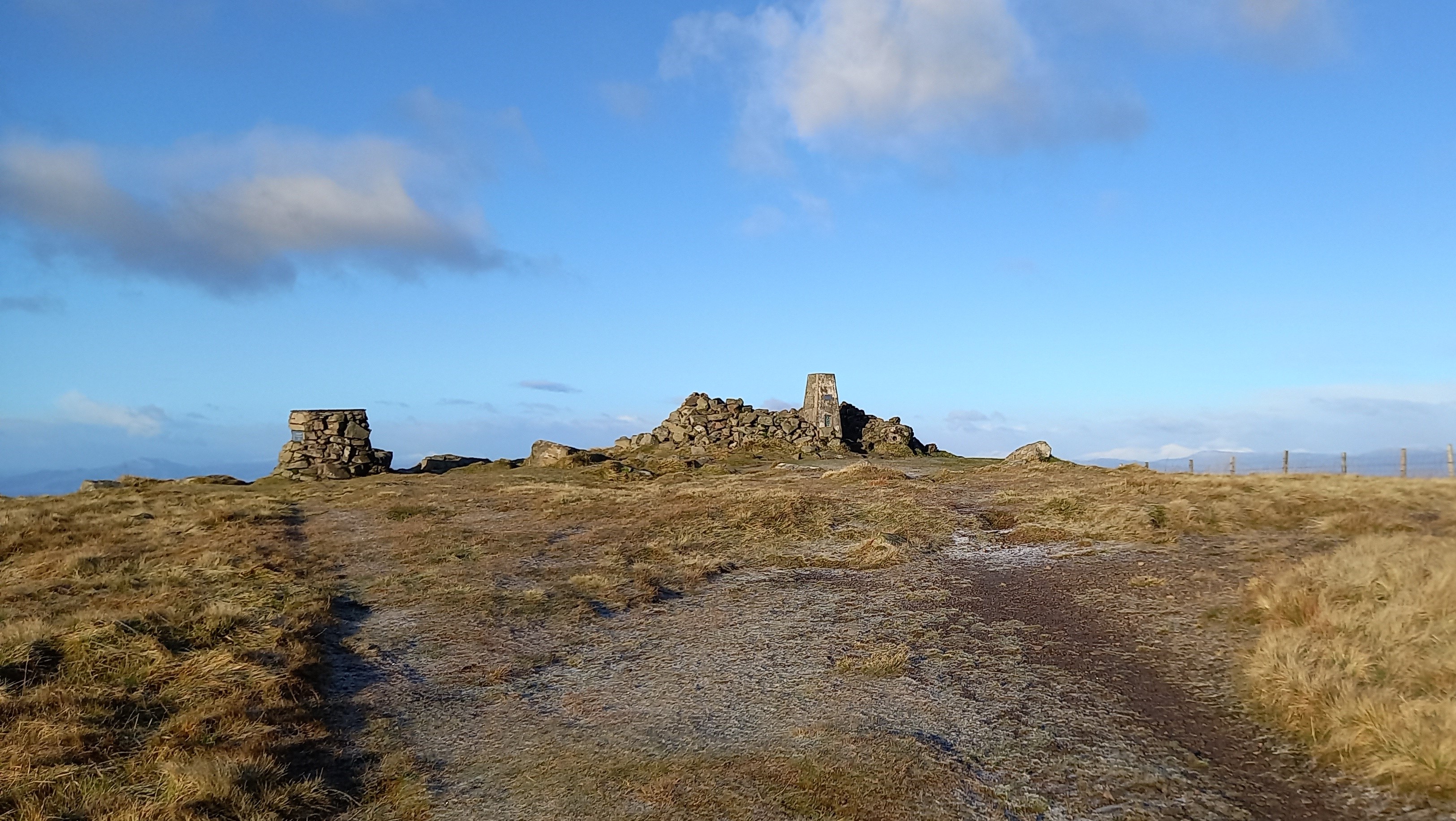
Ben Cleuch GM/SS-059
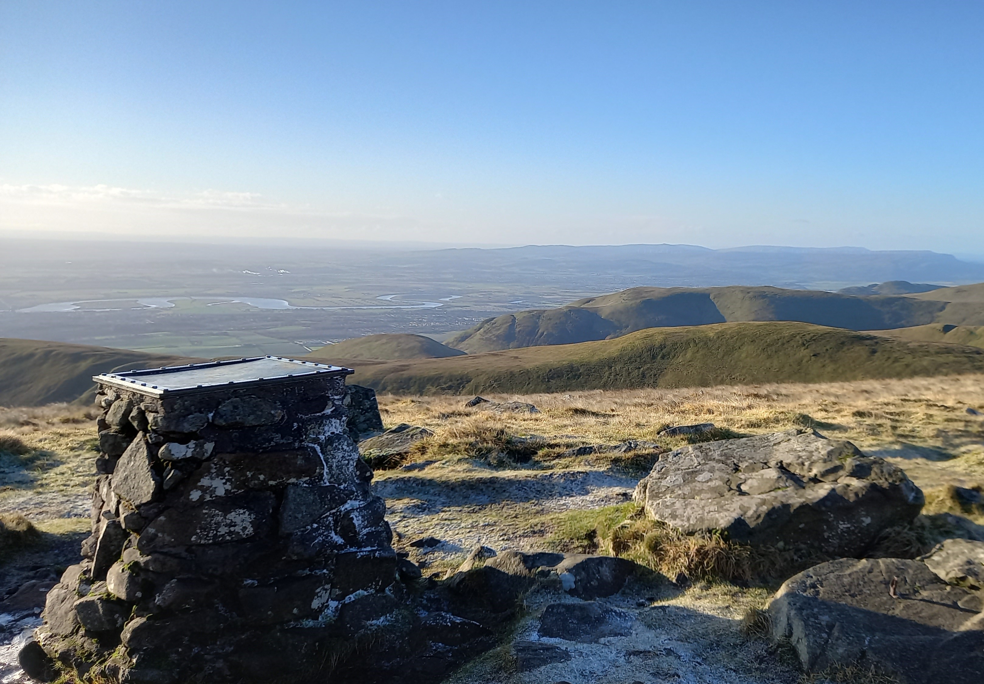
Looking south over the River Forth valley
Ben Cleuch has a great take off to the south, being on the edge of the Forth valley. Most of the entire central belt of Scotland is in 2m Hand-held range. For this reason, the Yaesu ft-3d was the only radio with me, however I had strapped the 2m/70cm half-wave to my rucksack and planned on using this to activate the summit.
The activation was brief! I worked five stations in a matter of minutes, wandering around the top, trying to shield the hand mic. from the worst of the wind. The ft-3d SD card was my log today, as it was too tricky to juggle hand mic. pen and paper in the wind.
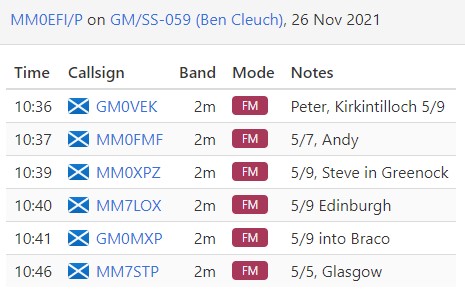
The first station I worked mis-heard my QSY frequency, so I had to move to the one he was on and re-direct him, and probably a few others who’d moved there too, but apart from that it was plain sailing. I worked Andy @MM0FMF (for his Complete), who was casually in his back bedroom on his hand held.
Being pedestrian mobile meant there was no packing up to do and I was soon on my way back down the hill, following the route of ascent.
Summary
Ascent - 2.5 miles 1hr 10 mins
Descent - 2.5 miles 55 mins
As I approached the upper reaches of the glen, my phone pinged. Met Office Red weather warning for the east coast. 100mph winds, potential for loss of life. Snow for Aberdeenshire. Mmmm…
I was back in the car and driving at 1200h.
Now, there are three main routes back into Deeside (my home) from the south. Glenshee at 665m, 2200’, the Cairn ‘O Mount a 455m, 1500’ and the Slug Road, 260m, 850’.
Approaching Perth, I called my friend Charlie MM6CHN, who lives in Braemar. “Avoid Glenshee. Drifting snow.” The snow was to be worst in the west of Aberdeenshire and the wind worst in the east, so I opted for the middle route, The Cairn o’ Mount. This was in itself a calculated risk. It is a ‘B’ road, often isn’t ploughed, has nasty hairpins at the very top and I’d neglected to fit the winter tyres to my BMW X4.
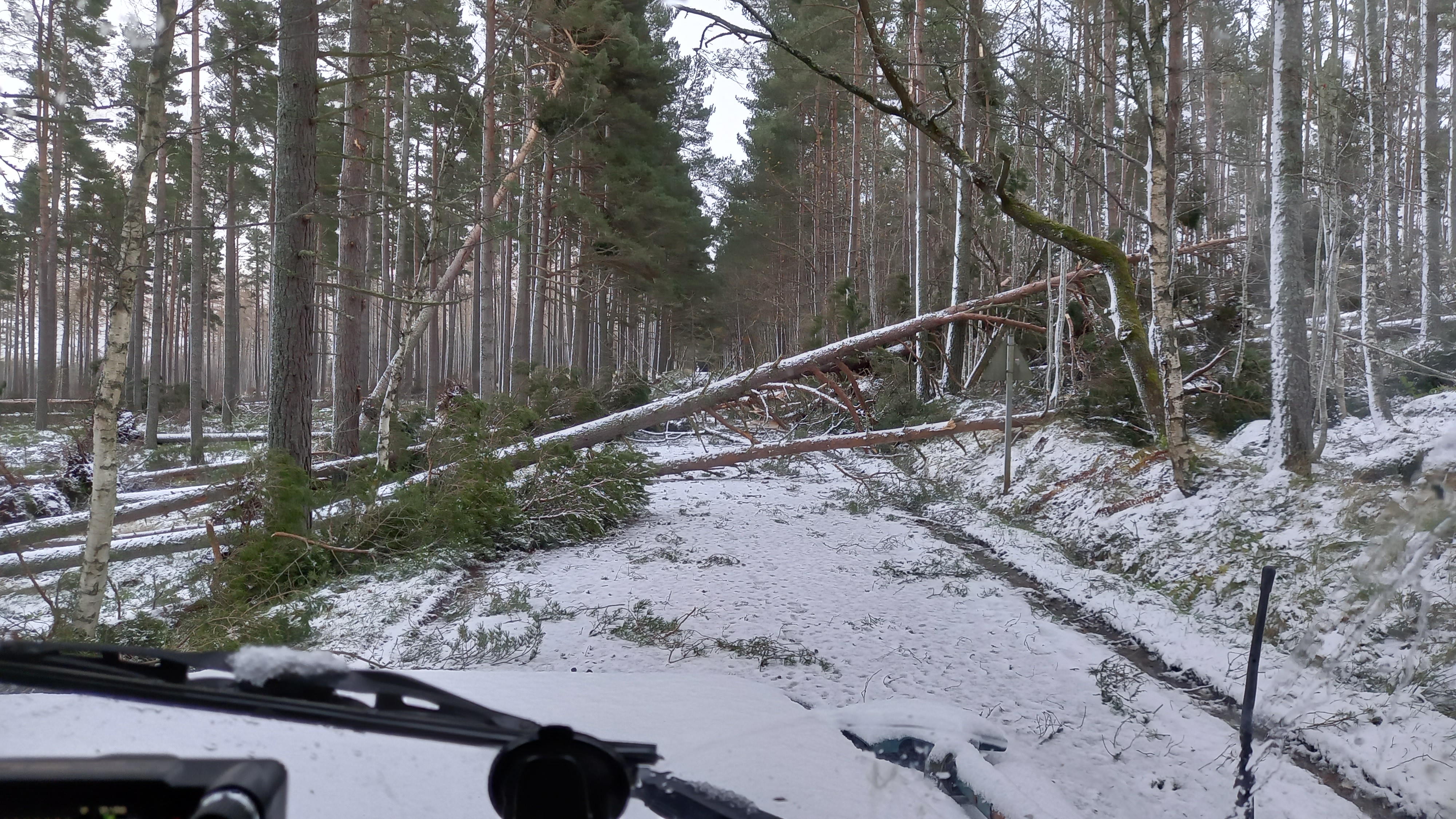
1400h and I’m nearing the top of the “Cairn” road, the snow getting deeper as altitude was gained. I then came across a Porsche Cayenne straddling the lower hairpin. Like me, he was on the wrong tyres. I had to stop and knew that it was game over. I slithered round, headed back down and had to take the much longer route over the Slug Road to get back home.
By the time I was eventually home at 1500, snow gates had been closed on Glenshee, The Cairn and the Lecht, pretty much shutting Deeside off from most directions.
The power went off at 1800h. As did the internet. As did the mobile networks - all of them. We had the log burner going and a steady supply of candles, so no issues.
Saturday 27th November
Woke up and the power/phones still down. As the manager of a large business on the edge of Aberdeen, I had a duty to try and at least make contact with the team to make sure the building was at least still standing and that everyone was OK, so I headed off to work in the Defender 110 at 0900. Spare clothes, food, recovery gear and the chainsaw came with me. I had to drive for 20 miles before I could get a phone signal. Only when reviewing news websites at work (where all was OK) did I realise the full extent of the problem and that it could be a long time before we were back to normal.
Winter Resilience
If you’re still reading this, I thought I’d put down a few thoughts on our resilience.
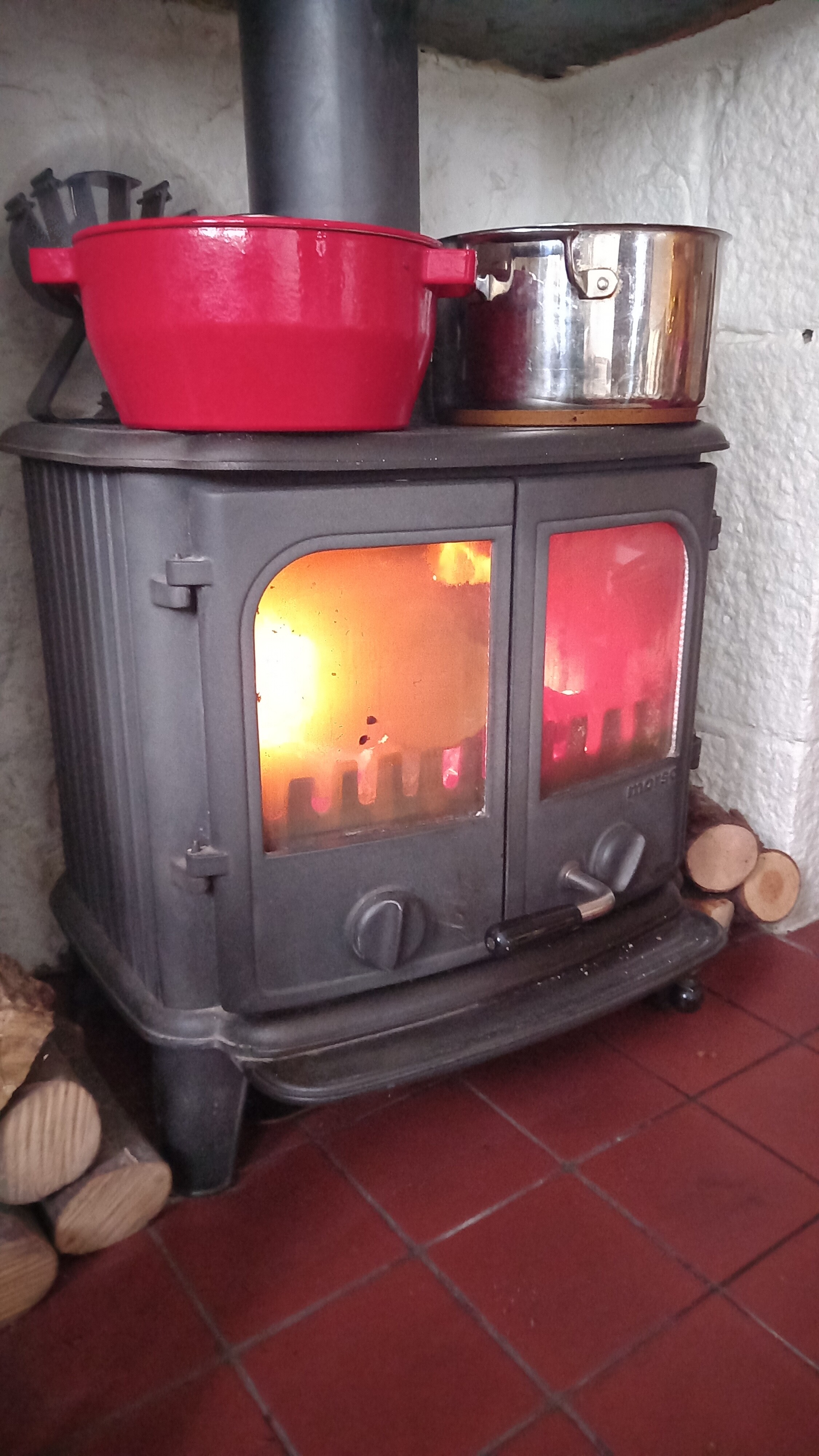
Heating - no problem. Log burner and plenty of logs
Water - mains connected, so all good. Two full water butts (which we have had to filter and use in the past). Outlying homes have a private supply or well and water is pumped electrically. These homes had no water.
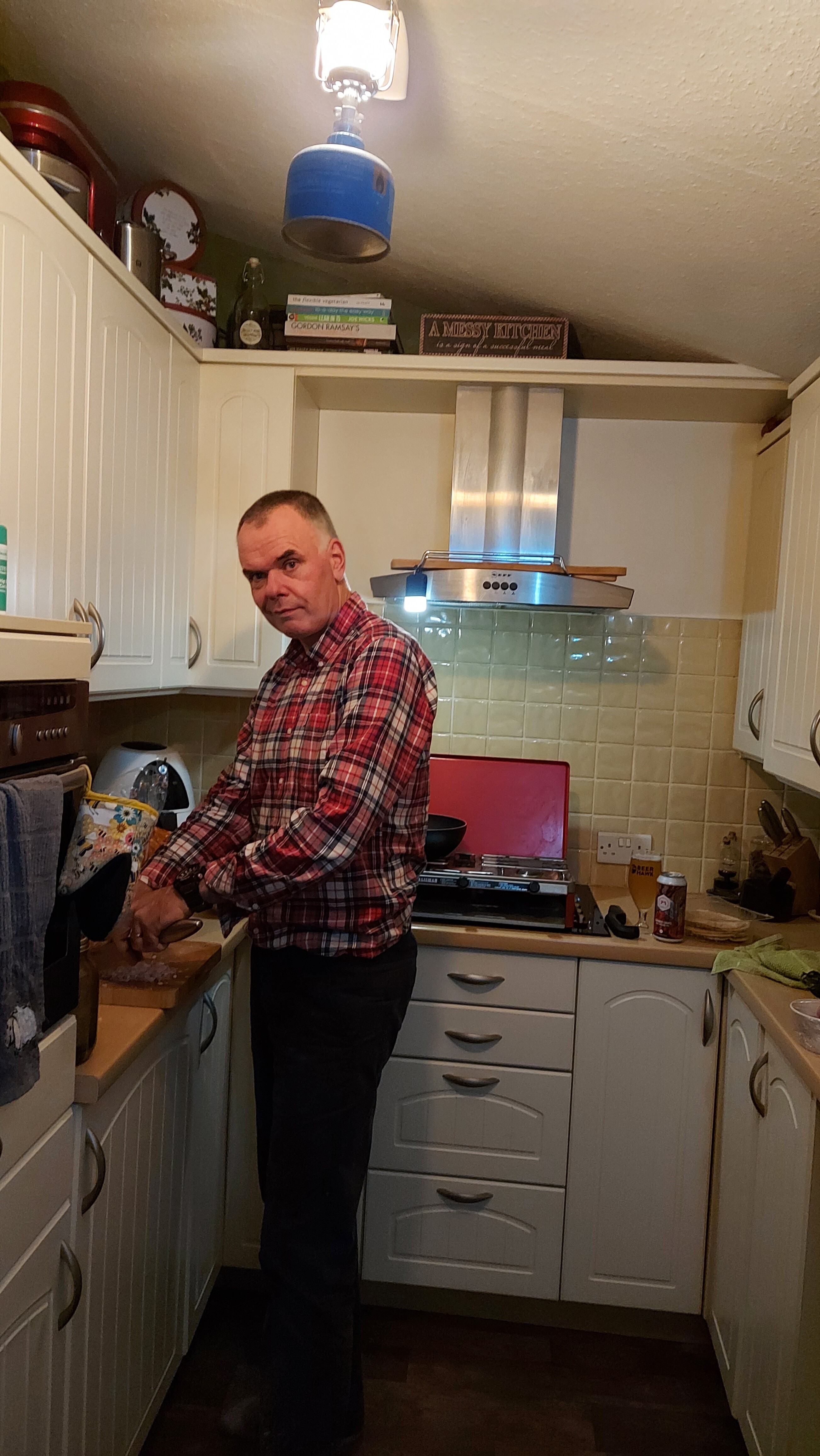
Cooking - all good. Double burner stove and gas bottle. Additional double burner cooker in Dora (Land Rover Camper). Small stove for cups of tea donated to the neighbours who only had a gas BBQ and couldn’t get the gas to flow in the freezing conditions.
By Sunday, Mo was using the wood burner as a slow cooker. The best Mince, tatties and white pudding ever!
Lighting - no issues. Old camping gaz lantern and multiple LED lights pressed into service. Head torches essential.
Home cooked Madras curry by gaslight
Log burner slow cooker
Communication - rather poor
Dual SIM phone useless
No internet
Internal phones are both DECT, so useless. We left the last landline phone at our last house move.
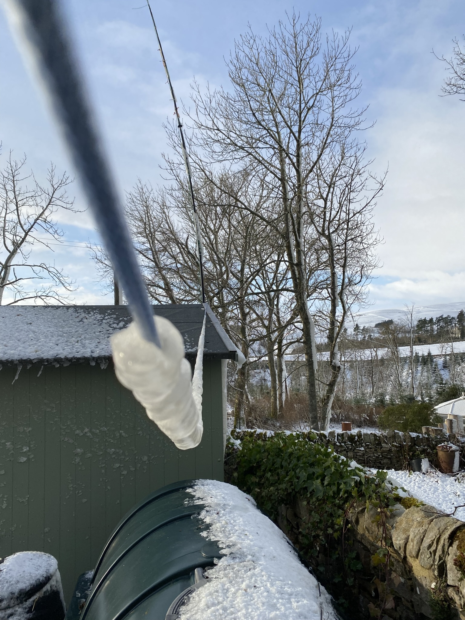
I run an APRS digipeater. It has a homemade SLAB UPS. However, it was useless due to the nearest APRS repeater being almost 30 miles away. So, no way to send or receive messages or emails over RF or through the internet using this. I turned it off.
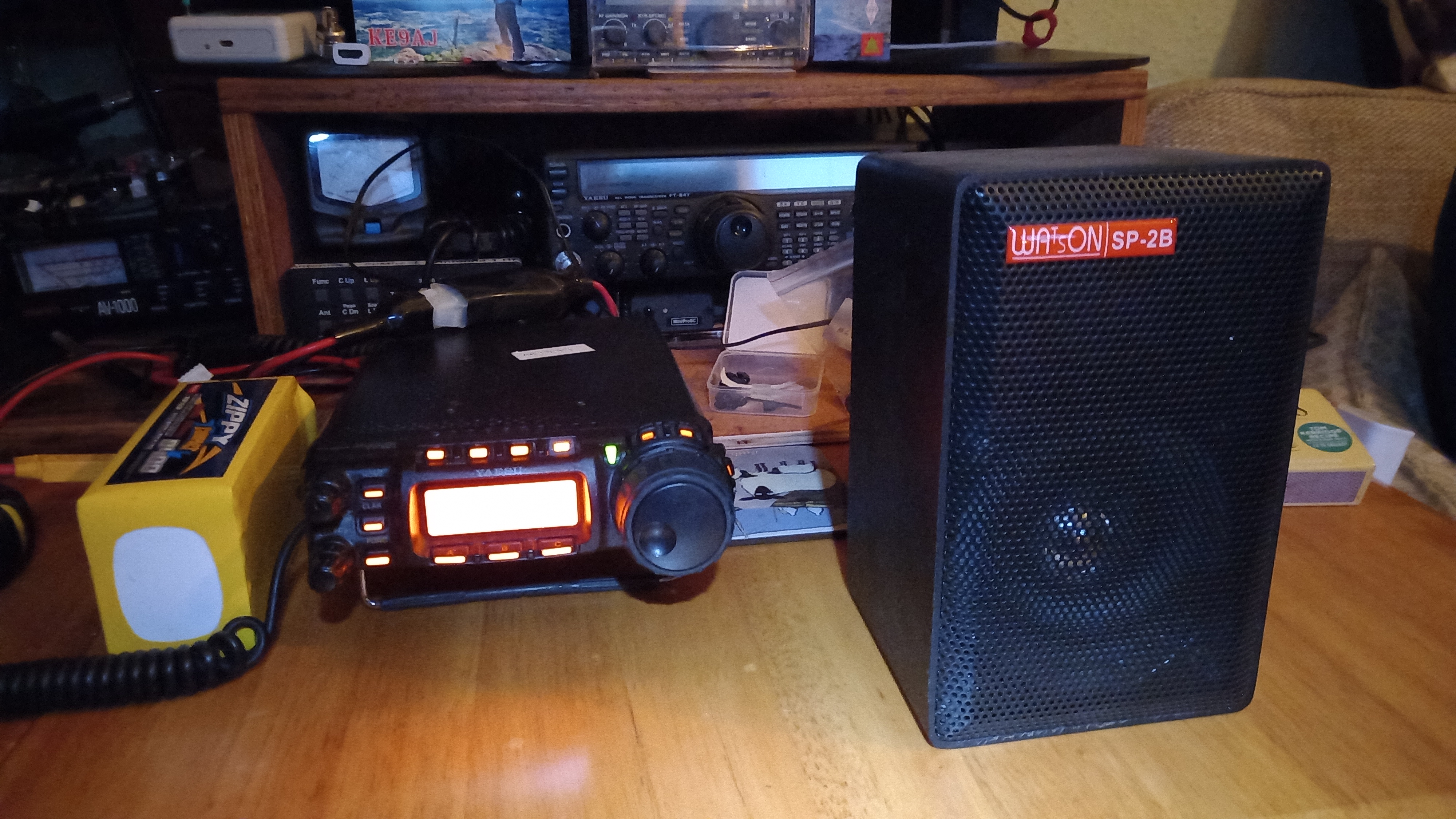
Radio - the only battery powered radio(s) - amateur handhelds. We listened to Radio 2 and Radio Scotland on Saturday night using the FT-3d and a long extendable whip.
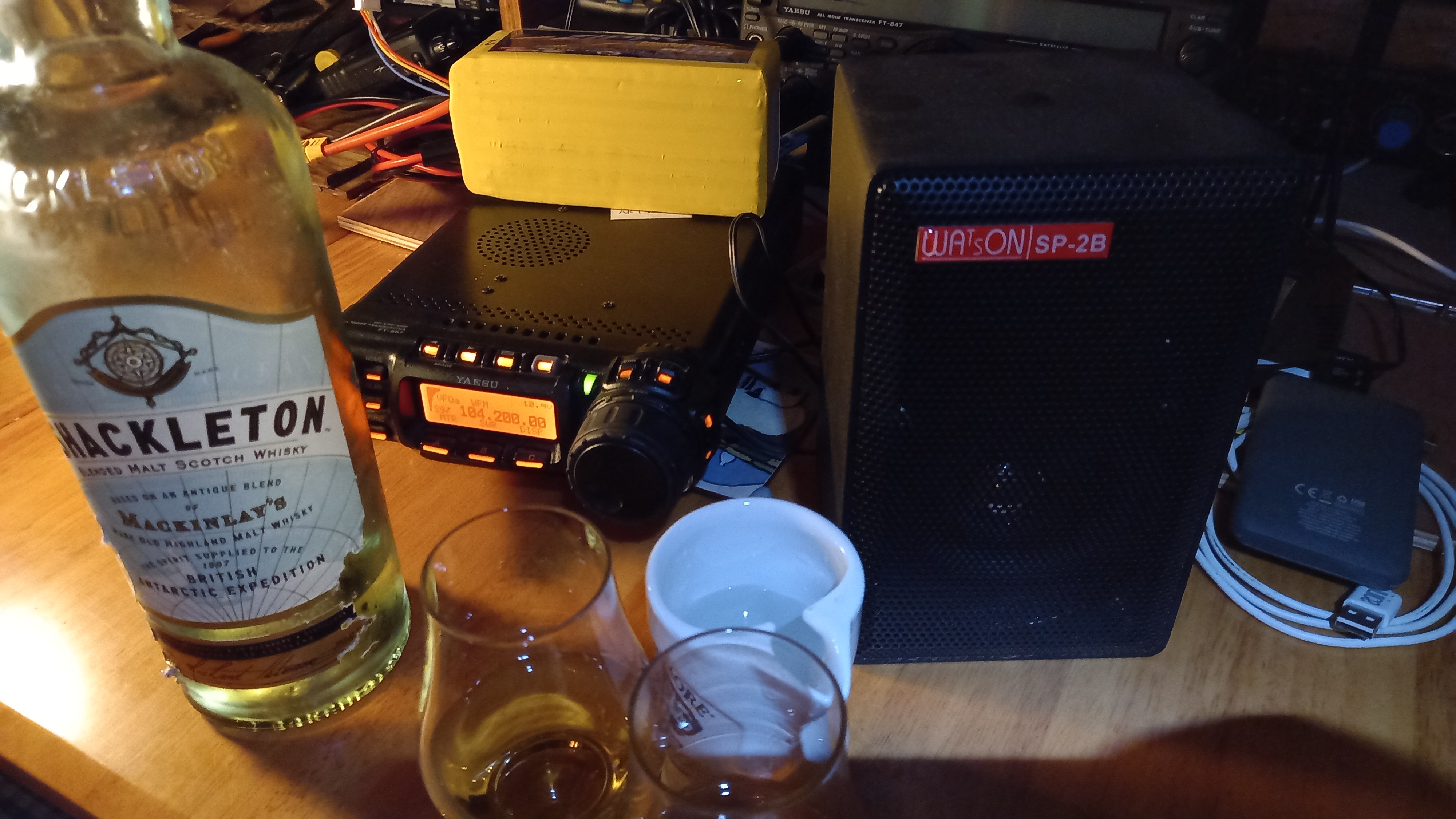
My small and little used shack is in a bothy in our garden. Sunday we lit the fire there and I hooked up my FT-857 to a LiFePO4 and connected it to the wire (W3EDP) antenna in the garden. The output was fed to an old Watson speaker for much improved reception and much improved audio. At least now we got updates on the outage and WX.
MKII listening set
Hygiene - water warmed on the stove and then a basin bath in front of the fire. Electric toothbrushes had a charge thankfully!
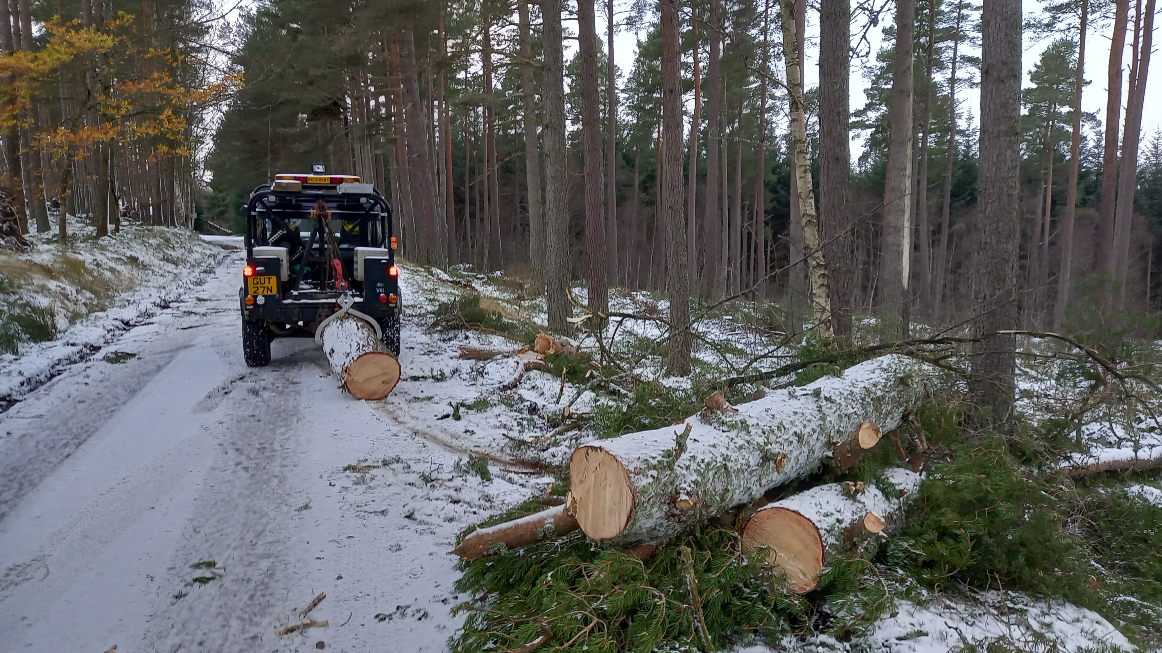
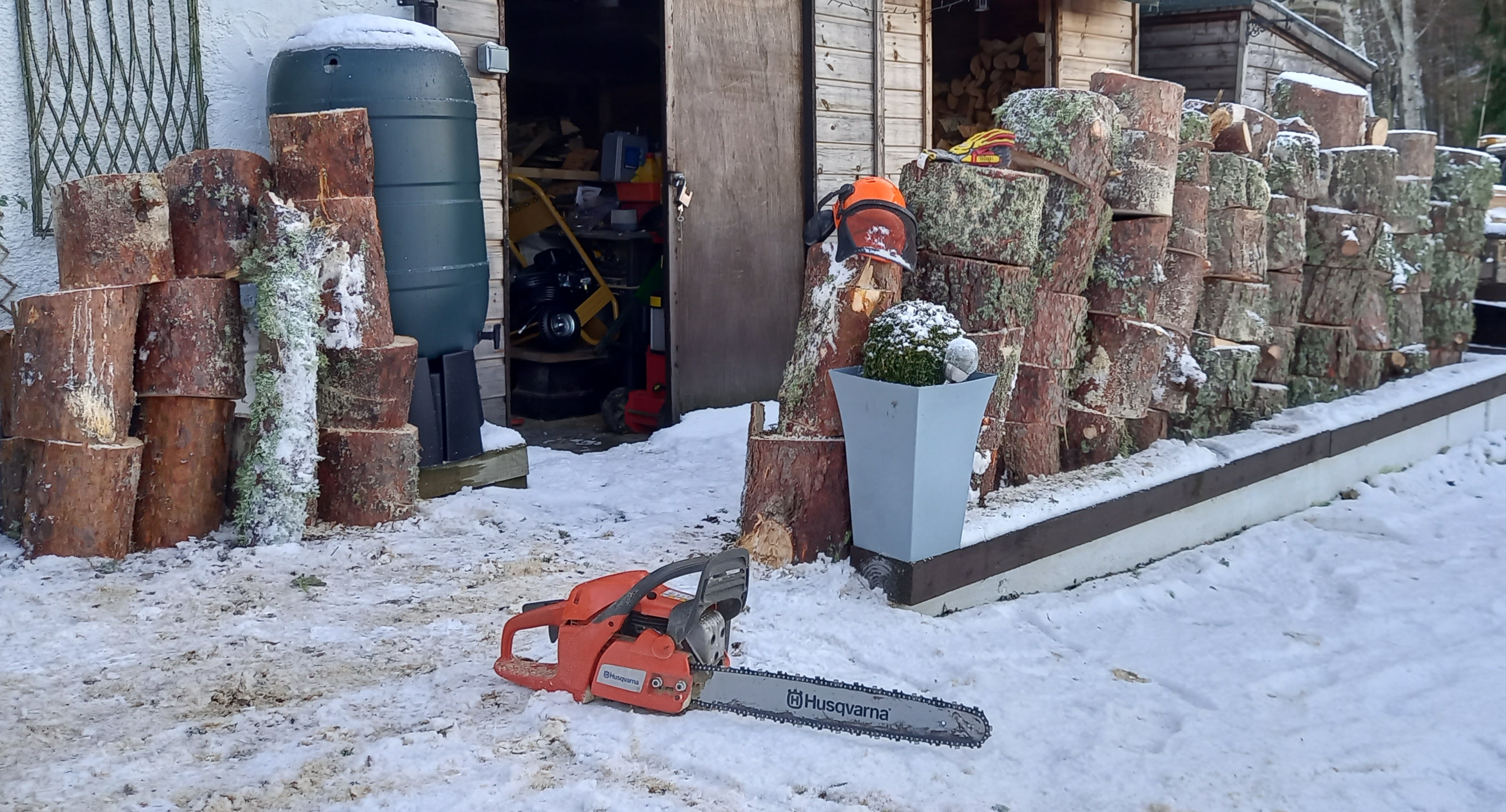
Transport - no issue, with four Land Rovers in residence. One pressed in to service to clear a road on Sunday (much free firewood gained).
Recovery crane used to lift trunk sections
four hours back breaking work with the chainsaw
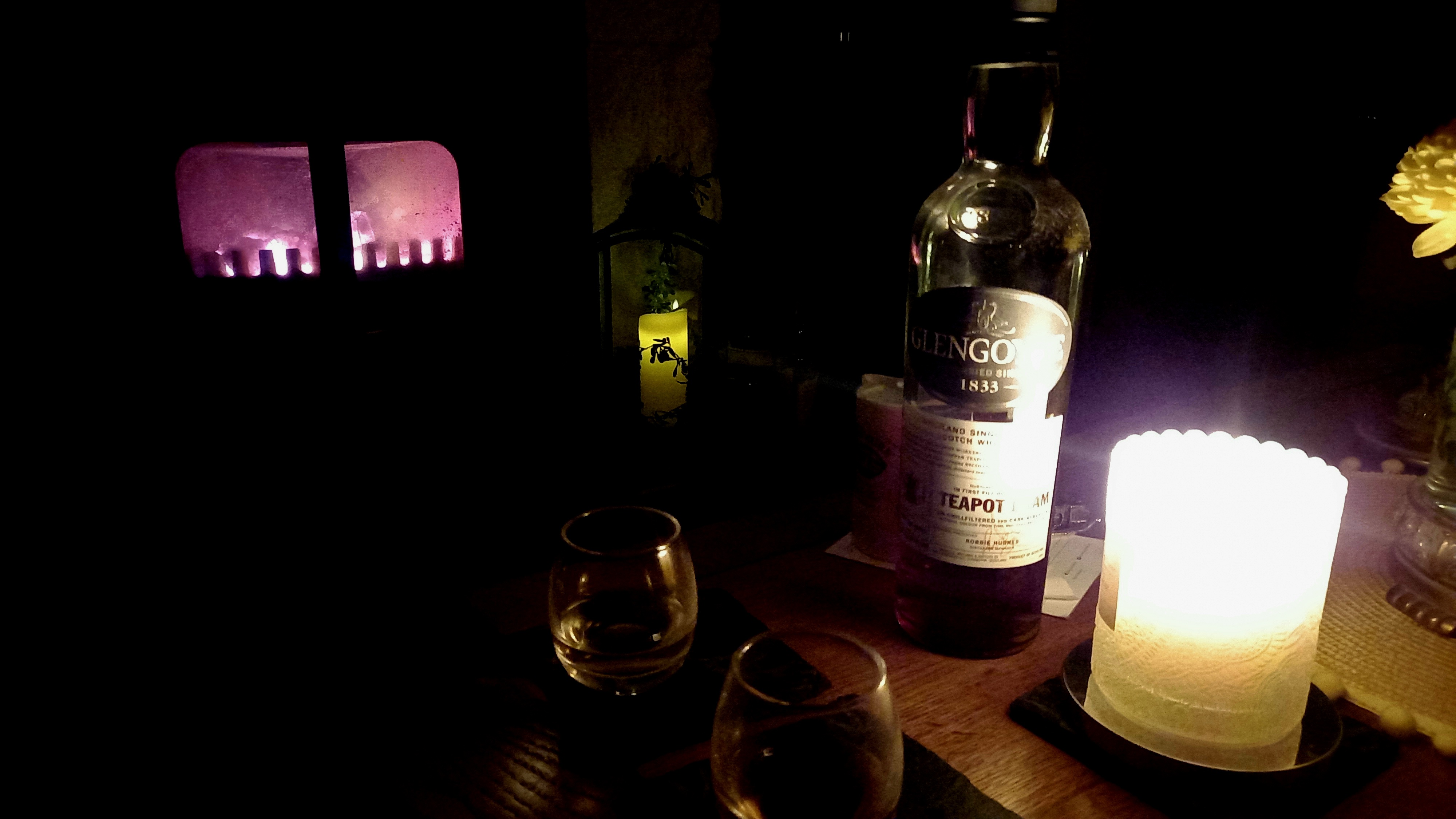
Morale - plenty of whisky to keep us going. The Shackleton blend of Malts is nice and smooth, with an interesting back story.
Shackleton - one of a few Malts we sampled that weekend
Thankfully, by Monday night we had electricity. This meant the mobile networks were back up too. Home internet was restored a day later.
I have a 2KVA petrol generator, but didn’t bother using it.
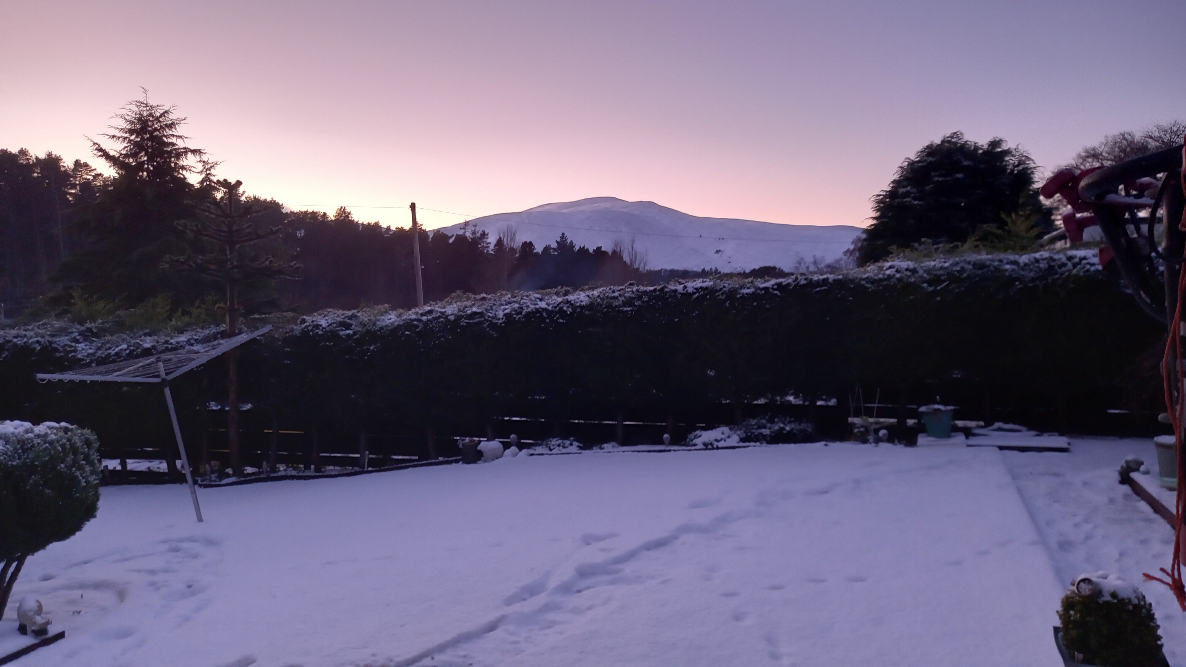
Morven GM/ES-018, taken from the bothy on Sunday evening
Almost a week later, there are still many outlying properties to be reconnected and a few roads still to be cleared of trees. I think Deeside will remember Storm Arwen 2015, as it did Storm Frank of 2015.
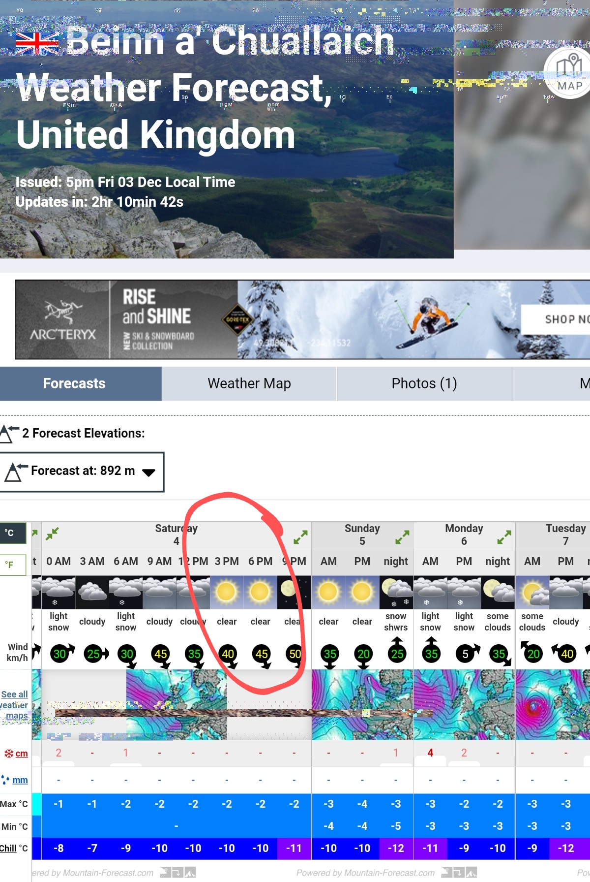
Mountain Weather Forecasts in GM
Oh, I nearly forgot to mention the weather forecast! I agree with Andy that the windspeed forecasts on www.mountain-forecast.com are more accurate, as this website can tailor forecasts to a smaller and more specific hill, whereas mwis.org is describing the worst case windspeed for an entire mountain range - eg SE Highlands. This area is vast. However, the mwis.org text forecasts do a much better job of describing how the weather is developing across a mountain area. I find the visuals on the mountain-forecast website too simplistic, vague and inaccurate for serious use.
Mountain-forecast didn’t actually have a specific forecast for Ben Cleuch, the highest and most popular hill in the range, but it did for a couple of lower summits nearby.
So, going forward (for me) mwis.org for the big picture and mountain-forecast for wind conditions on a specific mountain.
73, Fraser