G4YSS: PA/PA-006 Signaal Imbosch on 22-09-19
Issue-1
Activation of SIGNAAL IMBOSCH PA/PA-006 - 1 point
G4YSS Unaccompanied
Using PA/M1NNN/P (not the usual GX0OOO/P)
Bands: 40m & 160m CW
Follows joint activation on 19-09-19 with PA0HRM (see separate report)
All times: CET (UTC plus 2hr, UOS as ‘z’)
EQUIPMENT:
FT817ND HF/VHF/UHF 5W Transceiver
MX-P50M, 50 Watt HF Linear Amplifier
Link dipole for 80m thru’ 20m on a 5m CFC mast with 1m end-sticks
Home-brew tunable loading coils for 160m
5 Ah Li-Po battery
Garmin GEKO-301 GPS
Other Eqpt. Taken but Not Used:
J-Pole for 2m FM
70MHz 10W Transverter
3-Ely Beam for 70 MHz
IC-E90, 4-band, 5W VHF H/H
QRO pack (G4YSS): Approx 10.5kg (23 pounds)
INTRODUCTION:
After an enjoyable joint activation with Hans PA0HRM, on the 19th September, I planned a return. After all, having been shown the ropes, it should be easy. Famous last words!
When abroad, in place of my GX0OOO/P clubcall, I use one of my own callsigns, namely M1NNN. I put a few alerts on Sotawatch before leaving.
EXECUTION and ROUTE:
PA6 is the highest point of the Veluwezoom National Park just north of Rheden. When Hans drove me there it was quick and easy. This time it would be very different but I can’t say I wasn’t warned not to trust the satnav. Yes, I know these things need human supervision; Hans and I had that very discussion and agreement while driving back on the 19th but surely they can’t be that bad. I had taken the trouble to GPS the coordinates for the parking place that Hans took me to and that was duly entered into the satnav. What could go wrong?
Well, just about everything. First it turned me right out of the hotel drive when we should have gone left but that was OK because I was heading towards the right place wasn’t I? A place called Renkum that Hans told me to go by. The roads got bigger and soon I was on a motorway. It was then that I realised that it was Rheden which Hans had mentioned to go by and not Renkum which is in the opposite direction but that didn’t explain the satnav’s choice.
Stopping to fiddle with the satnav and a look at the map didn’t do me much good either. To cut a long story short, I was driving for one hour and thirty six minutes at speeds up to 120kph with several stops, for a journey which took 21 minutes on the way back! The machine seemed to have little idea of whether, where or how it was going to penetrate the national park I needed to be in and I think I proved that driving to civilisation from the back of beyond is fine for a satnav to handle but not the reverse process.
At one stage (N52.04932 E5.93952) it had got me on a cycle track with a turn right onto a dirt road to which it assigned a long impressive name; not quite Pennsylvania Avenue but a name all the same. It’s plan was to take me 4km through the soft sand and scrubby grass visible ahead. No way! Not in the XYL’s posh new car at least.
A while later, after driving to Rheden and starting again, a bit like the computer in ‘2001 A Space Odyssey’ the rogue device got switched off. Heading for a place called Posbank that Hans told me about but that wasn’t in my satnav, seemed to make sense. Presently I saw a sign off to the left, ‘Posbank 7km’ only to be told by two nice ladies that this was just another cycle track.
Continuing up the road I eventually came to a dead end with a car park. Only a bike track proceeded further. It was not the right car park but the GPS told me that PA6 was just 2.2km away. Good enough, I would walk it, though it would take me longer than the planned 0.8km. The trouble was I was over an hour late already and the 70 MHz sked with my son was less than half an hour away. That was cancelled by phone; fortunately there was a decent signal. In practical terms it was no great loss. Barring miracles we’d never have made it on 4m anyway.
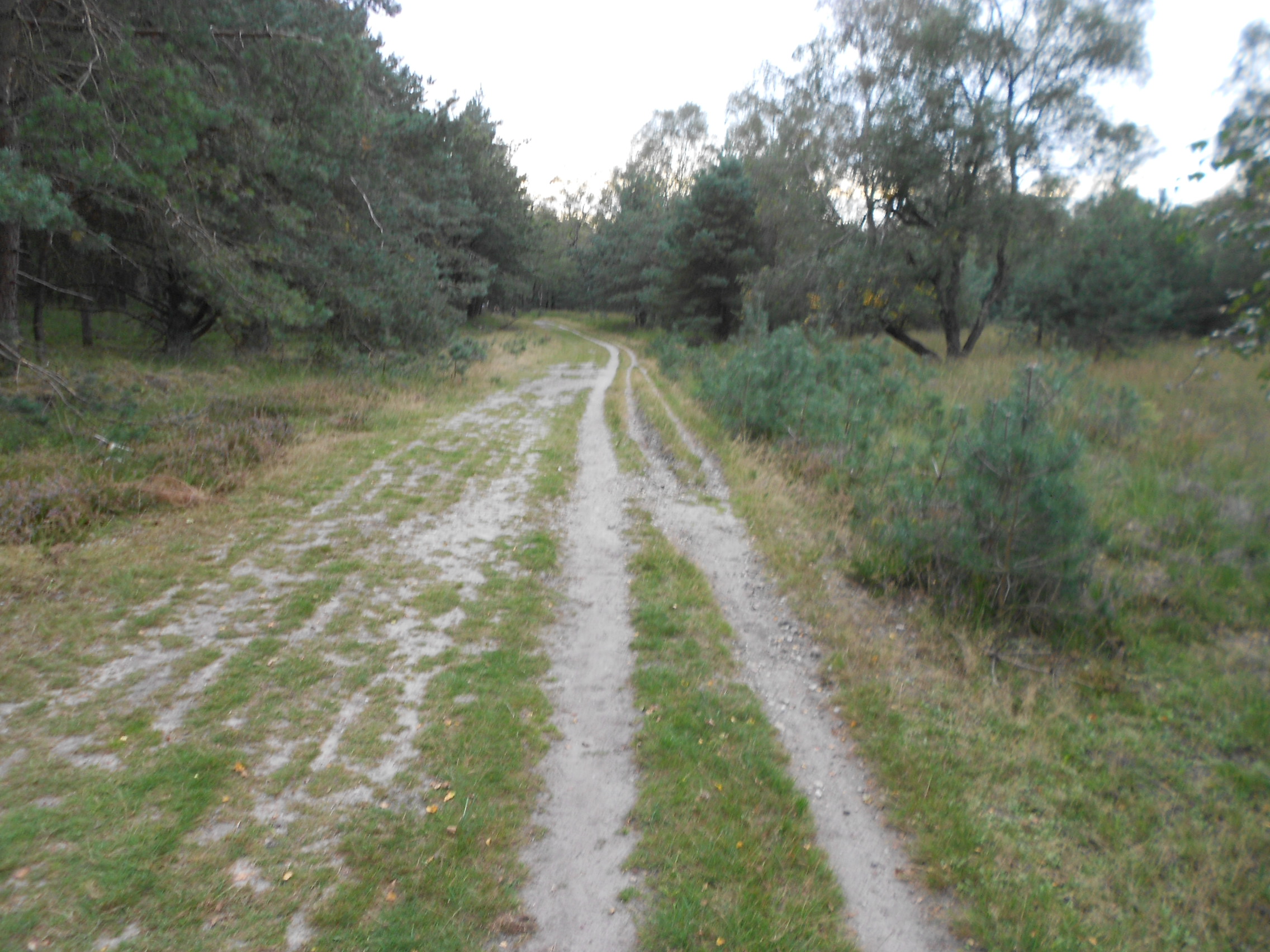
Route 22-09-19
It wasn’t in the plan but due to the above, today’s start point was N52.02479 E5.97599. I chose the wrong path initially but corrected it coming back. The best way is via a grassy track N52.02464 E5.97671, which goes across to join a metalled cycle track at N52.02558 E5.97955. It’s then just a case of following the bike track NE to a crossroads at N52.03707 E5.99070 but watch out for bikes. Being a Sunday there were quite a few about. I didn’t recognize it at the time but this crossroads is a few metres from the car park I failed to find; the one where Hans’ route starts.
I carried on following the GPS, luckily picking the right path. After a while there was a eureka moment when I spotted the WW2 aircraft control ruin on the right. Hans’ route which is a continuation of the above, is detailed below. You can put the two together or maybe you will have better luck than I did in finding the right start point for a much shorter walk.
Hans’ Route 19-09-19:
At N52.03694 E5.99090 there is an area on the left where several cars may be parked. From there it’s across the road onto a track going via N52.03717 E5.99109 and N52.03851 E5.99385, then turning right at N52.03928 E5.99617 on a sandy track. The final part is on a path which leaves the track at N52.03772 E5.99838, going to the summit marker, a small concrete block, GPS marked today at N52.03825 E5.99877 (110m ASL).
On the way you can make a short detour to a WW2 German fighter tracking station, now in ruins at N52.03797 E5.99303. Hans’ route is 800m to walk one way with an ascent of about 16m. Today I walked about 2.7km one way with the further penalty of extra ascent.
Setting Up:
As expected, the summit was deserted and it was easy to just mimic the setup of three days prior, using the same trees as supports or avoiding them as appropriate. It didn’t take long to put up the 80m link dipole on the 5m mast. Just as well, I now only had an hour or so.
SIGNAAL IMBOSCH, PA/PA-006, 454m, 1pt. 16:33 to 18:04. 20C, very light wind, sunny then overcast. (JO22XA). Weak but reliable phone signal.
7.033 CW - 10 QSO’s:
It was a slow start, the reason for which I would find out later. After quite a few CQ’s I heard DL7CX/P call. Olaf DA/SX-356 was a very weak signal; 339 at best with fading to zero. I got his 339 report and I assume he got mine. QSB won in the end but this entry is staying in the log unless it’s proven it doesn’t belong there.
Next came a big signal which turned out to be Hans PA0HRM 599+ both ways. We had a chat musing that we could have waved to each other and I was very pleased to get this particular QSO logged after our joint activation three days before. Apparently Hans was at Ginkel Heath for the mass parachute drop the day before but we didn’t see one another. That was hardly a surprise as I’m told there were almost 100,000 people there.
Continuing on I logged IK2CFD Graziano (who spotted me); I3VAD Giancarlo; IK2LEY Fabio; G4WSB Bill (recent activator of PA6); F6DRA Serge; LZ2AF/2 Rumen; G0HIO Mike and EA2DT Manuel. Reports were mainly 599 going out with 559 to 579 coming back. I got a 529 from my spotter and 339 from Manuel. These could have been better if I’d remembered to switch on the 50 Watt amplifier after checking the VSWR at the start. In consequence all these were worked with 5W from the FT817ND. Well, why worry? PA0HRM was doing well with 3.5W from here 3 days prior.
14.052.6 CW - Nil:
Unfortunately I posted this wrongly for a frequency of 145.0526, which is what comes of bodging one spot into another and failing to do it properly without spectacles. I later found out that my son Phil, recently back home from his PW Mag 4m contest, re-spotted it correctly. There were no contacts resulting but I may not have called CQ for long enough, something which I regret. On balance the band didn’t seem in good shape anyway.
1.832 CW - 1 QSO:
It took two visits to the antenna coils to get the resonance where I wanted it but once that was done, it took a surprisingly short time to attract some attention. I pre-spotted this session, adding in the notes that 1.844-SSB would be tried later and this time made sure that after SWR checks, the amp got switched back on for a 50 Watt output.
The single caller was SOTA chaser ON7DQ – Luc in Ostende. I have worked Luc a few times in the past and once on Top Band. I got 339 from him, sending 589 the other way. This was the ‘dream QSO’ and one that will ever be the first on 160m for PA/PA-006, which was my aim. Hoping to add to the score, I called CQ for a few more minutes but nobody else responded.
1.844 SSB - Nil:
No more to be said and after 5 minutes of CQ’ing, I returned to 1.832 for a couple more CQ’s in CW.
3.760 SSB - Nil:
I could hear the ‘heartbeat’ on here and was hoping that there might have been a late WAB chaser or two monitoring but it wasn’t to be.
Descent:
Packing up as quickly as possible without breaking or losing anything, I walked off at 18:04, simply retracing my steps apart from the final few hundred metres as mentioned earlier, arriving back at the car for 18:28.
At the car park, there was a worried looking woman who’d lost her dog ten minutes before I arrived but I hadn’t seen it. She asked a couple of others, both dog owners but looking up the track there was no sign. I know first hand from Sasha how it feels when a dog disappears and it was my regret that I was already late and couldn’t help. I hope she got ‘Max’ back quickly but using mostly sign language, I did try to advise her to return to the spot where she last saw the dog. According to Hans, you are not allowed in the park after 8pm.
Oh I nearly forgot - the return journey. It took just 21 minutes to drive back and it was so simple I barely needed a satnav. Quite soon there was a succession of signs for Oosterbeek. Easy, but I marked a few waypoints should I ever need to go back again.
ASCENT & DISTANCE:
Ascent approx 50m / Distance 2 x 2.7km (3.4 miles total)
Walking times:
Ascent: 29 min (net, without phone call)
Descent: 24 min
Summit time: 1hr-31 min
QSO Total: 11
10 on 40m-CW
1 on 160m-CW
COMMENTS:
What an activation. Three errors on my part. Driving all over the area with a satnav gone mad, forgetting to switch the 50W amp on for 40m and self spotting a ridiculous frequency where nobody would ever do CW. I must have wasted a gallon of Diesel as well as over 70 minutes of time, resulting with the cancellation of a 70MHz sked arranged 48 hours before.
On the plus side I did fulfil my ambition of putting this summit on the 160m map and I did get some extra exercise I hadn’t bargained for. Getting any further than Ostende was likely not going to happen in full daylight. In fact Ostende was a more than respectable distance.
The QSO count was lower than I’d hoped for but once things started going wrong I resigned myself to a low total. Besides, with the exception of 40m the bands didn’t seem to be too good.
THANKS:
To ALL STATIONS worked and to spotters IK2CFD; G0UUU and the spotting app. Apologies to all those chasers I might have worked, had I fully taken the advice of Hans PA0HRM! Thanks for the QSO Hans and have a good holiday. Great to meet you! Hope you get a laugh reading this!
73, John G4YSS
(Using PA/M1NNN/P)
Photos: 1-2-3-4-6-10-11
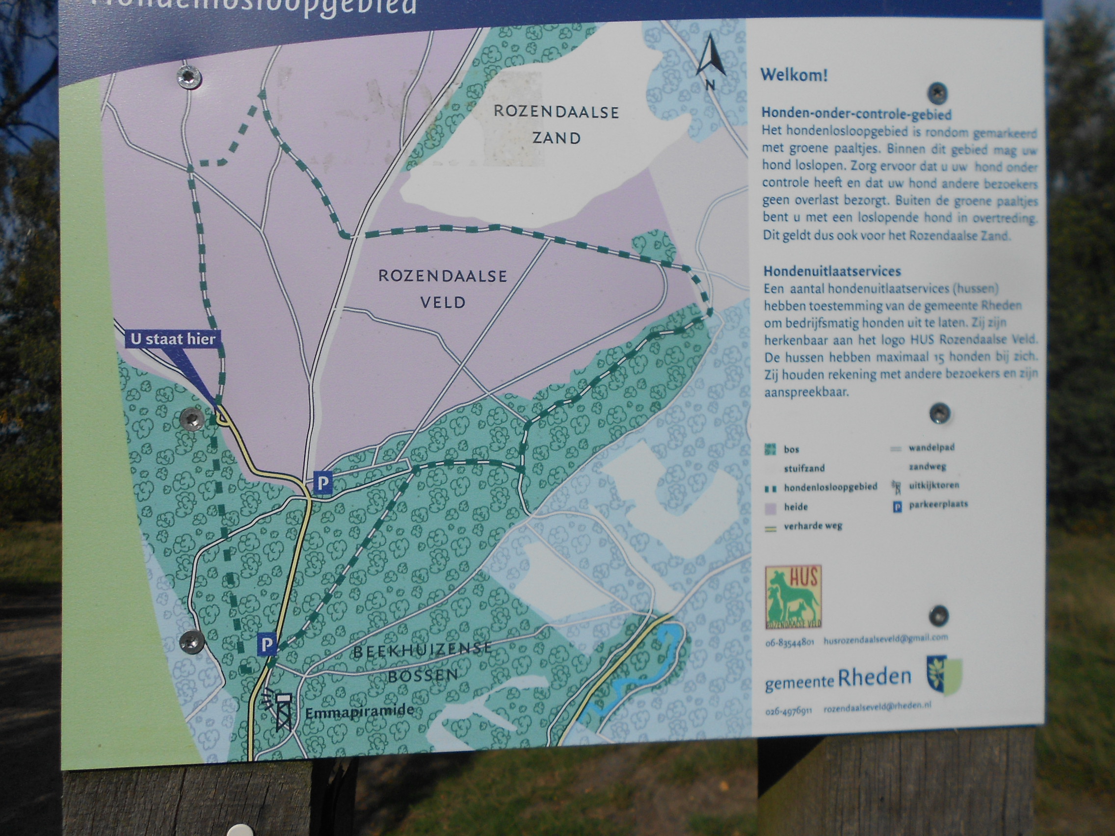
Above: Map board at today’s start point 2.7km from PA6

Above: The ‘wrong’ car park

Above: Map board at the start point of Hans’ route 800m from PA6
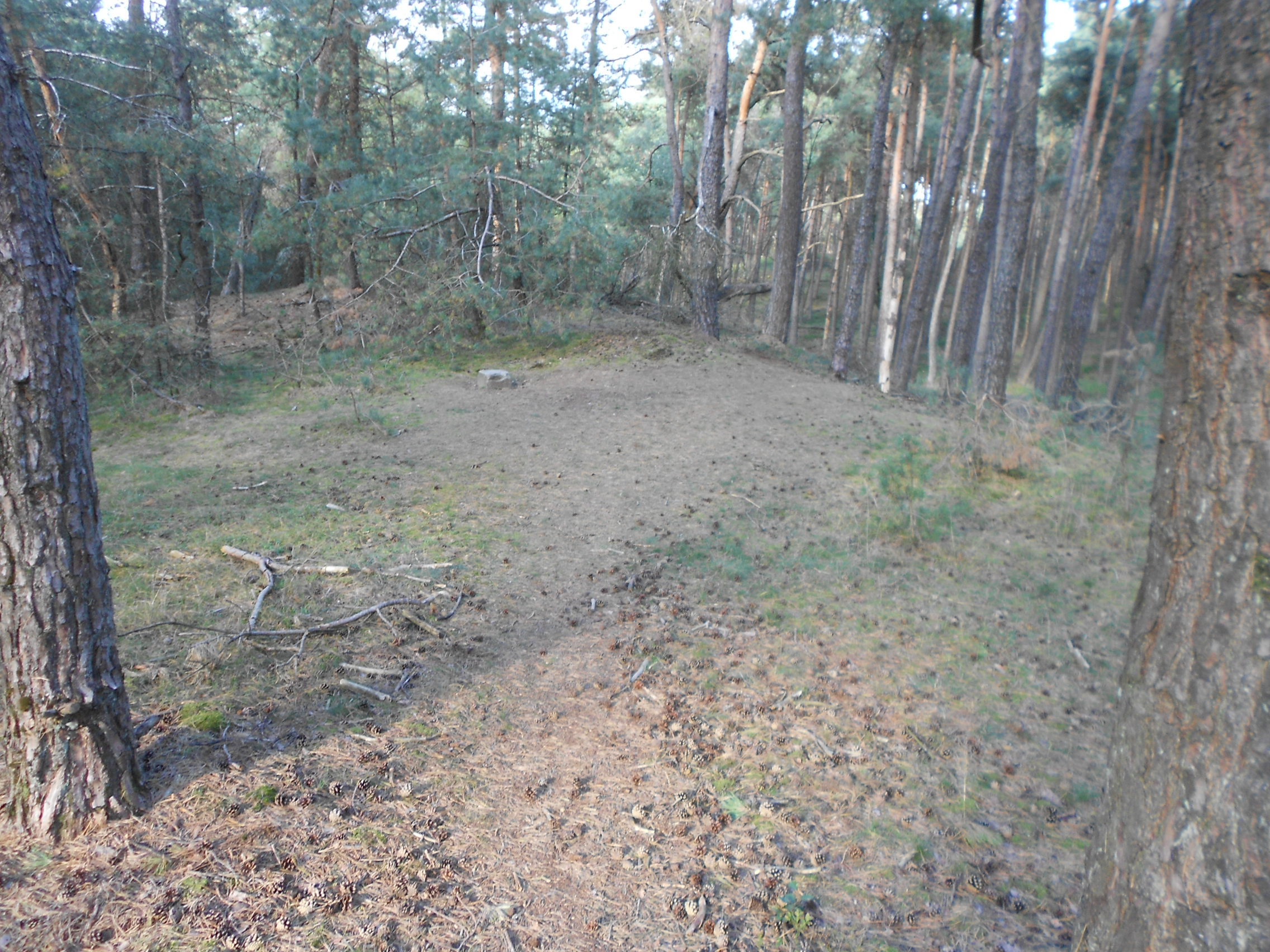
Above: A deserted PA/PA-006 now familiar
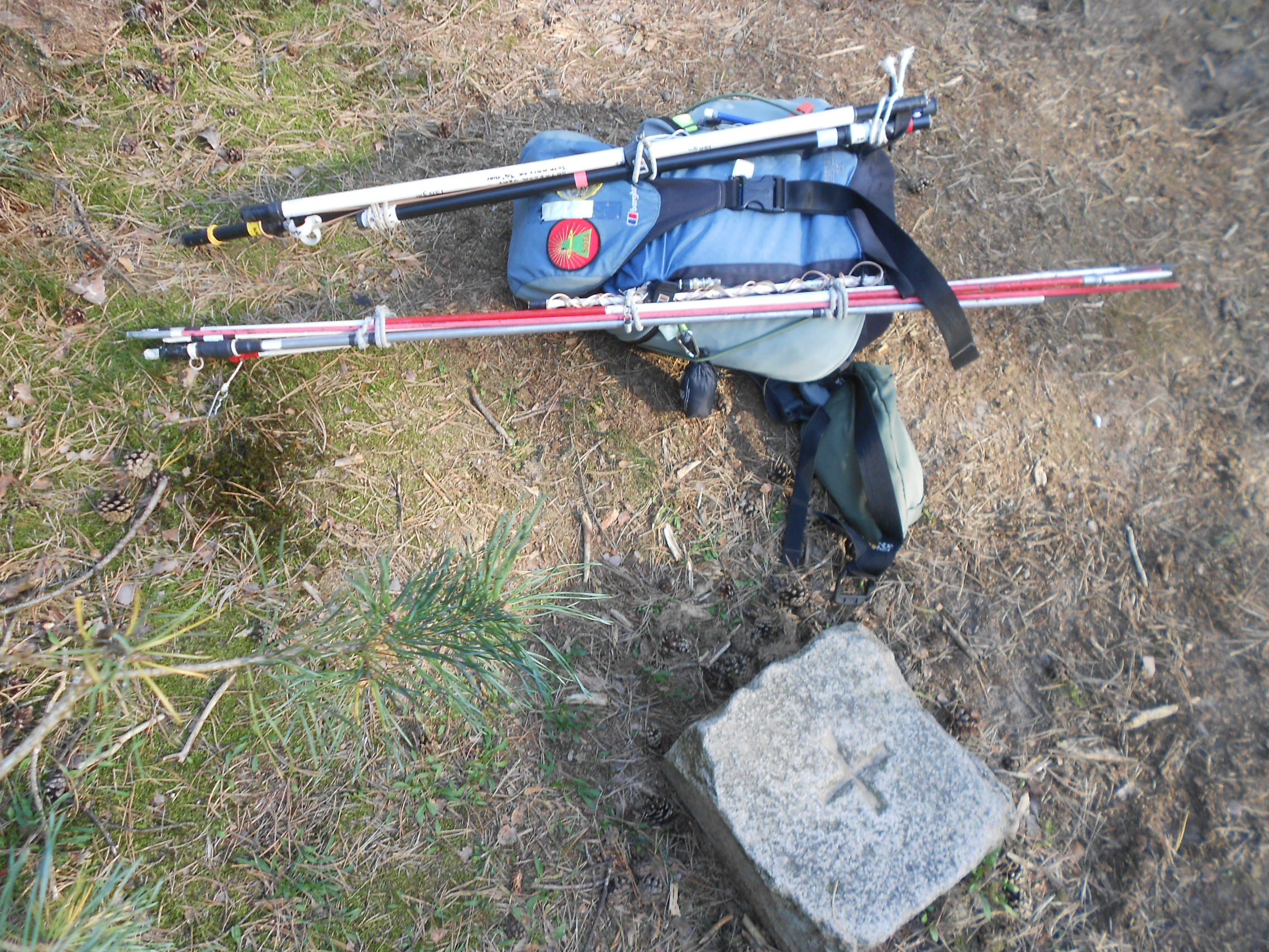
Above: A heavy load much of it now superfluous
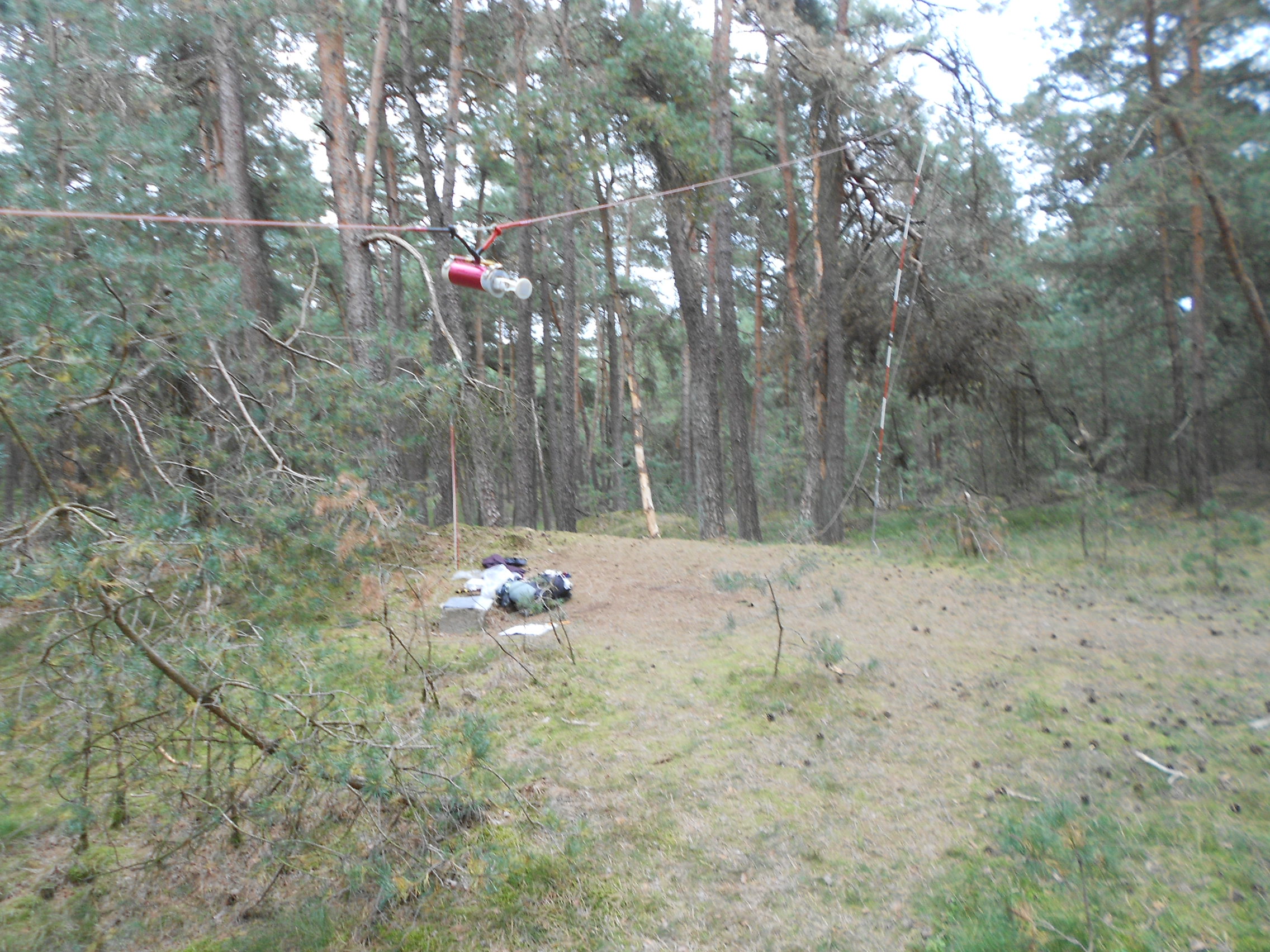
Above: 80m dipole configured for 160m. Coils adjusted and ready to go
Above: The retreat in a hurry
