BEINN ALLIGIN (WS98-Tom na Gruagaich) on 15th September 2016
GM/WS-098-6 on 40-20-60m QRO.
BEINN ALLIGIN (Tom na Gruagaich) 922m, the southernmost summit of the two tops.
(Beinn Alligin’s main summit - WS68 was not activated during this holiday)
Staying at Gairloch Hotel 9th to 19th September 2016.
Four activations: GM/WS-043; GM/WS-028; GM/WS-098 & GM/NS-001.
G(M)4YSS Unaccompanied.
SSEG Club-call GS0OOO/P & GM4YSS/P (the latter used for database).
All times BST (UTC plus 1hr, UOS)
RADIO EQUIPMENT:
HF-QRO:
FT817ND HF/VHF/UHF 5W Transceiver without internal batteries.
MX-P50M, 50 Watt HF Linear Amplifier.
Link dipole for 80-60-40-(30)-20m Bands
Four section x 5m home-brew CFC mast with 1m end sticks
Unitone 'D’ shape ear-cup headphones.
VHF QRP:
Baofeng UV-5R 2m/ 70cm, 5W-VHFM H/H with loaded helical antenna & 1.8 Ah battery.
J-Pole for 2m-FM (not used)
Batteries:
One 5 Ah Li-Po (Part discharged). No spare carried
GPS:
Garmin GEKO-301
Pack weight:
9.7 kg (21.3 pounds) inc. 0.5 litre fluids and a black umbrella.
Also carried fleece which would normally be worn in cooler conditions.
Introduction:
For general introduction, see GM/WS-043 Liathach report.
There are a number of similarities between Liathach and Beinn Alligin. Both have two Munro sized SOTA tops; in Alligin’s case GM/WS-068 and WS-098. WS98 is closer to the road and therefore easier to activate and has a trig point popular with WAB chasers. Unfortunately, as can be gleaned from its SOTA reference, it is the lower of the two to the tune of 64 metres.
Another thing which is common in this comparison is the fact that the two can be activated in one day as a round but as explained before that would not suit the activation style selected for this holiday. Lastly, doing the round involves passing over tricky ground. For Liathach that would be the pinnacles that exist between the two tops, but in Alligin’s case the difficulty is in the final retreat over the famous Horns of Alligin.
In order to avoid the potential difficulty provided by the Horns, I formulated a plan that would allow me to take in both summits without recourse to the tricky retreat. This would have involved first climbing WS98 then continuing round the straightforward ridge that connects it to WS68. A return could then be made by simply reversing the same route. The disadvantages of this approach would be that WS98 has to be climbed twice making a total ascent for the day of some 1,238 metres over a distance of around 10km. So long as the weather cooperated, that would not be too difficult but the time available between hotel meal times would make it impossible with two long multi-band HF activations added to the walking time. For that reason, I decided to limit the activation to WS98 only.
WX:
MWIS was predicting little if any rain, moderate wind speed and summit temperatures in the low teens. Unfortunately there was also a prediction for low-cloud.
Route and Execution:
Breakfast was at 07:45 and after dropping my XYL off at the local shops, I drove away at 09:15 for the start point in Glen Torridon, reaching there at 10:02 after 35 miles on quiet roads.
At NG 8690 5766 on the A896, there is a sizeable purpose-built car park sufficient to take up to twenty cars. The path leaves the road immediately opposite the entrance to this car park which is located beside a bridge and near a waterfall. The latter which is a short distance up Coire Mhic Nobuil, can be seen from the bridge looking north. I made certain to take the path to the west side of the bridge as the one which leaves to the east leads to the Horns and WS68 or to Beinn Dearg WS104.
The morning seemed good. It was quite still and I foolishly allowed midges to invade the vehicle. While I was downing my litre of cold water, a car pulled in. Out jumped an old greyhound and I asked the owners for an introduction as I was missing the lurcher that I walk on a daily basis at home. This one was a very tall male; a rescue dog from Ireland and despite a bandaged leg, he looked like his owners were preparing for a lengthy walk. Just after this at 10:23, I was underway. I was on the late side mainly due to a lack of enthusiasm which pervades me all too often these days.
http://www.walkhighlands.co.uk/ was even more useful than normal today as my map had not even the beginnings of a path marked for the direct approach to WS98. The work on this week’s routes was done months ago and a route based on the downloaded track was now about to be put to the test.
The path is on peat and therefore boggy at first. Just like WS43, higher up in the coire it changes to a mixture of peat and rocks initially with grass either side but later becoming wide and confused as it attempts to zig-zag up the final approach to the ridge. At the point where the path meets the plateau there stands a sizeable cairn. From there, unless the cloud is down, the summit can be seen no more than five minutes walk away, up a gentle slope.
Waypoints as follows:
NG 8690 5766 (car park); NG 8683 5786; NG 8668 5821 (ladder stile over deer fence); NG 8657 5859; NG 8638 5896 (path marker cairn); NG 8591 5945 (bear right (N) in coir’ nan Laogh); NG 8585 5983 (cross stream); NG 8586 5990 (rough); NG 8586 6001 (ascent path/ plateau marker cairn); NG 8697 5781 to the summit trig point which I GPS’d today at NG85964 60139.
Arrival time was 12:07 and there were 10 people clustered around the trig. One young chap was curious as to why I was photographing the trig point serial number plate and also asked what the poles were for. After a short while, with the exception of a solitary girl who walked off in the direction I’d come up from, they all took off for what we SOTA people know as WS68 and from there to the Horns of Alligin. Though the air was hazy, the famous Horns were visible and intimidating across a yawning gulf that must have been 2,000 feet deep. There was an almost vertical drop a metre or two from where I was standing.
I took plenty of photos but not many were very sharp in the hazy conditions. It would only get worse, just over an hour later visibility had dropped to 30m.
BEINN ALLIGIN (WS98-Tom na Gruagaich): 922m, GM/WS-098, 6 pts, 12:07 to 15:18. 15C, 10 mph wind. Sunshine at first then overcast. Low-cloud after 13:45. No rain. WAB-NG86; Trig Point TP-1149; LOC-IO77FN. No Orange (EE) mobile phone coverage at summit or along any of the route. Vodaphone coverage most of the time.
With a very steep NE face, this summit is large and grassy making dipole deployment simple. The station was set up about 20m SE of the rocks that support the trig point.
7.033 CW – 17 QSO’s:
A Vodafone call to G4SSH got me spotted. After a VSWR check, I called Roy with 5 Watts just to see what conditions were like and received an immediate ‘449.’ His signals were 589 to me. Flicking the switch on the linear increased the incoming report to 579. It’s worth doing this from time to time to ensure the amp is working properly and that you have the correct output LPF selected.
Knocking the power down to 30 Watts, I worked: G; DL; PA; F; EI; HB9; GM; SM and our keen QRP’er Marisz SP9AMH. Quite a few stations were reporting QRM and there was certainly QSB but neither of these troubled me on the summit. In my part of the World, the frequency was quiet and very low-noise levels negate most of the bad effects of QSB.
Reports were on the low side; most incoming in the 449 – 579 range with a 339 from Frid DL1FU and 419 from France.
From the seventeen stations worked, only five were ‘G’ stations but past experience has shown that a greater proportion of G’s would have success in SSB.
7.160 SSB – 24 QSO’s:
It was about now that the clag rolled in and it became noticeably cooler. Though it had been hazy, I was glad that the photos had been taken earlier in better viz. There were no further summiteers for the rest of my stay.
Once the ‘SSB’ signal and intended QSY frequency had been sent in CW, G4SSH was able to spot the change. In this case I chose the WAB channel because I had a trig point to offer. Besides, after months of not much happening due to pretty abysmal conditions on the 40m band over summer, it was obvious to me that 7.160 needed warming up a bit.
WAB mag. editor Ken G0FEX was first to find me here and there followed another WAB friend in the form of Brian G0BFJ in Huddersfield. After these I worked a further 20 UK stations plus EA2CKX Pedro and DL7UCW Ben. There was a good mixture of WAB and SOTA chasers so it was worth trying 7.160. Though this SOTA has been activated four times previously (last done in 2009) there had only been 18 QSO’s from it. Ten of those were on VHF, making it very doubtful that anybody had this trig point in their collection.
What a nice surprise when my ‘lad’ Phil G0UUU/M called in from somewhere on the Whitby Moors. He was a good signal too - with a proper 58 registering on my meter and armchair copy. Not bad for a 1m long home-brew mobile whip. Incidentally, we were not the only Father & Son combination on the frequency. I’d just logged Bill G4WSB and Steve 2E0SCS. Sadly I couldn’t pause for a chat as I’d just taken a list of half a dozen callsigns and the owners were patiently waiting.
Reports were moderate to very good in response to my 30 Watts and I got a 57 from Ben in Germany and a 52 from Pedro Spain. This took us round to 12:45z and time for a break. 40m band conditions were certainly looking up and this session proved it.
14.052.6 CW - 1 QSO:
The way it ended up was that only Sergei RV9DC worked me in CW on 14.052.6. I called quite a few times and the frequency was spotted for me by Roy G4SSH but to no avail. Migrating early to 14.265 SSB is when I found Sergei who also likes to collect in CW. We quickly went back down there but still no other stations called after Sergei booked himself a place in the 20m-CW log.
14.265 SSB - 7 QSO’s:
Returning to SSB the second time, I worked: W9OA/9 (George in Wisconsin); PA2CVD; UX2IQ; ON5SWA; DB6BB/m and EA2TW. Reports were all in the 57 to 59 range with a 55 being the lowest incomer from Frans in Belgium.
Not being familiar with USA callsigns, George’s confused me at first but conditions were so good that we were able to have a conversation to straighten things out for the log. Thanks again to G4SSH for spots. Power was maintained at 30 Watts.
5.381.5 CW - 5 QSO’s:
Using my own callsign G(M)4YSS/P and 30 Watts, I logged a few stations that missed it on 40m & 20m due to skip distance etc. Stations worked: LA8BCA; G4SSH; G4FGJ; GM4COX and G0TDM. (Terje, Roy, Gordon, Jack and John.) Reports on my signals were rather down with 339 being the worst and 559 the best, apart from Terje who gave my a 579.
It’s all too easy to slip back into a SOTA lifetime habit of calling CQ with the club callsign. Apologies for any confusion caused but I think I picked up the error quite quickly on this occasion.
This QRG was ‘borrowed’ so thanks to Dave G0EVV for his popularisation of this channel for SOTA CW and for the simplified 60m band plan he emailed to me. I have to remember that should there by a station already on there, the only QSY is down a little. Going up would soon take you out of band. I’ll be glad when (if) we get a proper 5 MHz allocation then we’ll only have to remember two band edges instead of nearly two dozen plus what callsign we can use.
5.400 SSB - 5 QSO’s:
The above may not be the precise frequency but 5.400 is what I call the old channel ‘FM.’ I was rewarded with three contacts on here in the form of Brian G4ZRP near Liverpool; John G0TDM and Geoff G4WHA/A - both in Penrith.
Despite my raising the power from 30 to 50 Watts for the final two contacts, conditions must have also come up in QSB since the CW session, as it was now 59 both ways with John G0TDM.
145.575 FM - Nil QSO’s:
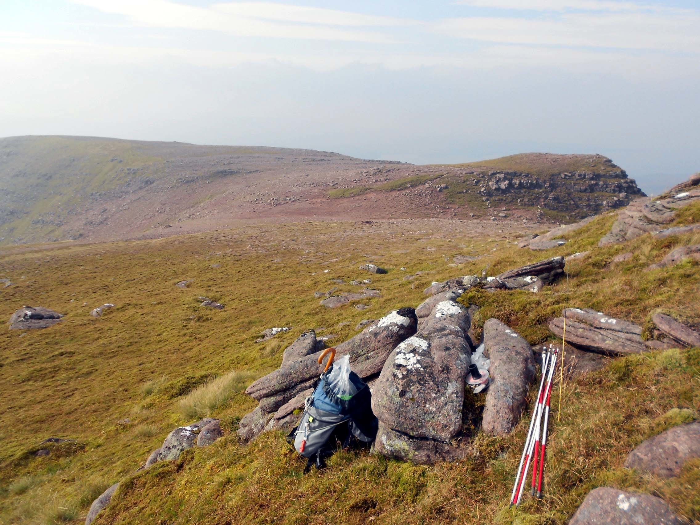
After relocating closer to the trig and thereby the highest point, using 5 Watts to the vertical J-Pole from the UV-5R, I called GM3PIL on 145.575 but Ray did not appear. The same thing happened on 145.500. This I took as a sign to pack up and go but not before selecting a few likely looking rocks to take with me.
The Descent:
The HF gear was already stowed and with the still cold UV-5R and J-Pole back in the sack, off we went at 15:18 heading for the down path on a bearing in low-cloud which I dropped out of before the left turn half way down Coire Mhic Nobuil.
I was back at the car early at 16:27 completing the 35 mile drive to Gairloch by 17:17 after calling at Torridon Stores for some picture postcards of the mountains climbed so far.
I rarely carry coins in walking clothes so grabbed the transparent box where I keep spare antenna pins, bits of wire, crimp terminals and the like. It also has a few pound coins for the LD region of Pen-y-Pass; both rip-off areas for car parking. Tipping out the box on the shop counter led me into an amateur radio conversation with the owner, who told me that one of her relatives was in the hobby and also that an amateur lives or lived in or near Torridon. It’s always a pleasure to have these conversations and promote the SOTA hobby a little.
After I’d paid for the post cards, she offered me a ‘popupdesigns’ model of Liathach but my XYL had beaten us to it in this very shop/ cafe a few days earlier. I now have this little wooden fretwork on the piano to remind me of the day I conquered Liathach and one for Alligin too.
QSO’s:
17 on 40m CW
24 on 40m SSB
1 on 20m CW
7 on 20m SSB
5 on 60m CW
3 on 60m SSB
0 on 2m FM
Total: 57
Ascent & distance: 884m (2,900ft) ascent - 5.3km (3.3 miles).
Elapsed times. Walking times. Up: 1hr-44min. Down: 1hr-9min. Summit time: 3hr-11min. Gross time: 6hr-4min.
Observations:
Like Liathach, Beinn Alligin consists of two Munros and two SOTA summits which were first activated by Andy GM0ULD/P in 2004; in this case on 11th October.
This was not the most exciting or challenging summit of the holiday, erring as I did on the side of safety and fitting it into the available time. If WS68 is included the retreat via the Horns of Alligin would certainly spice things up but as is often the case, I look for the quickest and easiest way of getting a summit on the air preferably using a versatile and capable station setup. That’s my excuse anyway!
The WS28 weather was kind enough; overcast for the climb, initially sunny at the top with a strong breeze and no rain. The low-cloud at only appeared for part of the time which made it seem quite cold but the temperature was actually up in the mid teens - warm for the time of year and the altitude.
Once again 40m band conditions with both inter-G and continental propagation were good. Unlike the WS28 activation of two days prior, 20m showed an example of excellent transatlantic propagation and I also got into Asiatic Russia. 60m did a decent job of sweeping up a handful of closer-in chasers.
Lines of sight to GM3PIL Ray at Piper Hill, a high point just south of Nairn 100 km away at the opposite side of Scotland and Andy GM0ULD on the Black Isle, could well have been cut off by the higher Liathach. Further 5 Watt calling on 145.500 and 145.575 resulted in no VHF contacts for this mountain.
Thanks to all stations worked and to those who spotted me, namely Roy G4SSH and ON5SWA. Thanks to Roy G4SSH for telephone liaison, alerts, spots and band condition advice.
73, John G(M)4YSS,
Also using SSEG GS0OOO/P.
(This summit will be entered under GM4YSS/P for SOTA purposes)
GM/WS-043 & GM/WS-028 (Liathach) reports already posted.
GM/NS-001 report to follow in due course.
Photos: (3)-8-12-14-16-17-25-39-42-43-44-45-47-57 (all ‘a’)
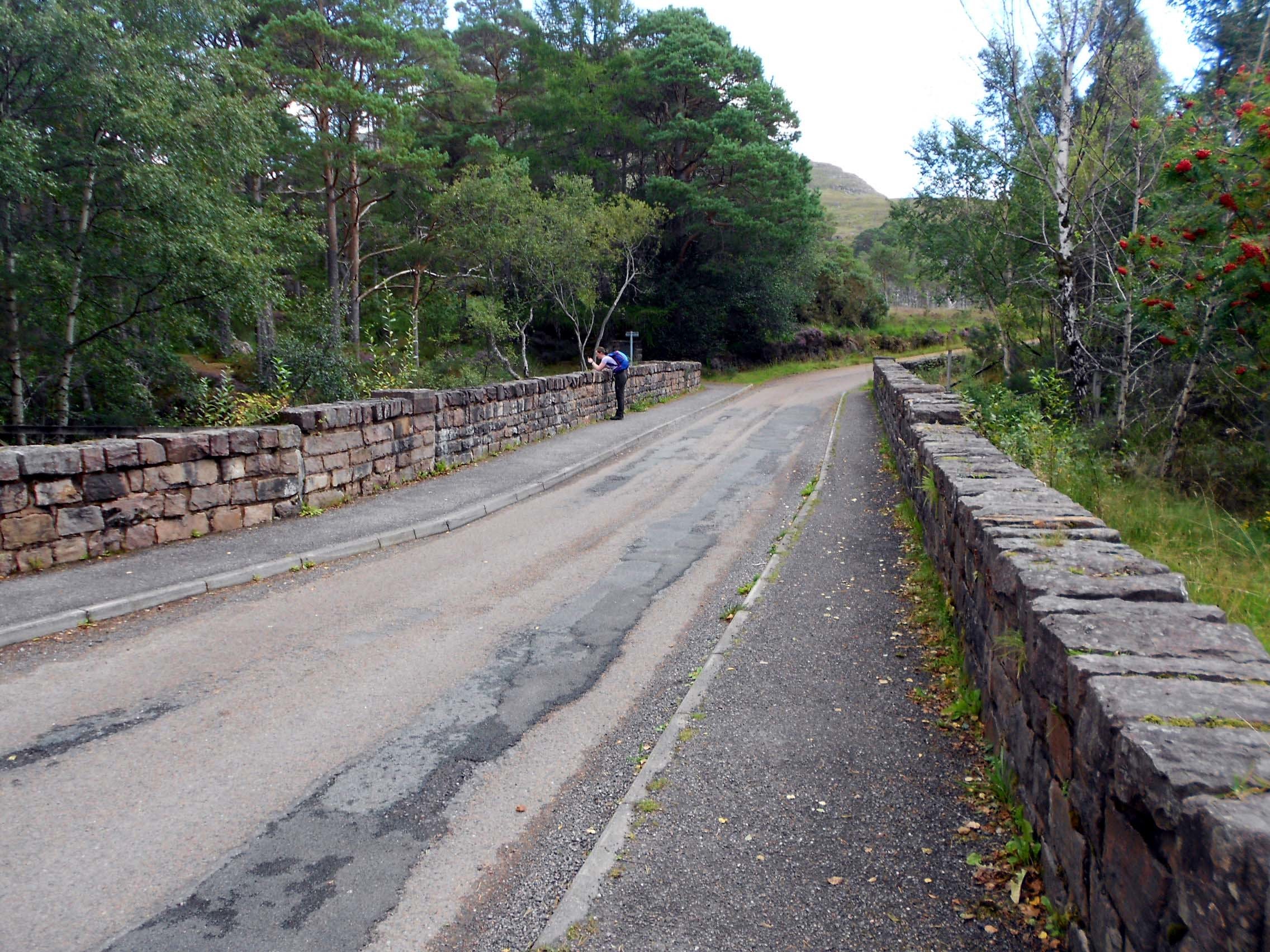
Above: NG 8690 5766 on the A896 is the WS98 path start point, just to left of camera position. The car park is out of frame to the right. Someone is photographing the waterfall.
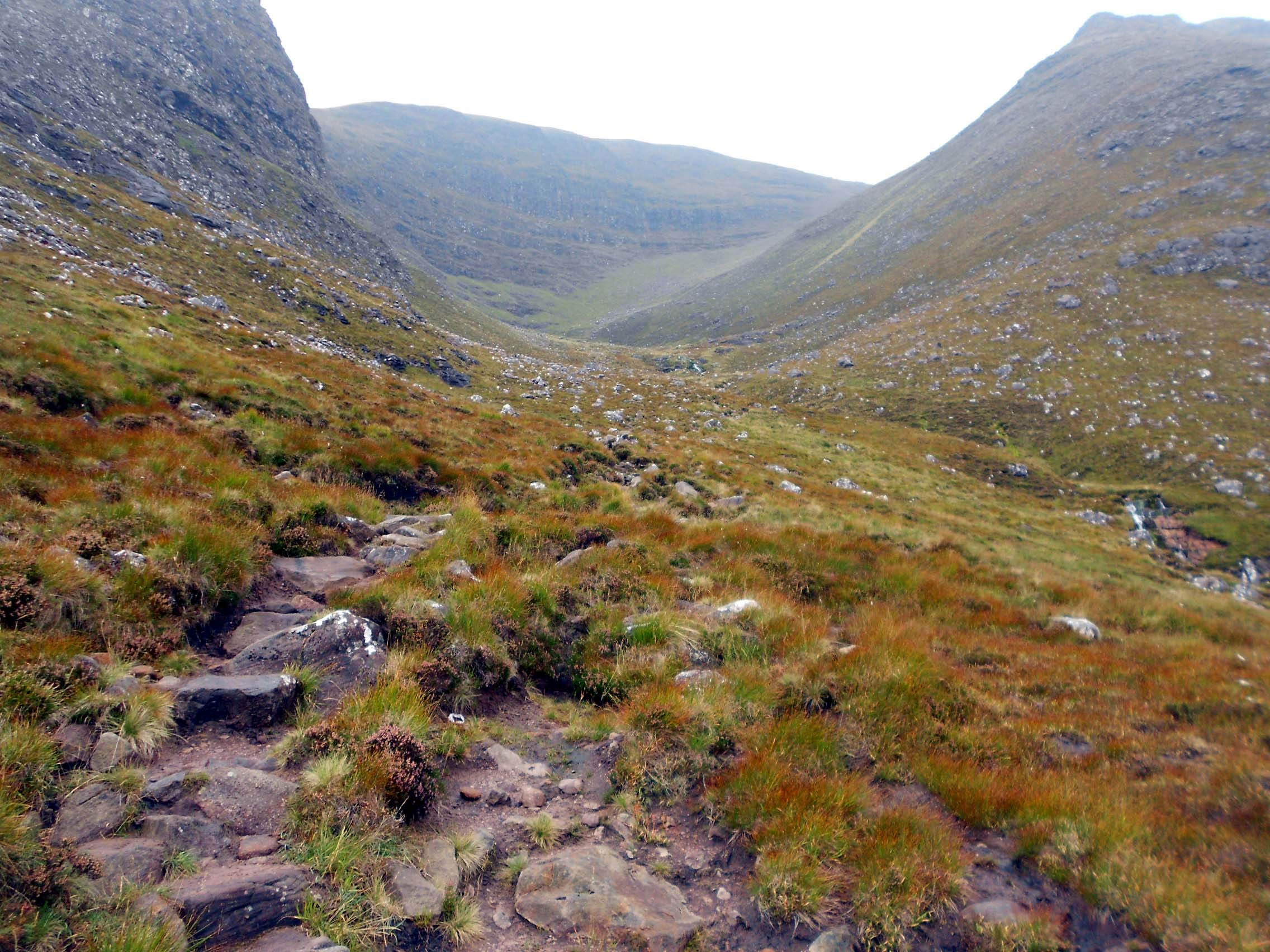
Above: Entering Coire Mhic Nobuil on the way up WS98. Turn right before the cliff.
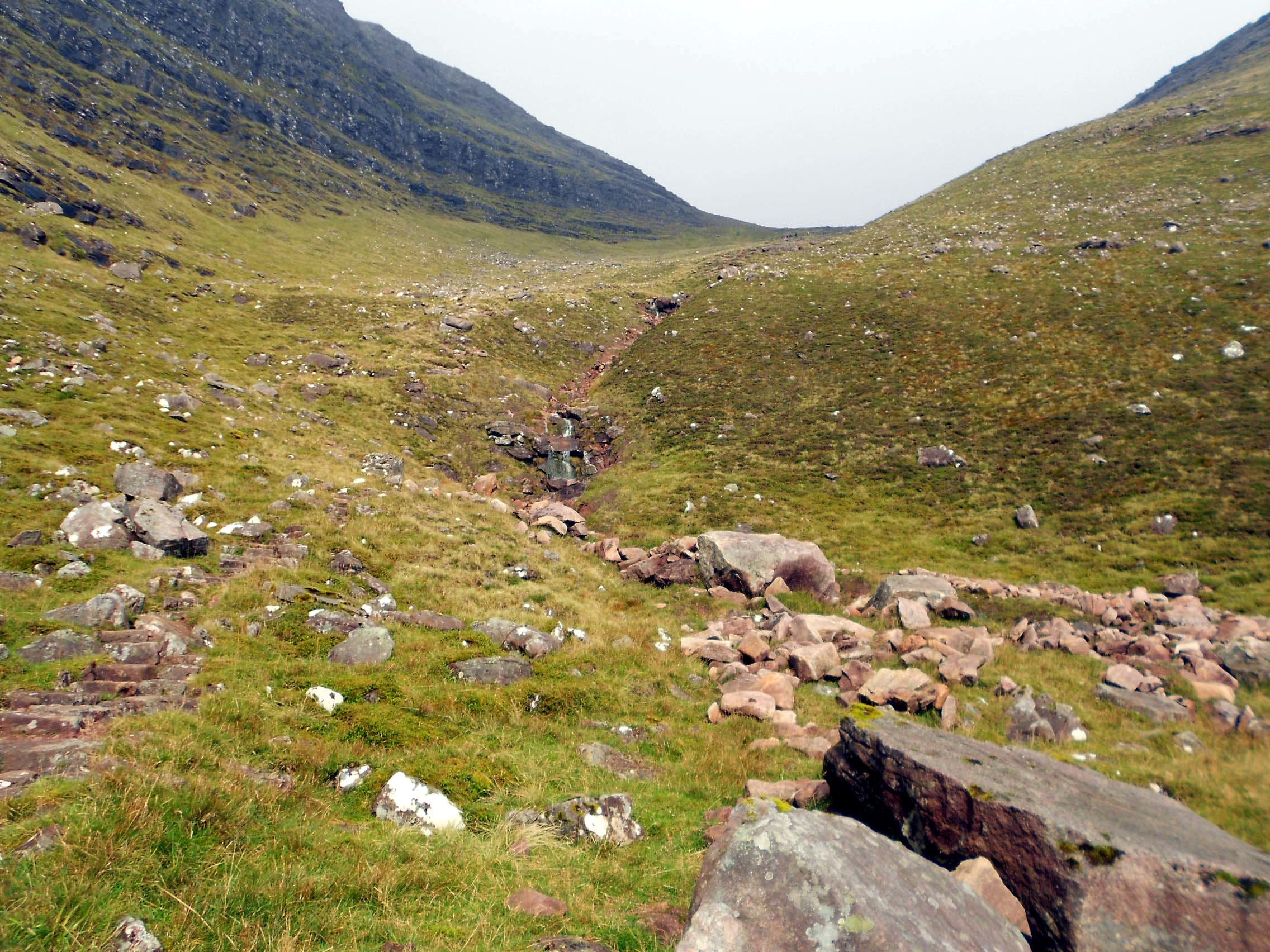
Above: The right turn in Coire Mhic Nobuil on the way up WS98.

Above: The higher reaches of Coire Mhic Nobuil on the way up WS98 showing the rougher path.
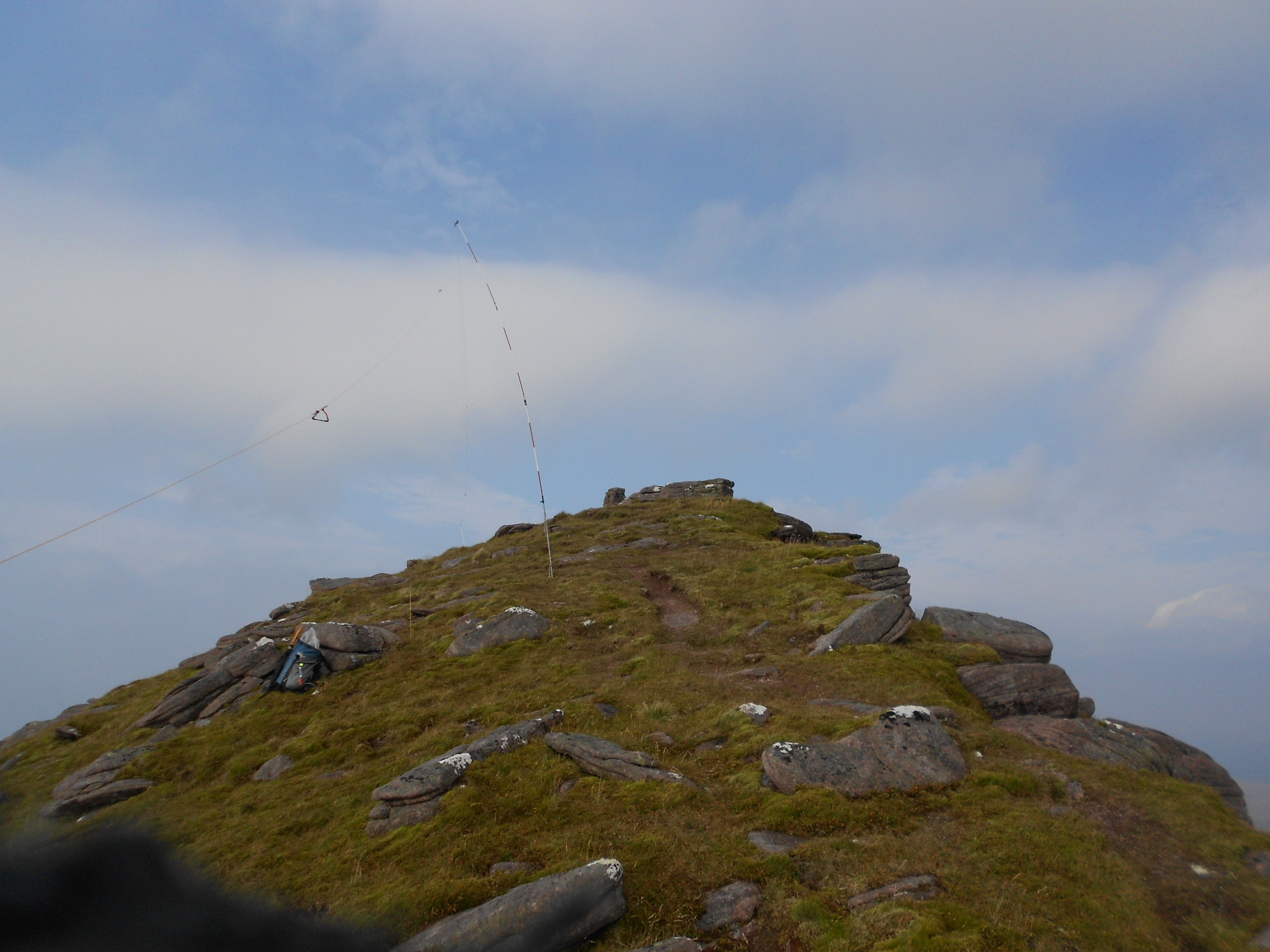
Above: Looking back at the cairn (NG 8586 6001) which marks the top of Coire Mhic Nobuil 170m short of the summit.
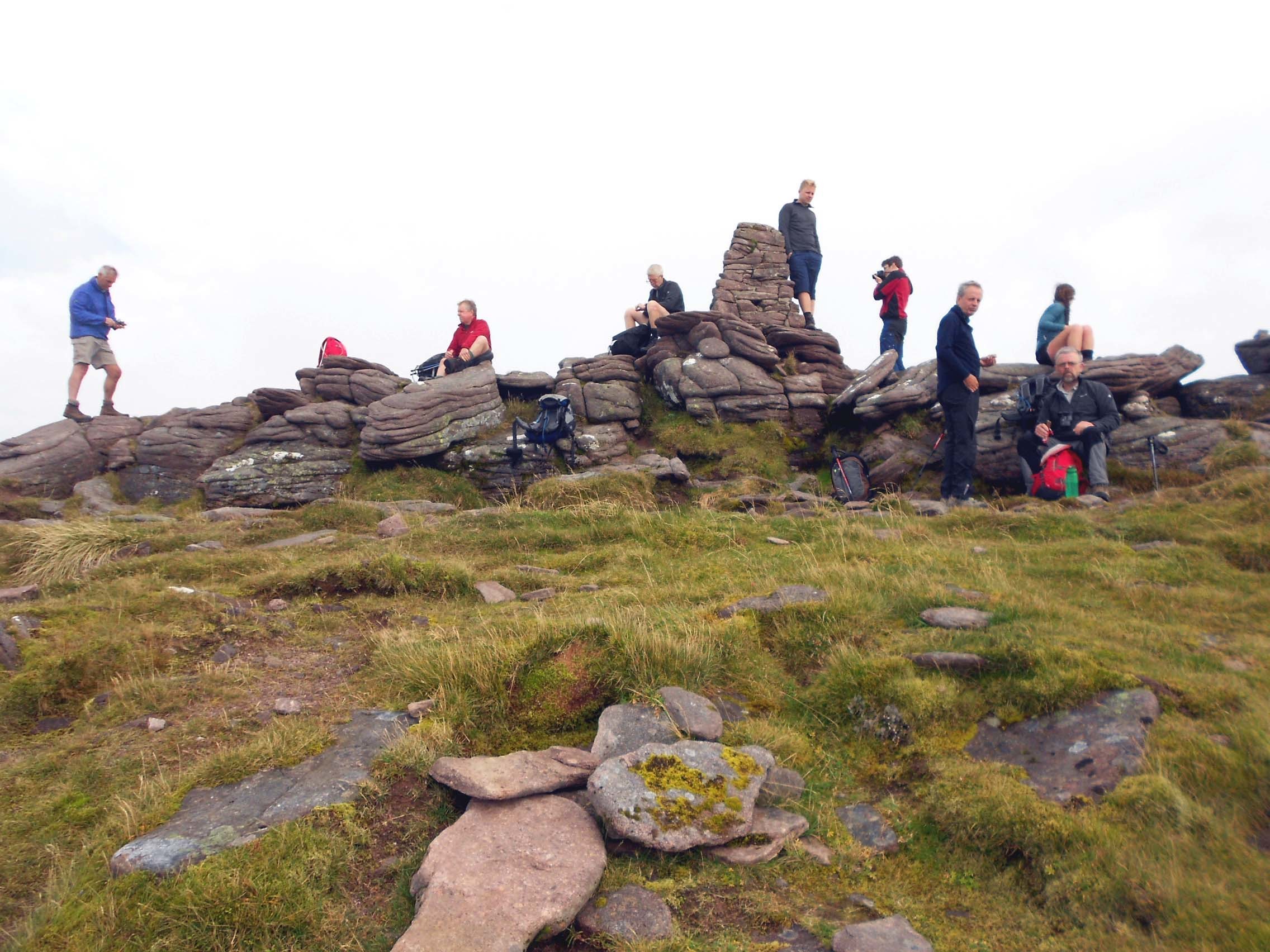
Above: Summit of WS98 - seemingly a popular climb.
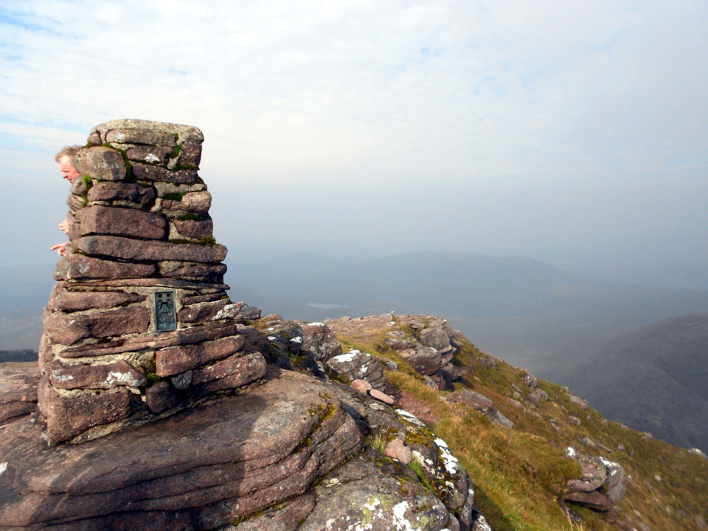
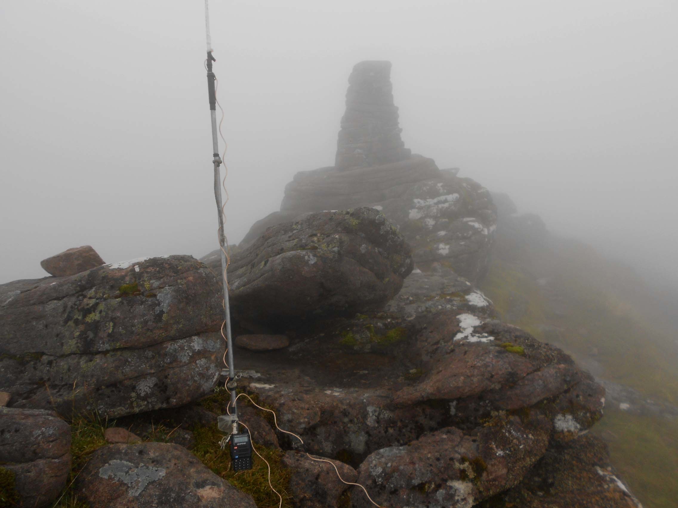
Above: Summit of WS98 and trig point TP-1149 (aka OS BM S9431)
Above: Summit of WS98. Setting up for the activation. Trig point out of frame to right.
Above: WS98 HF activation. Trig point just visible.
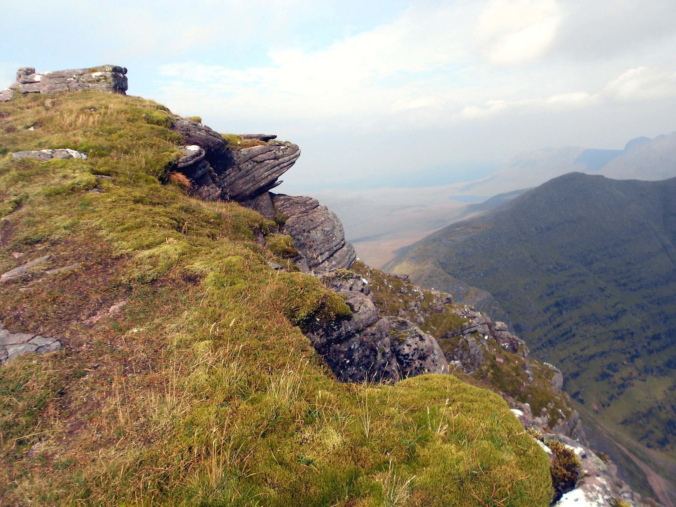
Above: The ridge (right) is the route to WS68.
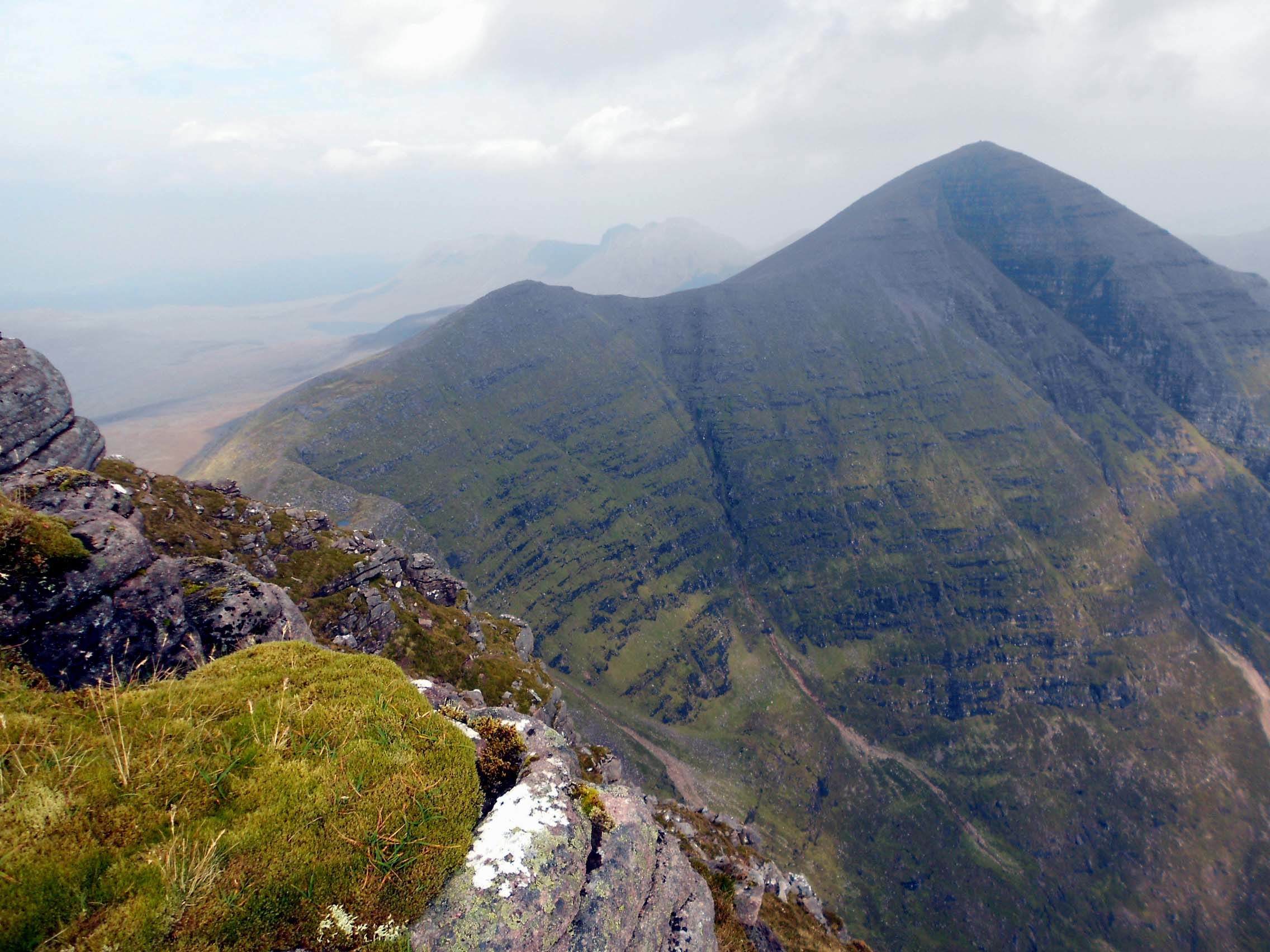
Above: WS68 is shown to the right with the connecting ridge from WS98.
Above: WS68 is left of photo with Horns of Alligin at centre, should you care to try this continuation and retreat route. I didn’t.

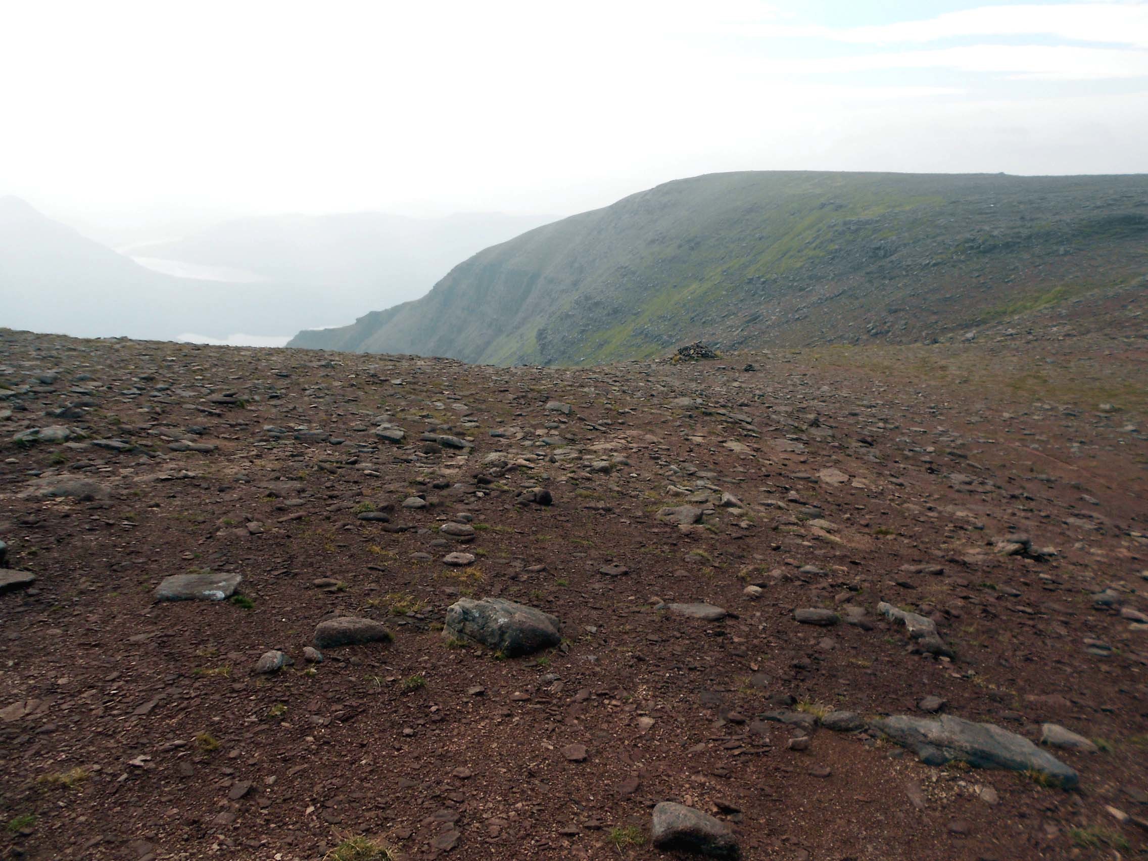
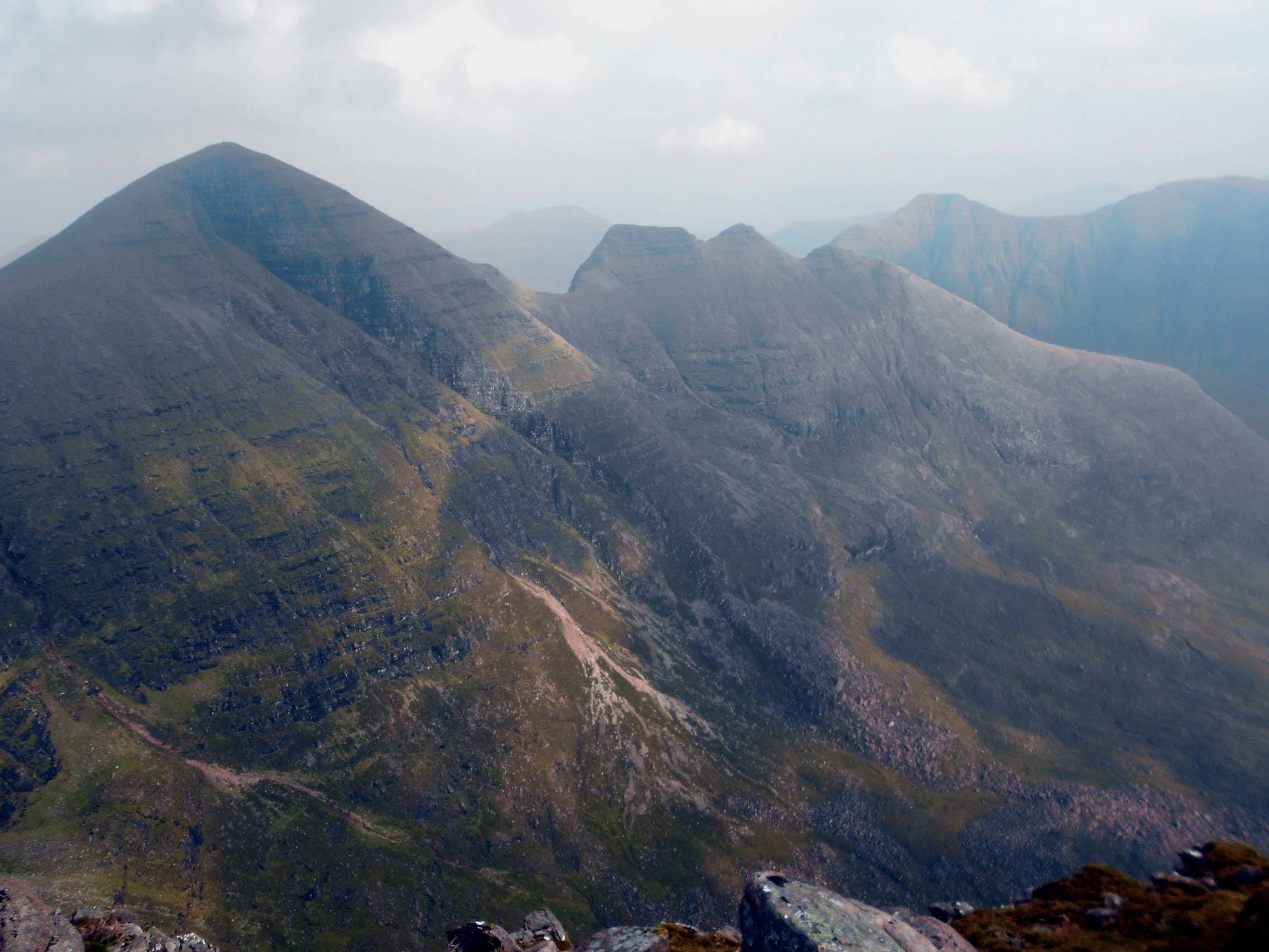
Above: View from WS98 looking roughly ESE over a 500m drop: Disregarding small hill half way up left frame; from L to R: Beinn Dearg (WS104); Beinn Eighe (WS63 & WS52); Liathach WS28 & WS43). Pity it’s a hazy day.
Above: WS98 VHF activation. UV-5R to J-Pole. Nil QSO’s.