A more complete report of my recent NA activations:
I’ve been staying in Knoxville, TN for a week for my work, and took the opportunity to do a couple of activations on one Saturday I had free. The return trip to the UK required a flight home via Atlanta, with a gap between flights of 8 hours at Atlanta - so I also took the opportunity to activate a hill on the eastern side of Atlanta.
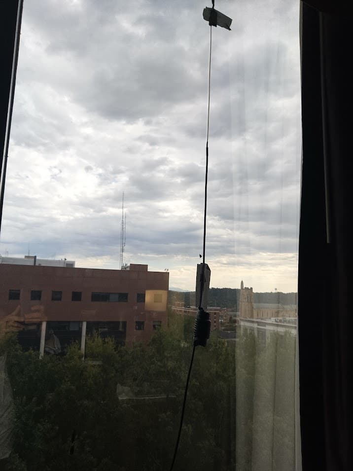
Operating from ninth floor of Knoxville Hilton with a flowerpot taped to the window
House Mountain - W4T/RV-035 Saturday 7 October
A lovely blue sky dawned on Saturday, and after a clear night it was surprisingly chilly. After stocking up on supplies from a nearby supermarket a got an Uber out to the first summit. I don’t drive and hiring a bicycle looked like being impractical - so I was reliant on Uber. My main concern was whether I would have a 'phone signal to request a return trip from the Uber app - a lack of signal would mean a long walk back to Knoxville.
The Uber dropped me off at a road intersection, and a walked the short distance to the car park near the trailhead. It as 0830 local time, and despite the fine weather the car-park was empty. The signal on my 'phone was very intermittent - but I had a backup plan to request my next ride, see later.
The walk up the summit started on a well maintained and waymarked trail through dense woodland. The trails form a circular loop taking in the summit, and I followed an anti-clockwise loop. The trail kicked up steeply across some rocky ground just before the summit, making it a more interesting walk than I had expected.
The summit was surrounded with trees - this is a novelty as only one or two of my SOTA activations so-far have had trees available.
I started off on 2m, glad that my second hand FT5D had been wide banded allowing me to call on the 2m frequency of 146.520MHZ. An immediate response from KQ4FRT gave me my first US SOTA qualification, this was followed by W4MW and then a S2S with K2JB on W4C/CM-028.
I moved onto HF, casting the end of my EFHW into a convenient tree, and placing myself and radio on a large flat boulder, I was using an FT818 with my recent 1850 battery modification.
It took a couple of minutes for RBN to spot me, and my first contact was with N4DC followed by N5DH. I had a bit of confusion with N5DH as he ended his over with “NC” and I assumed I had got his prefix wrong, after correcting “N” to an “ND” I then got even more confused as I was sure he had sent N5DH. It took a couple of more overs before I realized NC was his State (North Carolina).
I had a few more contacts on 40m before moving to 20m were a good pileup followed, 20m seemed more lively. I got a S2S with AC7PB on W7W/KG-122 .
Shifting to 15, OI had a clear QSO with EA2LY and SM5LNE - pleased to get across the Atlantic, and also got a S2S with AA7OY on W7A/AP-010 (a 10 pointer in Arizona).
It was starting to get a bit chilly, and I had to make decision whether to stay on this summit for most of the day, or try and activate a second summit.

Easy Walking

Activating House Mountain

Signal Point - W4T/RV-028 (First Activation) Saturday 7 October
My second planned summit for Saturday was Signal Point. This summit has so-far been unactivated due most probably to it being in private ownership… Some research prior to my trip with help N6JF revealed a report on the PeakBaggers website of a hiker who had gained permission to climb the hill, and gave the location of the house of the owner.
It felt like a bit of gamble to move on to Signal point, since there was not certainty the owner would be at home (or would give permission). Not only was it an additional Uber ride (taking me further from Knoxville), but I was having fun collecting new states and summits from house mountain.
The sense of adventure won, and I packed up ready to tr y and bag a first activation. Before leaving the summit, I reserved an Uber from the car park for 40minutes later (I had a good signal on the summit). I also reserved an Uber from the Signal point trailhead back to Knoxville for around 6 hours later - to give me a backup plan for having no signal and to ensure that an Uber driver would be happy to go out that far.
I made it back to the car park in plenty of tine, and met met the Uber. We were soon driving up the very rural McKinney road where I got dropped off at the house my research had earmarked. It didn’t look hopeful - curtains and blinds were closed.
I knocked on the door as the Uber pulled away, and found no answer. “Well that was a quick fail” was my main thought. I walked to a couple of neighboring properties but there didn’t seem to be anyone around.
Just as I was a bout to give up some workman arrived at what I thought was the owners house, and I had a brief conversation - they were not sure who owned the land but suggested I continue to ask neighbors; however, advised against approaching certain houses!
After trying a couple of neighbors I gave up, and started walking back tot he main highway to try and get a 'phone signal, perhaps going back to House Mountain for the afternoon. At the point a car drew up alongside me - the workmen had contacted the owner who had driven out to me.
The owner was a really kind chap and not only did he give me permission, but he drove me up the trailhead and chatted to me about the history of the area. Signal point was used a as a signaling station during the Civil war, using a heliograph to relay signals from the Smoky mountains northwards.
The land owners posses around 30 acres covering the hill, and a narrow strip of land joining it to the public road. He showed me the narrow strip of land, which at one point included a trail – but it is now heavily overgrown.
He wished me luck and asked me to pop back for a cup of tea on the way back down. I’m glad he pointed out the trailhead as I would not have been able to identity the overgrown route on my own.
I started hacking through undergrowth; with thick tree coverage GPS signals were intermittent and so I started recording my route using compass bearings and dead-reckoning so I had something to follow in the way back.
After about 1.5km I emerged onto a dirt track, and was then able to follow the excellent guide from the peak baggers website. The route proceeded as follows:
- Emerge from overgrown trail, leaving a marker to identify where to turnoff (and take a compass bearing)
*Walk around 300m to a junction of four tracks, turning left and heading north and then west for around 800m.
*at another junction make a harp right onto a smaller quad bike trail, climbing steeply (rutted in the middle due to water run-off). This takes you up to the main ridge
*A trail now follows around the ridge line, passing a couple of junctions, until it reaches Signal point

Hacking Through Undergrowth

Quadbike trail climbing up

Walking along the ridge
I was surprised how well used the trails appeared to be, and very relieved after the first 1.5km of undergrowth.
Atop the hill I made a couple of contacts on 2m, including a S2S and then moved to HF. Again, 20m gave the most activity, including F4WBN and a couple of S2S.
I packed up after an hour or so, and began retracing my steads, delighted to have achieved a first activation. Back at the road, the house owner was unfortunately out again, so I didn’t get my cup of tea, but was able to leave a note thanking him.

Operating conditions

EFHW threaded through two trees
Stone Mountain - W4G/CE-003 Friday 13 October
With an eight hour layover at Atlanta airport, I had plans to do a quick SOTA summit. After landing at about 0945 local, and with no need to collect my checked-in luggage, I was surprised how quickly I got through the airport with the only trouble being getting lost in a multi-story carpark on the way to the Uber pick-up zone. It was a around a a 30 to 40min drive to stone mountain (and typical Uber price of $30 - but can be higher). The Uber dropped me off at the gatehouse tot he Stone Mountain Park at 1051 local (avoiding the $20 entrance fee that is not charged to pedestrians).
This is a busy tourist spot, and it was fairly busy even though it was lightly raining. I started walking up the hill straight away. Stone mountain looks like a giant pebble, with the surface being entirely rick, all the way up. Only a few trees manage to somehow find root, and the rock can be slippery during wet conditions.
I reached the summit in about half an hour, and setup to call on 2m. I got absolutely no callers on 2m,despite spending around 20m calling. The summit features a a Tv transmitter (WGTV) transmitting on 174MHz at an ERP of 62kW. This was overloading my FT5D, so although I was getting lots of calls (I was later emailed by W3Cp who was listening in) I couldn’t hear any of them.
I scouted around for a tree to use with my EFWH. All my equipment needed to have been able to pass through airport security, so I couldn’t carry my heavy duty Sotabeams mast (which I assumed would be viewed as an idea bludgeon by security), hence was reliant on the trees. Despite the entry on the sota information page suggesting no trees are available here, there were plenty of options, the most difficult part was finding a loose stone to wrap around the antenna end for throwing. I soon had the antenna setup and was relieved to make my first contact and qualify this hill.
Operating with the FT818 held inside a dry back to protect from the light rain showers, I got a good pileup on 20m and 40m including a S2S. Switching to 15m I was called by K5El, EA2LU and OK2PDT.
I packed away at just before 1300hrs, and out another call on 2m – this time using my little rubber duck antenna. I managed a couple of contacts on 2m, but was unable to hear a S2S that was apparently calling me.
Pleased with getting the activation qualified, I started heading back down the hill, and was back at the airport by 1420.

Lower slopes of Stone Mountain

Handrail on a steep bit of Stone Mountain

Approaching the summit

Transmitter (and cable car station) on the summit

Trusty F818 and BaMaKey TPIII with EFHW balun dangling behind

Operating position

Operating position

Plaque half way up

My transport home – differnent to my usual method of cycling home!