Well today ended up being a Mega fail, drove all the way to W7M/PS-058 and did not feel comfortable entering due to private land. Ended up driving out to W7M and not activating, did not have the best antenna today. Still had a great time and climbed some pretty serious vertical feet in knee deep snow at -8 degrees Fahrenheit. New to radio but far from new to the mountains.
1 Like
Thank you for the clarity @everyone.
Great work climbing that summit in those conditions. I don’t know if there would have been cell coverage, but there is an SMS spotting system you can use to create a spot for yourself, alternatively if cell coverage is good you can use various apps or a web browser on your phone to access Sotawatch and create a self-spot. Or even use a repeater and ask anyone there to post a spot for you. That usually brings chasers like bees to a honeypot. Next time! 73 Andrew vk1da
1 Like
It was on 2m FM on a Sunday morning. Full story here:
1 Like
Hi,
You say you ended up not activating but your video shows you calling CQ SOTA on a magloop antenna. Where were you calling CQ from?
Was it from another SOTA?
What frequency were you CQing on?
It’s a shame you didn’t get any chasers but I hope you’ll work that out to better luck next time.
Remember that being spotted on SOTAwatch is key for a successfull activation.
73,
Guru
1 Like
It took me three goes to qualify GM/ES-001 (involving quite a considerable walk-in and ascent) but I had already activated it at first try with one qso and 3 qso’s on the first two forays. This was in the days before SOTAwatch was available and there were few chasers about - still kept going though 
1 Like
GM/ES-001 is on a 2021 hit list with gear for 13cms and more.
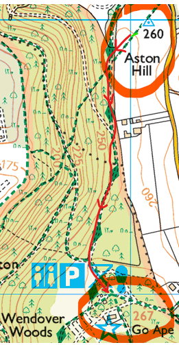
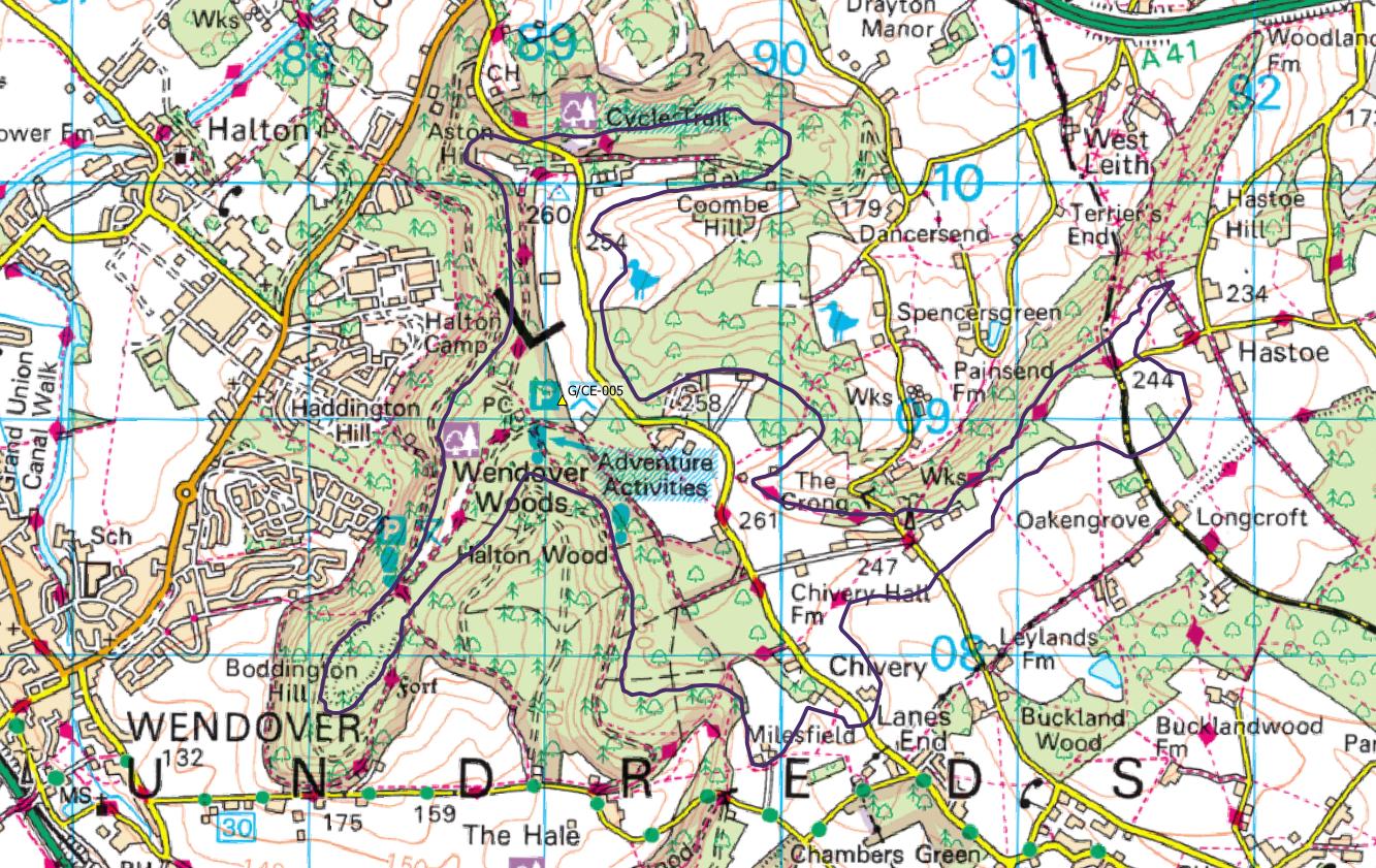
After living nearby for 19 years, I know that trig-point field and Wendover Woods like the back of my hand. Looking at your photos Tom, I’ve rarely seen that field looking such a mess - there’s obviously been a recent event where they used it as a car park.
I’ve erected everything from an 80m dipole through to a 23cm Yagi on a tripod on that field, albeit in better weather than you had. [The surrounding tall trees when wet make it less than ideal for 23cm]. Good old G4DUL - sometimes I would call CQ for ages and he was the only one to come back to me.
I see you breakfasted at that huge new visitor centre that they were just about to open when we left Bucks two years ago. The ‘highest point in the Chilterns’ marker is close by and I reckon - looking at the map - you were still in the AZ in the shelter of the centre. Pity you had no luck there either. Seems odd for Sunday mornings.
©Crown copyright 2021 Ordnance Survey. Media 018/21
Maybe next time.
1 Like
[Andy - I added the required notice for your map]
Approx AZ for G/CE-005, derived from OSGB Terrain 5 terrain model (available LIDAR does not cover the summit):
©Crown copyright 2021 Ordnance Survey. Media 018/21
1 Like
Ask Tom whether it would be a good idea if I tagged along for a “long day out” 
You can’t come on that trip… I want you on the other end of 13cms! 
Simon, It’s fascinating to see how much of the area is in the AZ. Boddington Hill in the SW corner of the AZ would have had a great VHF takeoff 2500 years ago when it was a Neolithic fort [not to mention a good lookout post for hostile tribes] but in modern times, the trig-point field is about the only place not covered in trees.
P.S. thanks for adding the OS Map caption (I forgot)
I’m glad I’m not the only one.