Ardnamurchan & Morven reports

I find the stuff so disgusting it would probably add a halo!

Doesn’t the extra 3 kg of weight on your feet slow you down?

Anyway, no luck today but at least I have found what the trouble is - I think of my garden as a wildlife haven but the little beggers have it in for me! A week or so ago a squirrel gnawed through the guy line holding up one end of my doublet, and today I found that the ribbon feeder has been bitten through in two places. Better luck tomorrow, I hope, though I am shopping in the morning!

Brian

Many, many thanks for taking 2m with you. It certainly has been a long wait to get some completes on any of the hills west of Loch Linnhe.

Maybe there will be a rush of activations when you download the rest of your pictures and everyone sees what cracking hills there are in Ardnamurchan. :wink: The Munro baggers ignore the area because the hills are relatively low - their loss!!!

Sadly true - though few can resist the siren call of Garbh Bhein (WS-125) after seeing the sun setting behind it from Glencoe!

Brian

Another view down Loch Sunart whilst I was enjoying another Belhaven Craft Pilsner…

The forecast is for rain from 900am. It’s possible I could outrun it and grab a small hill around Oban but I’m going to take a leisurely and scenic drive back. So there wont be a summit today, sorry.

No need to apologise. Not one of the summits in that area looks easy, so no quick up / quick down option. Will keep an eye on the spots anyway just in case a break in the weather does allow you to do something.

Have a safe journey back home.

73, Gerald G4OIG

#Distractions on the way…

To get to Ardnamurchan and Morvern you pass a few distracting Munros. They’re even more distracting on a nice day. Anyway I had to stop, the tourist traffic across Rannoch Moor was terrible.

So first we have Buachaille Etive Mor - Stob Dearg WS-044.

And when you look the other way you have these two Munros and a Corbett, Meall a’Bhuridh WS-017 (left of centre), Creise WS-019 (right of centre) and Beinn Mhic Chasgaig WS-140 (far right). Climb that lot and you get 24 points.

OK, major distractions dealt with! :wink:

Cruim Leacainn WS-344

This a wee hill with several transmitters at the top. I’d normally try to find something nicer to do on the way but this is due for deletion as it isn’t P150. However, before it can be deleted, I need to activate it. That’s now done so this one’s days are numbered. Park in the layby by the entrance to Achindaul Farm and follow the road then track to the summit. Easy peasy but very sweaty on what was now a “silly-hot” day. Nice views from the top and no interference noted on the LF bands or 2m FM. I was very surprised to work Robin GM7PKT who was on Ben Lawers CS-001, some kind of diffraction over the 1000m mountains between me at 228m ASL and robin at 1214m ASL. Return via same route then down to the Corran Ferry for the most expensive ferry trip per metre sailed. £8.20 for 400m! But it saves 70miles of awful roads so it is cheap really.

The view down Loch Linnhe. The thin strip of land is where the ferry sails. The hill in the centre in the very far distance is Bheinn Mheadhoin (Ben Vane) WS-203 on Morvern and the rising ground in to the right at the same distance is Beinn na Cille (Ben na Kill) WS-254 also on Morvern.

Three big boys, Aonach Mor, Carn Mor Dearg (Carn Mor Jer-rag) WS-003 and Benjamin J. Nevis Esq. WS-001!

Summit trig point Cruim Leacainn

All in all a very pleasant walk and nice wee hill with some jolly good views. Get it before I delete it.

5 Likes

A glorious photo of the Buachaille, all that lovely rock makes my palms itch for yet another grab and thrutch up it!

Brian

#Creach Bheinn WS-150

Tuesday started with a bright blue sky and a warm feeling. It got hotter and hotter, ending up over 25C and that is quite unusual for up here. I had arranged parking at Carnoch Farm and spoke to a man chopping firewood about the track. He told me it could be a bit damp on the North face and took take water as the burns can be very dirty.

My route was along the hydro track to the small (1MW) power station then up the hydro track which climbs the steep North face. Then I was going to follow a track marked on the OSM maps that follows the Allt na Fhaing burn. Easy! Then straight up to the ridge and thence the summit. How hard could it be? Er… well 25C temps had not been factored in for a start.

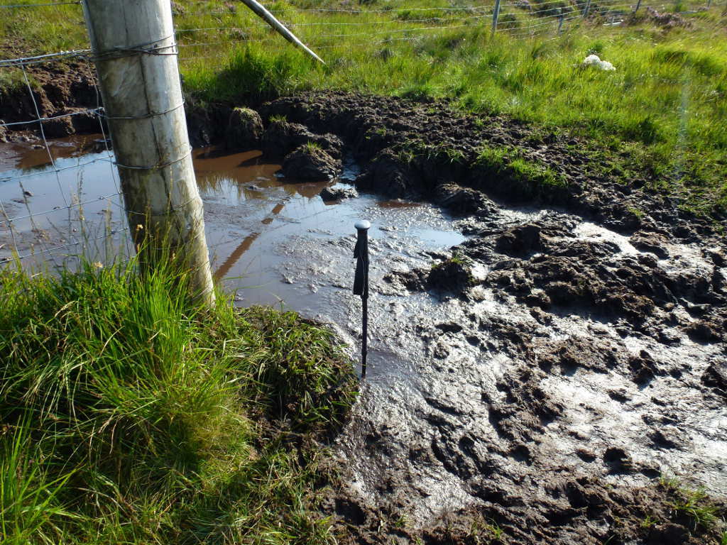
The track to the power station is easy, in fact I did discuss driving the track up to the end and the only problem was the gates could be padlock and the wood chopper didn’t have a key but he wasn’t concerned about it. My HiLux would have sailed up in low 4WD as well. But… I was really here to walk so I bimbled off. The hardcore track stops at about 225m ASL and there is a horrible wet ATV track that runs to a deer fence. There is a gate which is always good as 90kg of FMF 8ft in the air on a fence is scary.

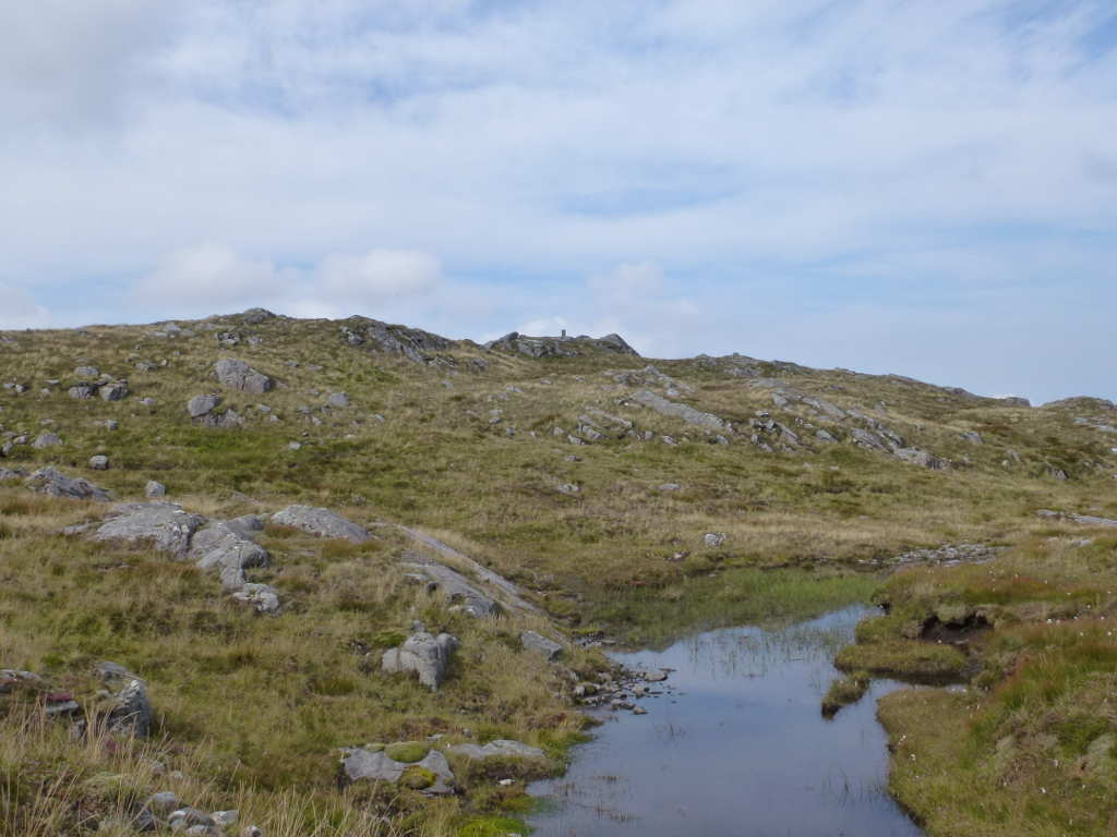
How wet? Here is the bog pool at the gate in the fence, my pole went 50cms into gloop!

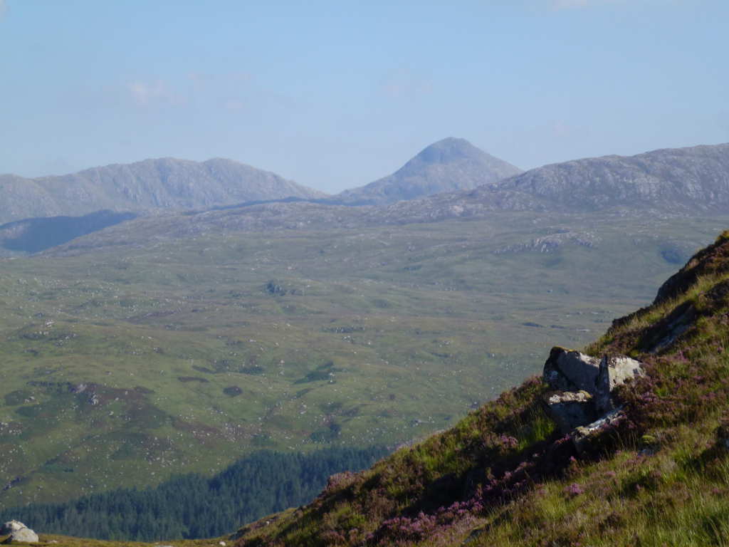
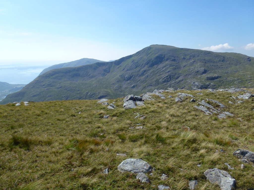
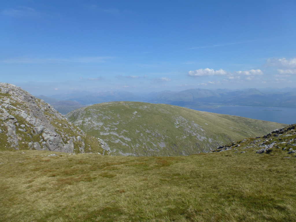
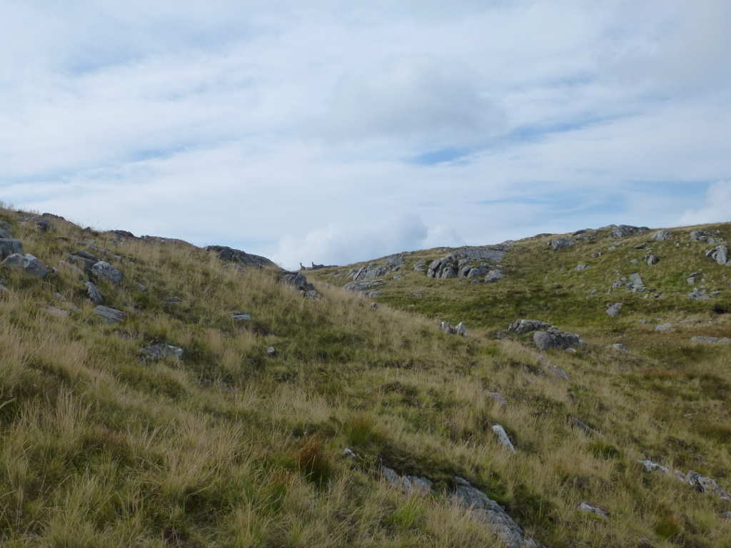
There’s a bit of a hint of a track after that but I aimed for the skyline at the bealach. It’s about 1.3km of rough terrain, uneven ground, long grass and rocky outcrops. Finally I reached the ridge and the ground improved massively. To make up for the horrible ascent so far, the view was not bad.

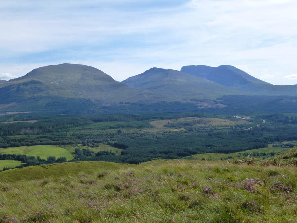
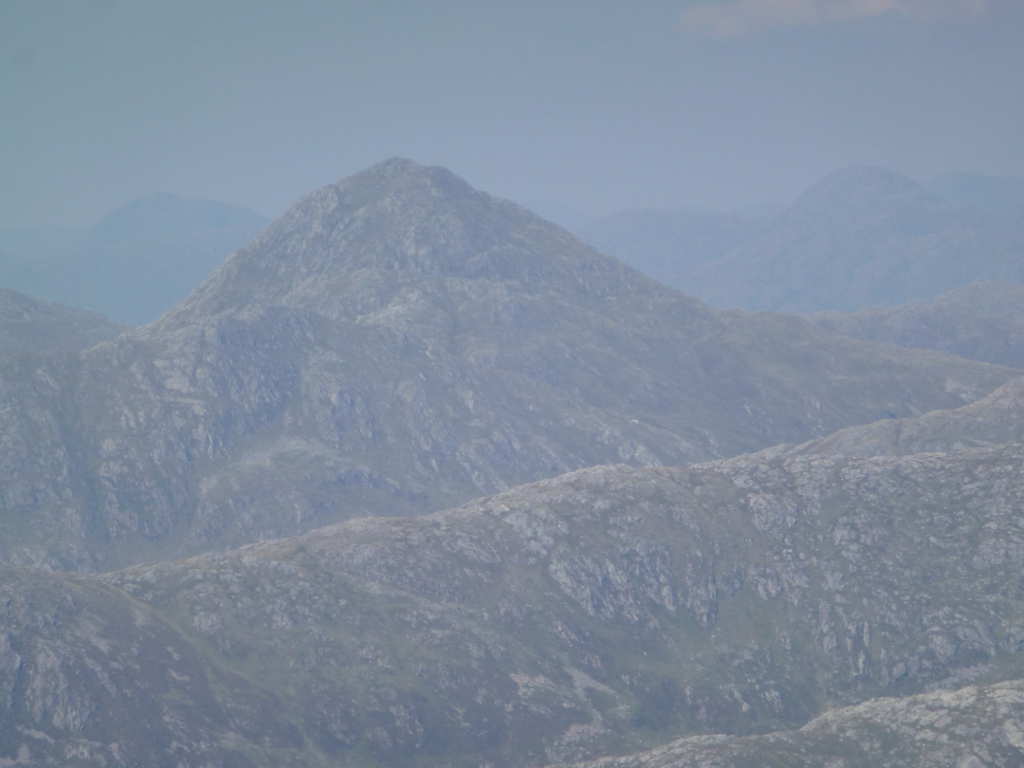
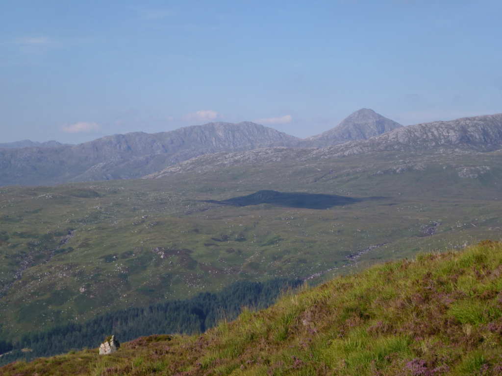
The fine point peak of Sgurr Dhomhnuill WS-125

To the South there are the 2 neighbour peaks on the classic horseshoe that Creach Bheinn sits on. The near summit is Fuar Bheinn WS-192 and Beinn na Cille WS-249.

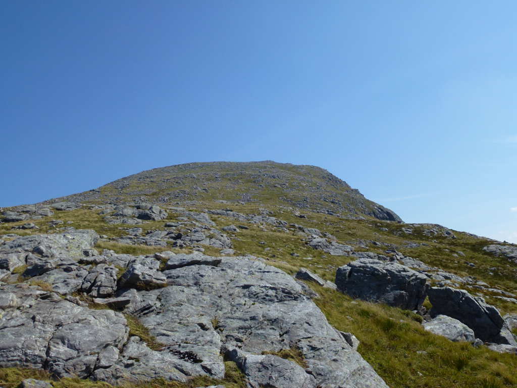
Are we there yet dad? Sadly not! :frowning:

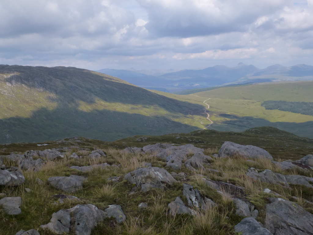
By the time I had slogged my way up that lot I was cream-crackered. I was doubting my ability to get up this as I ended up taking nearly 1h longer than the computer suggested. Partly the ground but mainly the heat was playing havoc. Now I had plans, depending on legs and WX, to attempt Fuar Bheinn afterwards or to visit Maol Odhar. Fuar Bheinn is worth 4 points and Maol Odhar has the plane wreckage. In May 1964, a F101 Voodoo flying at 25000ft exploded and the wreckage landed on Maol Odhar. There is substantial amounts remaining including the engines, pieces of fuselage showing USAF markings etc. Looking at what would be needed, the crash was less effort than more points. But both were out of my level of ability in the heat. Oh well, there’s always next time.

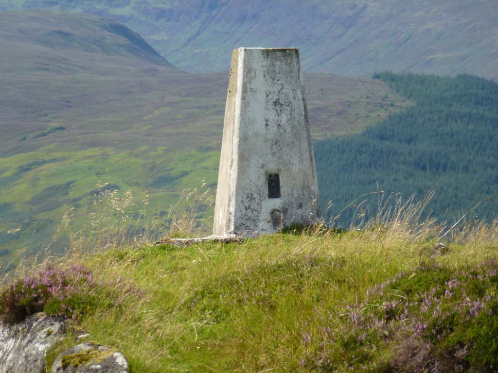
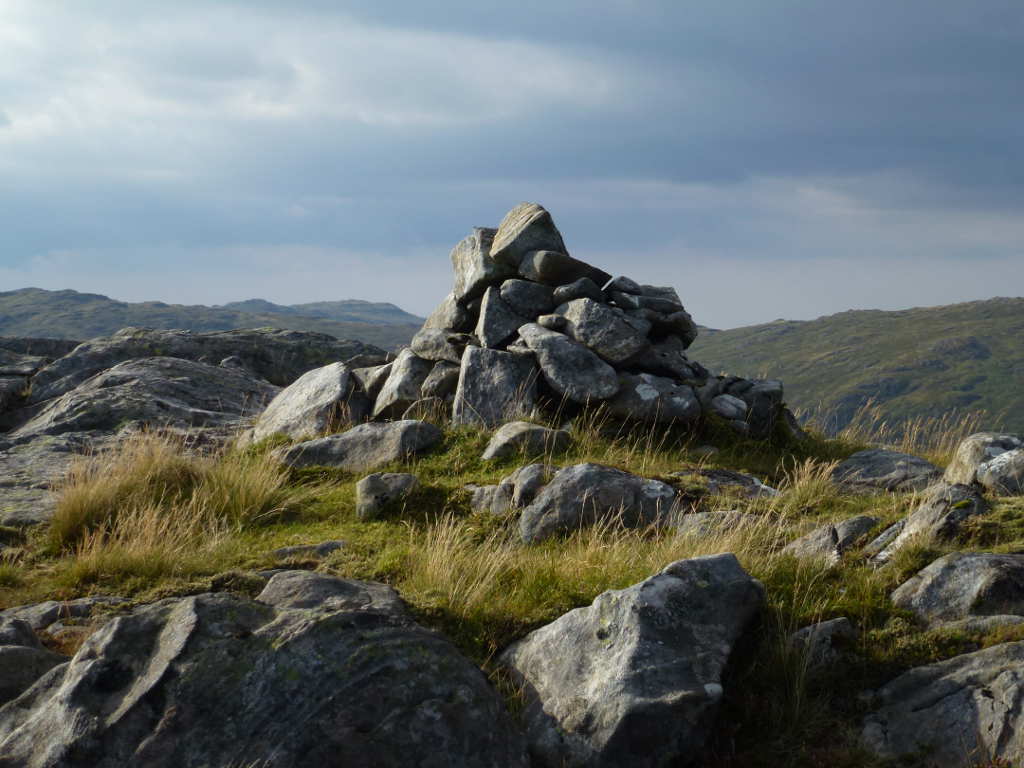
There was a wonderful strong breeze that kept the apparent temperature down. But I knew it was hot so I applied more sun cream before setting up. I’d planned a 2m S2S with Robin GM7PKT so the handy was on first as I set up the HF gear. Robin appeared and we had our S2S. Best of all it was a 2-way completion, Robin gained Creach Bheinn and I gained Mheall a’Bhuridh. Double smiles all round. After a goo chat about routes and summits for the rest of my stay I moved to HF were conditions were ok to rubbish. I had a QSO with Don G0RQL who wanted to know the trig number which I gave him. But sadly, damaged trigs don’t count.

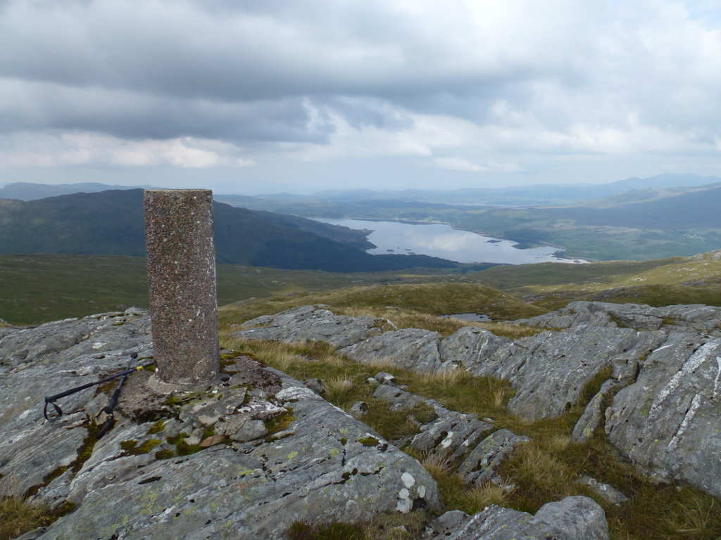
Don, @G0RQL, this is why the trig isn’t valid! The trig was a primary (original) trig and was made out of local stones rather than a concrete pyramid or pillar. Probably a lightening strike destroyed it but it has been broken for a long, long time. The oldest report on TrigpointingUK from 1996 has it damaged then. The fact it has a metal centre tube shows it was built before 1950 when the OS changed to lightweight cardboard tubes.

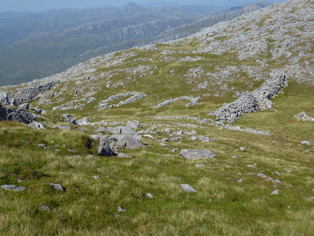
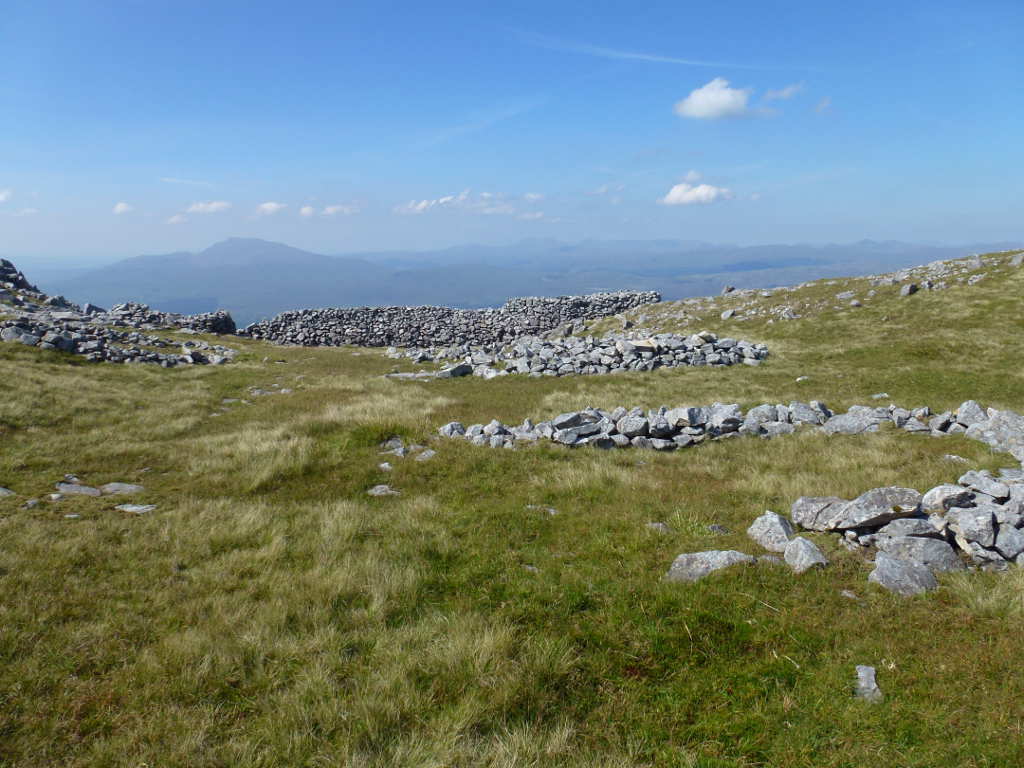
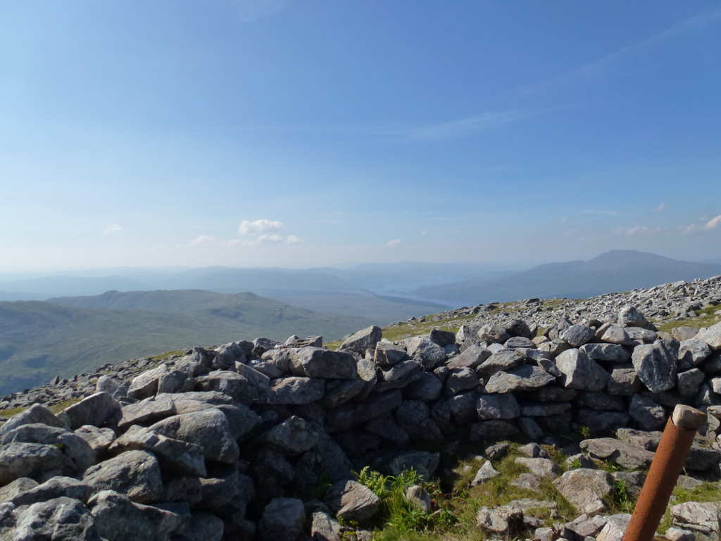
After working all the chasers I dropped down to inspect the Colby Camp remains. This was built during the first Triangulation of the UK in the 18th century. Creach Bheinn is such a good viewpoint up and down the west coast, it was chosen for some of the earliest observations. This is the second camp I’ve visited, the other was on Ben Hutig NS-132 up near Tongue.

Maol Odhar, location of the F101 Voodoo wreckage.

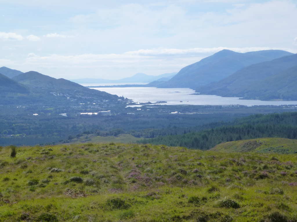
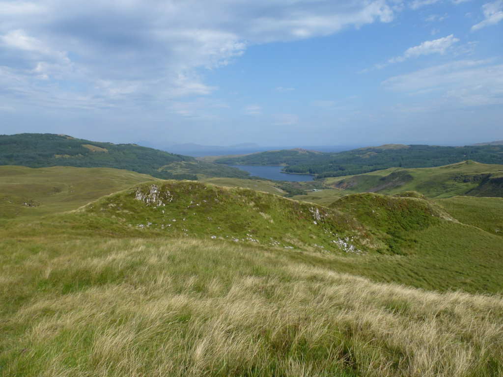
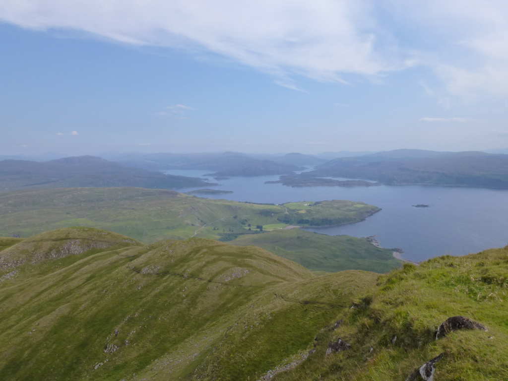
The Island of Lismore and the Lyn of Morvern

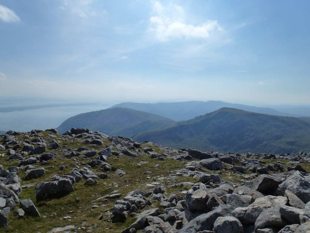
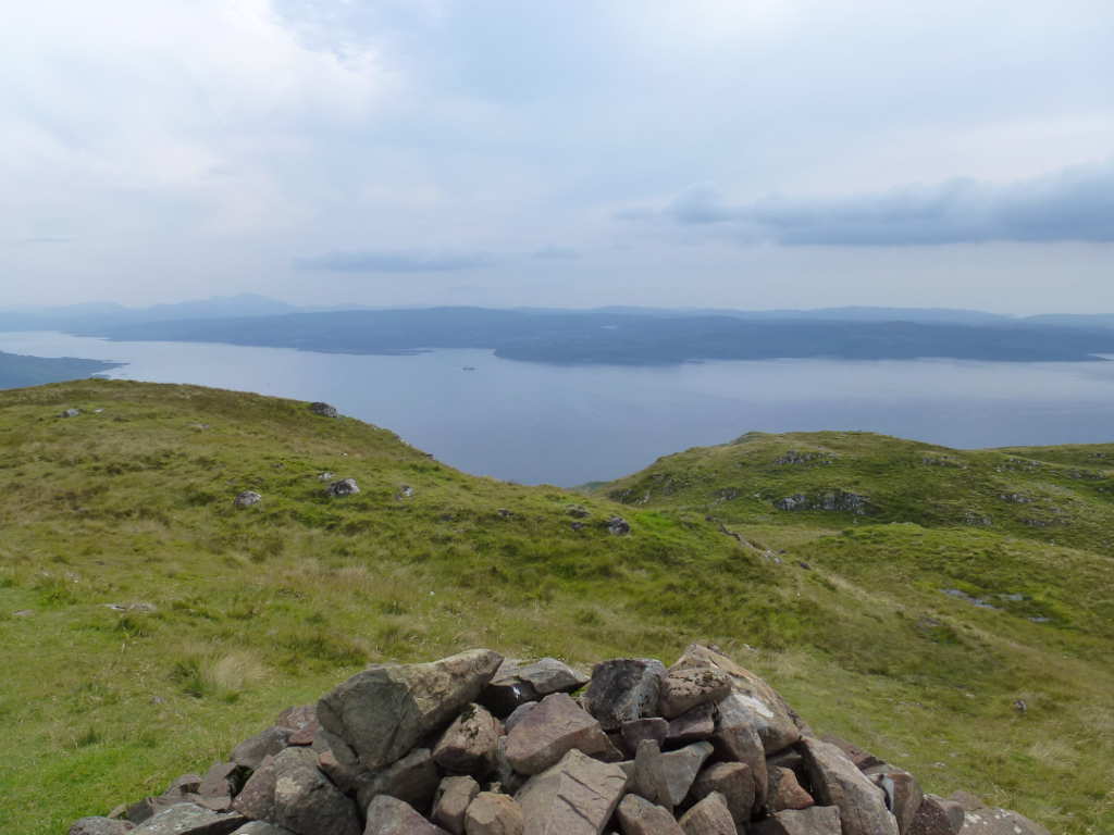
Looking South, Morvern summits: Fuar Bheinn WS-192, Beinn na Cille WS-249 and Beinn Mheadhoin WS-203

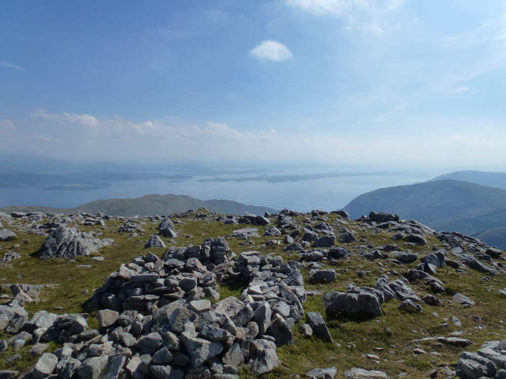
Looking down Loch Sunart, the big hill on the right is Beinn Resipol WS-153

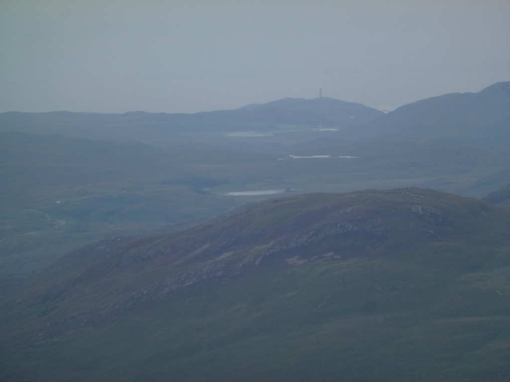
A zoom to Sgurr Dhomhnuill WS-125, it’s a shame it was so misty.

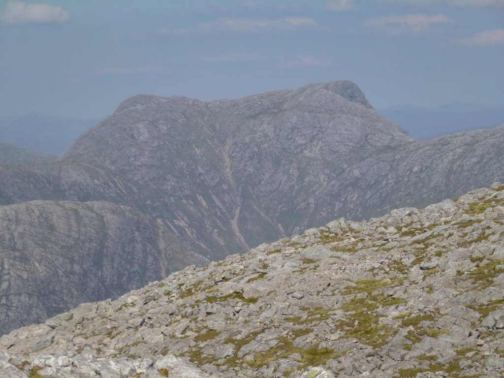
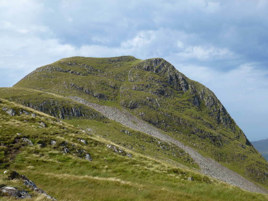
Brian G8ADD’s favourite Gharbh Bheinn WS-125

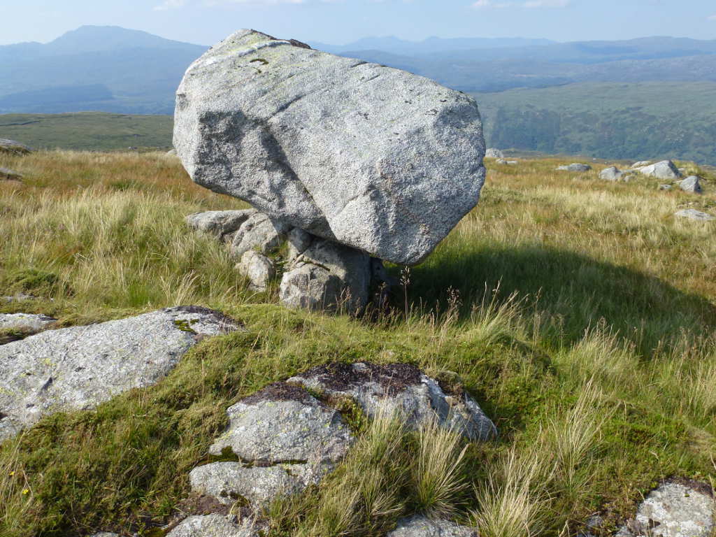
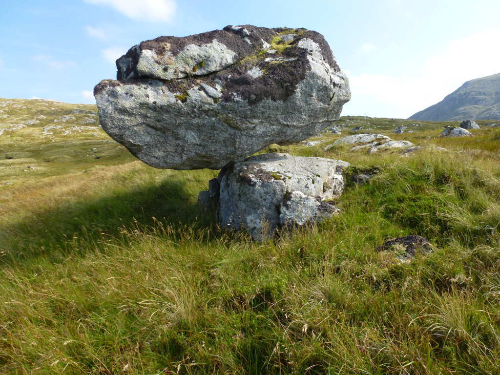
After spending ages just soaking up the view it was time to go. Packing up was easy and so was the descent. I expected significant complaints from my legs and feet but nothing. The route back was the reverse of the ascent. The burns I passed on the way up were fast flowing and very clean looking so I was confident in using up my remaining 0.5L of water knowing I could top up further down. On the way down I came across a wonderful piece of glacial tomfoolery.

Ladies and gentleman, the amazing balancing boulder!

But it gets better when viewed from the other side. This has probably been like this since the glaciers melted 10000-20000 years ago.

Sgurr Dhomhnuill WS-125, it’s so good you just have to insert another shot of him.

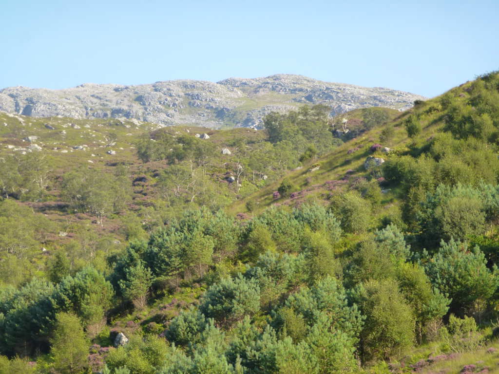
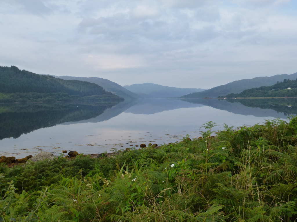
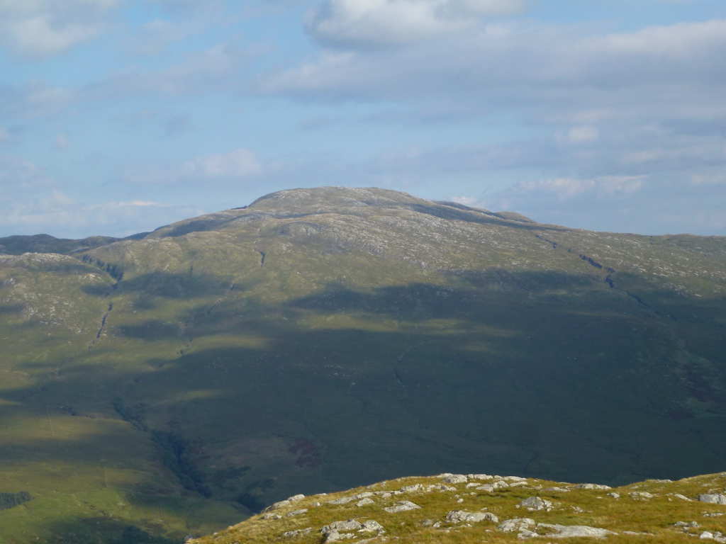
Finally back on the hydro track the heat was amazing. There was no breeze here at all and the reported temps where up around 27C. Resting on a gate I took this zoomed shot over the ancient woodlands looking at the summit of Creach Bheinn. I spent about 20mins here tripping out on my endorphins after all the exertion. A hot sunny day in a most amazingly beautiful part of the world with this to look at.

The lack of Munros on this activation was not a problem!

3 Likes

Thanks for the report, pics and the contacts I had with you Andy.

The signal path between West Wales and GM/WS was certainly working during the week. It looks and sounded as if you had a great time.

73 Allan GW4VPX

You sure know how to rub salt into a wound Andy. Those views have done nothing to settle my mind. I now have doubly serious GM deficiency syndrome. Thanks also for showing what Paul and I missed as we crossed Rannock Moor back in August 2014 after our week up in Inverness (en route to activate Beinn Dubh Airigh GM/SS-188). That didn’t help either!

73, Gerald G4OIG

Ben Hiant WS-294

With the WX holding and it being so lovely it was time to visit the far end of the peninsula. I’ve been here before but I was introduced to some “Noah” quality rain. It was a true delight to drive the narrow, twisty single track road through marvellous scenery. It took about an hour to drive from the 21 miles from Strontian to Ben Hiant. There is a large parking area at NM551641. From here there is a very good path to the summit. In fact it was the only summit with a walker’s path I saw all the time I was here.

I was delayed starting by a broken glove box lock on the car which stopped me retrieving the Raspberry Pi and satellite modem. 30mins late I was able to leave. The path is real strait forward, it’s an obvious black stripe full of boot prints nad requires no thought to follow. I discovered almost at once that the walk up Creach Bheinn the day before left me with zero power in my legs. So it took nearly twice as long as it should to climb this summit. It was well worth it and I was to find that this must be the most popular summit on the peninsula as there was a constant stream of visitors.

Looking North over Loch Mudle towards the isalnds of Eigg and Rum, the scenery is more gentle at this end of the peninisula.

At not too much time you are confronted with a riddle. How the hell do you get up this? This is meant to be a stroll not a scramble!

I’m not the only person to think that. Bill G4WSB said the same to me when we had a QSO, he saw this huge almost vertical wall and thought “how?”. Well it’s easy. When you finally get to the path you can see, the path continues around the back and is a gentle ascent to the trig. It is very confusing until you see it.

Looking back from the summit to where the previous photo was taken. You can see the black stripe of a path. Of course, nobody’s looking at the path. No, they’re looking at Loch Sunart and Ardnamurchan to the left and Morven to the right. Loch Sunart runs to the top left in this photo and Loch Teacuis is the narrow loch running away from this view. The biggish lump at the end of Loch Teacuis is Bheinn na h-Uamha ( Ben na hhhh-hoover ) WS-314. The island of Carna is where Loch Sunart and Loch Teacuis meet. Its summit, Cruachan Carna WS-347 had not been on the air since Clive MM1YAM actiavted in 2007. Then Bill G4WSB and Debbie M6BYW stayed there for a week this June. You wait for 9 years for another activation and seven come along all the same time!

Here is the CalMac ferry from Oban after sailing up the Sound Of Mull on its way to the Outer Hebridies.

Zoomed out you can see the Isle of Mull behind the ferry. The bay behind the boat is the entrance to Toberrmory.

Andy and Vanessa!

The bands were reasonable to poor. After arranging for S2S sessions with Robin GM7PKT yesterday, we’d arranged Robin would try to get somewhere suitable to chase me during his lunch time as he was working this day. I had the VX-170 + J-pole setup monitoring 145.500 and spotted myself. I’d worked 60m and was talking to some visitors when the handy squelch opened. Although it was a slightly scratchy 41 report both ways, I was able to let Robin complete Ben Hiant. The complete award has only been running a short time but it is retrospective so Robin had waited a few weeks shy of 14 years to complete this summit. We chatted about plans for tomorrow and I accepted Robin’s advice based on his experience of the area and decided Sithein na Raplaich ( sheen na rap-lack) would be badly overgrown with brambles and bracken for a Summer ascent.

After this I worked 40m and with the handy still on heard Rob GM3YTS out on the summit of Ben Lomond SS-011 for nice 105km 2m S2S. I had decided I was too tired to try another summit today and by taking it easy I would be able to attempt 2 summits tomorrow. So I moved to 30m and then 20m finishing off with another S2S with OH/PE1RMO/p.

The lighthouse at Ardnamurchan Point about 13km away. The most westerly point on the British Mainland.

I packed away, descended with ease as I expected leg complaints but there were none and decided that Sanna and its lovely beaches were in need of another visit. Last time I was here in 2005 I saw a Sea Otter. This time it was buzzing with tourists.

A failed attempt at an arty shot of Beinn na Seilg (ben na shell-agck ) WS-335 through the Machair. I couldn’t remember how to get manual focus so the mountain was sharp and the grass blurred. Never mind.
( Machair - Wikipedia )

Blue sky, warm sun, gentle breeze, white sands… this cannot be Scotland. But it is, the glorious beach at Sanna.

Finally, someone at the council makes a point about taking home your rubbish!

Another fantastic day rounded off with some nice food and lashings of excellent beer. I also sneaked a Magnum ice cream into the mix.

4 Likes

Bheinn nam Beathrach WS-294

After a reasonably gentle day before doing only a single (easy) summit I was prepared for 2 summits today. A lengthy talk with Robin GM7PKT the day before helped me decide that the bigger of my remaining possible targets would be completely hellish with bracken and brambles at this time of year. So Sithein na Raplaich was dumped and I decided to go with 2 straightforward summits Bheinn Chlaonleud and Bheinn nam Beathrach. Both a essentially straight up assaults followed by a bit of bimbling on the top.

It was meant to be cooler and cloudy today and it was cooler and cloudy but as the day went on, the cloud cleared, the haze cleared somewhat and it got warm again. There was almost no breeze down at sea level. Best show by these 2 views Loch Sunart which was completely calm.

The drive across Morvern was easy, it’s a single track road but was such it was easy to make good progress without driving like a loony. I parked at NM771570. This is a parking area that is not a passing place (something most tourists didn’t grasp) and is used to access the transmitters which are set back from the road. Take care not to block the gateway and track here as one of the transmitters is a Police/Ambulance transmitter. From the strength of the Vodaphone signal, I’m guessing that was the other one. There’s is a wet ATV track to the transmitters. From there it’s wild walking and the climbing starts. Robin’s advice was “keep north off the big gully and just go up”. That’s what I did. I didn’t take a photo from the car though so you don’t see the bank you climb. But you climb about 270m in 1km so moderately steep. With little wind it was very hard work but easier than Ben Hiant the day before.

Finally the slope eases off and it’s about 1 km to the top. It’s very uneven and there are what seems like an infinite number of lochans and bogs to avoid. In the mist this would be difficult. It would be hard to follow a bearing due to the non-stop direction changes on the ground and relying on a GPS full time is asking for trouble one day.In snow it would be tricky too… far too many places to get wet when you go through the snow!

Nearly there, the worst of the wet ground covered and the trig is clearly visible.

A couple of hinds caught on camera, they stood motionless until I reached for the camera then they were away. They;re on the skyline, left of centre.

I set up at the trig and started with 60m then moved on to 40m and finally 30m. Conditions seemed OK. There was some confusion when I worked David G(W)0EVV on GW/NW-062 as another station gave me a report as well as David. I worked Steve GM1INK for another S2S and the confusion on the WAB net was immense as there were 3 groups of stations not able to hear what was happening. But all in all it was enjoyable which is what it’s all about.

Creach Bheinn WS-150, Fuar Bheinn WS-192 and Beinn na Cille WS-249 dominate the middle distance. This is looking due East.

Finally let’s see if there’s any wind yet to disturb Loch Sunart? Nope, still flat calm!

A quick pack up and a dash back to the car the same way as I came up took almost no time. It was interesting watching just how much traffic there was on the road that goes nowhere but Lochaline and the ferry terminal to Mull as I dropped back to the car. A litre of water drunk I set off to the next summit.

3 Likes

Beinn Chlaonleud WS-308

It’s about 10mins to drive to the parking space for this summit from Bheinn nam Beathrach. I was still thirsty and the sun was now quite strong with the cloud lifting and the haze leaving to. What to drink to give me a boost? Ah… Red Bull. Well in my case a diet supermarket own brand which has the same ingredients but is a 1/4 the price. I mainlined 3 cans. Gordon Bennett it tastes awful but it does the trick.

The route up was from near Be Ach farm at an entrance to where the woods are being harvested, plenty of space here. The route was straight up to about 3/4 up the end of the ridge then follow the ridge to the summit. Surprisingly easy even though the sweat was dripping off me. Must be the Red Bull. It did seem to take forever to actually summit out but that was because I knew it would probably be the last of the trip with the changing WX.

Finally made it but 3 cans of Red Bull does leave an after-taste!

I thought the light was looking wonderful and the views which had been hazy where improving. Here is looking North with Bheinn nam Beathrach WS-274, the earlier summit, on the left, Sgurr Dhomhnuill WS-125 in the far, far distance. The road up to Loch Sunart snakes through the middle.

The triplets of Creach Bhein WS-150, Fuar Bheinn WS-192 and Beinn na Cille WS-249

I set up both the LF dipole and the J-pole for 2m. Robin GM7PKT was going to try to get away earlier from work for another complete for him. He was 1st in the log and a cracking signal. He told me Seamus MM0CWJ was going to activate Easaval (eesh-a-val) SI-184 on South Uist and it would be a simple QSO from my location. After a good chat I switched first to 60m SSB. I heard the squelch open on the handheld and it was Seamus calling CQ. An easy 2m FM QSO followed, 59 both ways over LOS 120km path. That was a nice contact to make. After that it was 40m SSB and then 40m CW. With a few unanswered CQ calls I decided that that was that and shutdown. End of expedition.

I packed up for the last time and took some final photos.

Still hazy to Sgurr Dhomhnuill WS-125. I don’t know about you but looks such a wonderful mountain that I must return and activate it without any question.

Another Morvern summit Beinn Mheadhoin WS-203. Another that cries out for me to activate.

The summit cairn of Beinn Chlaonleud… needs a trig point though.

On the descent, about 10mins from the car, another couple of hinds raced across the lower slopes. I managed to catch a better photo of this one. My own trusty steed in its parking place at the top.

The descent was easy and I was back at the car in quite a short time. I thought about another Red Bull but passed on the chance. I was looking forwards to fish and chips and beer! The drive back was effortless, I didn’t meet another car. On the final approach on the Southern banks of Loch Sunart, I finally got a decent photo of Sgurr Dhomhnuill WS-125.

I had a marvelous time made better by picking the best week of weather so far in 2016. The week before the WX was horrific here and for once I was lucky. I was also lucky finding an excellent B&B in Strontian. Stylish, comfortable, well priced and the breakfasts were really good. There’s not much in Strontian, only 3 places to eat in the evening and as the Strontian Hotel was 10mins walk, served freshly cooked food and decent beer, I did spend quite a few hours there :wink:

Midges are a problem in this part of Scotland. I used Smidge instead of Skin So Soft. It’s not cheap but it works 110% for me. You need to cover all exposed skin or the blighters will pick on that unprotected area. Best of all it dries quickly and doesn’t leave a greasy residue and smells nice. A head net was useful too. Not for midges but for flying ants on Cruim Leacainn. Mobile coverage is patchy at best, something to note if you come this way.

Finally, I cannot thank Robin GM7PKT enough for his help and advice on this trip. I tentatively emailed him with some questions about the area some months back and got detailed answers back. A few more emails enabled us to have some rough plans for Robin to get some completes on VHF which he had been hoping to work for a long time. But best of all was actually talking to someone who has lived and walked this area for a long time. Talking to him on successive days about the next walks with practical advice that made it possible for a lardy slob like me to activate 5 quite wild summits with ease. The only problem really was my lack of fitness in the heat. Taking part in SOTA has had massive benefits for my health, I hate to think how I would be had I not started.

Also having so many 2m FM contacts over paths I wouldn’t have considered has re-kindled some 2m activation interest and I can feel some ideas brewing for some kind of 2m SOTA challenge/award/activity.

Time to plan some SP/OK activations next then another family holiday with SOTA somewhere in EA8.

3 Likes

Thought you might like to know that your excellent reports are doing Paul and myself some serious damage! Concentration levels at work have plummeted to an all time low.

Well done on activating these “not easy” summits. Looks like I may well just have to pay that area a visit, but Mull is also calling me back… hmm, what a dilemma.

73, Gerald G4OIG