ADIF Processor - Google Earth, ADIF Enhancement & Markdown Tables

I’m working on Low Earth Satellite support in the ADIF Processor Google Earth visualisation module, and it’s coming along nicely.

p.s. just before anyone comments those QSOs are fictitious based on a real pass of JAS-2 (FO-29) a couple of nights ago.

If anyone has an ADIF file for LEO satellite contacts from a SOTA summit that would be cool to visualize, it may be I can trawl SOTA data and find such contacts.

4 Likes

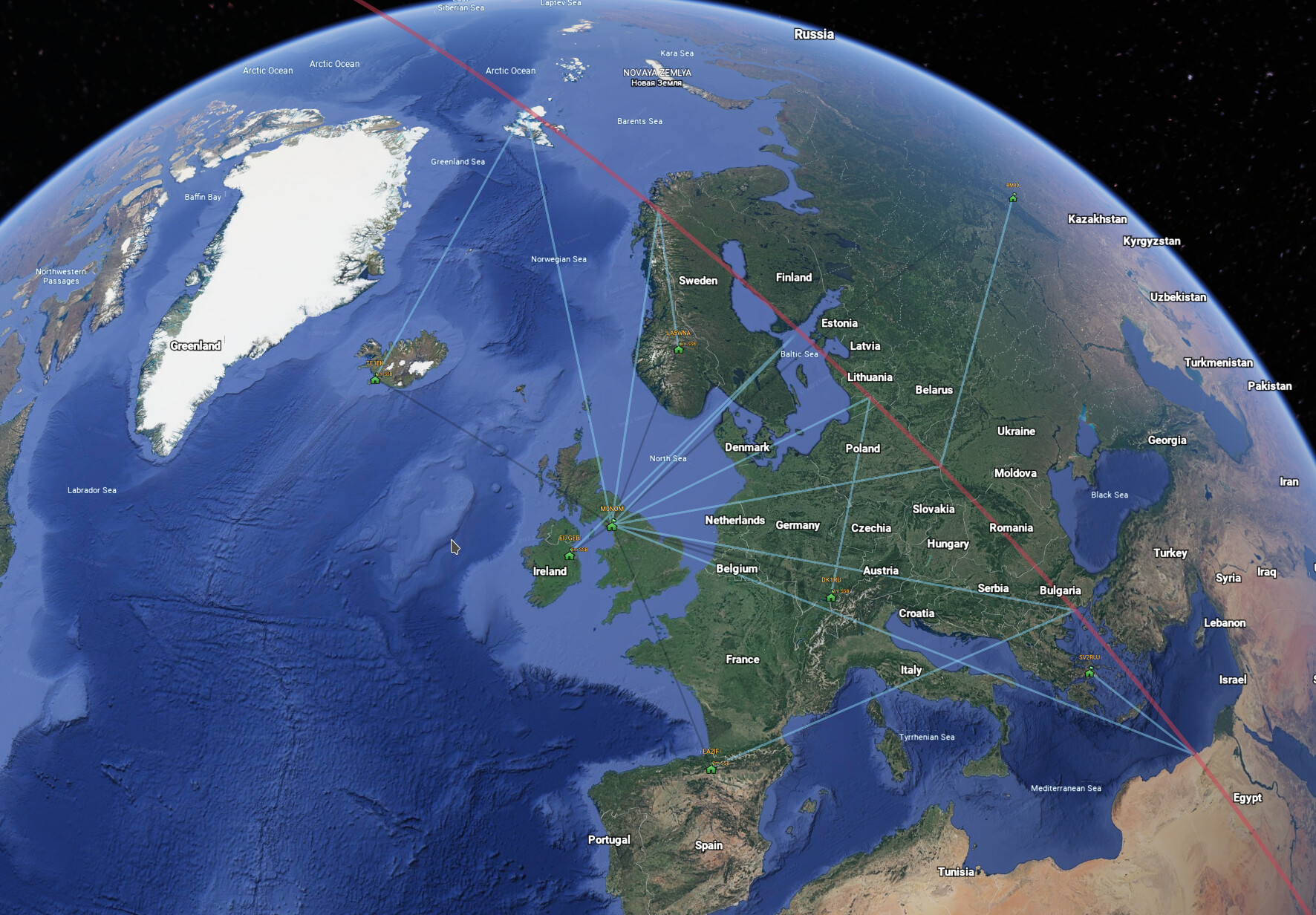
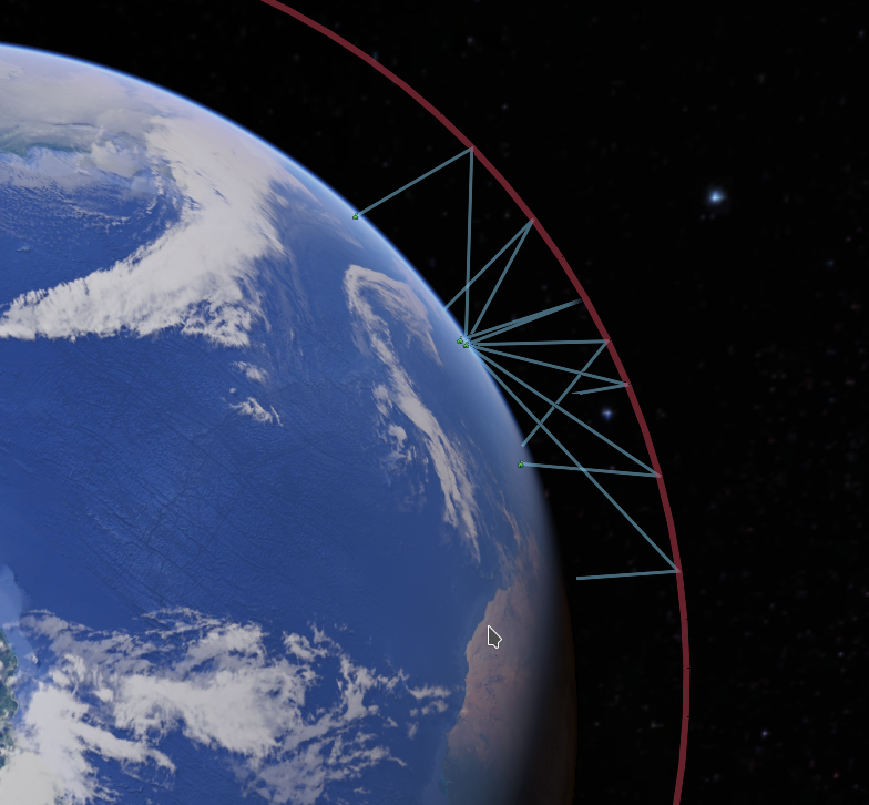
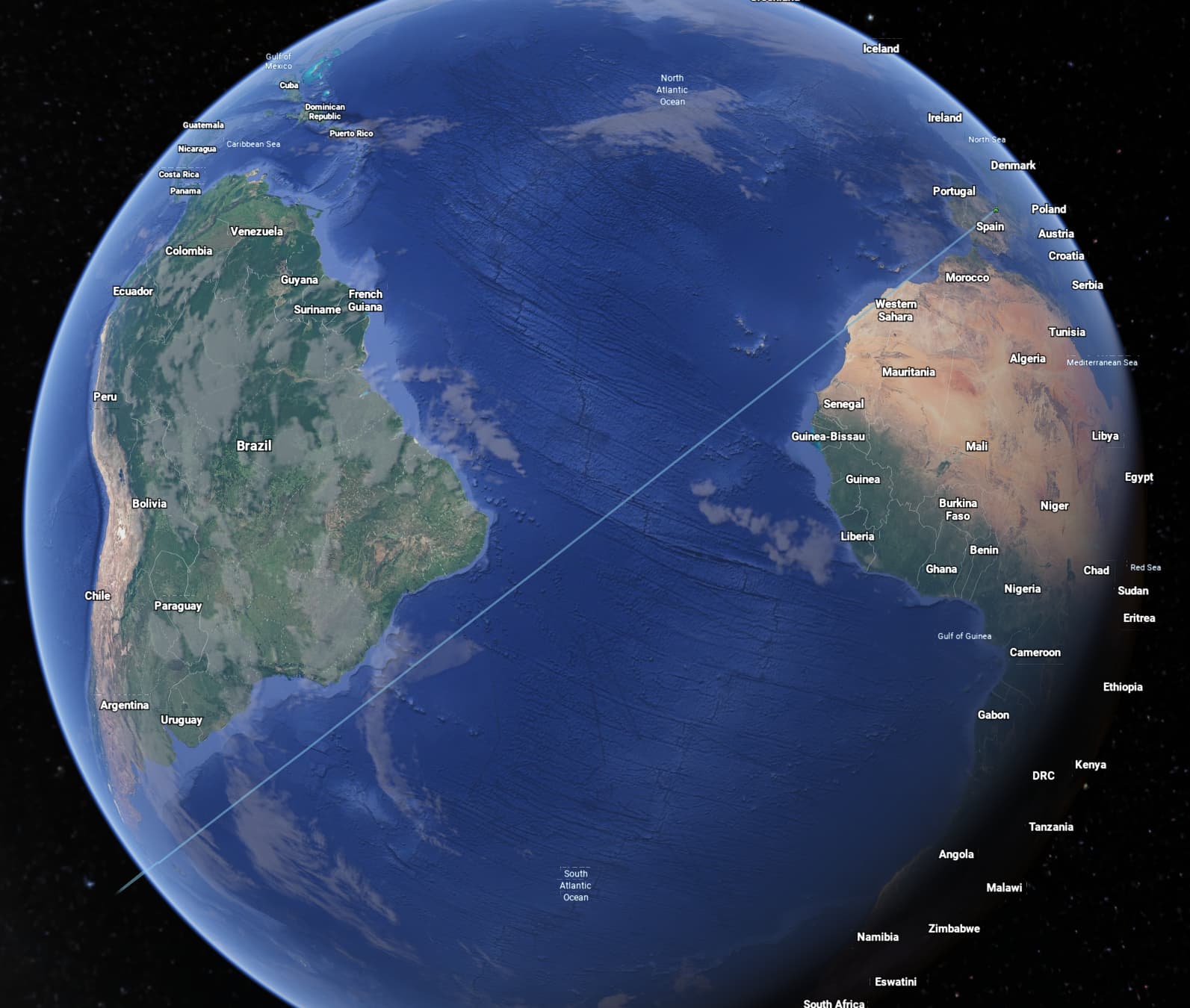
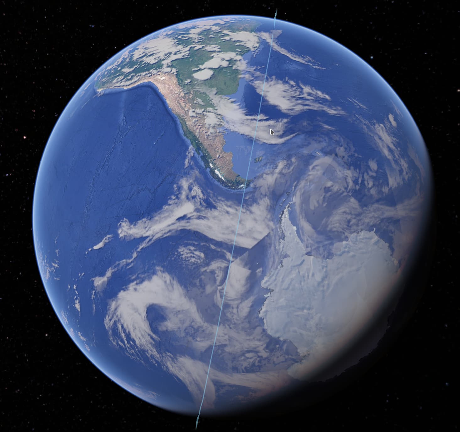
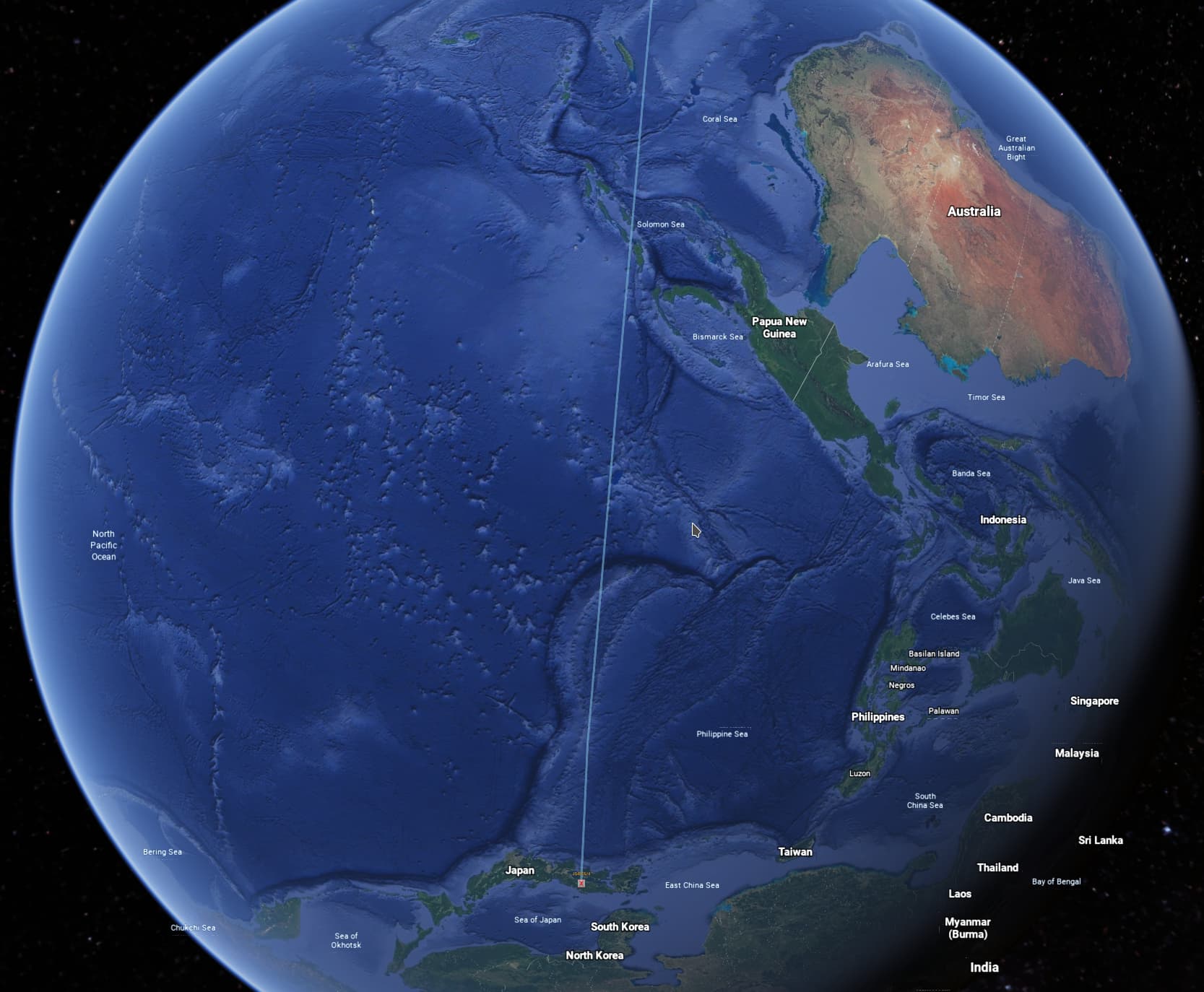
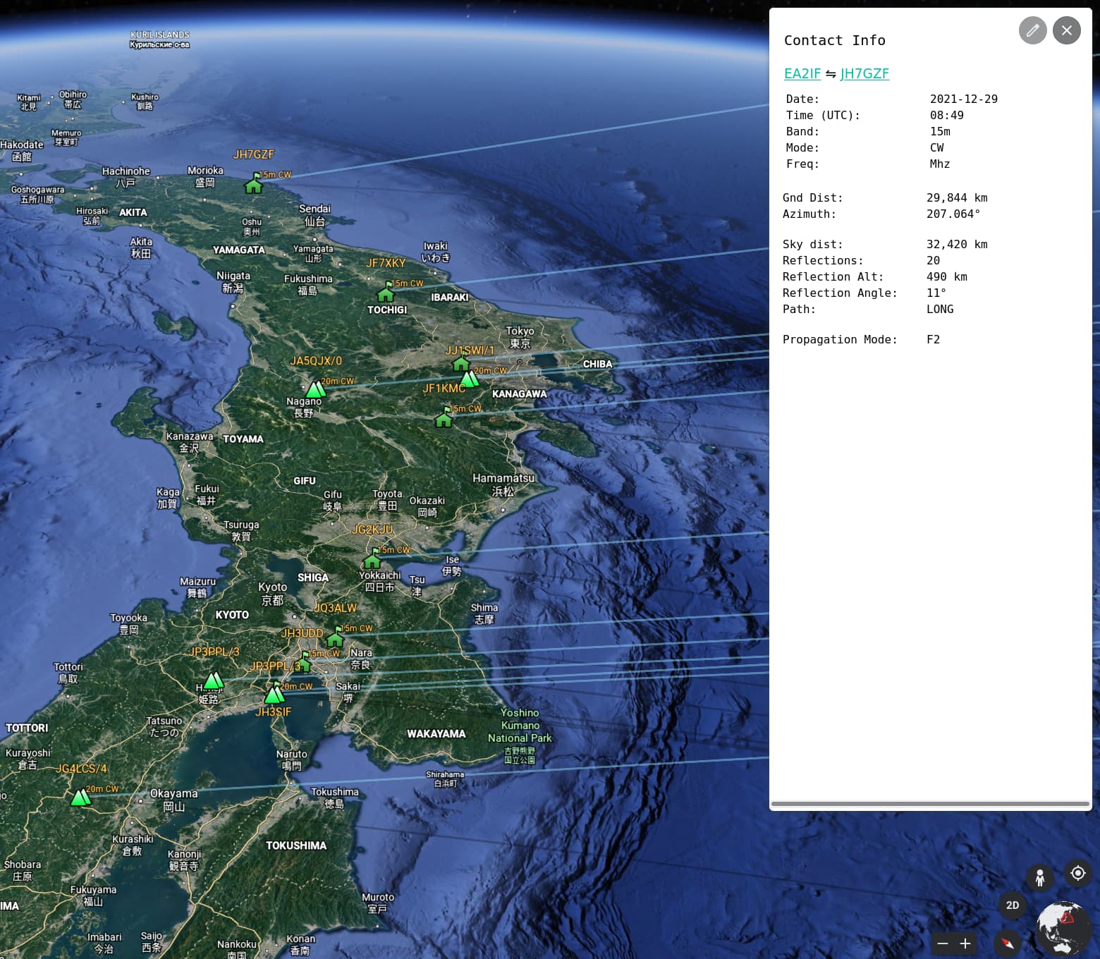
Finally got round to the thorny problem of Long Path HF Visualization, prompted by @EA2IF Guru’s SOTA chase of @JG4LCS Seiji on JA/OY-060 on 10-JAN-2022 at 07:49.

According to my calculation the QSO distance was 29,499 km.

Date: 2022-01-10
Time (UTC): 07:49
Band: 20m
Mode: CW
Freq: 14.285 Mhz
Gnd Dist: 29,499 km
Bearing: 215.082°
Bounces: 12
Reflection Alt: 405 km
Propagation Mode: F2

EA2IFJG4LCS/4

Still plenty of wrinkles to iron out but the hard bit is over :wink:

Regards, Mark.

7 Likes

Think the code is stable now, just uploaded a new version.

@EA2IF Guru was kind enough to provide me with an ADIF file containing some of his long path SOTA chases, very impressive!

3 Likes

Did a quick video creating the Google Earth KML file from Guru’s ADIF file, load it up in Google Earth and a (long) scroll around!

8 Likes