Good advise, Andy. Thank you.
I hope you’ll get that rest and your back will soon be fully recovered.
73 de Guru
Even before doing SOTA, I prefer to hike and hunt alone. I know that it flies in the face of conventional wisdom, but I prefer it for many reasons, from people not being able to keep up to my activities taking place in remote areas where there is illegal activity. It is much easier to take care of just myself in certain circumstances.
I leave my itinerary with the wife and family. I also use an app called “Glympse” that allows whomever I want to follow along with me. If I do not have constant coverage, I sent my GPS location when possible and I always have an exit time, after which, if no one has heard from me search and rescue is called. I am thinking about getting one of those “spot me” or whatever it’s called that does not need cell coverage to communicate GPS stuff, but haven’t pulled the trigger on that one yet.
Technology aside, the best plan is to make sure people know exactly where you are going and when to expect you back.
Mike
Thanks for the well wishes here and in some emails. I’m sure it’s just a muscle strain and I’ll take things gently for a while until I’m sure I’m back to normal.
The point of writing this was that, this time, all I had was a minor injury and was able to make the decision to turn around and get out with it turning into a drama or crisis. But, I had the knowledge that if I couldn’t get back or call for help, someone would eventually report me missing and where I may be found. And that is the crucial thing, someone knew where I was going.
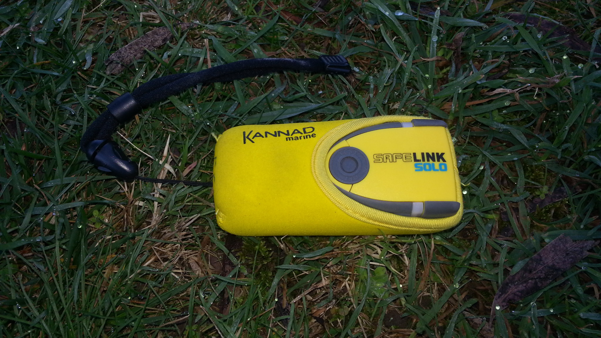
I’m not sure whether I do anything extreme enough to warrant carrying some kind of PLB/EPIRB though I know some people do. If I was responsible for other people’s safety then I’d carry one as a matter of course. I do have a satellite messaging system I use for spotting in the real wilds of Scotland (not very wild compared to much of the world) and I think I may add a method of messaging outside of spotting to that.
Most of my activations are solo ones and can be hours away from civilisation, often in difficult 4WD terrain. For example yesterday I was on a track saying to myself as I engaged low range and both diff locks that I really shouldn’t be doing this track by myself. There are plenty of other VK activators who do more remote stuff than I typically do.
I run APRS (vehicle and often HH for portable), carry a 3G phone, Sat phone and a PLB if it all goes to s&*%., Plus spot via SOTA Goat on the summit. My son (a VK2) and a few others around could piece it all together from all of that if I didnt make it back. In Australia its a call to Police to activate the very efficient S&R process if you are unheard of after the nominated time. I would of course be reliant on my wife to make the call, she knows my insurance details !
PS: The experience of some emergency service agencies in VK2 is that SPOT is not reliable enough as it needs a clear view of the sky to get to the satellite. Yes, I know that PLB’s and sat phones need this as well which is why I carry the mix of devices on the basis that I am likely to get a message out on one or more of them.
Compton
Hi Chris,
Check out Bowen Therapie - this massage like process, developed in Australia can help relieve the pain and delay if not remove the need for surgery. As always YMMV but it certainly helped my wife big time.
73 Ed.
If you walk the Scottish hills you are definitely in “remote terrain”. Particularly going to little walked 1 and 2 pointers. It might not be the Yukon, but it could take SAR a long while to find you.
I got a PLB when I went to Nepal a few years back. It sits quietly in my rucksack, hoping never to see the light of day on the hill (battery test when I remember - supposed to be monthly. Also will need a new battery next year).
1 Like
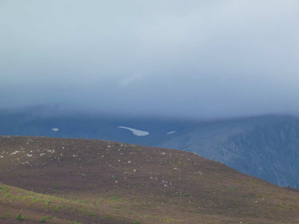
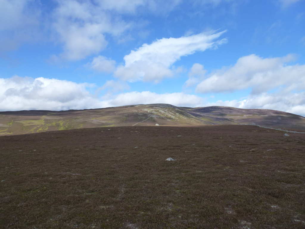
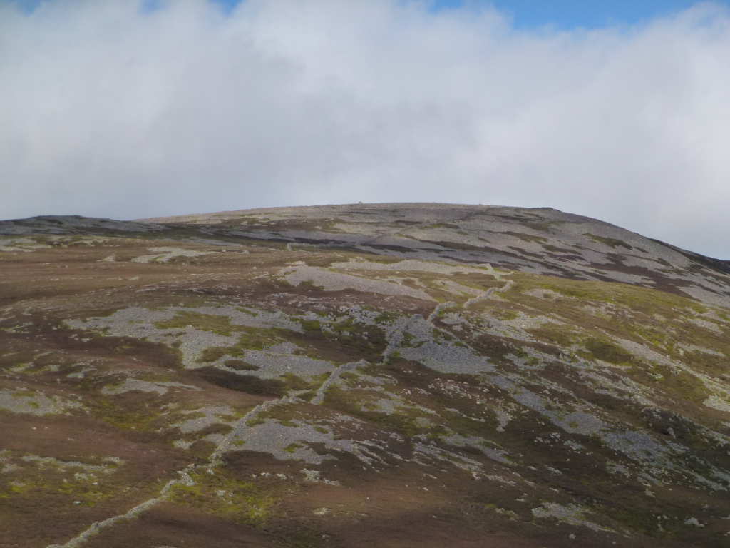
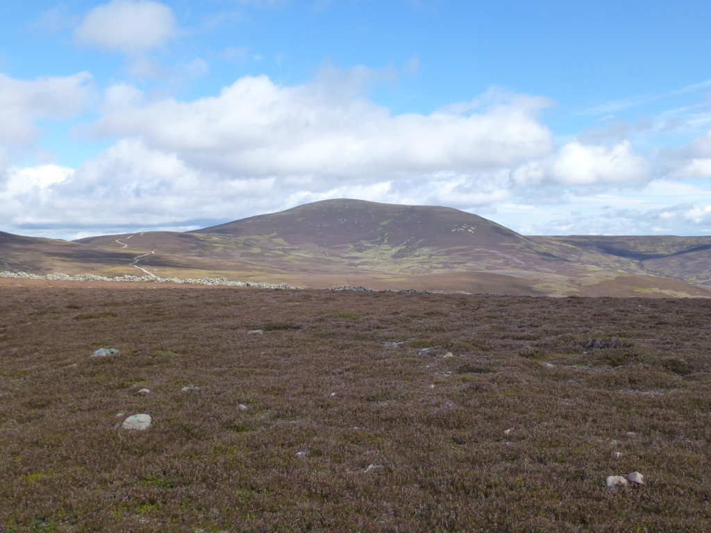
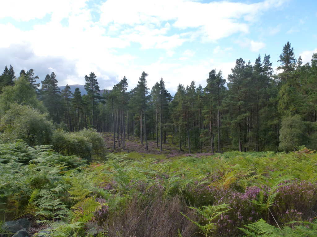
Some pictures of the aborted walk.
Permanent snow patch on Beinn a’Bhuirdh, the cloud burnt off by the time I was on the way back.
Carn Liath (grey hill) ES-020 from as far as I got on Craig a’Chait.
So near yet so far… follow the drystane dyke to the summit, you can see the summit cairn of Carn Liath ES-020 in this zoomed photo from the same location as before.
Seldom activated Culardoch ES-015, at least a 9km walk from the car park.
Typical view in the forests of Invercauld. Sparse pine trees and a carpet of purple heather. A stunning place to visit and best of all, the estate owners make visitors very welcome.
2 Likes
This is certainly true once you leave the honeypot regions like Glencoe and Ben Nevis. There are some VERY long walks even for the better known summits: Ben Macdui GM/ES-001 iis a round walk of 19 miles (30 km), Ben Avon is longer at 24 miles (39km), but you can have remote summits even in the popular areas, if you want to do the Grey Corries (WS-015+WS-021) its 17.5 miles (28 km). The real long distances are in the north, the longest one is A’Mhaighdean NS-013 at 27 miles, 43 km. If you break an ankle on A’Mhaighdean and can’t contact SAR then its a 20+km crawl to the road. As Gerald says, it may not be the Yukon - but where the remoteness really stacks up it might as well be, those distances compare with many of the larger ranges elsewhere in the world, and if for any reason you have left the track SAR could have tens of square miles to search.
Brian
Andy I hope you are recovering well.
When hiking, alone or with others, I leave a detailed plan describing the route from home, to where I am parking the car, to the summit and back home including ETA and GPS coordinates for each major point. This plan is printed and stuck on the side of my desktop PC with a magnet. Once I am back on the bitumen roads I will ring and let my wife know all is good.
I carry a PLB and upload the same detailed plan to the AMSA beacon website so if I trigger my PLB the authorities already have the info. Also on the AMSA beacon website are my vehicle details with photos. http://beacons.amsa.gov.au/about/
I hope to never have to use the beacon, and if I do I hope that it works as expected.
73
Peter VK3ZPF
www.vk3zpf.com
Actually, it can be significantly more than that.
When SAR managers allocate resources for a search they use three different methods to arrive at a search area boundary. The first is a theoretical boundary, a circle, the radius of which is based on how quickly a subject moves multiplied by the amount of time since they were at their last known position. This is the maximum limit of the search area. Obviously this can grow quite quickly and is nearly impossible to cover adequately, so they move on the the next method: a statistical/probable boundary. Historical data based on the subject profile (age, gender, disabilities, equipment, skills/experience, etc.) and time since they were last seen to determine where that particular person would be most likely to go. Children, for example, will sometimes hide from searchers at night due to fear* and are more commonly located during daylight hours. Subjects with developmental disabilities have a tendency to start walking in one direction and not stop, sometimes for days, and have a high probability of being found far away from their last known location.
The last boundary is determined by practical considerations. These are established by looking at historical data for searches in that area as well as local features like rivers, roads, cliffs, and trails. Unless something in the statistical boundary analysis suggests otherwise, most of the intensive searches in the first 24 hours will happen within 30m of the trails and roads.
Regardless of the profile, however, the probability of a subject being located alive drops by 50% for every 24 hour period they are missing. These parameters help the SAR manager to concentrate resources in the first few operational periods.
Assuming a conservative pace of 2km/h, the theoretical search area after 24 hours is a circle with a radius of 48 km, giving us an area of 7,238 km^2, or 2,790 miles^2, and the probability of finding the subject alive is <50%. After 48 hours the theoretical search area is approaching 29,000 km^2 and the probability drops to <25%. Probability drops faster if there are natural hazards in the area, or inclement weather closes in. After a week missing, even in good conditions, most search operations become recovery operations. People still beat the odds, but it’s a rare thing.
The key to rescuing subjects successfully, much like ensuring critically injured patients survive, is to respond as quickly as possible. This is where the PLB comes in (EPIRBs are usually nautical/marine devices, and ELTs are used for aviation tracking) and the “call 911 if I’m not home by 9” method is somewhat lacking. Most volunteer SAR groups (most GSAR is volunteer based) don’t have the capacity to fly at night, unless they get the Army involved, so being able to activate a rescue before the sun goes down reduces the complexity significantly.
So, long story short, search areas expand exponentially, chances of survival/full recovery drop rapidly, and searching at night adds complexity and time to any rescue. For anybody still reading, thanks for hanging in there and you can look forward to our next installment: Incident Command Structures and You.
*One 7 year old subject who was located alive and well the morning after he was reported missing told stories about “giants with one bright, shining eye” who were wandering through the woods at night and knew his name. He had mistaken the searchers for mythical creatures and hid under a tree stump until daylight.
1 Like
It may not be generally known but in the UK you can now register your mobile phone to be able to text the emrgency call number (999). Useful adjunct to all the other means we have available.
Ben Macdui 19 miles - lightweight - ask Tom & Jimmy how far I took them on our one day jaunt for just two summits!! Ben Avon, knock 16 miles off that if you cycle in (on tarmac most of the way) from my home village. Now Knoydart, that is remote!
Barry GM4TOE
1 Like
I had a somewhat “mad” day doing the summits on Ben Avon and Beinn a Bhuird, combined with all their tops. I was younger and fitter then. I recall it being over 40Km.
To register for Emergency SMS see below
It was originally designed for deaf people to contact the Emergency Services but it’s very common for non deaf UK hill goers to use it.
It’s worth pointing out that SMS messages will often get through in marginal signal areas where voice calls (let alone data!) will fail.
In Australia there is a smart phone app with a one button emergency call capability that sends the GPS co-ordinates from your phone and a request for help directly to the emergency services. You do need cell phone coverage of course - which often isn’t the case but I was surprised not to see similar apps for the UK or other countries.
Ed.
Additional info:
Here is the link to the app (for Android, Iphone or Windows Phone - but only allowed to be downloaded in Australia)
http://www.triplezero.gov.au/Pages/EmergencySmartphoneApp.aspx
You lived away from here for too long Ed. People now ring 999 and ask for emergency services when out on a mountain for all the wrong reasons. “It’s wet” “Can we be collected by helicopter as we’re tired” “I only wore flip-flops and my feet hurt”.
There now exists an overiding sense of worthiness but without responsibility that comes with it. People ring for help when they go out in the countryside when they shouldn’t be let lose in a local town park. If such an app existed Ed, if would be abused to ruin within weeks in this country.
Brian was correct in that you used to be on your own when you went out. Now there are all sorts of ways of summoning help. There’s nothing wrong with having or using such a device as long as you know when is the right time to use it. Knowledge I doubt many of my countrymen would be able demonstrate ![]()
As a mountain rescue volunteer in the UK I couldn’t possibly comment… ![]()
But seriously, it is almost universally accepted that the advantages of being able to summon assistance by mobile to save lives or alleviate genuine suffering far outweighs the calls from groups suffering from, shall we say, a lack of self reliance…
![]()
A lack of the knowledge that self-reliance is founded upon.
Fifty or sixty years ago, and inspired by the Everest film, people just went out and did it. There was no plethora of outdoor centres offering courses, there were no professional guides, you read eagerly a book or two, bought some ex army boots (“commando boots”, the very name was magic!) and a submariners sweater, and caught a train to somewhere like Llanfairfechan. That was where the school started. You learned not to wear blue jeans, you learned that the canvas cagoules sold by Black’s were great in snow and useless in rain (but Hallelujia, Peter Storm started selling shell clothing for yachtsmen!) in fact you learned your craft by doing it and sometimes making mistakes that by some fluke you survived! You were never in any doubt that it was up to you, there weren’t many rescue teams, nobody would happen by to pull you out of the mire, and that knowledge itself was precious to us. Competence and self reliance were a source of pride. It may be an OF attitude but I wonder if the ease of summoning assistance leads to negligence?
Yes, Minister!
Brian
1 Like
That is a sad situation indeed!
The typical Aussie would probably only use the app if his or someone elses life was in danger, otherwise they would just “muddle through” not wanting to inconvenience the emerency services.
Any more thoughts on this guys & gals?
Cheers
Jack(;>J
Well, I wouldn’t have any idea about how to do that, I would leave it to those with the knowhow, but the people who need that route info are the Mountain Rescue teams so the problem becomes making sure that MR teams know about and can use this information source.
Brian