Hebrides SOTA trip by Rod & Vicki
Summits activated:-
While travelling North:-
Lambrigg Fell, G/LD-046
Beinn Lora, GM/WS-336
In the islands (with M6BWA 2m fm contacts added at the end in brackets):-
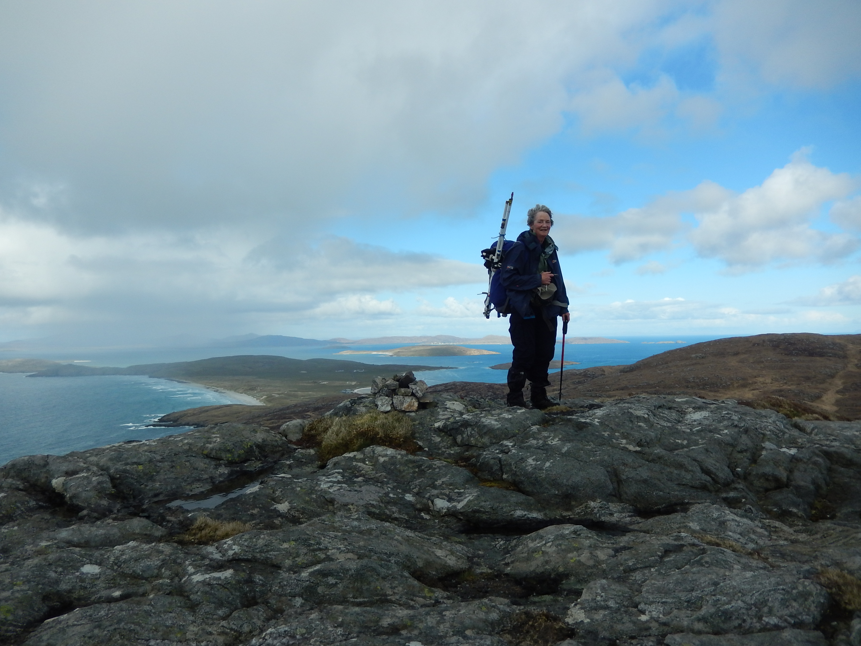
26/04/2018 - Heaval, GM/SI-120 – 40m 17 QSO, (2m 1 QSO)
26/04/2018 - Huisval Mor, GM/SI-208 – 80m 10 QSO, (2m 1 QSO)
27/04/2018 - Ben Tangaval, GM/SI-137 - 40m 10 QSO, (2m 1 QSO)
27/04/2018 - Ben Cliad, GM/SI-199 - 80m 4 QSO; 60m 4 QSO, (2m 2 QSO)
28/04/2018 - Ben Scrien, GM/SI-209 - 80m 2 QSO; 60m 9 QSO; 2m s2s GM7PKT/P, (2m 6 QSO inc s2s))
28/04/2018 - Easaval, GM/SI-184 - 80m s2s G6WRW/P; 60m 5 QSO; 2m s2s GM7PKT/P, (2m 3 QSO inc s2s)
29/04/2018 - Eaval, GM/SI-132 - 40m 17 QSO s2s LA1KHA/P, (2m 4 QSO)
30/04/2018 - North Lee, GM/SI-172 - 60m 5 QSO; 40m 8 QSO s2s EI/GI4AZA/P, G4VPX/P, G6WRW/P; 2m 2 QSO, (2m 4 QSO)
30/04/2018 - South Lee, GM/SI-163 - 60m 3 QSO s2s G4VPX/P; 40m 10 QSO
02/05/2018 - Marrival, GM/SI-186 - 40m 16 QSO
03/05/2018 - Crogary Mor, GM/SI-211 - 40m 20 QSO, (2m 1 QSO)
06/05/2018 - Husival Mor, GM/SI-073 - 1st activation by MM6BWA/P - 40m 17 QSO; 2m 2 QSO, (2m 1 QSO)
07/05/2018 - Oreval, gm/si-038 abandoned 1st activation
08/05/2018 - Greabhal, GM/SI-165 - 60m 8 QSO s2s MI1MAJ/P; 2m 2 QSO, (2m 4 QSO)
08/05/2018 - Chaipval, GM/SI-129 - 60m 4 QSO, (2m 4 QSO)
10/05/2018 - Toddun, GM/SI-059 - 60m 4 QSO; 40m 5 QSO, (2m 4 QSO)
While travelling home:-
East Cairn Hill, GM/SS-282
Gathersnow Hill, GM/SS-077
Penvalla, GM/SS-145
Goseland Hill, GM/SS-203
21 summits 15 SI, 4 SS, 1 WS, 1 G/LD + 1 abandoned ascent
M0JLA QSO analysis – I was very pleased to make summit to summit contacts with
Adrian, EI/G4AZS/P, in eastern Eire; Carolyn, G6WRW/P, Helen, M0YHB/P, and Allan,G4VPX/P in the Lake District and N Pennines; Martyn, MI1MAJ/P in the Sperrins; Robin, GM7PKT/P on Skye and Kjell, LA1KHA/P in Norway. (Apologies for any incorrect spelling of names here.)
140 QSOs from 59 different operators in my log; there will be some extras in Vicki’s from her 2m operation (below); very many thanks to them all. 80m yielded 15 QSOs, 60m 42, 40m 76 and 2m 7 QSOs in MY log. Conditions were really inconsistent, some summits proving very difficult indeed.
It looks as if Terry, G0VWP, is my top chaser with 12 QSOs in my log and lots in Vicki’s too; many thanks Terry. Don, G0RQL, just behind with 11 QSOs and Bill, G4WSB with 10.
M6BWA QSO analysis: 155 QSO from the trip with 89 from the 15 SI summits. It seemed unlikely that I would activate (1 contact) let alone qualify (4 contacts) many of the SI summits and I am not permitted on 60m so we usually started on 80m (at the beginning of the trip) or 40m (towards the end) to ensure that I got at least one contact and then I would return to my own mast to try my luck on 2m. I made 36 2m fm QSOs in total from SI summits, with results varying from 0 to 6 (SI-209, Ben Scrien on Eriskay on a Saturday and including the first of 2 s2s with GM7PKT Robin on small Skye summits.) Apart from my most frequent chaser GM4AOS Gordon from Mallaig 7 QSOs all the other contacts were islanders mainly from Skye (GM0HBK Colin 6 QSOs +WS-336). I also contacted 3 from Uist including GM0HBF Charles who we met as we spotted his masts very close to our cottage and 3 from the Stornoway area, I am very grateful to them all for their help but none were able to give me a 70cm contact with ‘aerial broken’ (in view of the winds we encountered I had no difficulty believing this!) or ‘no suitable radio’ the usual comments - hence 70cm fm 0 QSOs!
M6BWA HF contacts: 80m 7 QSOs, 40m 46 QSOs. My grateful thanks to all my contacts on these bands as I am unused to operating on HF and found it very difficult to pick out callsigns (especially foreign ones that don’t turn up on 2m! Thanks for your patience especially when we were sharing the mike and all contacts took longer than usual. Thanks also to M0JLA for devising a method for us to share the same radio and for plugging all the extra lead into the right holes so I only had to carry them! The only time we had to share a bothy bag was on the first activation of GM/SI-073 when the rain came in more than an hour earlier than expected but we did find it possible to remain fairly dry as I called for 20 minutes waiting for anyone to answer. I was very grateful to MW0ISC when he found me and another 8 were collected in the next half hour. A call on 2m from the VX7 from inside the bag (with no dipole) raised GM0HBF in his garden in North Uist which finished the activation but then we had to take down and follow the GPS off the hill. I now understand why a phone signal for a spot is so essential on HF.
Access details below
Barra; we stayed in a large 4 bed caravan at Castlebay, actually on the lower slopes of Heaval.
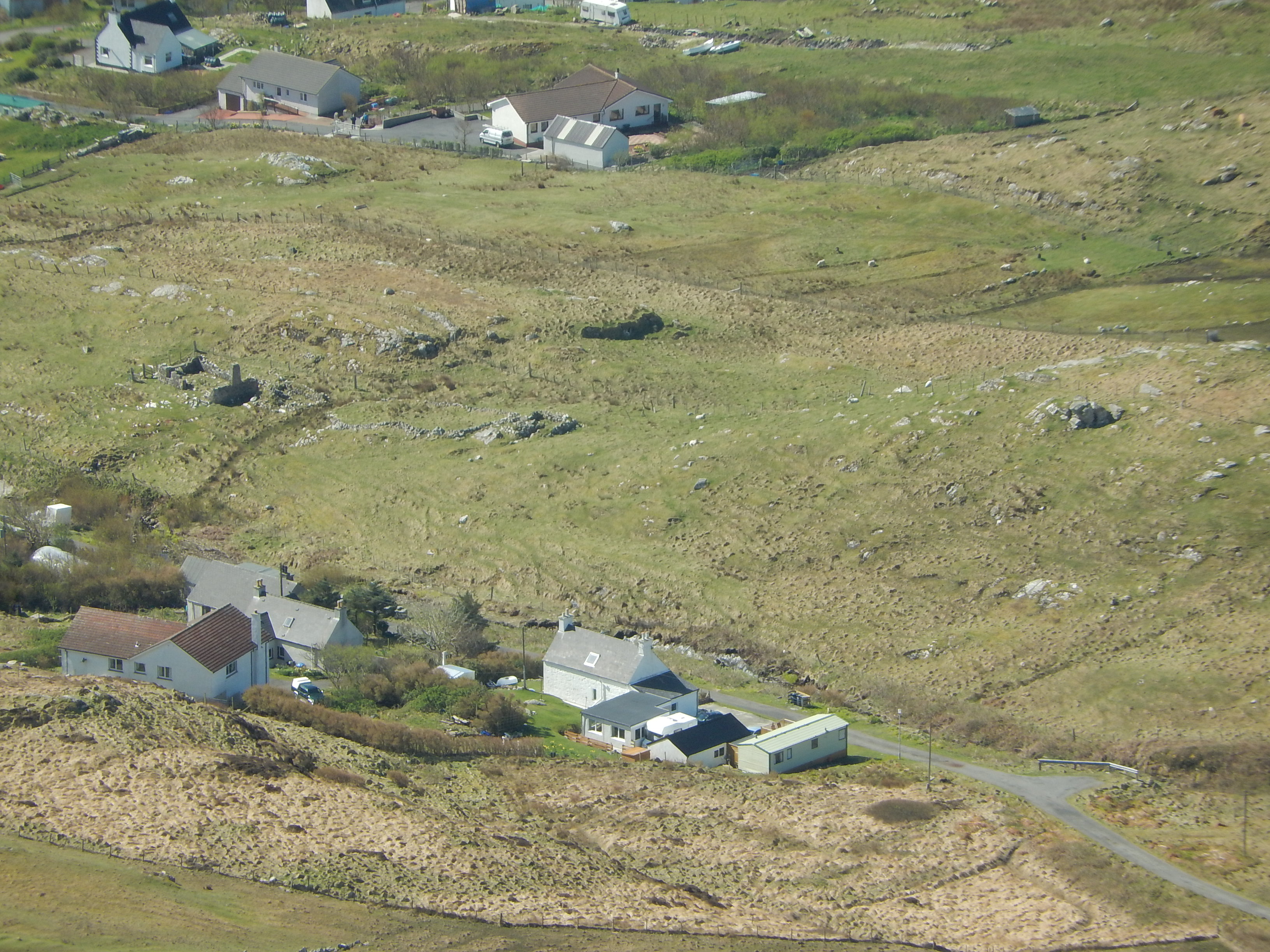
Heaval, GM/SI-120
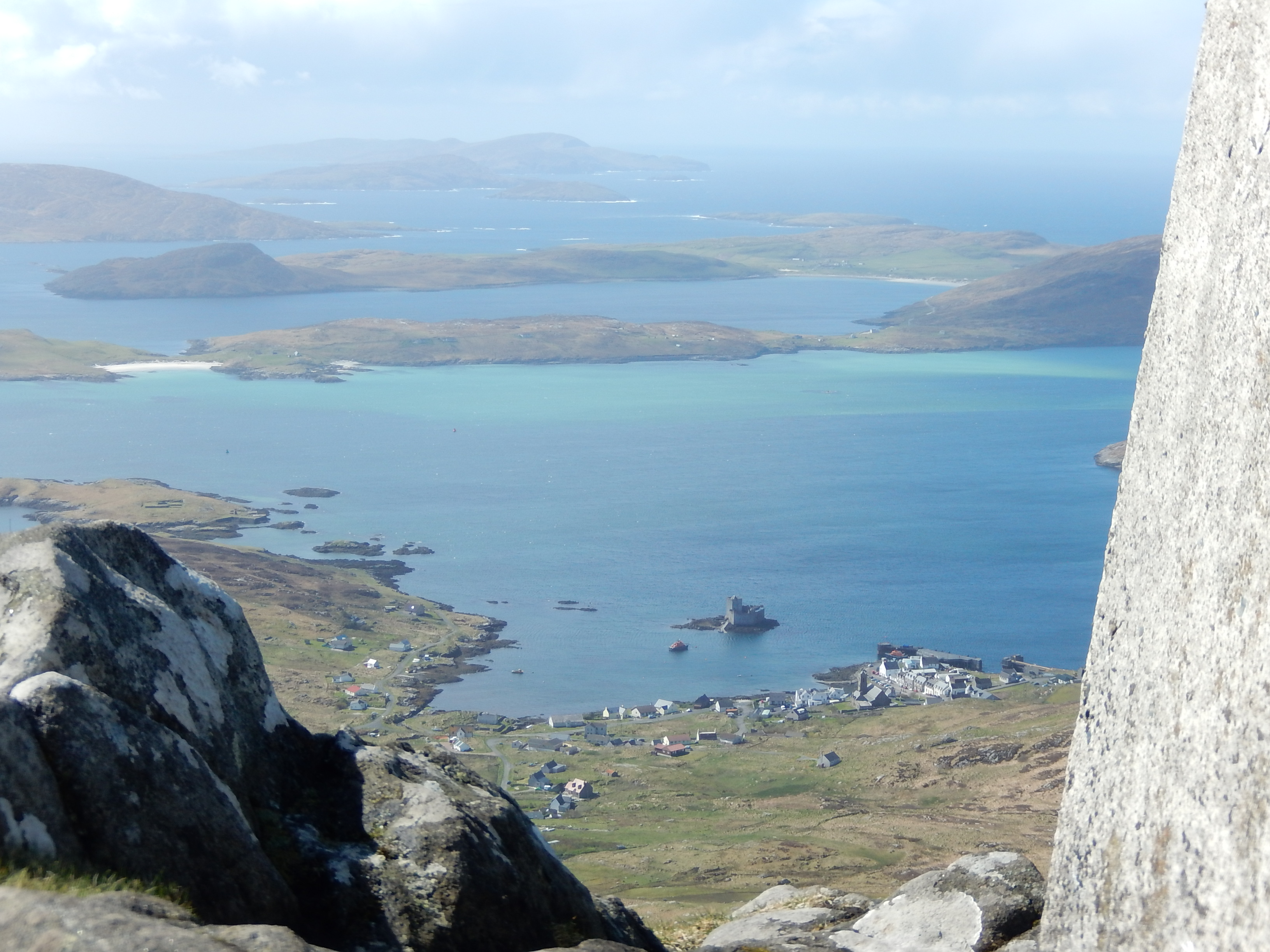
As the caravan was actually at Gleann, a little way out of Castlebay we were already on our way up (50m) and so this one had to be first. A path takes off at a gate a little way past the bend in the rapidly deteriorating track and winds its way (with many branches) past the statue to the summit. We descended a largely different set of little paths but on the same general line. Unless staying at Gleann a more convenient route would be to park as shown, NL678987, beside the main road and use the main path(s) up to the statue.
Huisval Mor, GM/SI-208 - (Not to be confused with SI-073.)
This is actually on Vatersay so we crossed our first causeway (of many). We were still finding our way in this unfamiliar terrain, so having found good parking shortly after the bend in the road, about NL631967, we set off roughly parallei with the road but rising slowly. The fences marked on the map appear to be what we call Cornish hedges and are not very obvious. Having found the broad re-entrant we set off up its W side, rising as much above it as felt comfortable. This gave us a long and lumpy walk across the tops to the actual summit but we considered it worth it and descended roughly the same way.
Ben Tangaval, GM/SI-137
We combined this with a visit to Dun Ban so there are shorter alternatives. Starting from the Tangasdale phone box at around NL649001 we followed the waymarks which gave access to the gates and bridge leading to the open land. We then lost them where their route and the notes we were following diverged. (There is a crossing point onto the hill around NL642998, close to the loch which should be good for the direct route.) Near to Dun Ban a stile permitted access to the shore and another allowed us to proceed up the hill to the E of the obvious stream, initially close by and trending away aiming for better ground. We returned much the same way, crossed a stile further E than on the ascent and followed the drier ground N of the fence, bog and stream as we approached the loch.
Ben Cliad, GM/SI-199
We parked just before the cattle grid, about NF672043 and set off for the point where stream and fence cross. Neither is difficult but the bog alongside was very wet indeed. Fortunately the walk is short so having a bootfull was not really an issue. I remember little else about the summit except getting another bootfull on the way back.
Uist & Eriskay; we had a very well appointed rather compact little 5 bed house at Sidinish, between Lochs Euport and Obisary. Very good for bird watching; static fresh water to the front, tidal to the rear.
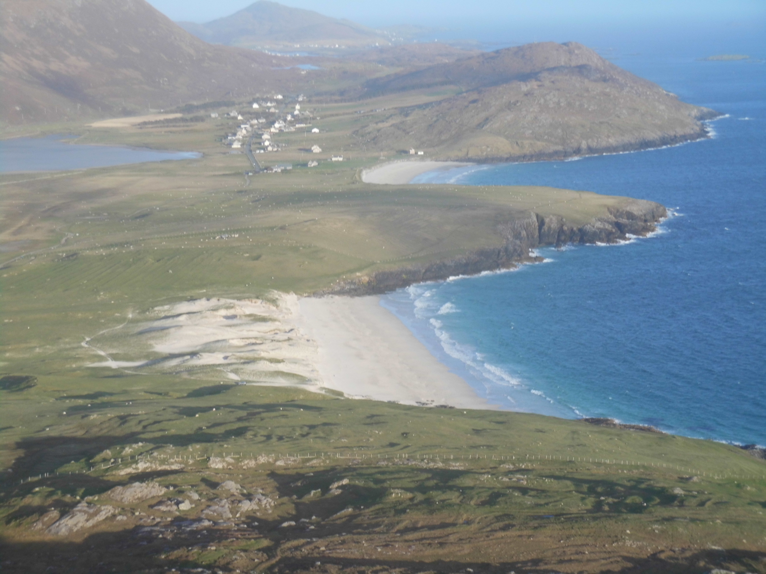
Ben Scrien, GM/SI-209
This, the most activated in the SI series, is the only summit on Eriskay which is joined by a causeway to S Uist and is where the ferry from Barra now docks. After leaving the ferry we parked at a good spot beside the road just N of the high point on the road, between the mast and a memorial, neither of which appears to be on our map. We found two crossing places for the wall, ascending we crossed at a gated sheepfold, descending at a gate having followed a faint path. The traverse below the steep N side of the hill leads to a broad re-entrant which leads to the E end of the summit area. We followed a lower line on return, thus finding the gate.
Easaval, GM/SI-184
There is a choice of parking places near the modern church at Trossary, just after a road/track crossroads at around NF758164. (If you feel tempted by the huge church car-park be warned that by the time of our return it was stuffed and cars were parking on the roadside.) We followed the track starting about 100m S of the church. It deteriorates rapidly but facilitates fence crossing. By keeping on due E we would have found the gate at the fence corner, around NF766163. Concentrating on a good route through the bogs we (ie Vicki!) headed for Coire Bheinn and so ended up approaching the summit from WSW rather than NW which was easy enough but added length and time and confusion in locating the actual top (the 3rd one we found!). We descended by a much more direct route to the gate.
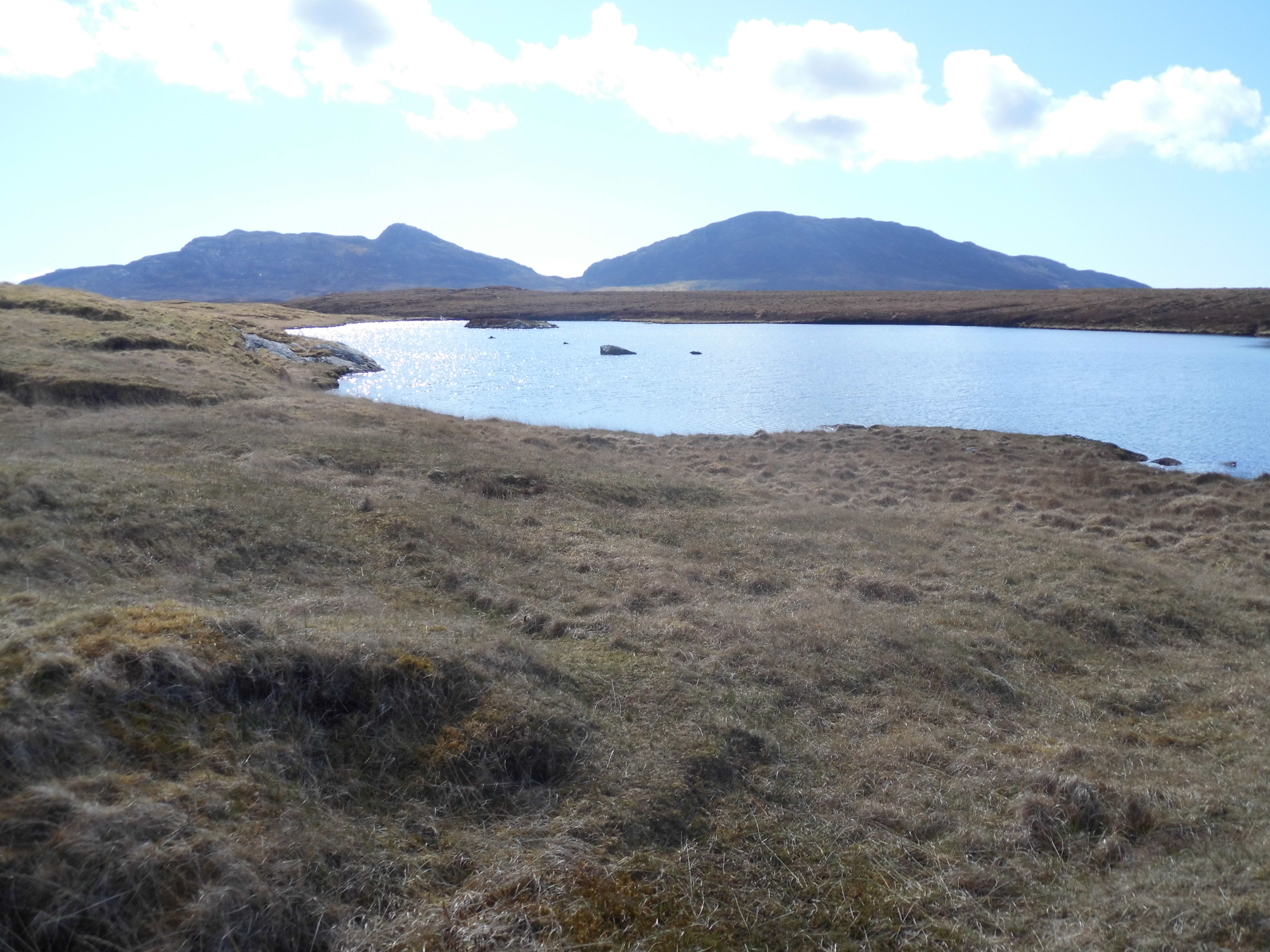
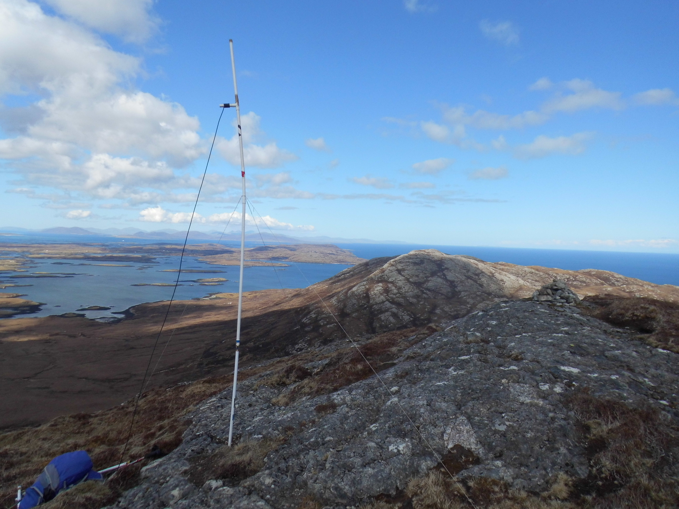
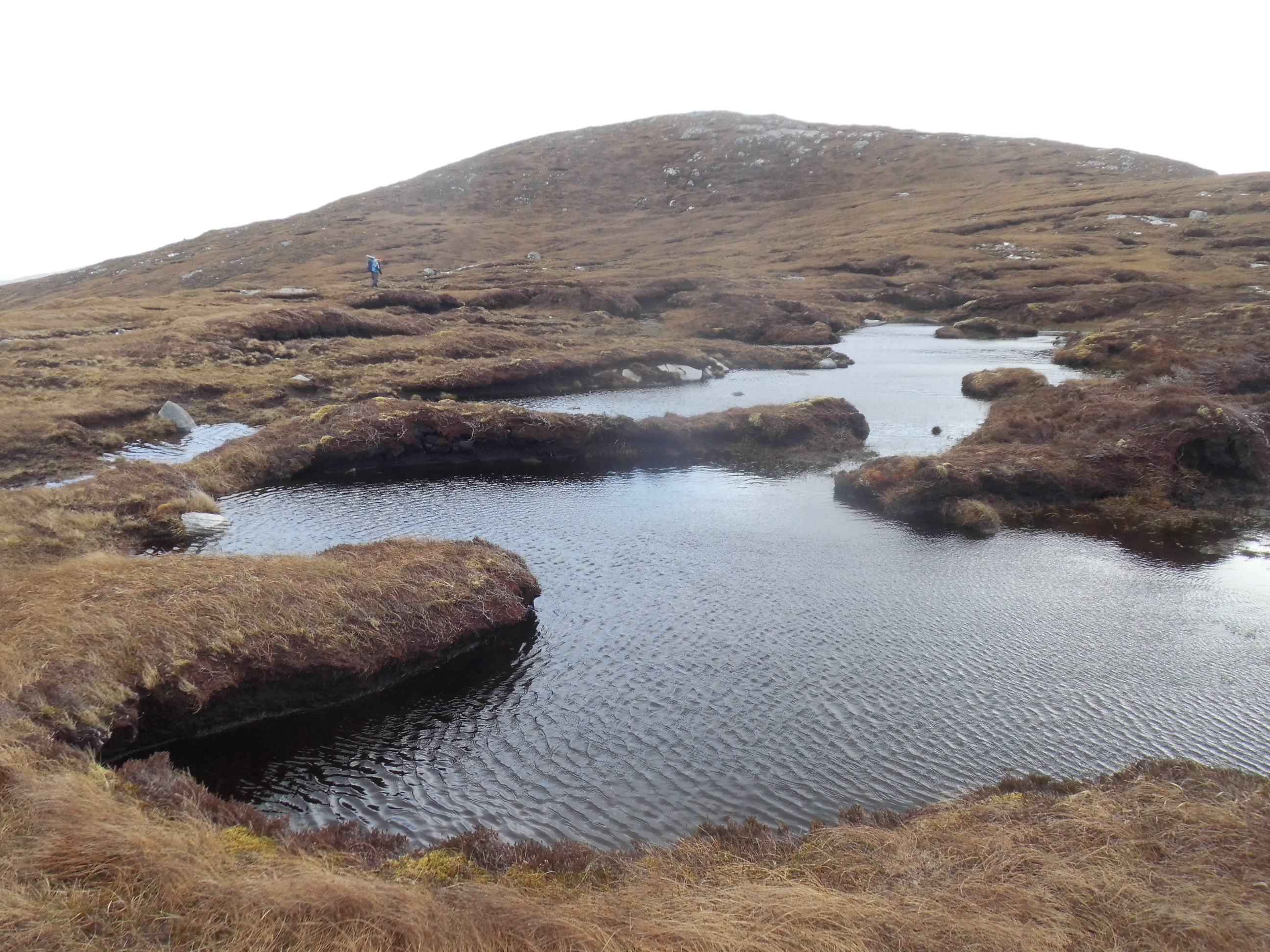
Eaval, GM/SI-132
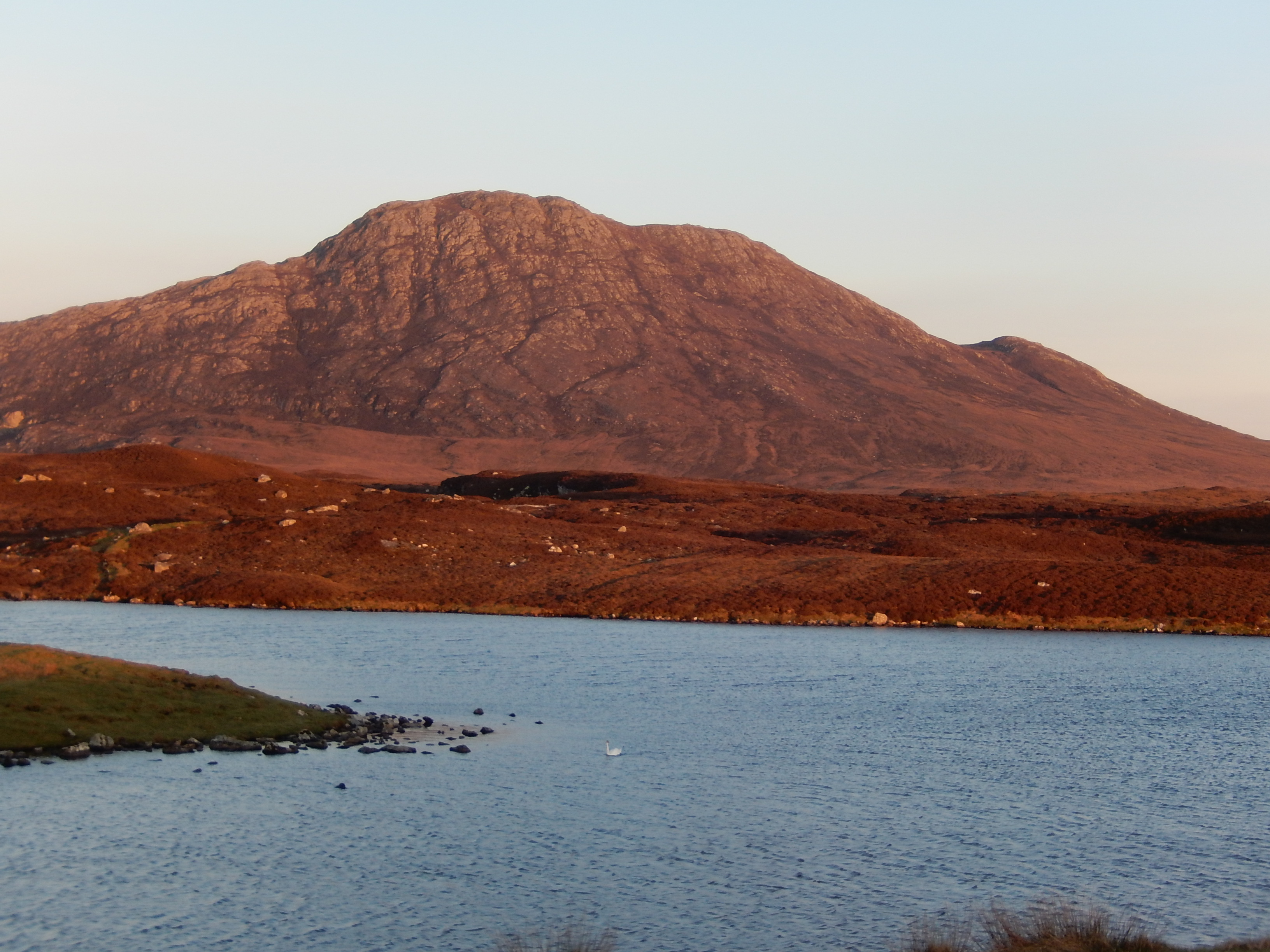
This was the view from our living room window. We moved the car to the end of the tarmac as we were running late (as usual). The first challenge on this walk is the tidal stepping stones. They were well clear of the water (and expected to remain so at least until 1600) so over we went.
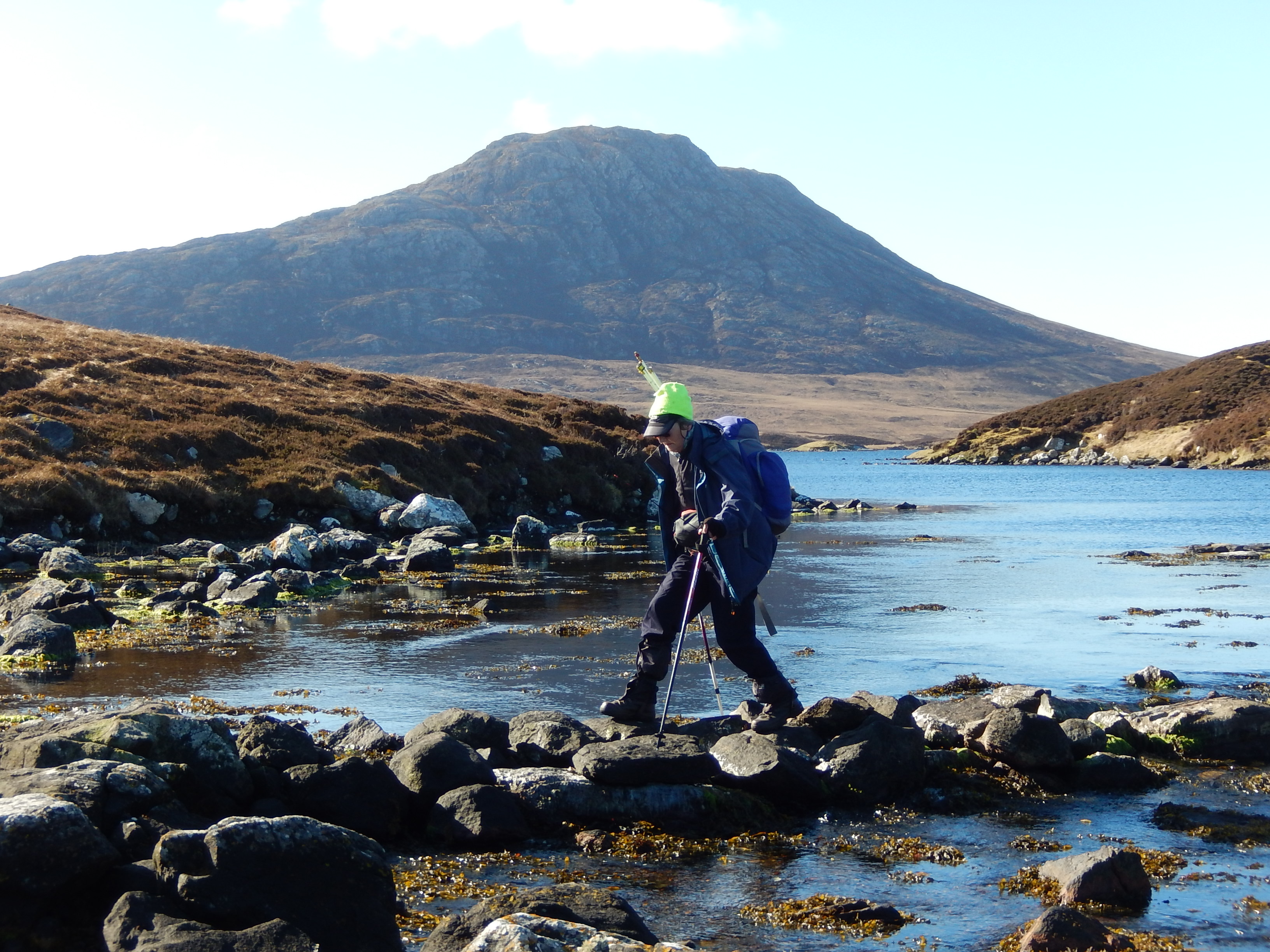
Fortunately Loch Obisary prevents the direct approach to the rather daunting N face of Eaval; unfortunately it’s a long way around it to get to the W ridge.
This has some very large rock slabs and some awkward steep bits, enough to put off one of a couple we caught up with but the upper part was easier than it looked and her companion came back with that news so she carried on.
(This led to some embarrassment on our part; there we all were in the middle of miles and miles of undisturbed wilderness and we were intent on disturbing it.
We all needed to be on the same part of the summit to get respite from the incessant cold Hebridean wind so we left them in the better position, set up somewhat lower and I then went back up to apologise for disturbing their peace before getting on with the activation. We returned by the same route. This was the only time that we met or even saw another walker on the hills - deer were much more often seen!
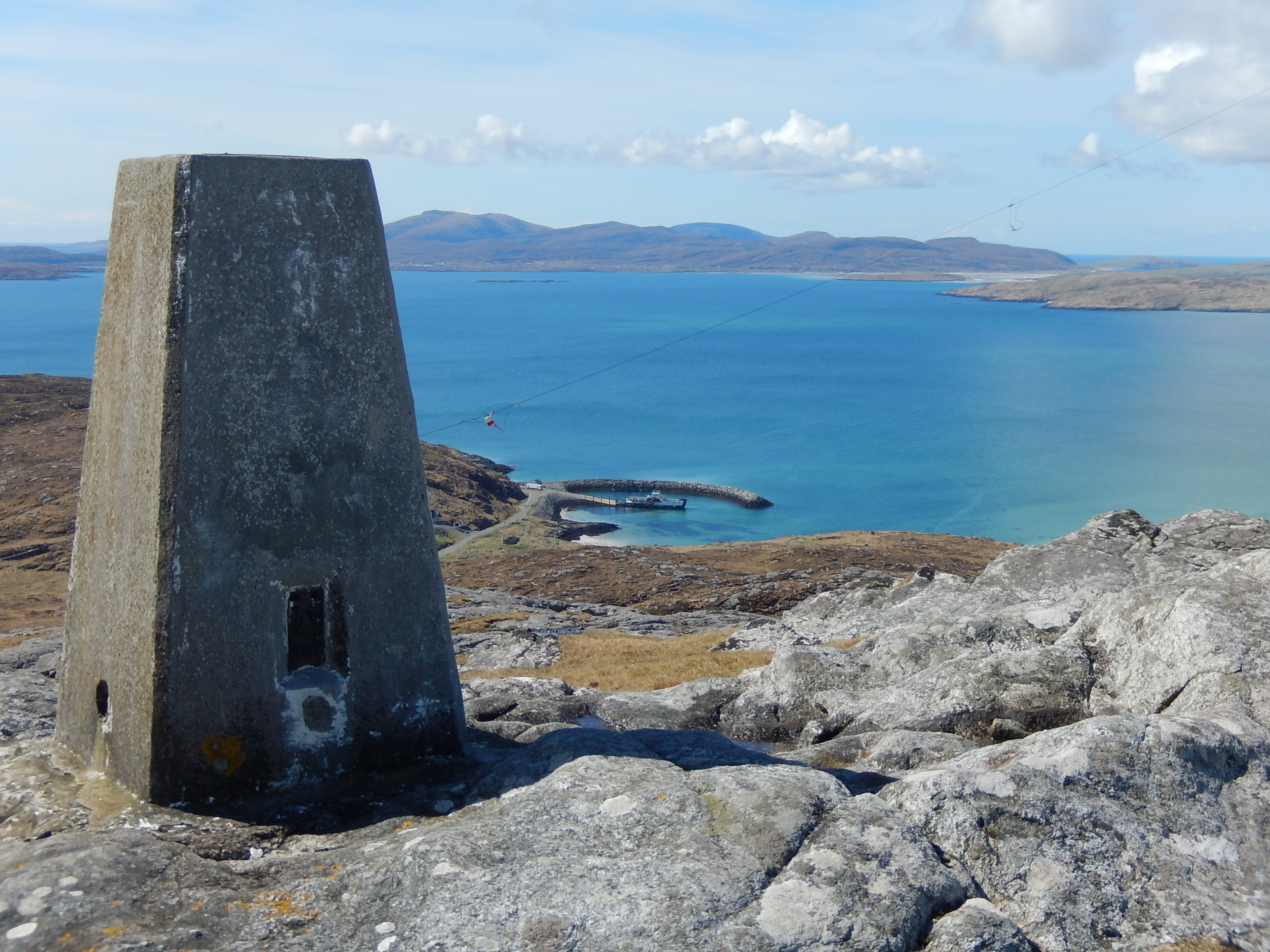
North Lee, GM/SI-172 and South Lee, GM/SI-163
Also visible from our living room window but not as convenient for access.
There is parking on the old road or verges at the start of the North Lee Walk, clearly marked by a sign at around NF997680. Waymarks wind you through the bogs and around the lochs via bridges, gates and stiles to the foot of the hills.
We took the right-hand route (intended as the descent) as the left-hand one is rather circuitous, taking in the N Lee trigpoint. These waymarks led us up a good zigzag route from the dam on the little loch to the N Lee summit. We took the same route down for a bit and South Lee looked close but the pass (and dam)were way below us
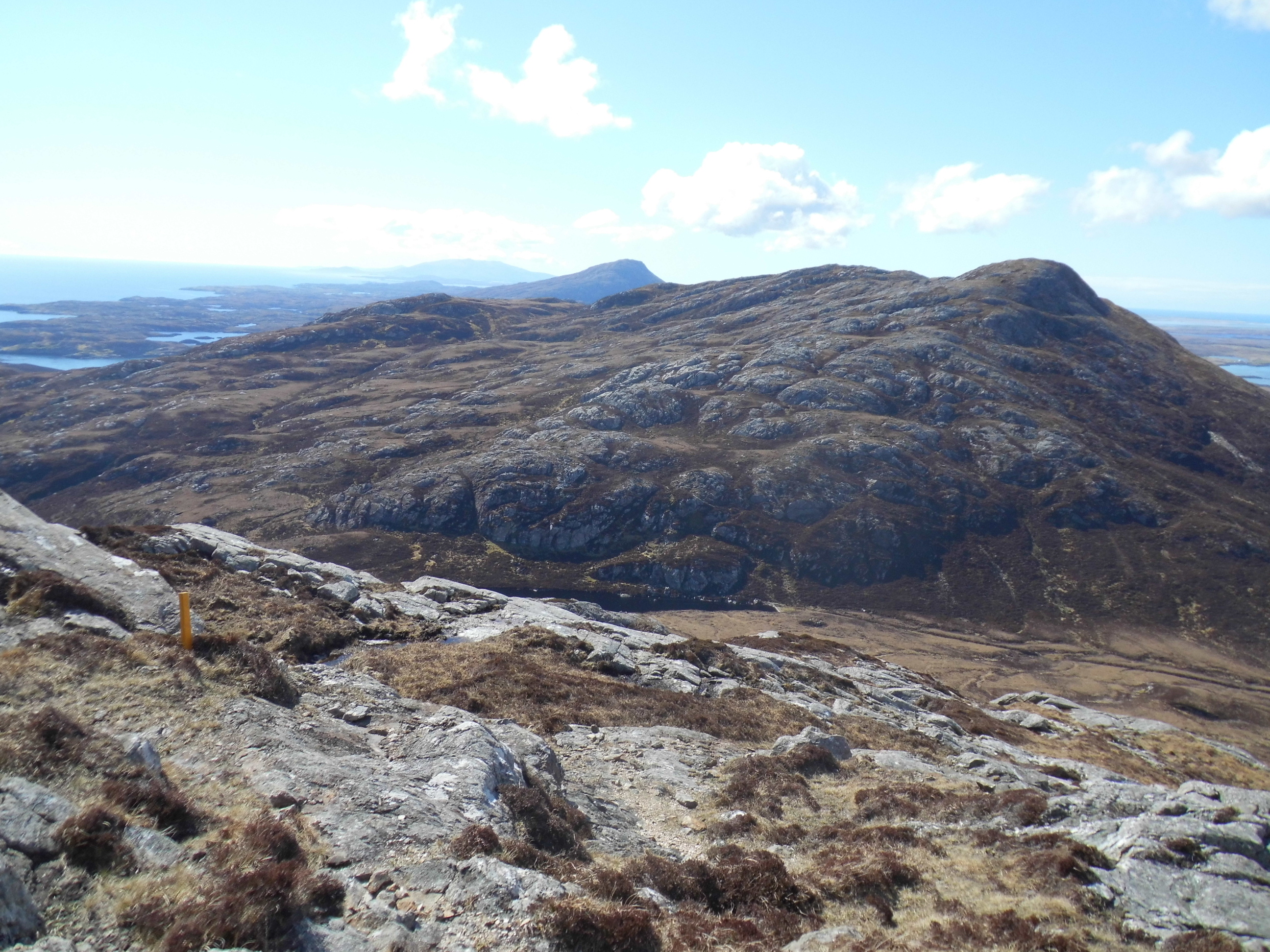
so we abandoned the waymarks to head off to the other end of the loch to pick up the obvious route line via the more gentle contours to the east. This was harder going than it looked on the map, alternating between steep and rocky and easy soft ground. The upper part was much easier going but no-one answered the calls from this dipole! Finding the suggested route down involved continuing SW along the summit for a bit and finding a broad sloping terrace which we had been able to see clearly from the approach to N Lee. This enabled us to lose a lot of height before it petered out and we bumbled down through the heather to reach the fence not far from our ascent path stile. We followed the waymarks back to the car. A long and tiring day and even the locals were surprised that we had visited both summits.
Marrival, GM/SI-186
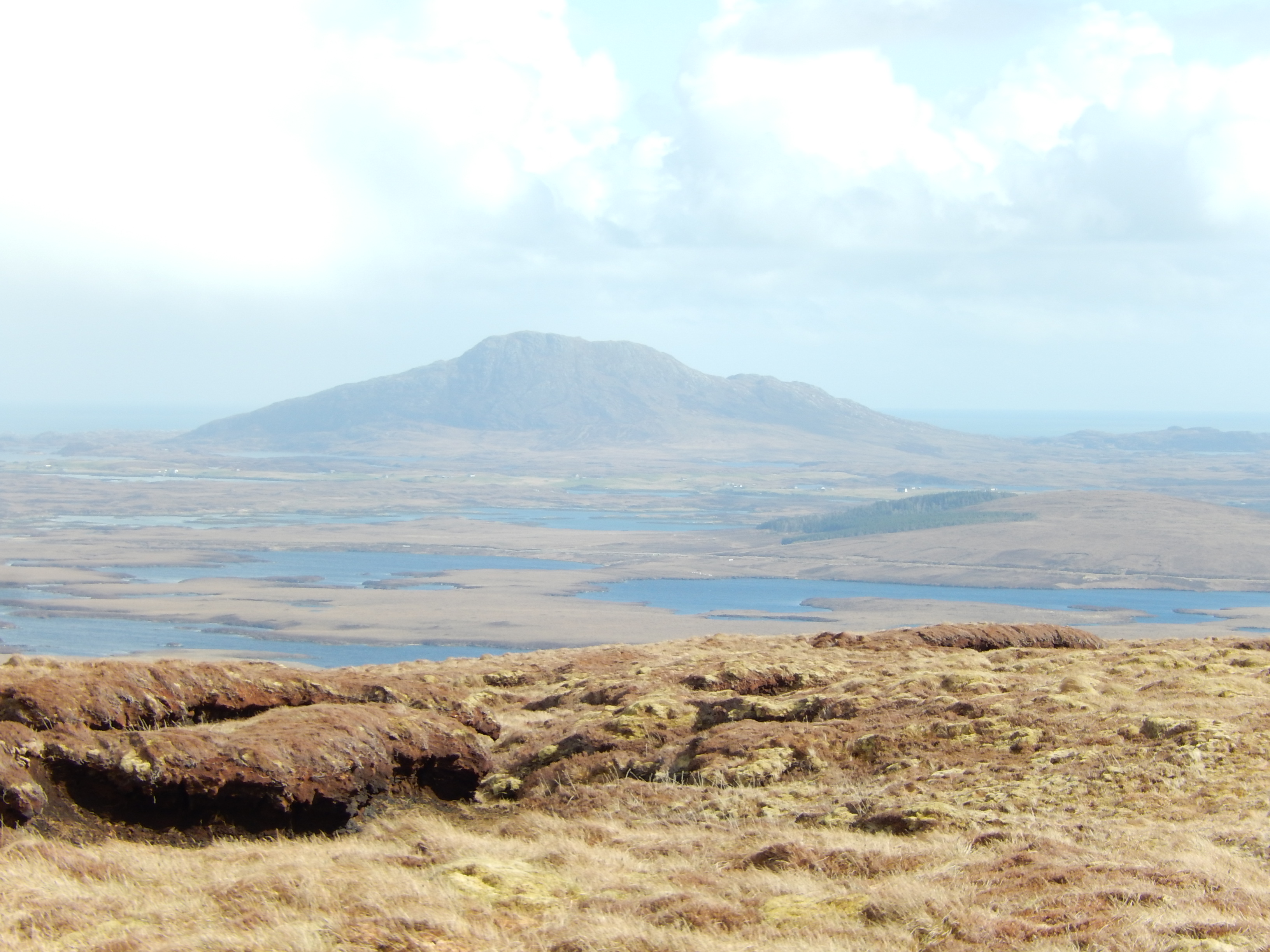
We parked at the broad bend on the Committee Road and set off towards the block of forest, following its upper edge to the end and heading towards the summit. We kept fairly low to avoid the very flat area between the peaks, skirting the worst of the peaty ground. Return by a similar route.
An aside; as there are few shops in the area it is worth noting the excellent Co-op store at Sollas, between this hill and the next one. We found it very useful.
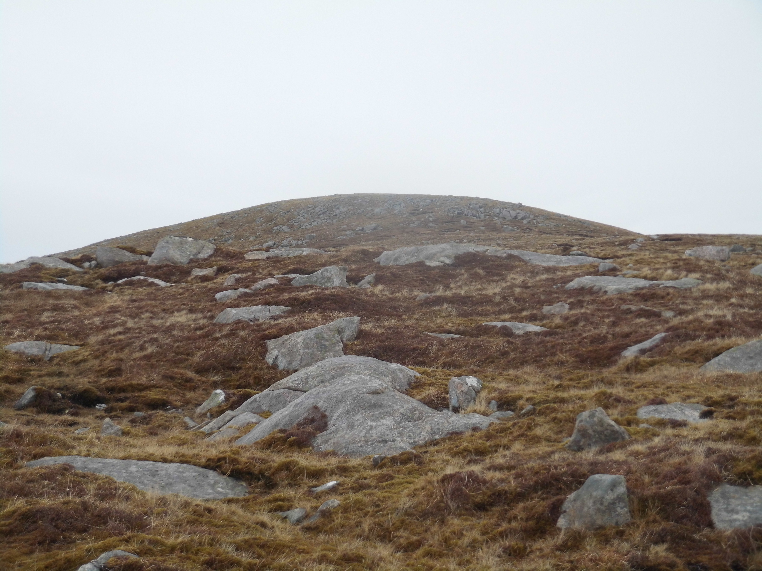
Crogary Mor, GM/SI-211
We parked at an access to the shore around NF860742, walked along the road and found the expected track skirting the Loch and heading steadily SE before vanishing. There are several faint paths, the best heading roughly S before trending more SE towards the bealach.

We turned NE some way before the ground became too lumpy and headed for the foot of the SSW facing steep slope. This is steep but has a zigzag path which took us to the top a little way WNW of the summit. Without a GPS waymark we would have had difficulty (in the howling wind conditions) finding it for the descent which we followed much the same route back.
Harris. Here we had a large house on the shore of East Loch Tarbert beside one branch of the Golden Road.
Husival Mor, GM/SI-073 - 1st activation
There is some rather soft but satisfactory parking at the road junction opposite the mast at NB018096. We walked up to the right of the stream aiming pretty well N as far as the lie of the land permitted. The large rock slabs were easily bypassed and we made reasonably good time up the rather easy slope in dry (this didn’t last!) but windy weather.
and it rained and the bothy bag rattled as Vicki called for 20 mins before the first contact was made (thanks to MW0ISC!) Using the GPS the descent was unpleasant but uneventful. In fact the hardest part of the whole activation (apart from making contacts) was the drive from Ardhasaig where the B887 leaves the main road. Even by Hebridean standards this is not an easy drive and definitely one not to hurry.
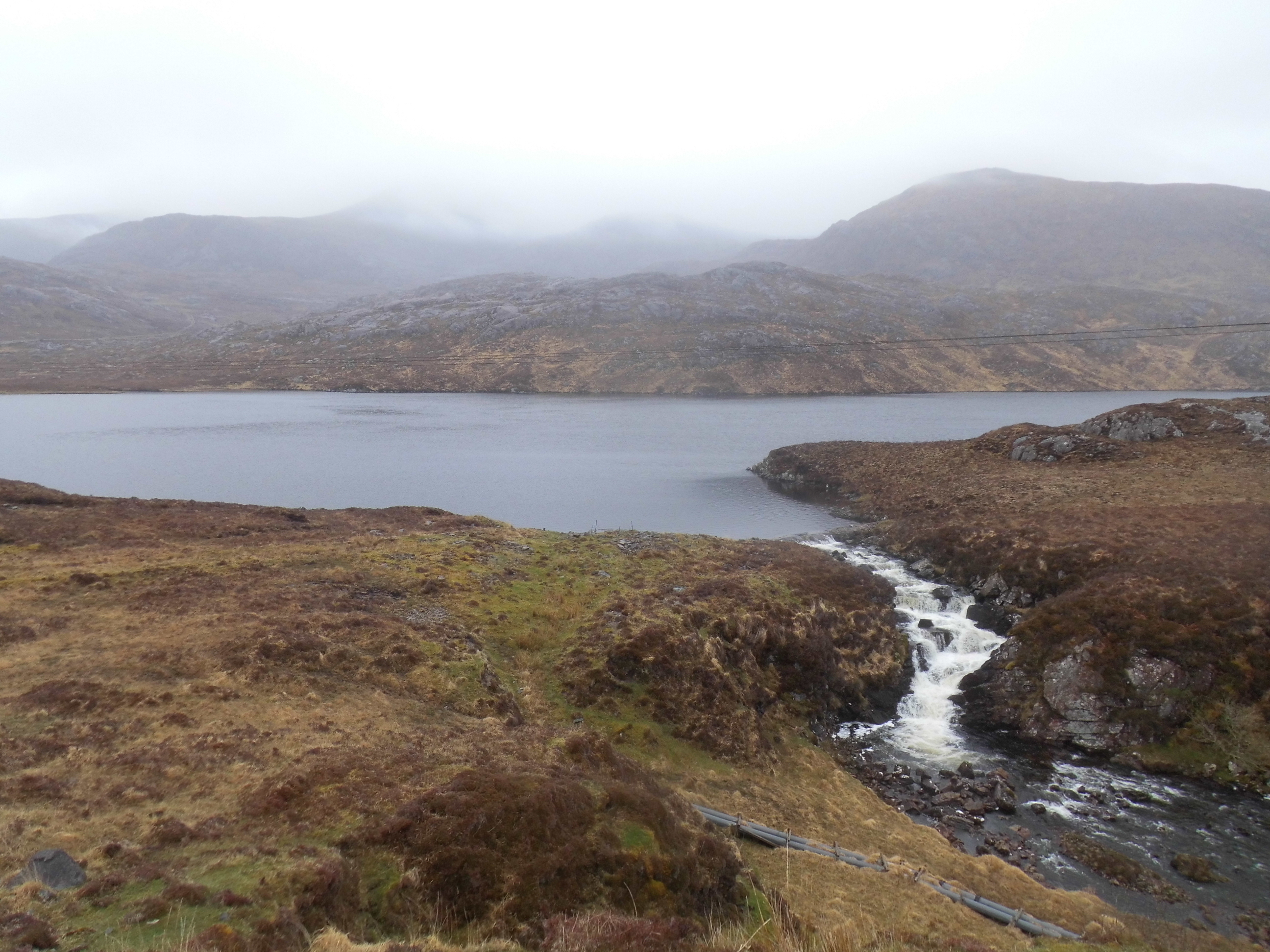
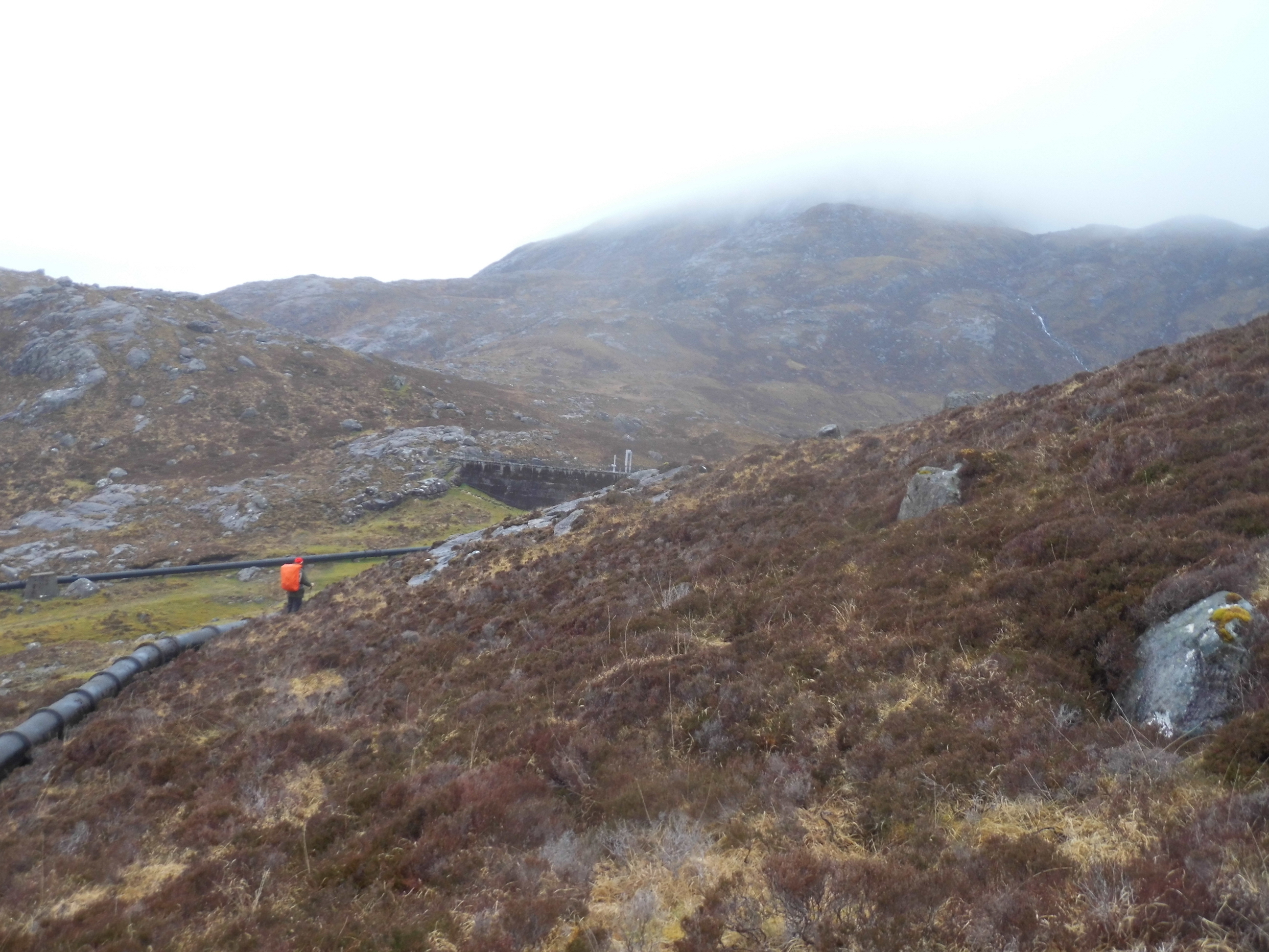
Oreval,GM/SI-038 abandoned 1st activation
We parked beside the junction of the road and the vehicle track to the power station
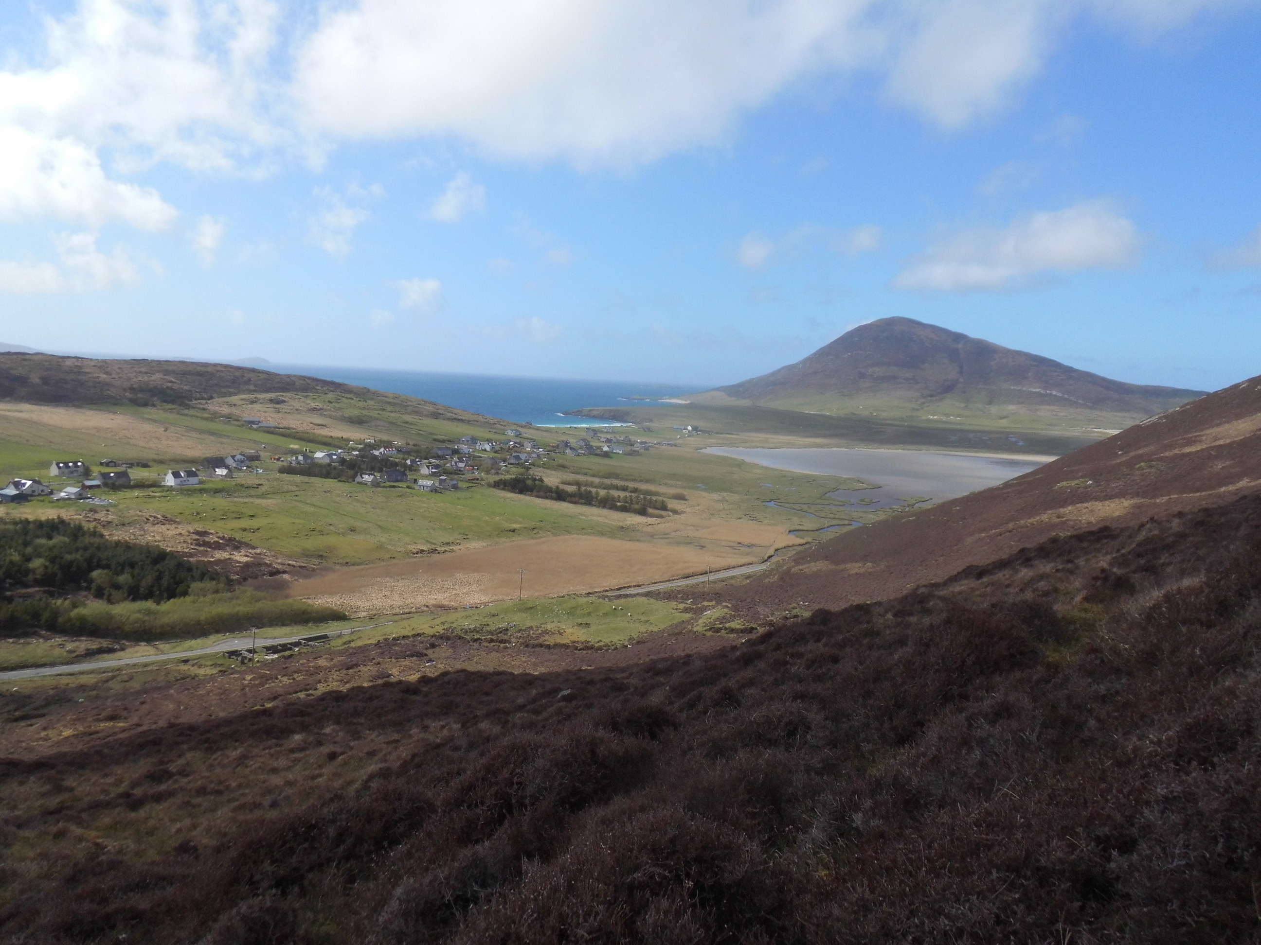
Greabhal, GM/SI-165
A large walled parking area is on the West side of the A780 just N of the turn into Northton. A gate a little further N on the other side of the road gives access to the hill. We went straight up until we reached a clearly visible line going pretty well due N. This is much easier going but takes you much too far North. We turned sharply up and back to emerge near NF999901 giving us a long rough walk to the summit exposed to the wind.
Chaipval, GM/SI-129
We parked on the verge just beyond Northton(which has an excellent roadside ‘honesty’ bakery shop), finding neither the parking nor the PC marked on the map. We followed the southernmost track but the walk description in our walks book is misleading; on the descent we found a metal gate giving access to the hill long before you reach the Temple ruin. No walls or fences on our map for this one but the gate is around NF977920. We think there may be a better path from the northernmost track on the map but we lost it on the way down. The strong SW wind had pushed us up
(and up and…) the very steep ascent from near the Temple as we looked back to Greabhal but I (M6BWA) was not looking forward to attempting to descend the same way.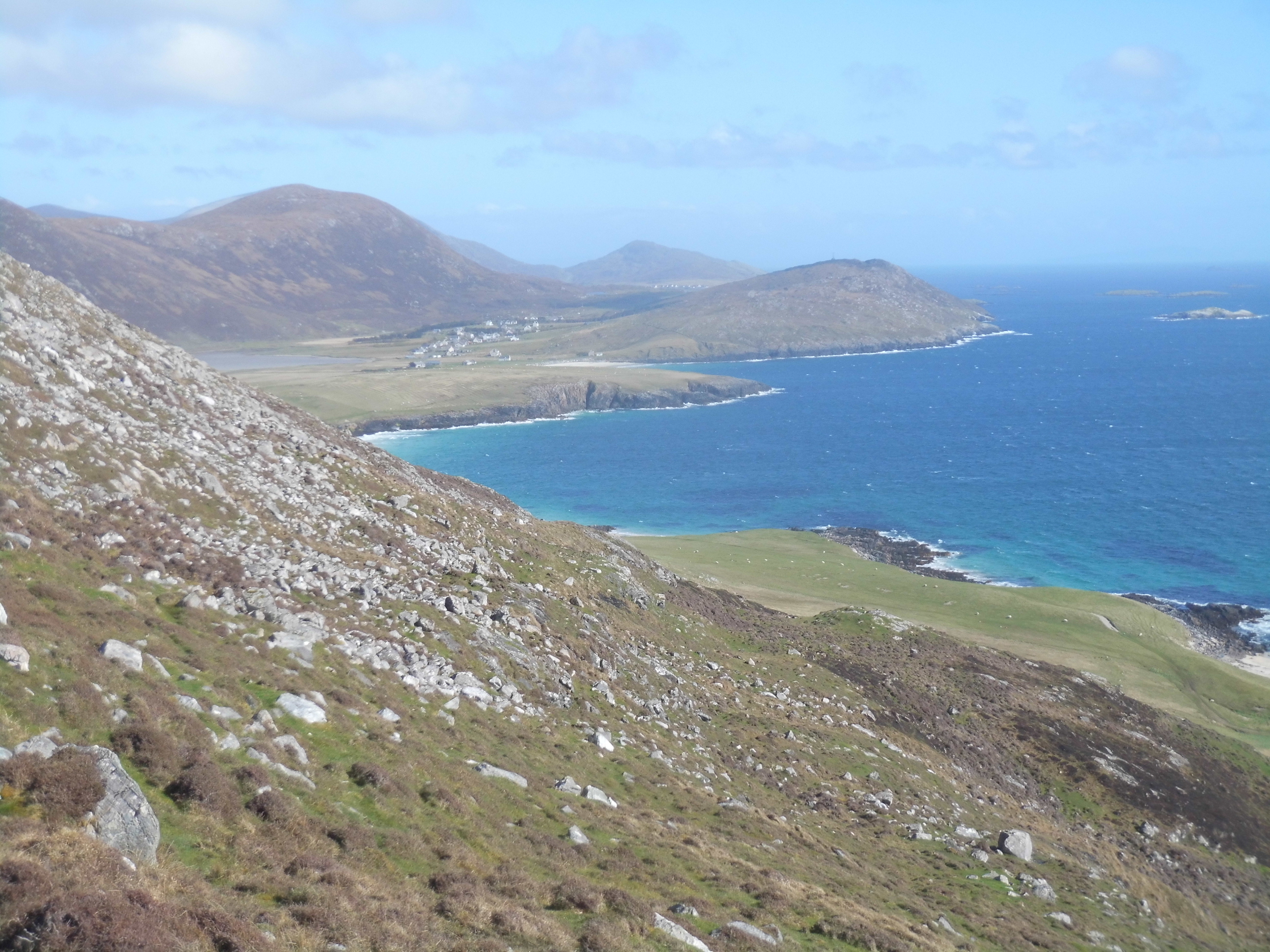
Fortunately we found the top of a fairly well used path SSE from the top which was not quite so steep and wound its way down the slopes with some daunting views for those with vertigo!
This is only a low summit 368m but you start at only 10m (like most of these SI summits) and gain/lose the height in less than 1km so you can’t afford a slip. It was 1930 BST when we left the summit as we had had to delay our start for the rain to clear and I was glad to be at sea level an hour later eventhough it was (still) a sunny evening. In wet conditions these routes would not be advisable,
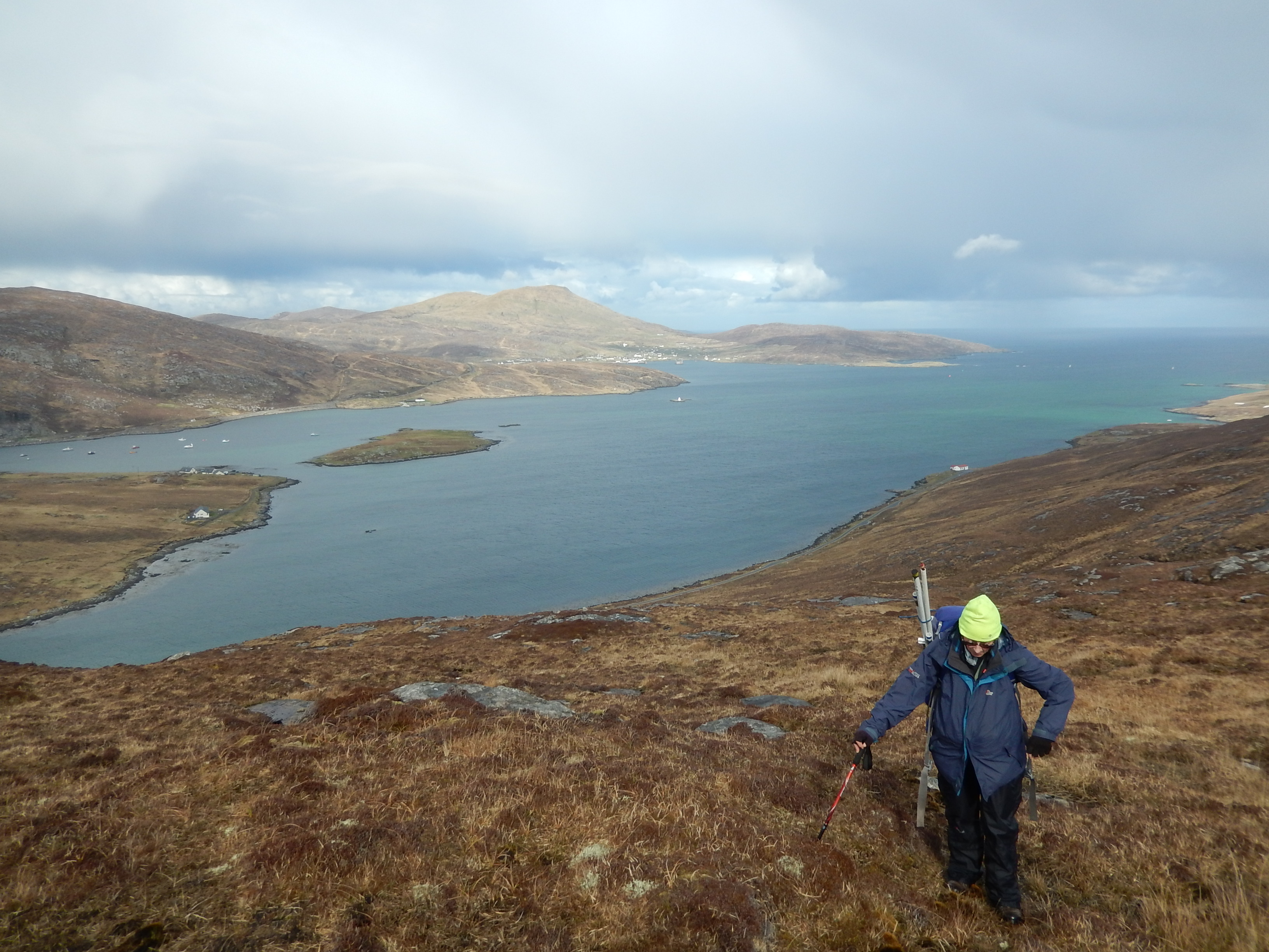
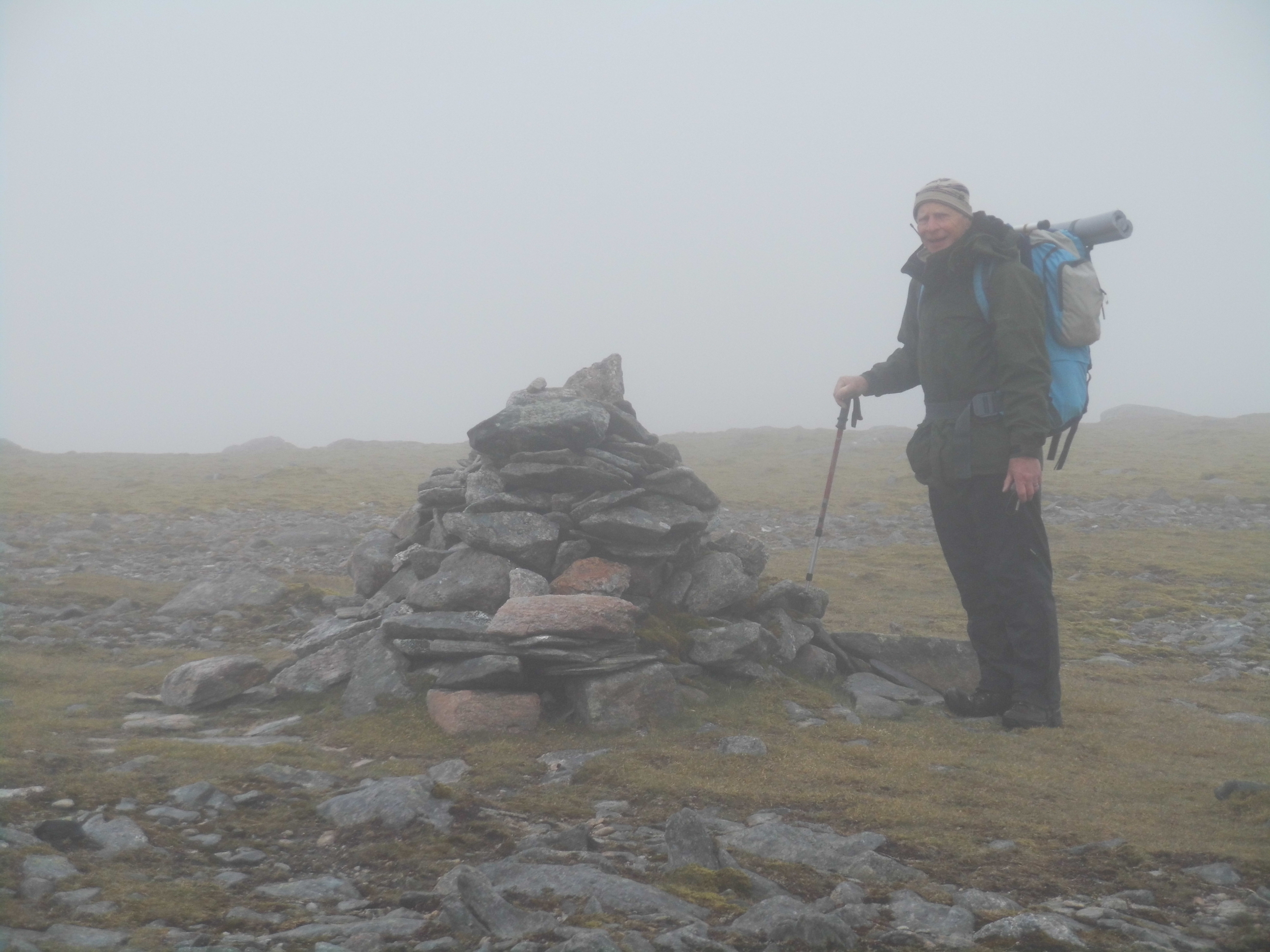
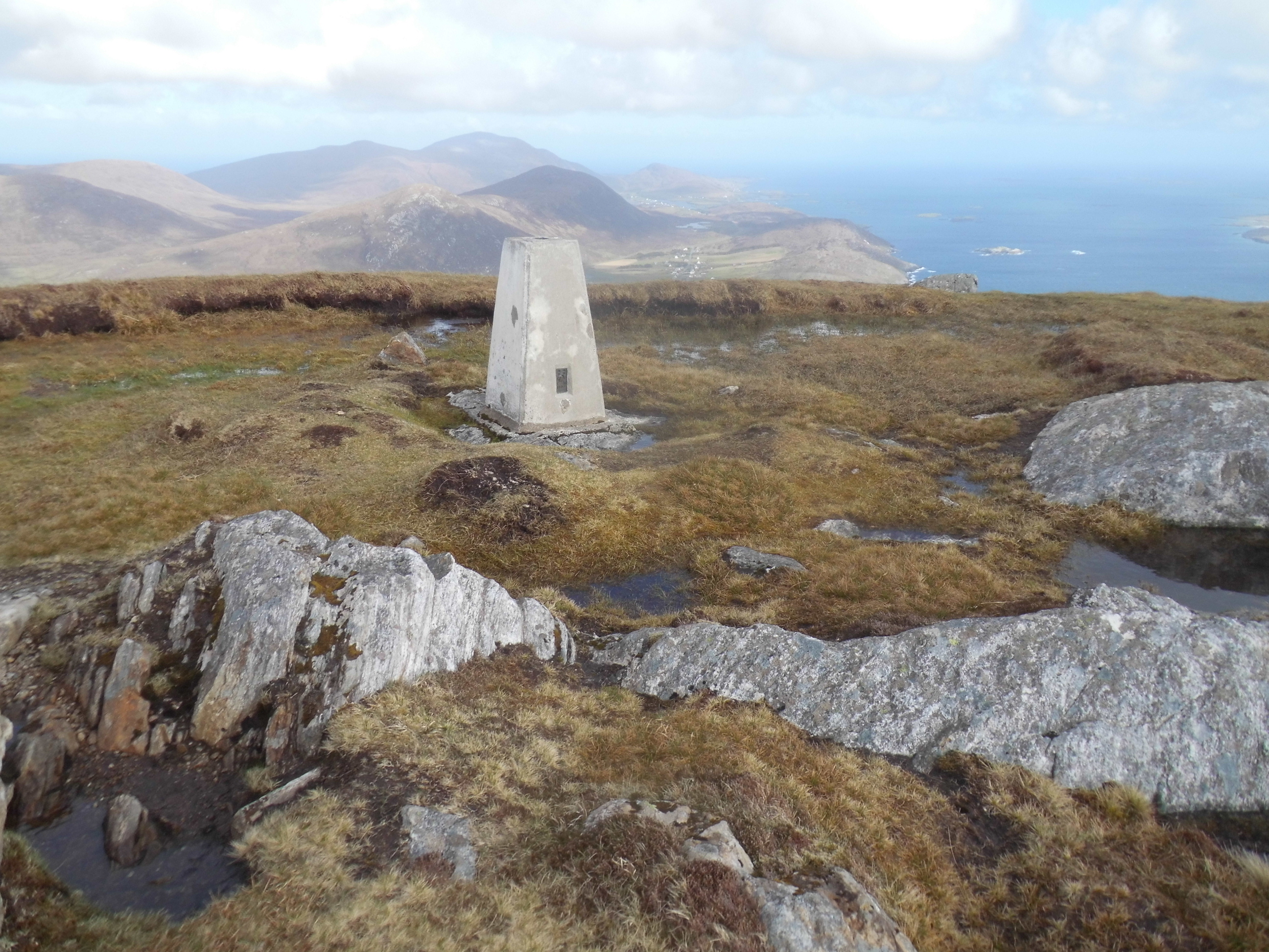
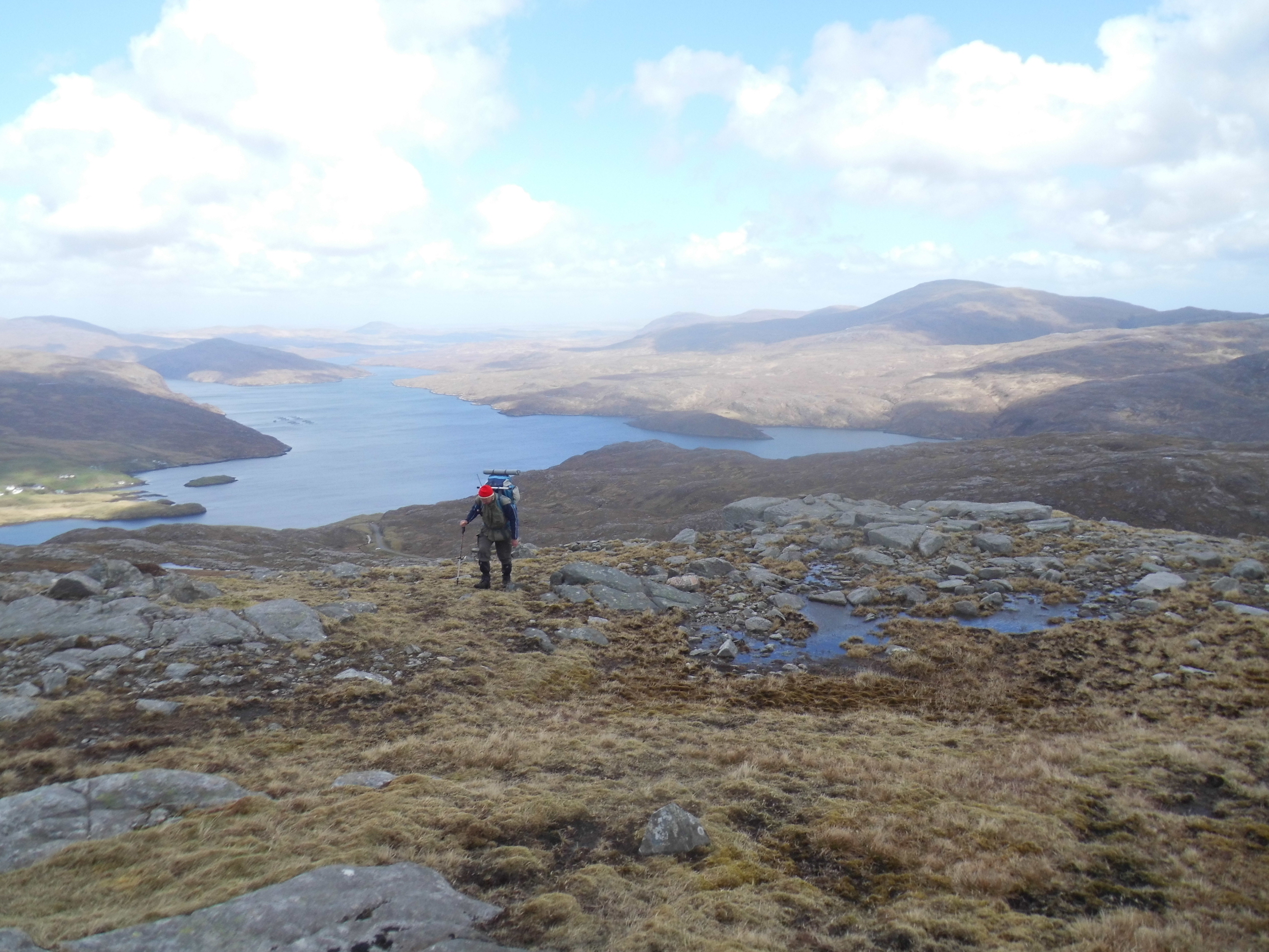
Toddun, GM/SI-059
We really enjoyed this one in spite of a fierce W wind.

There is parking just before the bend (NB207051) and more about 400m further on (NB208047). We made our way up, with fine views back to Loch Seaforth,
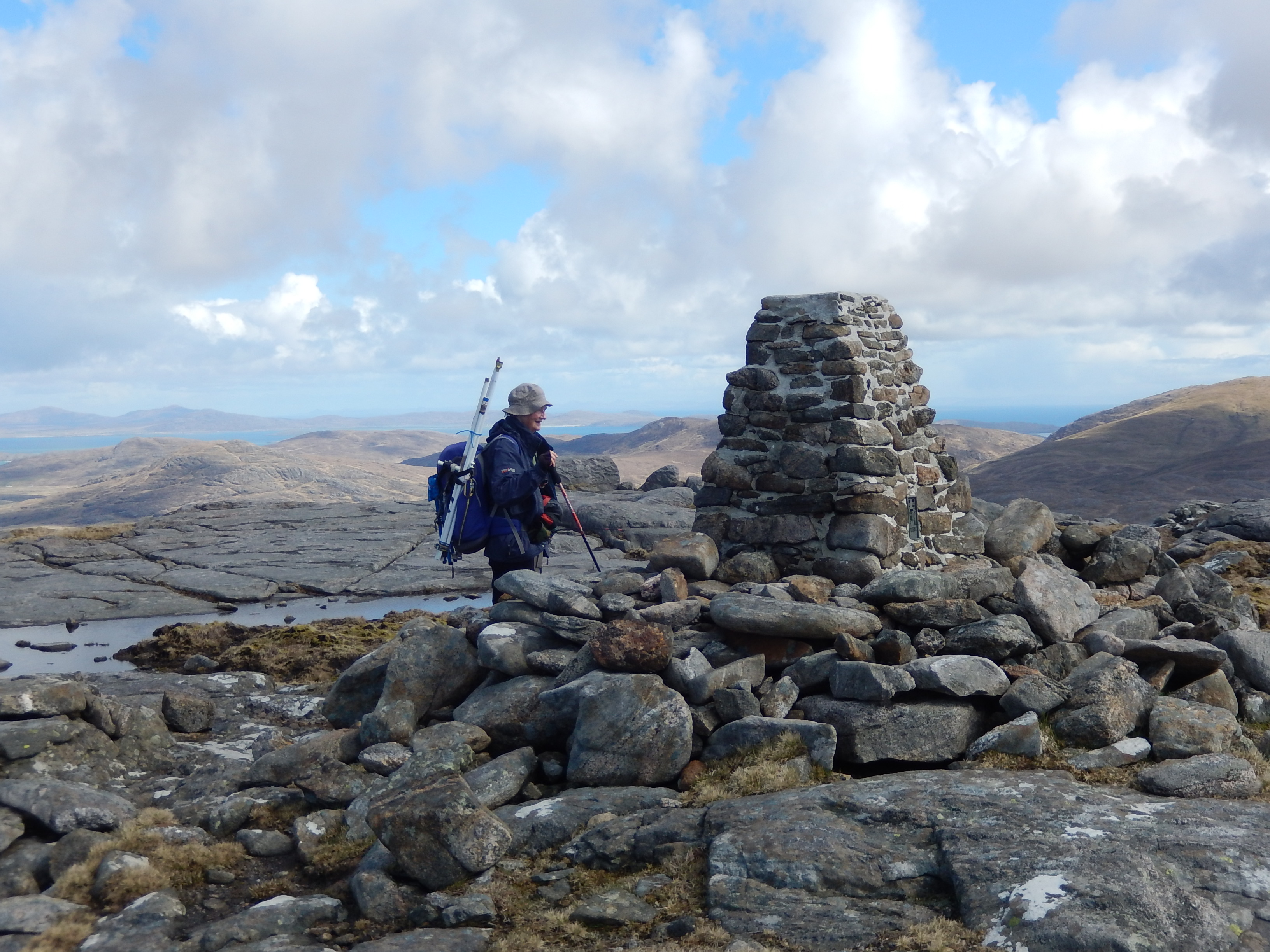
crossing the wide re-entrant to reach the eastern side of the ridge; we went up that until the steepening ground forced us on to the top. Unusually for us we both used the shelter around the trig although there wasn’t much leg room!.

On the ridge there was just room for my linked dipole with one leg into the wind and the other pegged rather closer to the edge than I liked (a hands-and knees job). Soon after we arrived the superb view disappeared and some weather approached …
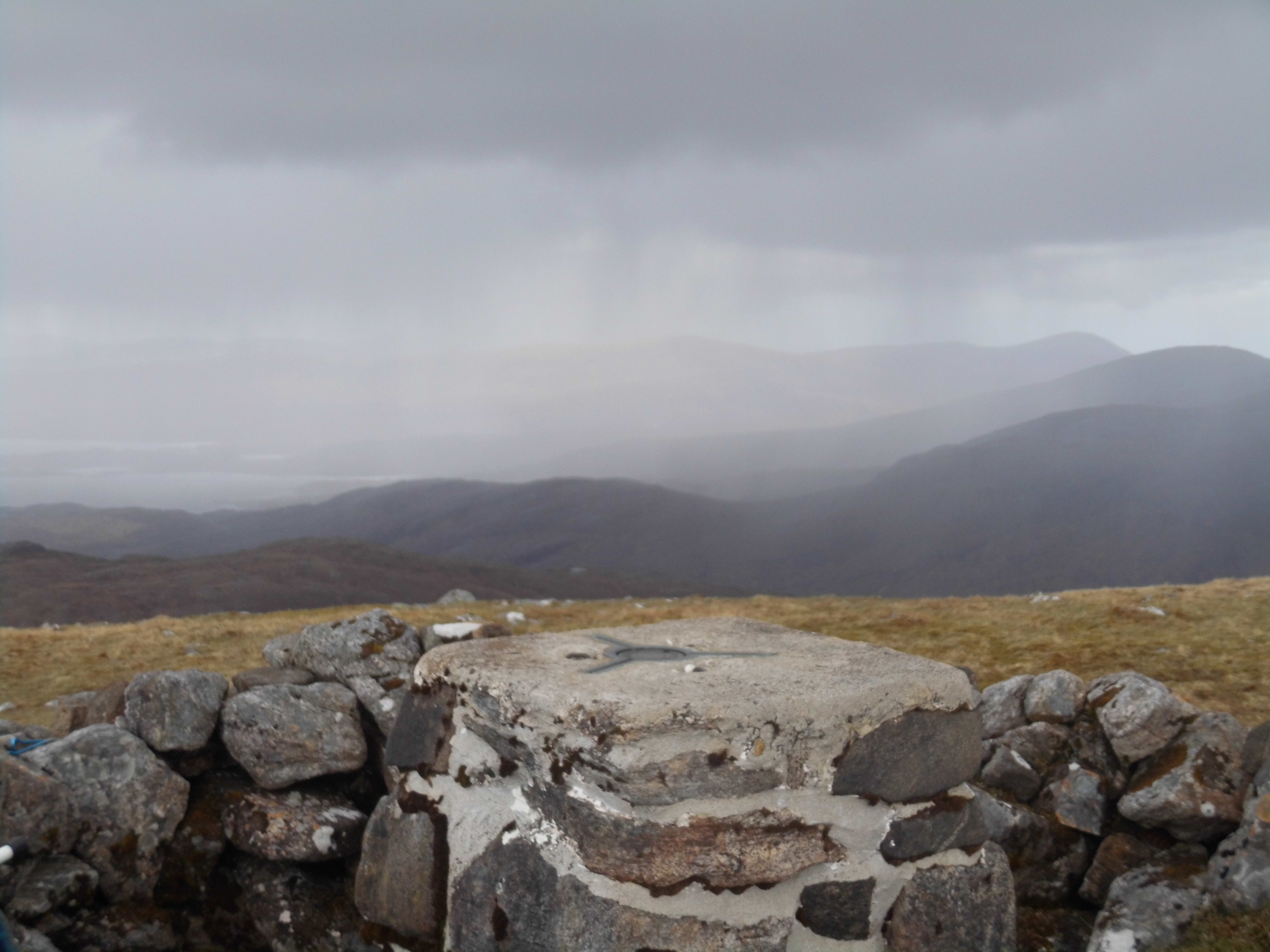
The Harris hailstones are just as sharp as those on North Uist but are more painful as the wind was stronger! We returned by a very similar route pleased that we had finally bagged a 2 pointer of the trip and had had an enjoyable walk.
Just to close this account rather less abruptly - I think we can recommend the basic itinerary; overnight in Oban, ferry to Castleby, progressing to Harris and Lewis via the Uists and then returning Stornoway to Ullapool with an easy early evening drive to overnight in Inverness. We spent a whole day of fairly decent weather exploring Lewis; stone circle, broch, black houses etc and really enjoyed the change. A very interesting holiday with a wide variety of small but not easy hills and superb beaches and views when conditions permitted. We were much too early for the machair to be flowering; a pity but the bonus was that we were also much to early for the dreaded midge.
The visit was enhanced for me (Rod) by reading Peter May’s Lewis Trilogy - started before our trip, taken as compact reading in Kindle format and completed just before leaving.
 ) to follow; pressure of lawn mowing and other domestic duties will delay further notes for a bit.