Yesterday afternoon / evening I had my RAYNET hat on (not literally !!) providing radio cover on the checkpoint on Stiperstones summit for the 50 mile Long Mynd Hike.
During the afternoon Roger M6RYR came to do an activation on the same summit G-WB-003
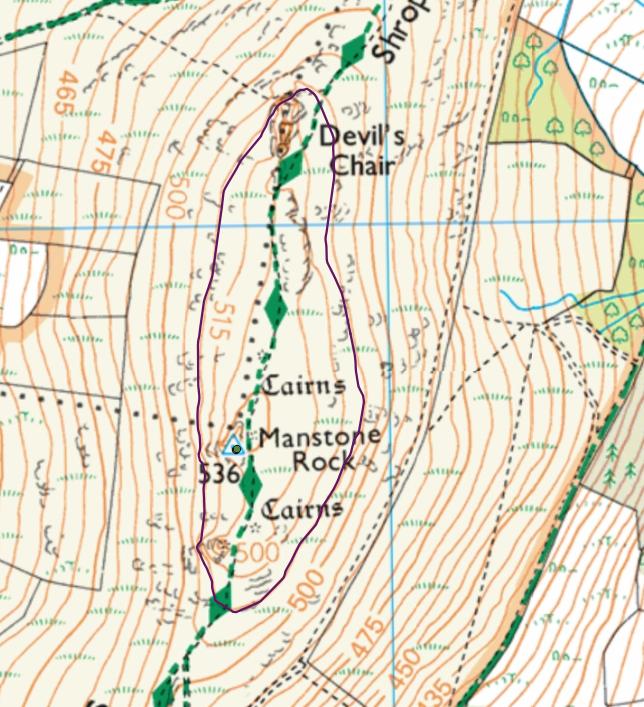
At first he was operating one the plateau in front of the trig point, but later moved up to the trig point. I placed a spot for him.
Out of interest - where would I have needed to be to work him and claim chaser points ?
The trig on the OS map is 536 mts but most of the plateau is just above the 500mt contour - if I had walked outside this contour I guess this would have been outside the activation zone ?
On a normal walk it would have been easy to walk further away and descend but I couldn’t really move too far away from the check point.
If the activator was within the 515 mt contour then yes he’s in the activation zone, would a chaser on the 500 mt contour be ok to chase ? My take is it’s the summit height that defines the activation zone, not the activators position as long as he’s within that zone.
Regards
Steve
G6UYG