Hello, I have a couple of quick questions regarding SOTA maps.
Is there a way to use characters such as an apostrophe when entering a GPS track description. It seems I cannot. Is there a limitation on special characters? I just wanted to check if it is just me or if others can do this.
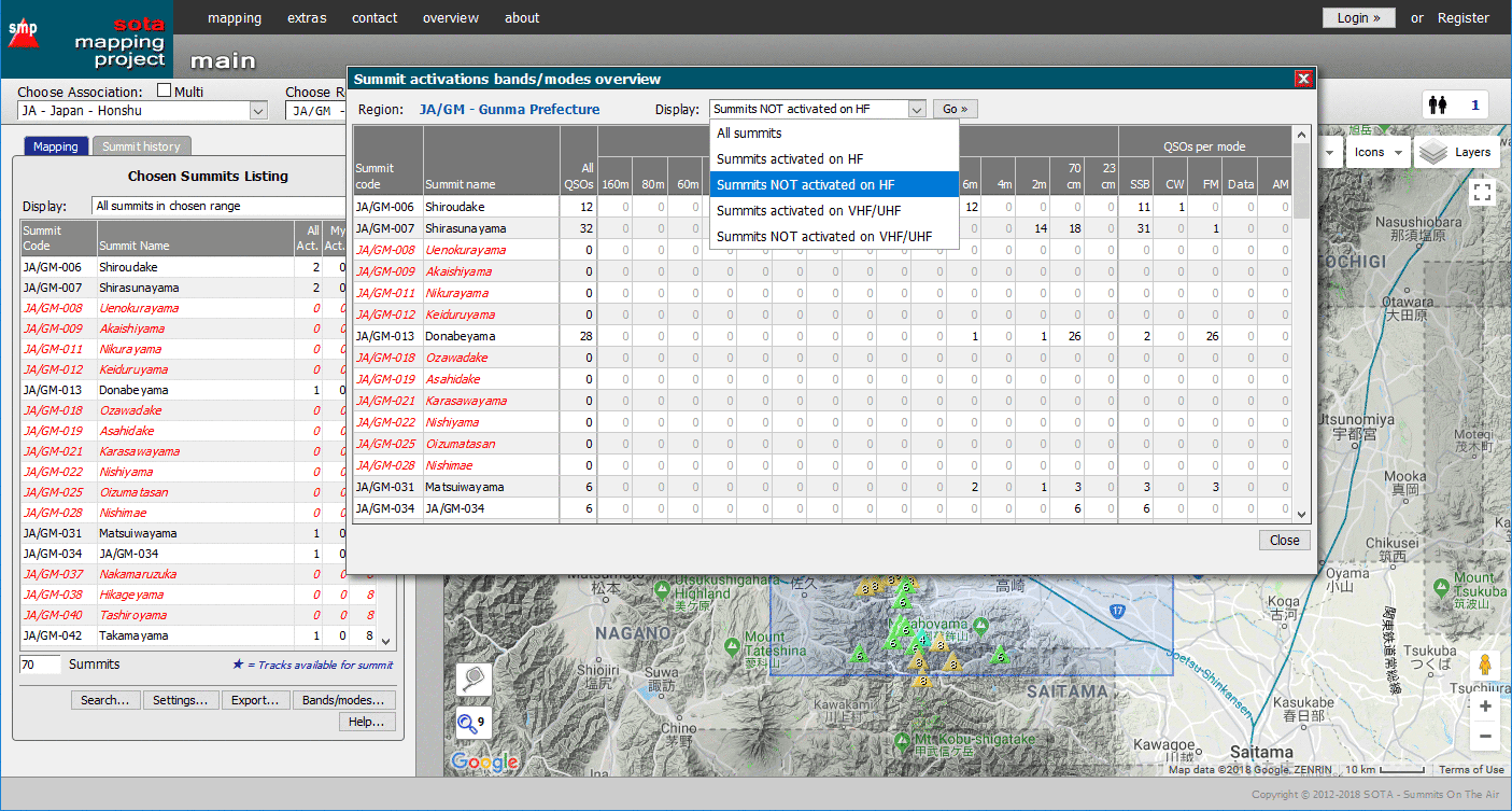
I have noticed that many of the higher summits are activated using VHF/UHF due to weight considerations on a harder climb or space restrictions at the summit. I can filter in SOTA maps for summits that are unactivated but is there a way to have another filter that could show summits yet unactivated in HF (or other modes) for example? If it does not exist, are there been any thoughts about potentially adding these?
Yes, there is a limitation on special characters, which has stripped apostrophes from user-input texts. I’ve now altered the code to accept apostrophes.
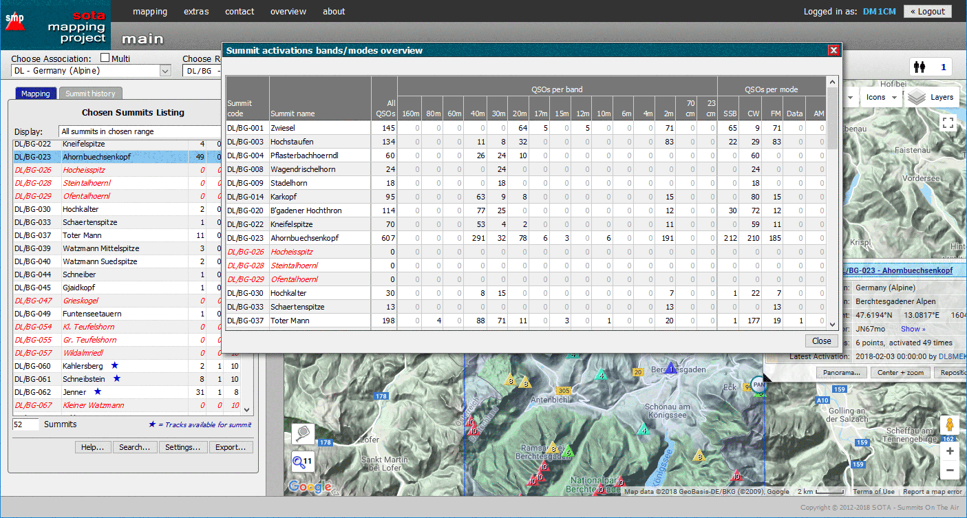
As to seeing on which bands/modes a particular summit has been activated, the database has such details - see e.g. Summits on the Air .
To see such details for all summits in a particular region, I’ll work on adding an extra dialog in the SMP to show them. With that running, you would not have to filter, just run your eyes down the columns to see which bands/modes, etc. have been used in the past on each summit.
EDIT: So, a couple of hours later, this dialog has now been built and here’s what it looks like:
Unfortunately this is only available in the newest version of the SMP, and not in the present one, since the duplication effort is too much for little old me… And the new version of the SMP is not yet live, since it and the supporting infrastructures are not yet at a production stage.
Thanks for allowing the apostrophe in the track description.
Very impressed by what you were able to produce in such a short amount of time. I will wait for the new version, no need to duplicate your efforts.
Do you think there would be a way to only show the summit triangles on the map for those that have not yet been activated in HF (for example, or any other mode)? ie: unactivated-HF etc…
I am aware of this functionality and I have used it in the past.
I think that SMP is more helpful in visual terms. For example if I want to check which summit near my house has not yet been activated in HF yet it is easier to look at the map than to check summit by summit in the actual database.
The database feature is very helpful but SMP would allow you to check multiple summits at once by just looking at the map if we were able to implement such a feature.
Both the database & SMP are very helpful already as they are, I am just wondering if we can add that little tweak to SMP.
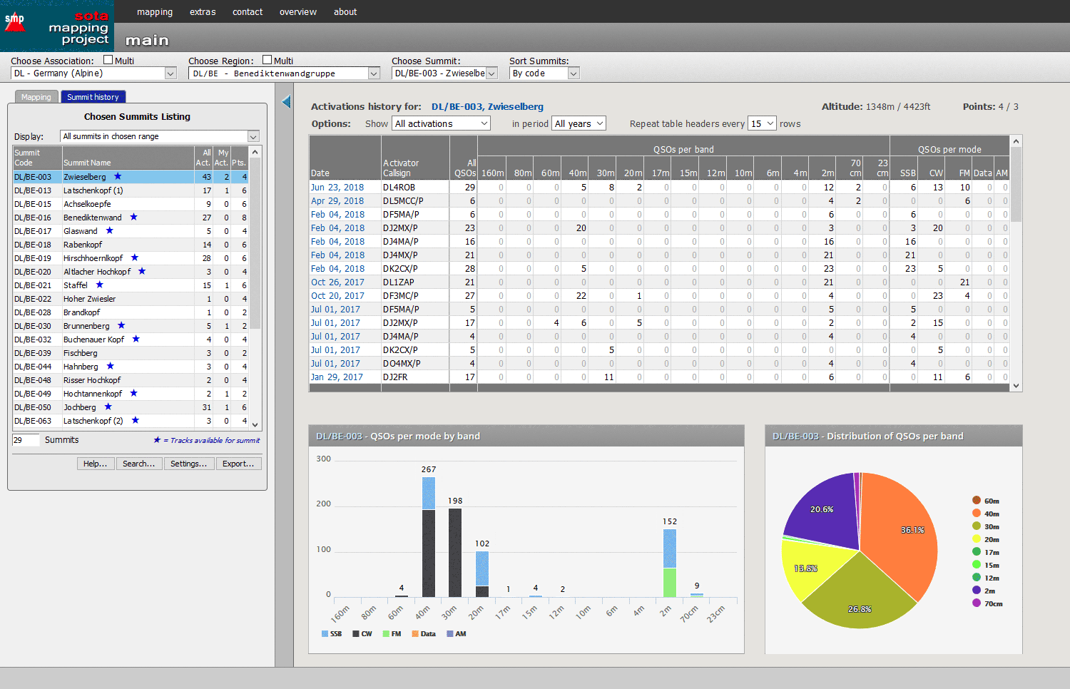
Actually, the very same page in the new SMP also features the data for each individual summit as in the example provided by Andy, plus a couple of graphs:
In addition, each activation listed for the particular summit has a direct link to that activation which is then loaded into the activations page in the new SMP. Again, not yet live…