SOTA Cycling Week 2016 - intentions?

#@!#%** cyclists.

Don’t like them myself.

It’s the way they ride at a speed that is slow enough to hold me up when I’m driving, but too fast for me to easily complete a safe overtaking manoeuvre. Or when they ride two-abreast on a main road, especially on the bits with double white lines in the middle. Or that they ride six feet away from the left-hand edge of the carriageway when there’s a perfectly good gutter for them to ride in. And don’t even get me started on the wannabe Olympian holiday cyclists in Majorca.

And that’s nothing compared to the mountain bikers that persist in churning up the paths on The Cloud G/SP-015, happily riding past and happily ignoring the National Trust signs that prohibit cycling on there. I mean, just how selfish can people be?

Now the Olympians themselves are OK. I don’t mind them so much. I like the way they win lots of gold medals for Britain and give us some sporting pride, especially just after the national football team has performed to its usual tournament standard in a tournament. And how our boys keep winning the Tour de France. I think Kenya counts as “ours” doesn’t it?

So with Mr Froome set to ride into Paris as the “le Tour” winner once again, I thought I would bury the hatchet for one afternoon and support “SOTA Cycling Week”. To do this, I piled all my gear and grown-up children into my Citroen Xsara Picasso and drove up to Gun G/SP-013 for a look at Richard G3CWI’s bike.

I arrived at a strangely deserted parking area just after 3pm local. It was no surprise that Richard’s car wasn’t there, but there were no other cars there either. Not even Mickey 2E0YYY’s car. Unbelievable! I felt every one of my now 46 years on the long and gruelling ascent, with Jimmy disappearing into a dot on the horizon, and my failing to keep pace with Liam despite my very finest efforts.

Richard had already finished his 2m FM activation and was sat by the trig point modelling his yellow cycling helmet and branded SOTAbeams cycling vest. Jimmy was delighted not to have any competition for VHF spectrum and made 9 contacts of his own on 2m FM. On 15m CW, I made 6 QSOs, mainly into central Europe.

I was tempted to stay longer with some very loud signals being heard on the PSK frequencies - and I had all the data kit with me. However, Richard’s suggestion of beer at the Harrington Arms, Gawsworth won the day. We’d worked out that if we started packing up at the same time that Richard set off on his bike, that we’d arrive at the pub around a similar time. And we did, and enjoyed a couple of very welcome beers.

Richard, having established that Marianne was working a late shift, then managed to skilfully manipulate himself an invitation to dinner at EYP Towers. That necessitated a diversion to Big Sainsburys on the way home to get ingredients for my speciality - chicken, chorizo and squid paella. This had a cycling theme to it as well as a cyclist joined us to eat it. Apparently, sometimes cyclists in Spain eat it too.

So, there’s my entry to the SOTAbeams SOTA Cycling Week activation report thing. I think it’s a sure-fire winner myself - we took part in a SOTA Cycling Week activation, we had a look at a bike, we overtook two bikes on the roads, we took a photo of a bike and we fed a cyclist. #WINNER

5 Likes

I’ll be making an attempt on Mt. Bishop (VE7/GV-004) tomorrow, using a bike to cruise the 14km of trail before a steep and technical climb to the summit. Vancouver is UTC -7:00, so hopefully I’ll be able to get this done and written up before the contest ends.

Edit: At 32 km return distance, and an elevation gain/loss of more than 1200m, this will probably take about 14 hours, so I’ll more than likely be a little late in putting up a trip report.

1 Like

Not to worry, mate, you’ve got another couple of decades before you start to seriously slow down!

Brian

PS I had to shift a bike in the garage today so that the window cleaner could get through, does that count?

Probably more than mine does Brian :smiley:

Today I drove up to Mt Stromlo, on the lower slopes of which is a cycling park. Had numerous mountain bikers ripping up the trails adjacent to my activation site - and drove past a multitude of them on the way to and from the parking area. I didn’t even force any of them off the road either. Does this count as an entry for SOTA cycling week? :smiling_imp:

Matt
VK1MA

It appears that my thunder has been unceremoniously stolen by a motorist. Anyway I had a very nice ride out from Macclesfield to Gun G/SP-013. I decided to see if I could get there without getting out of breath and I did …by cycling very slowly. 11.3 miles, average 10.1 mph (but a mad max of 41.8 mph = 67 kph - a new PB for me). I pushed the bike along the public footpath to the summit - not rideable on a road bike in any case.

I had bought a Yaesu VX3 for just this sort of thing and it worked very well - my Baofeng is virtually unusable on local summits due to overload. 5 QSOs before Tom M1EYP bowled up breathing harder after his 200 m flat walk than I had on any of the 1,335ft ascent I had ridden on the way there.

Tom gave me a head start to the pub and I was in the mood for a blast so I covered the 10.3 miles at an average of just under 20 mph but timed it right so the beer was in on arrival - perfect!

After a couple of beers I cycled home and was amazed to bag a PB on an ascent that I have had 124 previous attempts at, proving conclusively that beer is a performance enhancing drug.

That’s another SOTA Cycling event over for me.

The day was rounded off by a pleasant meal at chez M1EYP, cheers mate!

4 Likes

This was more of a smash and grab by bike. I mountain biked (and pushed) up Bredon Hill (G/CE-003) from Elmley Castle choosing the slightly less steep route up. I only had my 2M Wouxun with the Sotabeams multifunction
dipole, which is a light system to carry, but I thought I had paid the price as there were no UK 2M spots among a mass of HF spots. At first it was very quiet, but after a while the spot put on by G0LGS must have been seen, and I made the grand total of seven QSO. Then I enjoyed the second best bit of the day with a couple of km of “single track” and a fun descent down the slightly steeper route, all on bridleways and not a single national trust sign to ignore.

Last time I took part in the SOTA cycle weekend, I found the batteries were flat in my camera. This time I checked, but I have just had my SD card show as corrupted. Oh well, perhaps there will be pictures next year.

Richard
G0IBE

2 Likes

Well, other commitments during the week meant that my trip to Wendover Woods was just not to be.
There’re just too many things to do during the summer and SOTA takes a back seat…

Anyway, with only today remaining, I grabbed the bike and set off for Bredon Hill, G/CE-003.
A grey overcast day and it rained before I had completed my first mile. :unamused:
It did stop soon after and it was a pleasant enough ride to Bredon Hill.
It appeared to be fairly deserted on arrival (but more later) and I set up in my usual spot in a strong blustery wind.
It was grey and rain showers could be seen in the distance rolling down the Severn Vale.

CQ on 7Mhz brought the grand total of 3 contacts, hardly readable above the noise of the wind. I’d forgotten how low the volume is on my little MTRs (reminder to self to fix this sometime!)

Moving to 10Mhz netted 3 more contacts and a nice surprise S2S with Joerg, HB9BIN/p on HB/FR-035.
Swapping to my second MTR, I called on 14Mhz. This was the money band today! Four QSOs before that dried up too.

I set up for 60M but as I started calling a heavy shower hit with a vengeance.
I couldn’t be bothered to hang around so packed up.

I’d noticed, even in this inclement weather, quite a few people coming and going from Parsons Folly on the ramparts of the Hill Fort. Of course it was only when I checked in on my Pokemon Go, that I realised I was next to a Pokespot with a Pokegym next door! On further investigation there were a couple of dozen young people huddled out of the rain in its lee, all chasing Pokemon!

Replenished with Pokeballs, I hit the trail for home.
I’d initially thought about heading for Cleeve Hill, G/CE-001, on the way home, but the weather, lousy HF condx and the need to stop at regular intervals to chase Pokemon meant it wasn’t to be…

Round trip exactly 40 miles.

5 Likes

I’m back safe but totally bagged. Trip report to follow.

Quick stats:
Distance biked: 28 km return
Distance hiked: 7km return
Elevation gained/lost: 1400m
Average hiking grade: 37%
Sandwiches eaten: 2
Bugs eaten: 4
Contacts: 9

4 Likes

I hope that everyone who took part enjoyed the slightly different challenge of a cycling activation. Don’t forget to share your SOTA Cycling Week reports here. They will encourage others to give this transport option a try. And of course you might win a little prize.

The cut off date for submissions is Monday 1st August

I planned to activate DM/HE-484, Krehberg – 576 m; DM/HE-068, Tromm – 577 m and DM/HE-333 Stotz – 478m with a total distance of 163.1 km and a total ascent of 1511 m.

Youtube

The preparations for my participation to the SOTA Cycling Week 2016 started with a streak of bad luck. It began two days before I was about to set off for the summit activations. It was a rainy day. Together with DL6LX, we left the local amateur radio club meeting by bicycle and mono-wheel trailer. A couple of minutes after our rivers bent, I noticed a flat front tyre. I pushed my bicycle to his place and he provided me with tools to fix that flat tyre quickly. It started raining again. I put on my rainwear. In doing so, the zipper seam of my rain coat had torn. “All good things come in threes” as they say. That’s just how I turned out to be. A few minutes after I’ve left heading for my place, the carrier mounted metal plate for my VHF/UHF antenna suddenly broke. After more than 3 years of almost every-day usage, the vibration stress did the rest. I wasn’t able to adapt my sleep pattern for a very early take-off the day after next. Quite the contrary I had to find a way to fix my VHF/UHF antenna mount and purchase a new rain coat. Fortunately, however DL6LX provided me with tools at his garden to cut the broken metal plate to size required for the carrier mount and to drill in for the SO-239 mount.


I went to my preferential outdoor outfitter to purchase a rain coat. It was the first day of holiday in my federal state, no wonder that there was huge queue. On Sunday morning, I found out, that the carrier tyre was flat, too. So I had to fix that in order to set off.

As a result of this streak of bad luck I set off way too late. I’d be able to make two summits at most.


At least the weather conditions were pleasant, after heavy rainfalls during the night. I set the FT-100 remote control at the handlebar to the SOTA 40m SSB CoA 7118 kHz on and set off. I went downtown to the city centre of Frankfurt, passed the river Main and joined a forest aisle. Then I noticed, that one of my HT’s was missing. I went back a few kilometres to pick my lost HT, which I lost during a minor accident. After a few miles on the forest aisle I encountered several hundreds of juvenile Bufo bufo individuals crossing the gravel path. As I continued my ride, I came across joggers and other cyclists until I approached a fallen tree which barred the way.
It was time for breakfast then.
Until the final approach to DM/HE-484, I encountered only minor obstructions such as several gates and low bridge underpasses. I had to fix the tuning cable RJ connector with a twig. During the ride, I made several QSOs on digital voice modes with stations from the UK, USA, Australia and Germany. I listened to other stations on HF in SSB and CW as well. Suddenly, I passed a path, which looked quite familiar to me. I had been hiking on this path as I did DM/HE-314, DM/HE-102 and DM/HE-053 on May 8, 2016. I passed several villages as I followed along a street which runs parallel to a beautiful cycling path. As I finalized the asphalt road I joined a strong slope on a mountainbike trail which took me to the activation zone of DM/HE-484.

The mixed beech forest protected from the light rain. There was absolutely no need for artificial rain protection. I spotted myself via APRS2SOTA and just after a few calls on 14285 kHz with my trailer mounted vertical I got chased by Don, G0RQL. The propagation conditions weren’t quite good. I decided to switch to my end-fed vertical long wire antenna and I erected my 10 m GRP pole. Right after that I gave it try to 40m and got a S2S call from Juerg, HB9BIN/P, who was on HB/FR-019, Le Moléson – 2002 m. No response on 145.500 FM and 144.300 SSB. All in all I’ve logged 11 QSOs on DM/HE-484.

In view of the late hour, I felt strengthened in my decision to do only two summits, rather than three. So I went to DM/HE-333 as my second and final summit for the SOTA Cycling Week 2016. I went down Krehberg on a very steep mountainbike trail with narrow passages between trees and bushes.


As I left the forest, I found myself on a beautiful grassland plateau with a spectacular view to the several hills of the Odenwald. Next very hilly, up and down I followed very rough paths as well as country lanes until I passed Lindenfels (345 m), a beautiful village with the beautiful Castle Lindenfels.
It’s the first documented Castle in the inner Odenwald. The descent from Lindenfels was one of the most beautiful parts of the journey. Because of the heavy and frequent ascents and a heavy baggage (including the mono-wheel carrier) I had to push up my bicycle several times to get to the activation zone of Stotz, DM/HE-333.
The propagation on HF got worse. I was hardly able to get 4 contacts into my log. Manuel, EA2DT was very patient and kind, so I was able to work him on 40m and on 20m. Again no response on 145.500 FM and 144.300 SSB. I was very happy, that I’ve successfully activated two summits on this day. This was the time to go back to Frankfurt. After a long and very varied route back to Frankfurt, I spontaneously made a stop-over and stayed with friends 10 km off the outskirts of Frankfurt.

It was my first SOTA Cycling week participation and it was an amazing and unique experience, however I did “hamcycling” and summit activations with my bicycle before.


Equipment:

  • VHF/UHF (handlebar bag)
    • SG-7900 VHF/UHF, 1.58m, 5.0/7.6 dB @Carrier-mounted
    • Yaesu VX-8 VHF/UHF/6m, TNC, APRS; Mic. MH-74 +GPS
    • Motorola DP3600/XPR6550 UHF DMR/FM
    • Motorola Astro Saber I UHF APCO P25/FM
    • Motorola MTP-850S UHF TETRA
    • Icom ID-31 UHF D-STAR/FM
    • Yaesu FT-1D VHF/UHF Fusion/FM
  • HF (monowheel trailer)
    • 3m Vertical whip
    • MFJ-928 Automatic Tuner
    • Yaesu FT-100 160m-6m, VHF/UHF, with Mobile Remote Control @Handlebar-mounted
    • 12V 12Ah lead acid battery
    • 12V 5Ah lead acid battery
  • Other devices
    • Garmin etrexVista HCX GPS
    • Trip recorder
    • Digital camera
    • 12V 12Ah lead acid battery
    • 12V 5Ah lead acid battery

Stats:

  • Summits: 2
  • Total SOTA QSOs: 15
  • SOTA S2S QSOs: 1
  • Countries: 9
  • Total distance: 152 km
  • Total ascent: 1307 m
  • Loading of the bicycle (2 panniers, handlebar bag): 10.1 kg
  • Loading of the mono-wheel trailer: 22.3 kg
  • Bananas eaten: 6
  • Ticks: 3


9 Likes

This weekend is the last opportunity to post your Cycling Weekend reports. The prize for the best account will be awarded on the 1st August.

Here we go! Trip report from Mt. Bishop (VE7/GV-004) on July 24, 2016.
Follow the link for a full report and more pictures: SOTA Cycling Week: Mt. Bishop | Summits and Radios

Mt. Bishop is the northernmost peak in Mt. Seymour Provincial Park and represents a typical, if somewhat more strenuous, hiking experience in the North Shore Mountains of Vancouver. The summit was first climbed from the East via Indian Arm by a BCMC party in 1909, though modern access is now found from the West in the Lower Seymour Conservation Reserve and, less commonly, from the South via Mt. Seymour and Mt. Elsay. It is not a particularly well-traveled route, though the trail is maintained and well flagged by North Shore Search and Rescue.

There are several ways to reach the base of the Mt. Bishop trail, including various river crossings and boat trips, but in the spirit of the event I chose to approach the trailhead by bicycle along the Seymour Valley Trail, crossing the Seymour River near the fish hatchery at the South end of Seymour Lake.

The cycling trail is quite pleasant, following the valley bottom before breaking out near the river. Once I was across the bridge a short climb brought me to Spur Road 4 and the end of the cycling portion of the approach. From there the trail the trail goes steeply up towards the Vicar Lakes and is not bike friendly.

Those familiar with North Shore trails will not be surprised by the 35% grade and sections of scrambling with fixed ropes that are the hallmark of most ascents in North Vancouver. For others it can be quite a shock to find such steep hiking and borderline 3rd class terrain below treeline. This particular trail is not nearly as popular as routes like the Grouse Grind or Mt. Seymour, where you can expect lineups at the steeper parts, and I had the entire mountain to myself. A few footprints and flagging tape were the only evidence that anyone had been up there in the last six months.

It took me 4 hours of climbing to reach the summit. The final 200m breaks out into a nice alpine setting with a small creek to pick up water. There are several variations to the summit and there’s a bit of something for everybody. I opted to scramble up the granite blocks on the North ridge to the top instead of hiking up the lower angled West Ridge (because seriously, where’s the fun?)

The summit is relatively flat and there are some Krummholz (small trees) to use as antenna supports.
I also used an old avalanche probe to prop up one end. My antenna was a 20m dipole with a SOTABEAMS pico balun and 5m of RG-174 coax. This was my first time using this antenna and I found that #22 AWG silicone coated wire fit very well in the PCB holes. Of course, I’d forgotten my soldering iron in Revelstoke so I had to make do with wrapping some bare wire around the PCB to ensure an electrical connection. There were no operational issues and the simple SWR meter on my FT-817 didn’t show any bars. This antenna weighs less than 1/3 of my old setup, which consisted 7.5m of RG-58 and some #14 AWG wire, and will undoubtedly be coming along for future activations.


Despite poor band conditions I was able to pick up 6 HF contacts on 20m SSB, which is the most HF activity I’ve ever had. On previous activations I had run into low audio issues with the MH-31 microphone that comes with the FT-817. Even after cranking up the mic gain to 100 I was barely audible. For this attempt I upgraded to a powered electret microphone and was finally being heard. It was exciting to finally get my HF setup working properly and I’m looking forward to using it more in the future. Self-spotting was essential to being successful, though I’ll need to find an alternate way of being spotted on summits without cellular coverage. It’s good motivation to keep practicing CW.

The trip back down was fairly uneventful and I was able to get back to my bike in about 2 hours and then another hour to bike back to the car. It was a bit of a toss-up leaving my baby hidden in the ferns, but it remained unmolested and there were some fun downhill bits while heading home.

4 Likes

Hi John,
Awesome pics of a very impressive climb.
The mike of the 817 does not have a perfect reliability record. Some people have replaced the dynamic element with an electret with appropriate DC offset supply from the 5v supplied to the up/down keys. You need a blocking capacitor to remove the DC before mike audio is sent to the rig, but with only a few components you can get at least as good (some say better) audio from the improved mike. Peter vk3ye wrote up his mods and there are others on the ft817 yahoo group.
73
Andrew VK1DA/VK2UH

1 Like

Thank you for the various SOTA Cycling reports. It has been very enjoyable reading about the various adventures. Picking a winner was always going to be tricky but I think that Jakob, DK3CW’s report was the best of the bunch this year.

Jakob, drop me a PM with your address so that I can send you your prize.

Anyone fancy doing it all again next year?

1 Like

Hi Richard,

first of all, thank you for encouraging SOTA activators to approach
summits by bicycle! I really like to go by bicycle and to do amateur
radio at the same time. If there is such an opportunity, I’m even more
delighted to enjoy the participation.
I’m looking forward to the SOTA Cycling Week 2017!

SOTA Cycling Week 2016 is over, but my bicycle ride continues. Tomorrow morning, I’ll set off by bicycle for Tyrol and Kaernten, Austria (OE/TI, OE/TL, OE/KT). I’ll do OE/KT-304 as a first activation followed by many other not yet activated OE and maybe I (Italy) summits (summits of 2000 and 3000m peaks). All final summit approaches will be done by hiking or climbing.

73 Jakop (JP) DK3CW

1 Like

SOTA CYCLING 2016

I intended to take part in the SOTA cycling week but enthusiasm waned as the temperature rose (34C) and we (M6BWA and M0JLA )were preparing for a week of orienteering (M0), sand dune visiting by bike (M6) and SOTA (both) at Porthcawl on the South Wales coast starting Saturday 23 July. It was Tuesday 26th which was the earliest possible day for some SOTA (on 2m fm and 70cm fm) cycling as he could drop me at a summit before driving off to his start near Maesteg. The weather forecast suggested I might stay dry until about 1pm, get some rain and then improve later (it didn’t).

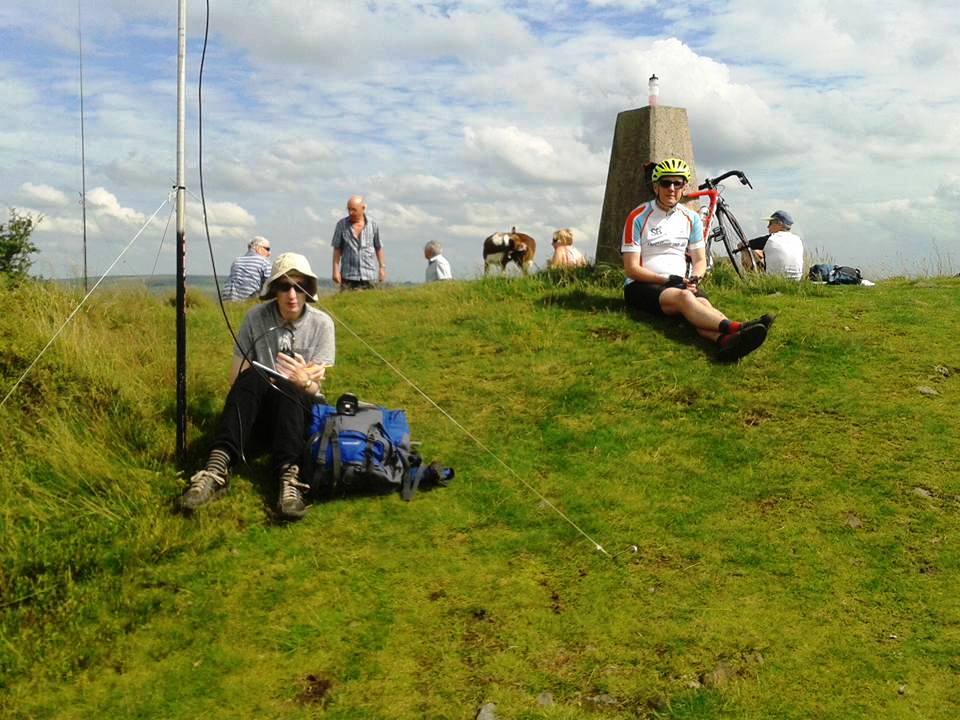
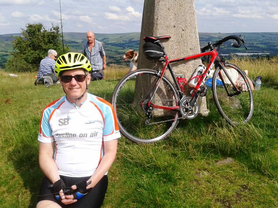
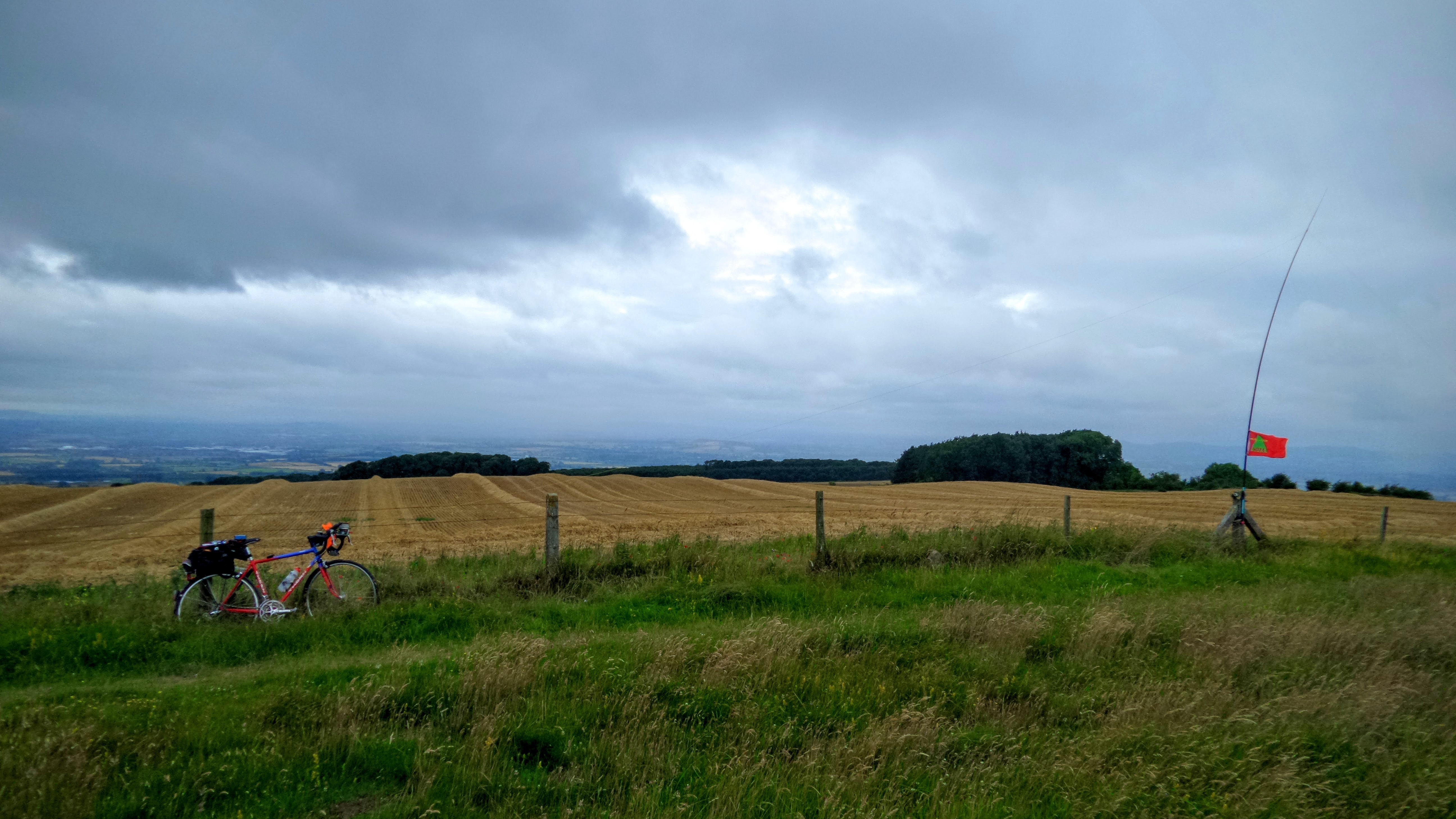
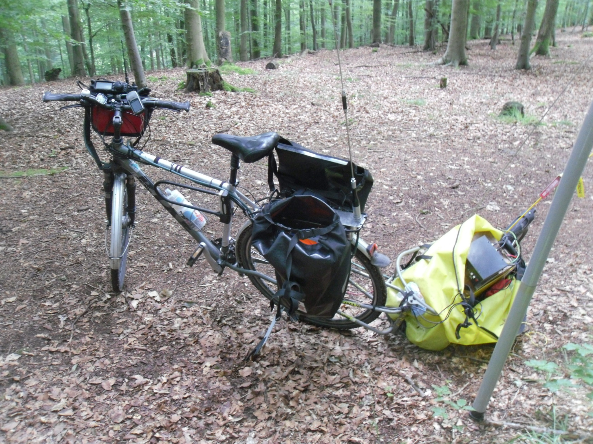
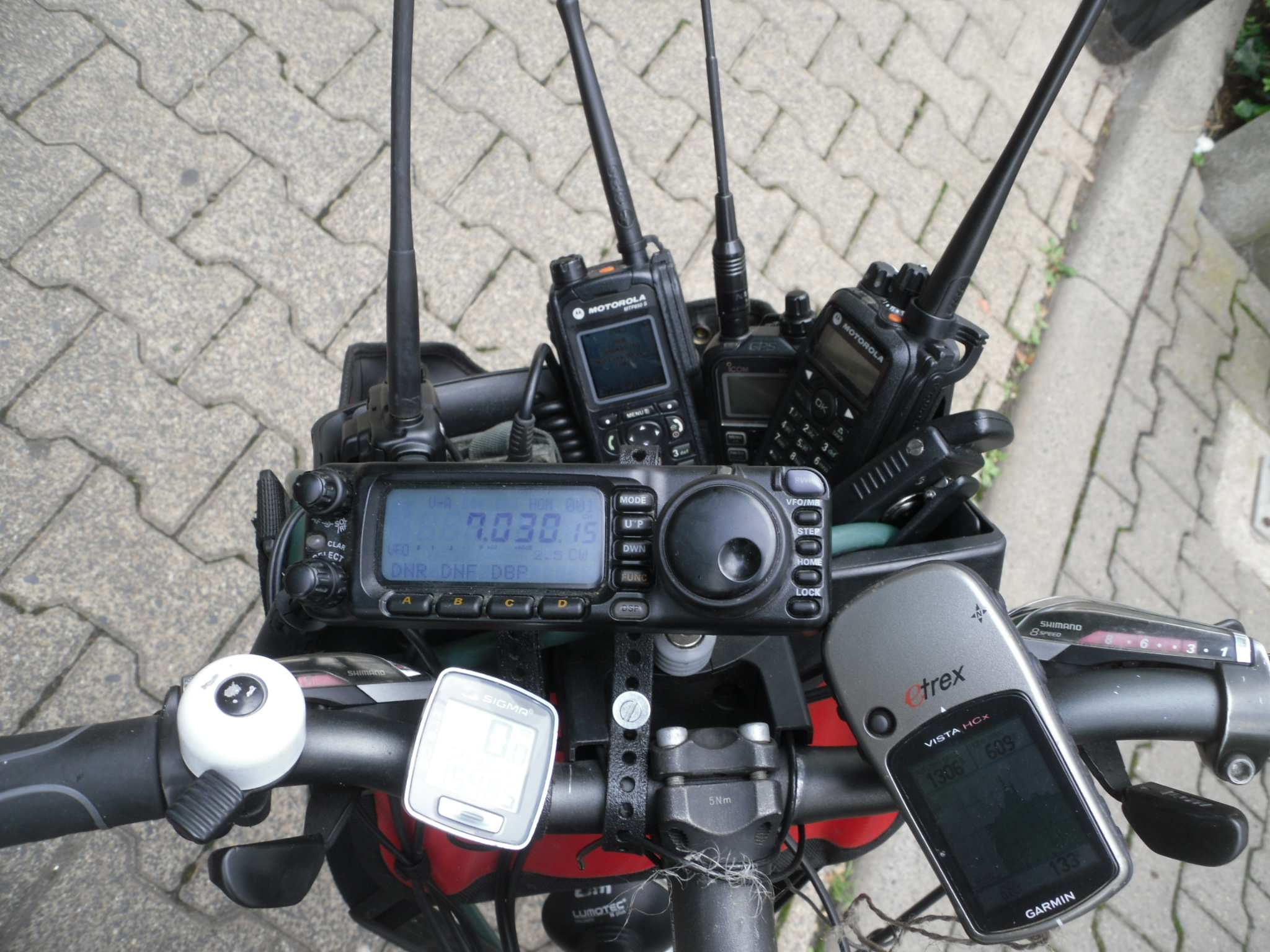
I was dropped at Mynydd Bettws (GW/SW-020) 374m, a flat boggy summit north of Swansea with a road running over the top – not the most inspiring of summits. I set up on the verge (at that time I had dry feet!) where my fishing rod and J-pole drew some strange looks from passing cars. To my amazement my first calls were immediately answered and 4 x 2m contacts were in the log in 8 mins with 4 x 70cm in a further 5 mins (this was the life!!) and I closed down after 17 mins with 5 call signs on each frequency, mostly local with Cardigan the furthest. Down came the rig, into the panniers and, after a quick wave to M0JLA who was still struggling on HF, I wobbled down the steep unfenced road, wondered at the police car and van which were nestled at the bottom (had they been alerted to suspicious activities on a nearby road side??) and continued the first descent towards my second summit.

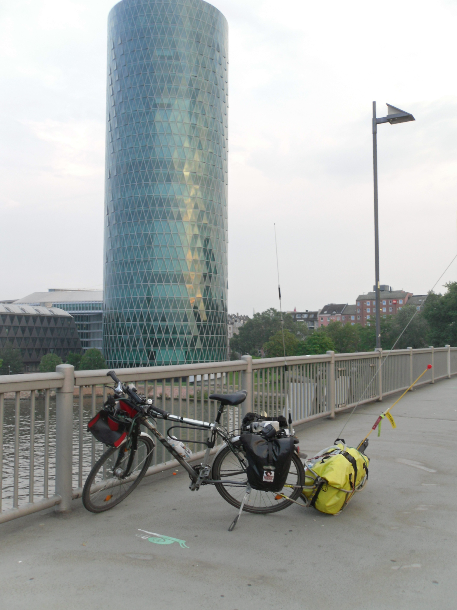
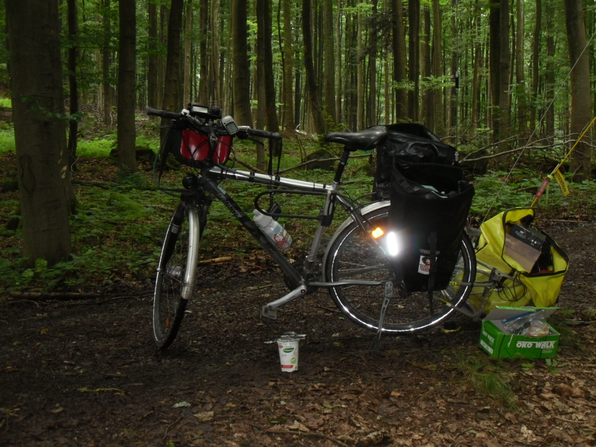
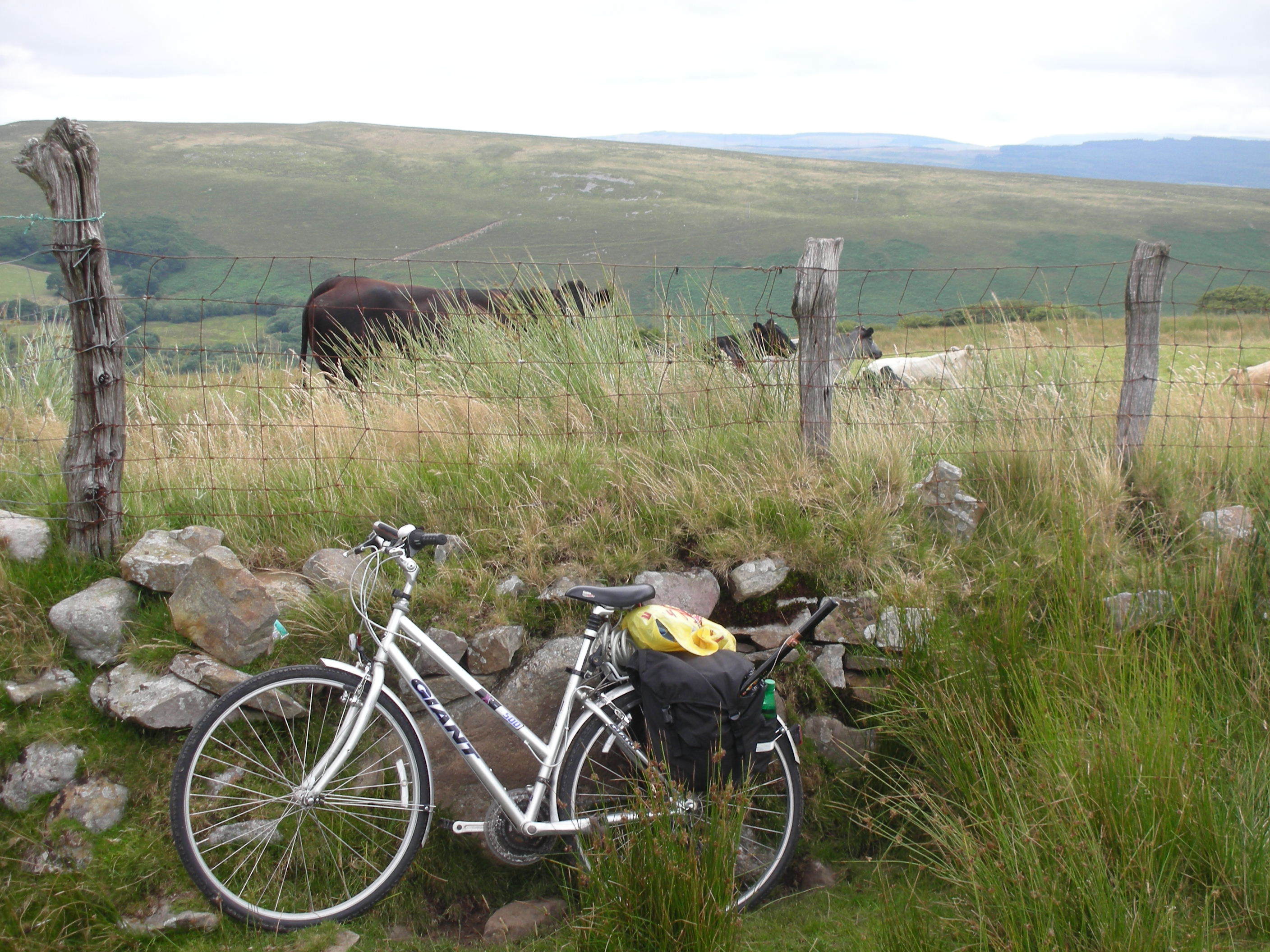
My training for this expedition had been my usual commute in and out of Hereford city on the town bike (about 3m round trip but laden with shopping for the uphill section) and a 6 mile almost flat spin on the Giant hybrid X-500 to remind myself how the gears worked as it hadn’t been used for a year or so (possibly since the last SOTA cycling week ??!) Also I had given myself permission, some years ago, to push the bike up hills without any shame or guilt and I found this had increased the range of my occasional expeditions considerably. Hence I was soon pushing the steed up the far side of the steep valley and remounting when the gradient eased.

I had chosen an obscure zigzag route down to the crossing of the A474 with no steep sections – and grass growing through the tarmac. The only busy part was just before the main route when the road widened and I passed the landfill site and the domestic waste tip. I had apparently travelled through the remains of a coal mine whose workings had stretched to Pontardawe but had been closed in the 1990s.

Once over the A474 I was straight into preparations for a new wind farm but, luckily, their traffic soon took off on to a brand new road on the other side of the hedge on my right. I was soon pushing again at intervals and once more on an unfenced road.

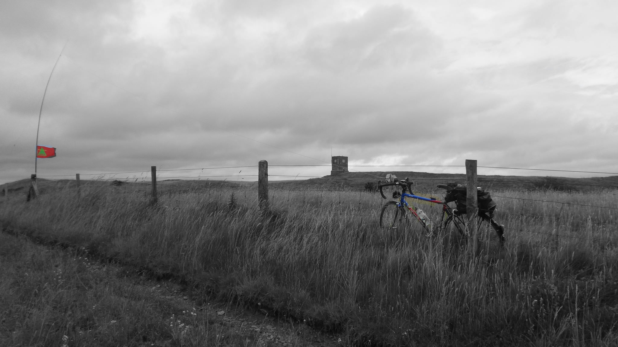
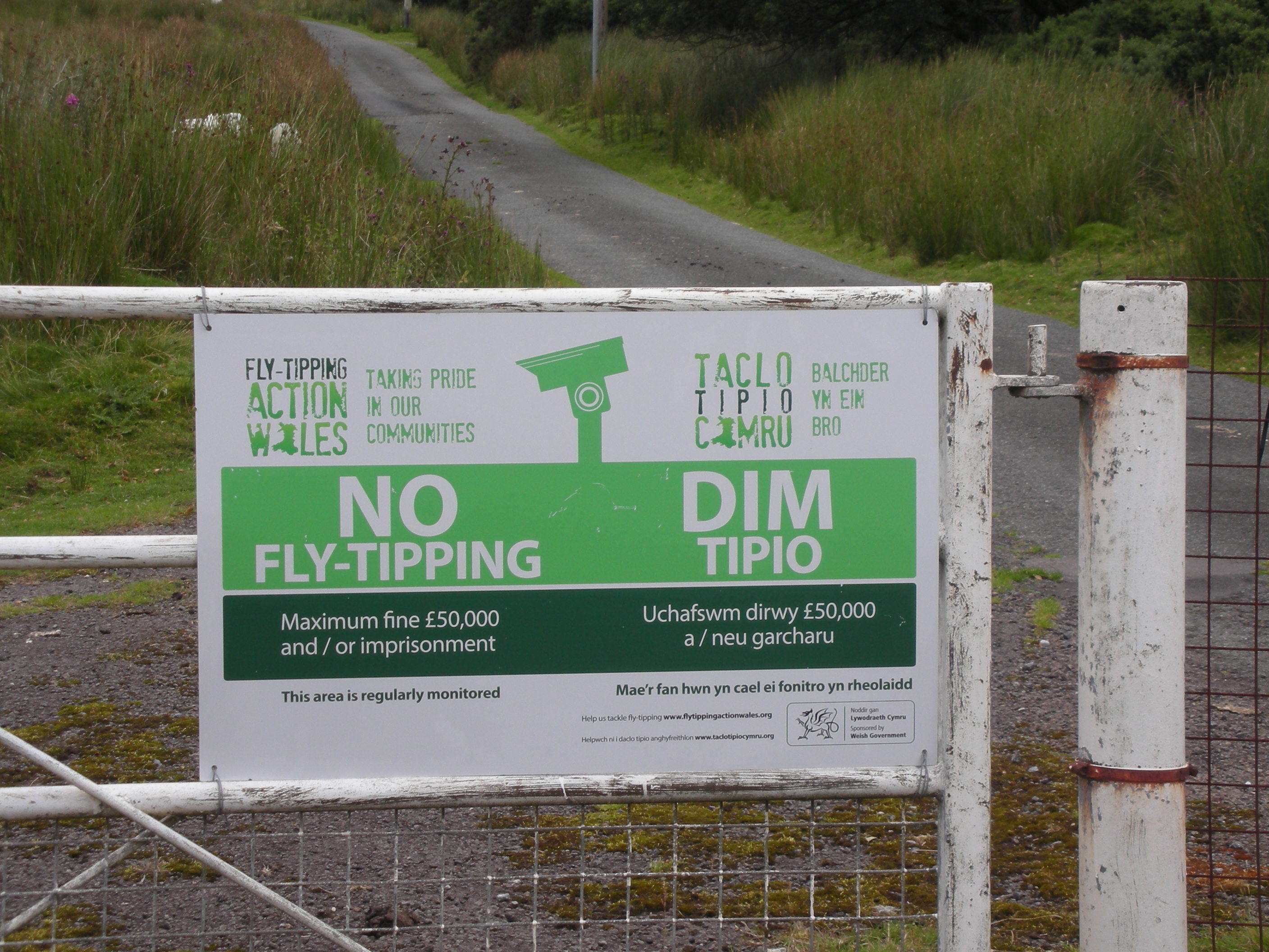
I was carrying too much gear and longed to jettison some of it but was to frightened by the ‘Dim Tipio’ notice! My route to Mynydd Uchaf (GW/SW-031) 337m was up a moorland road until the saddle and then push the bike across the vegetation (heather/marsh/tussocks – no-one had been able to tell me) up to the summit and then push again down to a black path shown on the map which changed to a ‘track’ which eventually joined another tarmac road coming in from the north after a total distance of nearly 3 miles. A request on the Reflector for information on this route had not revealed any information so I was just hoping that some of the path/track actually existed and was even cyclable. As I pushed up the road a red Parcelforce van drew level and stopped to talk to me. After greetings he said “You do realise this is a dead-end road and only goes to a farm where I am delivering a parcel, don’t you? You will have to go back the way you have come.” Rather surprised by this helpful advice I explained I was going to the (featureless) summit in front of me and was expecting to have to push the bike there. He had another go: “There is no road out from here except this one. You can’t go on to anywhere else and will have to go back down.” Perhaps I should have taken his advice (the weather was obviously getting more threatening) and immediately turned round and freewheeled back to the valley but I persisted and explained I was hoping to use a track over to the next road but realised it was I might have to push. I then added that, if things went wrong, then I would turn round and go down the road I was still staggering up. Satisfied by this comment, he then left me and continued up the hill. As I turned off the road on a faint muddy path (which I hoped was heading for the summit) he reappeared on his way down and he waved at my thumbs-up signal. I was rather impressed by his helpfulness and his attempts to head me back to civilisation.

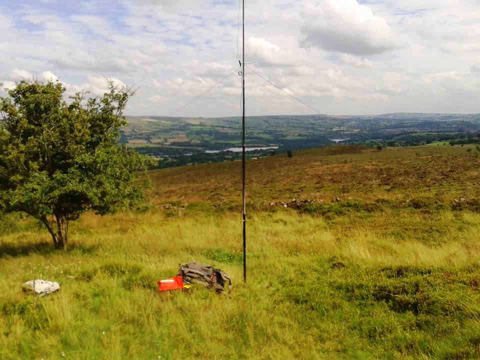
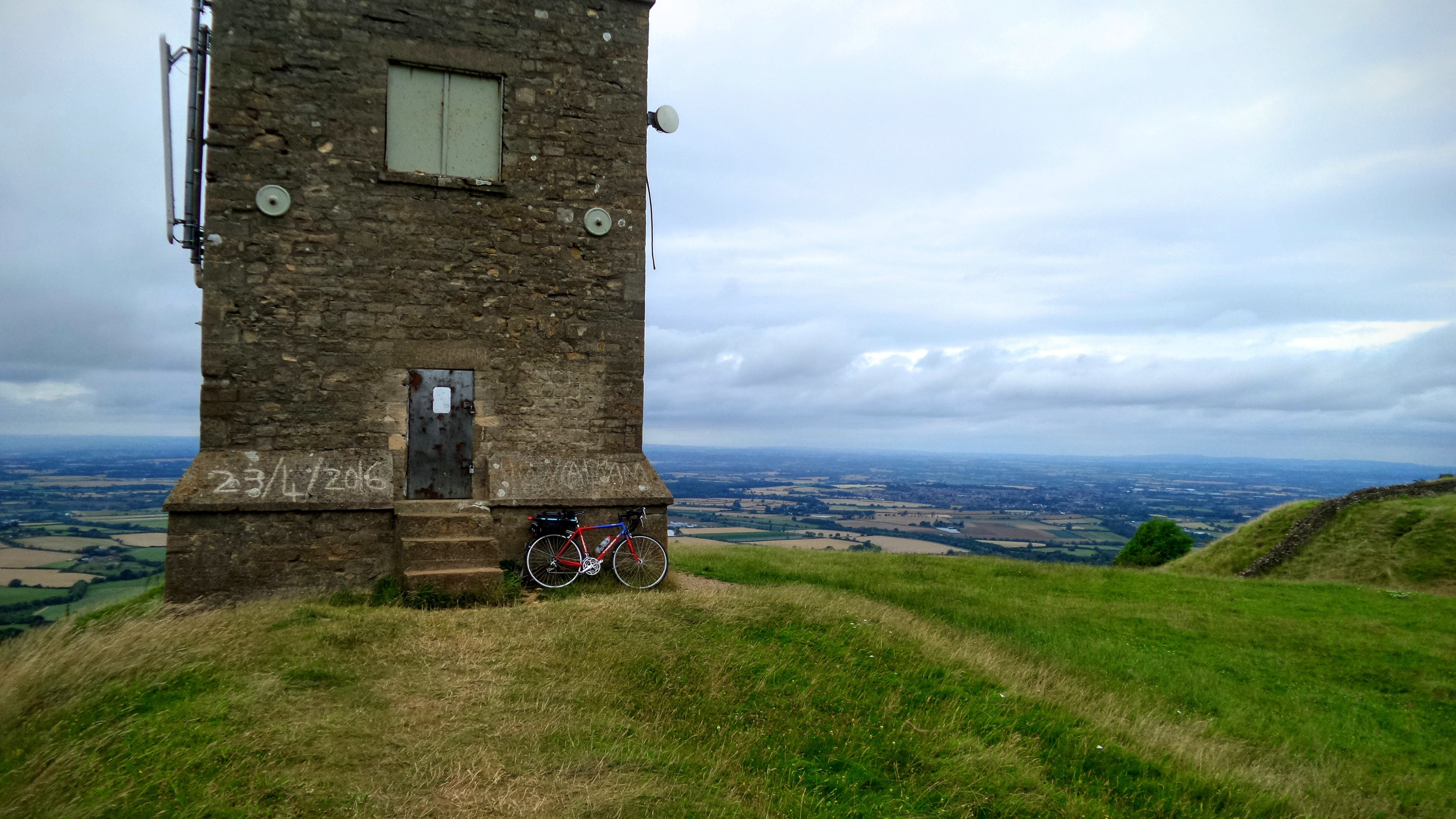
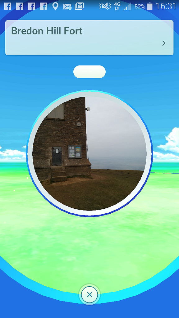
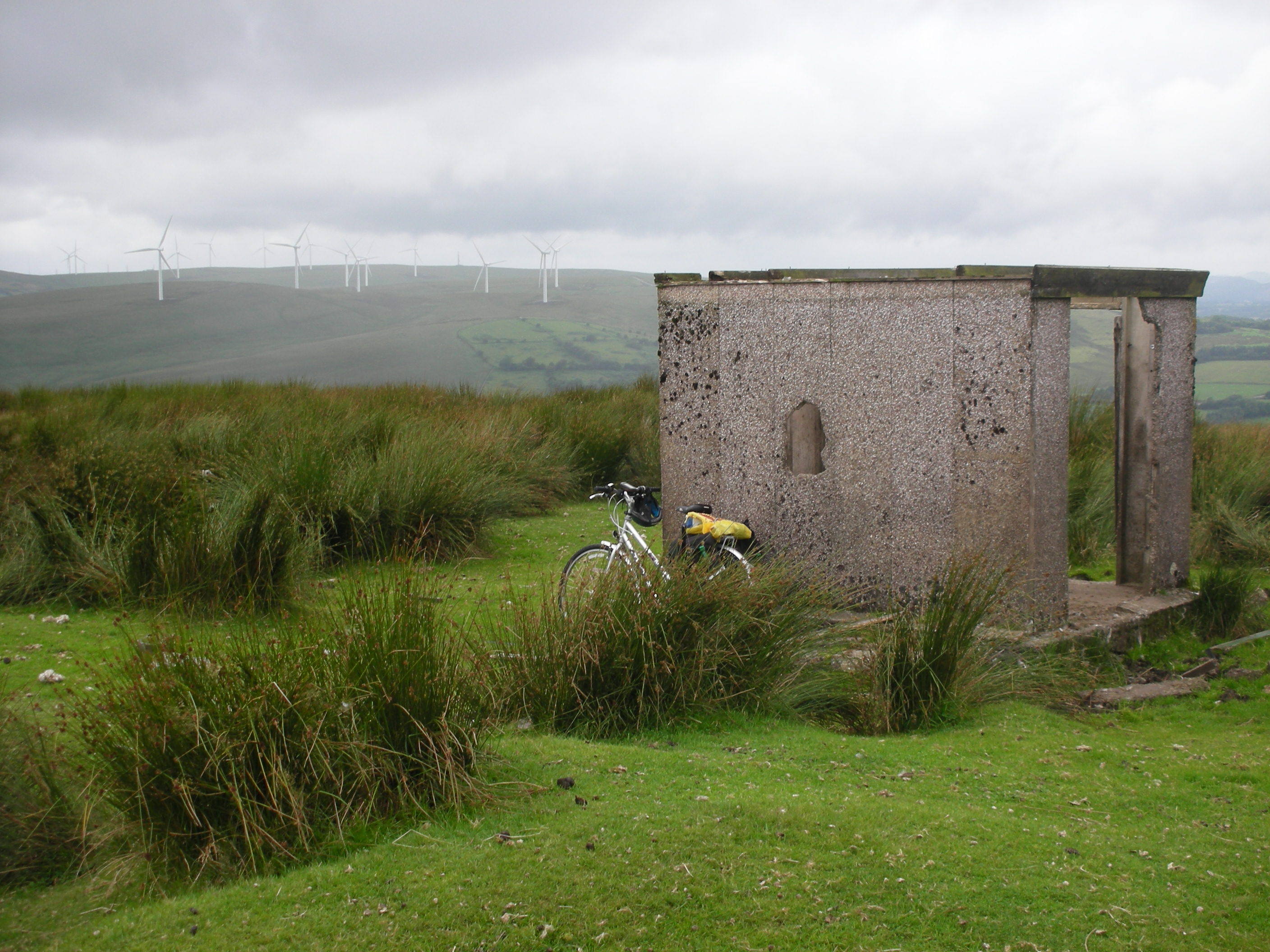
Luckily the footpath led me through the marsh at a fairly dry spot and not only took me into the AZ but to the rather strange little ‘hut’ near the top which had featured in accounts by other activators. This was apparently erected by the Redifusion television company in the 1970s with a mast for the TV signal which was then cabled down the hillside to local subscribers. This system was long since defunct but the building provided some shelter from the brisk wind despite the lack of a roof and at least 2 walls! It also helped to prop up the fishing rod and 4 x 2m contacts were in the log in 12 minutes but 4 on 70cm took another 15 mins using the waterproof log book as the rain had started. I decided a long stay was called for so it was lunch, a long chat on 70 cm to M1JMH in Clovelly (56 both ways) and a quick scout round to see where I was going to push the bike as my obvious path had ended. I eventually decided I couldn’t spend the rest of the day in the lee of this hut so, after a 2m/70cm contact with a rather baffled gent in his car in Princetown I started the next phase of pushing. A very faint path led through the rushes and tussocks and I suddenly realised the wind farm road had reappeared not far from where my track should be so it was a ‘no-brainer’ to push a little further and join the wide hard stone path and get back to cycling. This was fine until I realised I was about to come to a dead-end where the foundations for a turbine were being excavated (!) so I turned off to the (less good but passable) farm track towards the trig point (ht 352m) at the end of the flat summit. Surprised not to see it above me, I turned onto another track and went searching.

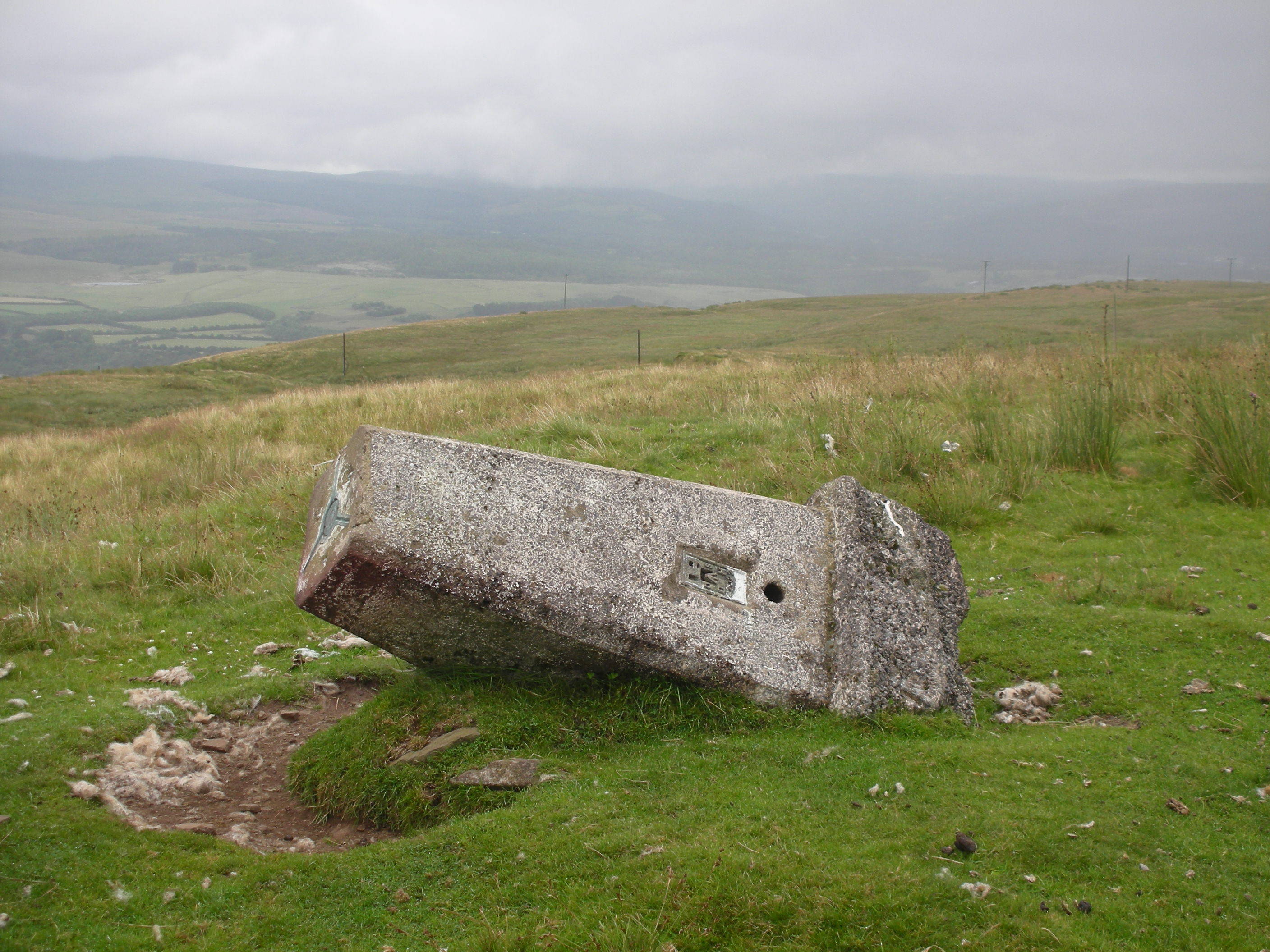
Luckily the plate was still visible (for those who collect such things) and I continued on as the track got worse and then improved again just before a tarmac road was glimpsed some 3 hrs since leaving the previous road (and the Parcelforce van).

The next bit was supposed to be fun – a 3 mile ride gently down a spur with fine views. There were a few snags: I hadn’t noticed there were a few ups as well as downs on this route, it was into the wind and also the rain re-started in earnest as I inspected a lonely chapel with graveyard (still in use) but with no homesteads visible in any direction.

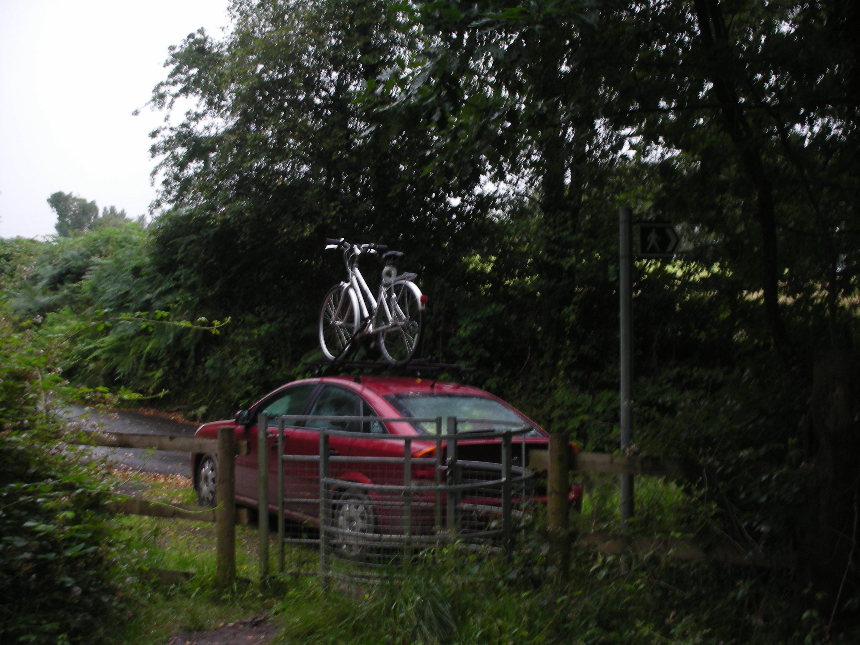
The lych-gate shelter helped the donning of waterproof trousers (again) but I had to set off with my head down. Luckily the GPS reminded me when I should turn off (no signposts on these sorts of roads) and dive down to Ynysmeudwy (glad I didn’t have to ask the way…) and 1 km on the B4603 (gosh: houses, pavements and cars).

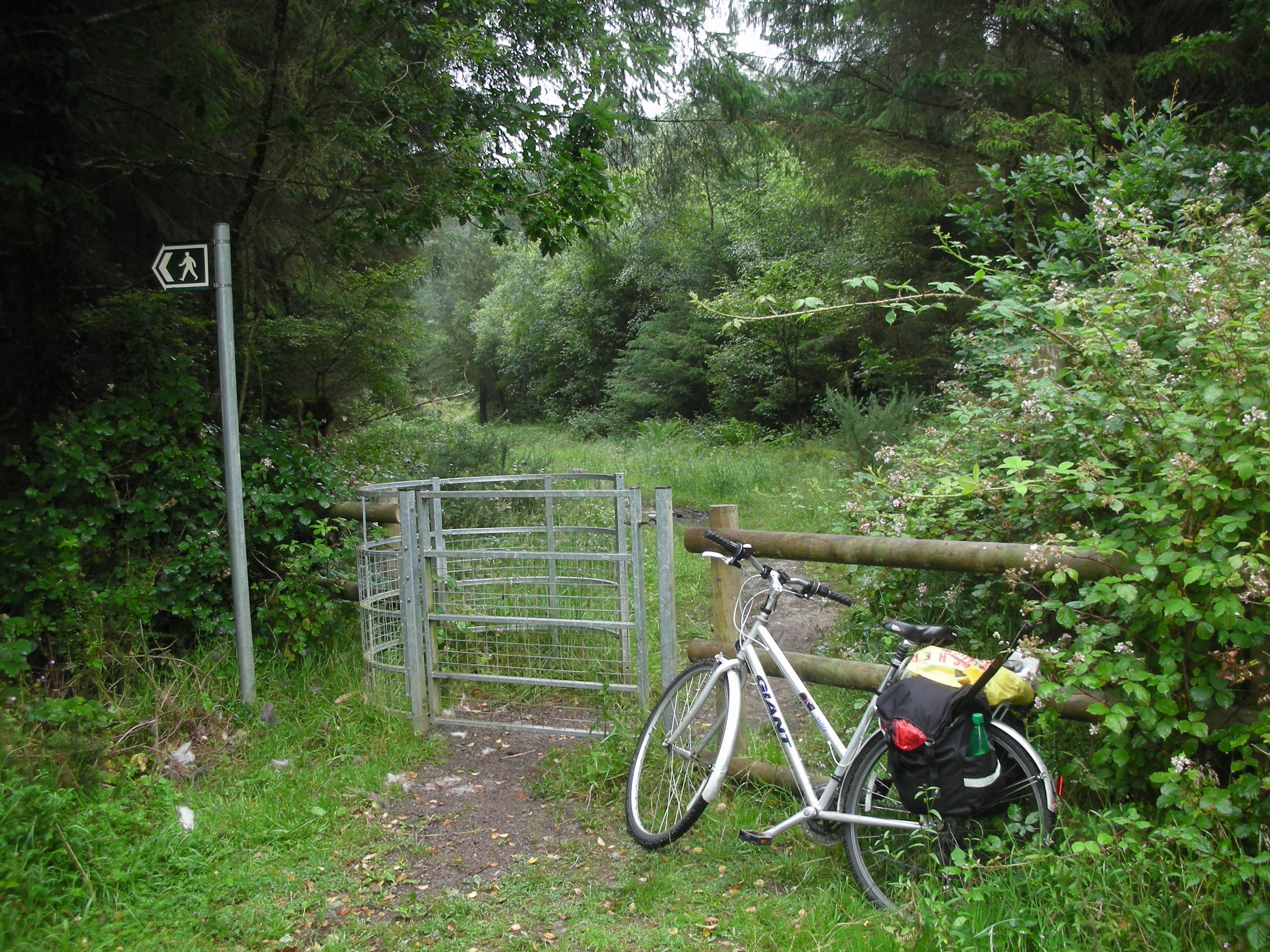
Then, very reluctantly, I turned left and started up to the third summit very very slowly as the road into the new housing estate was the steepest I had found and my enthusiasm (?) and legs were failing. I was aiming for a kissing gate at the start of a forest track on the side of Mynydd Allt-y-Grug (GW/SW-032) 338m. As I unfurled the rucksack and emptied the panniers, Rod and the support car arrived but he declined the offer to accompany me to the summit as he preferred to help me by chasing me from the comfort of the car!!

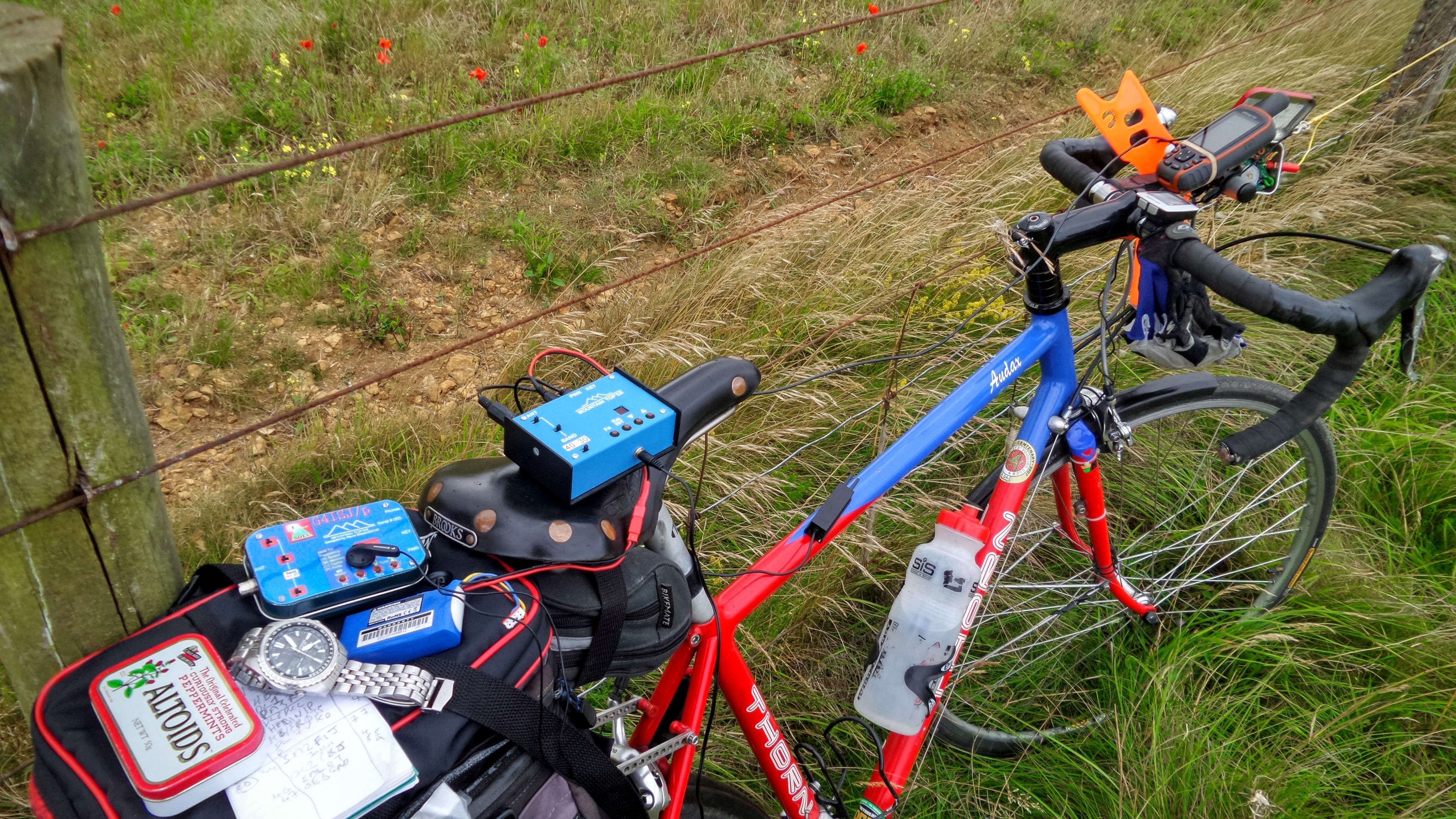
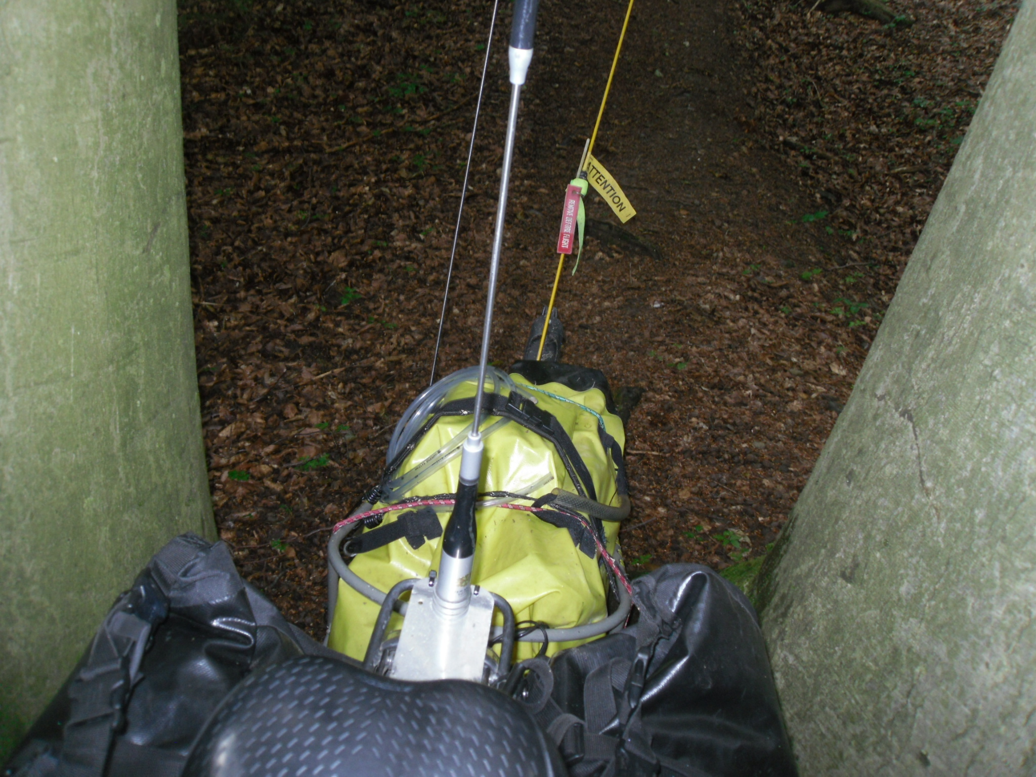
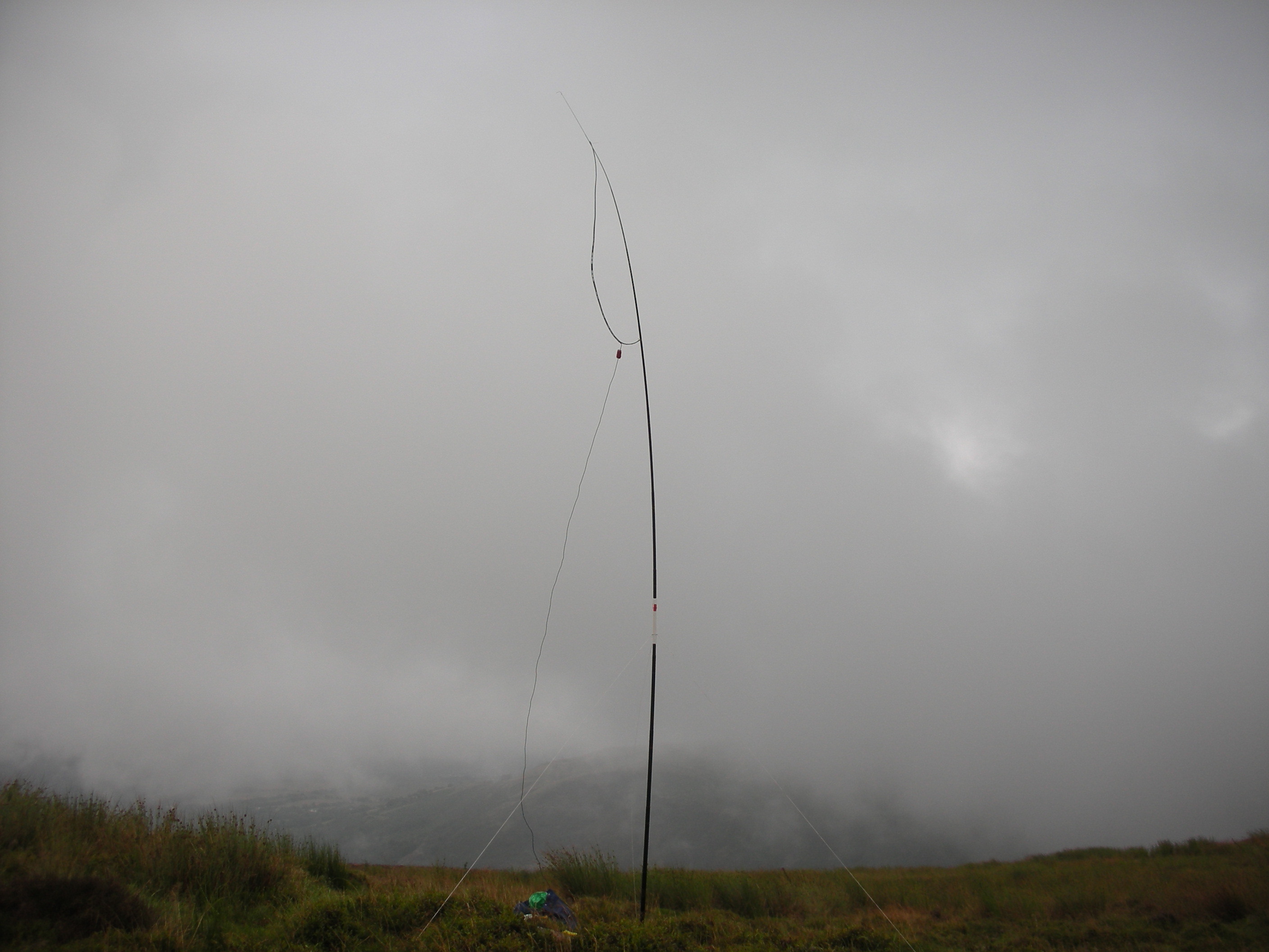
As the cloud was down and it was raining this was no surprise but I felt I couldn’t get much wetter but I did take the opportunity of changing my lighter shoes for my walking boots. This was wise as I soon left the path and was following a mountain bike track steeply up the hill looking for the promised gap in the barbed wire on the perimeter fence. This I didn’t find (was I too high?) so I plodded up and up checking the fence as I went. I was soon out of the trees and into shoulder-high wet bracken which wasn’t an improvement. Luckily others had also embarked on this quest so I had a narrow path to follow until I arrived at another (the same?) track amongst fire-blackened trees alongside the fence. Just as I was about to give up, an old piece of fence was spotted with loose barbed wire at the top and I wriggled (as many others had done) through and with GPS clutched in my hand, strode towards the top of this cloud-covered featureless summit (what WAS I doing here??) Choosing a large wet tussock I lowered my sack and talked (2m/70cm) to MW0JLA in the car on the stick aerial and also 2W0RKF before erecting the mast, attaching the VX-7 and calling into the mist… (A good thing that a VX-7R is reckoned to be waterproof!)

Three stations replied instantly and 5 more 2m were speedily in the log followed by 4 x 70cm and yet another 2m! Thus I had 7 x 2m and 6 x 70m contacts from one of the most notorious VHF summits in South Wales in 30 mins including time to erect the mast – what a wonderful band of local chasers I had acquired! As quickly as possible the station was packed up, the GPS guided me to the loose wire and I was through and walking down the forest track which returned me to the car in 20 mins (the ascent took 50 mins).


All this for 3 points!

Statistics
3 summits activated on both 2m fm and 70cm fm
Total contacts – 19 x 2m, 16 x 70cm
Height gained (cycling and pushing) – 570m
Distance travelled by (or with) the bike - 16 miles
Cycling and pushing – 4 hours, Sunbathing – nil,
Ascending and descending last summit (on foot) – 1 hr 20 min
Activating, setting up and dismantling – 3 hrs 10 min,
Total time – 8½ hours
Weather – British 2016 Summer (ie overcast, brisk wind, drizzle, bouts of rain, low cloud later)

PS I know that this activation was 2 days too late to count for the challenge but I was struggling to get the account finished ‘by 1 Aug’ as instructed but I now find the judging has been done and I’m too late (as ever). Too bad, but after all this effort I am going to post it. Thanks for the incentive to get out on the bike again and congrats to the winner for a well deserved victory.

Viki M6BWA

4 Likes

Nice account Viki. Thank you for posting it.

There is always next year…

Cycling Week? You are joking. MTB + SOTA should always be a stand-alone competition. :laughing:
People all around the world should understand that is not an easier way to activate, but it’s harder!
This summer I climbed over 5.000mts and cycled for over 300kms. Sadly not all summits were yet part of the SOTA program (Italy…) but anyway I had fun and I always feel like I’m triathlon champion when I tie my bike to a tree and I keep on climbing to the top, through the hardest path, with my 10kgs backpack. :sunglasses:
http://www.sotaliguria.com/it/articoli/articolo/il_monte_porcile_e_referenza_wxm
http://www.sotaliguria.com/it/articoli/articolo/montagna_radio_qrp_mountainbike

2 Likes

Rather than start a new thread, I have bumped this one. I’m curious to know if there are any dates pencilled in for SOTA cycling week/weekend for 2017? Unfortunately ill health robbed me of taking part last year.

73 Chris M0RSF

2 Likes