Hi everyone!
I’m relatively new to SOTA and have just 9 activation points.
I am having a bit of trouble with Seager Hill G/WB-022.
It doesn’t help that there is no phone signal there.
I have read a couple of the activation reports and it says to park near a gate and proceed up the summit.
The problem I saw when I visited there earlier on in the week was that the gate was locked and I wasn’t sure it was private property.
Has anyone activated the summit recently? Do you just climb over the locked gate?
Sorry if it seems obvious, I just didn’t want to upset the local farmers!
73s de M0IQQ
From Phil G4OBK’s activation report of Seager Hill in 2013:
“We parked by a locked gate at SO 622379 and walked for one mile uphill”. So the answer would be yes, climb over the gate.
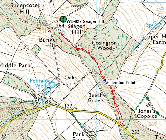
Yes, as Andy says simply climb the gate and walk up the track. I went to the trig point but it was overgrown there but we saw it about 10m from where we stood. As we were operating on VHF I spied a better take off on the way to the trig which was clear of the trees and not so far from that gate, so I set up there. So long as you are within 25m vertical height of the highest point that is within the rules. See map.
73 Phil
Thank you very much for the information! I’ll try and activate it on my way home from work today.
It was just the gate being locked that worried me.
Thanks again!
Perfectly reasonable chain of thought Tom, especially if you are new to wandering about the countryside. I was somewhat amazed when I found out just how relaxed the law is up here in GM with regards to accessing someone’s property. Different down in England, more restrictions and rules.
Park by the gate, notice stile and fp sign, cross stile (or work around it through gap left of gate) and go up very short path to top. (Might be a bit overgrown.)
Wide grassy track along top of hill with bits of fence etc plenty of space for aerials. Activation area is huge - about 3km long.
Good luck, 73
Rod
Note that the trig point is not the summit of this hill - though it is within the AZ.
Thanks everyone. After studying the map, I realise I was at the wrong gate (there are many!)
Rookie mistake!
This is where the grid reference is.
Fingers crossed I’ll activate it later
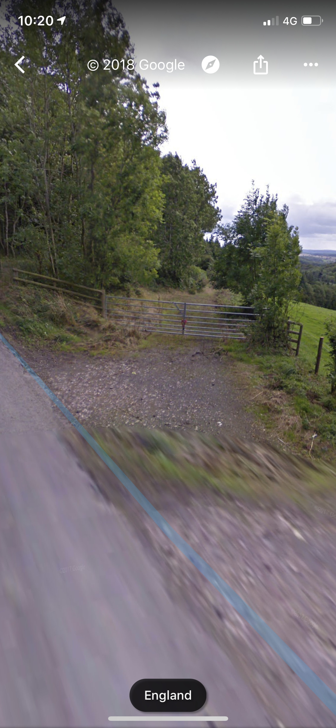
When I did it I parked here:
…and took the path up to the activation zone.
Good luck! 73
I have parked in the same place as Mike G7HEM each time I have activated this one.
The gate you show Tom is about 100m NW of the one Mike shows, so if you carry on SE along the road you will see the other gate on the left and the style you need to go over to the right of it.
This map might help:
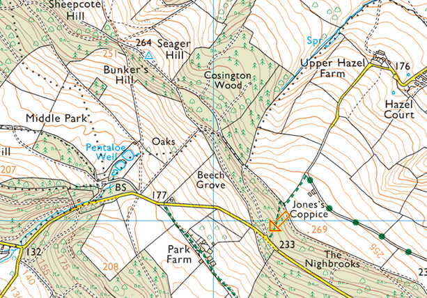
The arrow points to the given GRID Reference and so can see the path going NNW up through the wood, i have turned right at the top and found somewhere just a little way along to operate from looking down over Jones’ Coppice and Upper Hazel Farm etc.
Google Street View will take you up the track to at least Jone’s Coppice, but I will not be trying to get up there!.
Stewart G0LGS
Thank you very much Mike and Stewart for the help.
My previous 8 or 9 activations I have just used my phone to use google maps. I think I should invest in a map and a gps device.
I always study previous activation reports and people are helpful enough to give out grid references.