I’m planning our imminent trip to the Glencoe area where there are several big attractive summits which we have already chased, so would like to activate for the complete. Unfortunately many of them don’t fit well with my need to avoid scrambling and exposure, so I’m interested if anyone has for routes which don’t involve scrambling or exposure.
GM/WS-002, Aonach Beag: I looked at the ascent from Glen Nevis because I was worried about the traverse from Aonach Mor if we used the Gondola, but that looks trickier. So views on the traverse welcome.
GM/WS-003, Carn Mor Dearg I’m looking at the ascent from the Torlundy side (we have no plans to do Ben Nevis again and the traverse between them looks unpleasant), but the final ridge tooks a bit narrow.
GM/WS-007, Bidean nam Bian: the approaches from Glencoe all look too scary, so I was looking at the approach from Glen Etive, but that also looks to have narrow ridges!
GM/WS-044, Buachaille Etive Mor - Stob Dearg: having seen this many times and when doing the two summits on its smaller neighbour, it really says “climb me”. However so far as I can see there aren’t any ways on or off that don’t involve at least some exposure or scrambling
GM/WS-069, An Gearanach: the approach for this from the end of the Glen Nevis road was looking good until I saw pictures of the “wire” bridge over the river so I think I’ve rules that one out.
WS-002: It is an easy walk between Aonach Mor and Aonach Beag, I don’t know about the climb from the gondola, it wasn’t there on my last visit! I followed the track from the ruin of Steall in Glen Nevis to the col with WS-003 and then up to the col with A. Mor, there was a path and no scrambling. Incidentally, I didn’t try it but from the col to WS-003 looked fairly easy. From the summit of A. Beag I descended the SW ridge finding it easier than I had expected, mostly grass.
GM/WS-007, there are no routes that can be called easy, perhaps the easiest is the east ridge from the col above the Lost Valley, but it isn’t difficult from the northwest up Ant Sron and over Stob Coire nam Beithe, the final climb to the summit is a bit rocky but not difficult. Exposed in places - Tom would hate it!
GM/WS-044 the Buachaille looks terrible, doesn’t it? It isn’t! Follow the track up Lairig Garten on the west side and there is a grassy rise to the col halfway between Stob Dearg and Stob na Broige and a grassy walk northeast to the final stony dome of the summit, no hand work necessary! You could be bold and go up from the road straight to the rocky side - there is a water slide on a slab visible from the road, aim for that and pass it on the left aiming for a gap to the left of the big imposing rock face (Crowberry Ridge), a couple of scrambly moves gives access to “Easy Gully” which is full of bouldery scree but will take you to the summit. It is all a lot more amenable than it looks and quicker than the route I mentioned above, but yes, it looks frightening!
WS-069. Don’t worry about the wire bridge, it is easier than it looks…but don’t look down! To the left near the waterfall you can walk through the river in dry weather or a winters morning when the tributaries are still frozen, the climb after that is rocky and vegetated, not recommended except in dry weather! See below for an alternative.
You might consider WS-011, Binnean Mor via the track past Mamore Lodge near Kinlochleven, this joins a landrover track and then a stalkers path leads in to the col between WS-011 and WS-049, and a faint track goes up the SE ridge to the Binnean Mor ridge, a magical climb especially in winter. Sgur Eilde Mor looks pretty rough but actually it is a doddle if you have enough energy left after the big one! Also the ridge from WS-011 to WS-069 is easy except for a hiatus after na Gruagaichean, returning there is a stalkers path zig-zagging down to the landrover track from the col.
I hope all this helps, but it is about 30 years since I was last on those hills so by now some of the tracks are probably a bit easier to find after all the boots that have tramped them!
Some years ago but have done Buachaille Etive Mor ( twice, once in summer and again in winter) and via Coire Altrruim I don’t remember it being difficult, steep but not exposed.
Also completed the three wire bridge and An Gearanach although memorable I do not remember being unduly concerned. I seem to remeber the biggest issue was very cold feet after an icy river crossing after the bridge.
Generally I don’t enjoy being exposed but neither worried me!
I think the the one we are most likely to try is Buachaille Etive Mor via Coire Altrruim, though we’re only going to go up anything big if the weather is good: needs to be a lot better than we’ve been having recently!
I had also looked at doing Sgur Eilde Mor but not with Binnean Mor. We have been known to walk up to a col and do a different summit then originally planned. I don’t think we have the energy to be able to do WS-069 from the south: we’re beginning to feel our increasing years.
Despite what you both say about the wire bridge I think it’s too scary for me (especially when I’m carrying a loaded rucksack), but useful to know that the river might be fordable, though I’m guessing they’ve probably had even more rain than we have in the eastern flatlands.
A good choice, I would say. A lot of people go for the direct approach up Coire na Tulaich from behind Lagangarbh Cottage (the coire is also known as Lagangarbh Gully), this is fine when there is snow in the upper reaches that you can kick or crampon your way up, but in summer it is a nightmare mixture of mud and scree suitable only for an emergency descent if the weather turns grim!
I have fond memories of the wire bridge! When I first saw it in the early 1960’s there were four main wires with a lot of the vertical and horizontal cross ties still in place. Five years later all the ties had gone and you had to straddle across it, it got a bit hairy if somebody was following you and making it bounce! A few years later they had pulled the two lower wires together making it much better for your feet. It is the access to the climbing hut on the far bank, I remember arriving for a stay in the hut on one occasion, it was fun crossing the bridge in the wee small hours with two rucksacks (one with rope and climbing gear.) A few nights later we sat outside the hut drinking whisky and watching a grand display of the northern lights, and next morning we got rid of hangovers by doing Tyrolean traverses of the bridge, though one guy fell in! Still, the thing I wanted to say about the bridge is that when my kids were small, aged between five and ten, we walked them up the gorge (no decking in those days!) and showed them the bridge, and predictably they were all over it! So if kids can do it…
I don’t know how familiar you are with those summits, but even in summer some of the navigation can be tricky, especially when the cloud/clag is down. Need good map reading skills and compass ability.
Coincidentally I am researching (and hopefully taking in) information on the summits around Glencoe in readiness for a few days up there in September when Paul and I will be tackling Ben Nevis and whatever we else we can manage. With efficiency and value for money in mind (as always), I have looked at grouping summits together. Having done an appraisal of this possibility, it seems to me that some summit groupings require very long days and quite a bit of effort to activate. Despite having been “fixed”, I do wonder whether I am past doing some of these such as the Ring of Steall - WS-069, WS-037 and WS-020 - which is a 16km walk with 1,676m of ascent, that is if you don’t go wrong somewhere. This is a hard day by most people’s standards requiring 8 hours walking (maybe!) and when coupled with say 90 minutes on each summit for activating, it does rather make a daunting task. Paul and I have walked 20km in a day with more than 1,000m of ascent taking in three summits, but that took 14 hours.
The summits that you and Brian refer to are on my list -
GM/WS-002, Aonach Beag: It seems that the approach from the track from the ruin of Steall in Glen Nevis may be the best option. If you haven’t already read it, the report on Walkhighlands gives some useful pointers as to the route to take. Aonach Beag and Aonach Mòr from Glen Nevis (Walkhighlands)
GM/WS-003, Carn Mor Dearg: I don’t think there is any easy way to get to this summit, particularly if you don’t like exposure. Quite a few reports indicate the arete between Ben Nevis and Carn Mor Dearg is not as bad as it looks, but that is purely a matter of opinion! Having done several similar traverses in my time I would be willing to give it a go, but unfortunately I think it will be a summit too far when Paul and I do Ben Nevis.
GM/WS-007: I read John’s report on this and the summit quickly slid down the list of possibles. Maybe one for another visit when the options for new ones are fewer.
GM/WS-044, Buachaille Etive Mor: It looks like Brian may have persuaded you… and me!
There are so many wonderful summits in this area that it is difficult to know which to select. I get the feeling that we will go loaded with a fistful of options and make our choice day by day depending on what the weather turns out to be.
It is worth bearing in mind that there are three “two for the price of one” summits in the Glencoe area. The most obvious one is to follow the track from just east of Glencoe village to the col between the Pap and Sgor nam Fiannaidh then you can do both, WS-074 and 200. Equally obvious is Buachaille Etive Beag, ascend to the col opposite Coire Altruim and the ridge between WS-079 and 096 is hands in pockets. Less obvious is Bhein a’ Bheithir, most munro baggers will go for the full traverse, which is a terrific day out, but for SOTA purposes it can be shortened considerably, straight up the north ridge to WS-042, an easy ridge walk to WS-057, then continue the ridge to follow a vague path down from the next col. The only problem is avoiding getting lost on the forestry tracks!
Not too far away, the two SOTA summits at the north end of the Blackmount, WS-017 and 019 can be approached conveniently from the ski facilities!
I have to confess that I found the CMD arete rather disappointing when I did it, I was expecting something as exciting as the Aonach Eagach but it was just a stroll, really - though the ascent of the Ben was up a tiresome boulder field!
I should have commented on the Ring of Steall. As a circuit this is done from Glen Nevis, and frankly I found the ascent and descent tiresome to say the least on both times I did it, a maze of heavily vegetated outcrops with a very discontinuous scrambly path making route finding difficult, but once on the ridge the walking is terriffic. Not recommended for SOTA but a must for hill walkers! What I would do is go up past Mamore Lodge on the Kinlochleven side and follow the zig-zag stalkers path in Coire na Ba to the col between na Gruagaichean and Stob Coire a’Chairn then from the latter top do WS-069 then back track to WS-037, then either descend by the way you ascended or go on to descend the track into Coire na h-Eirghe, longer but reduces the amount of ridge walking. WS-020 is best done as a single summit. Stob Ban WS-058 from Achriabhach (some parking at the bridge) is quite amenable.
Of course, it is quite a long time since I last walked in the Mamores, but I doubt that much has changed!
True, but my early impressions from nearly sixty years ago were that you had to earn those beautiful mountains by the penance of being in Scotland! It was a long tiresome journey to a land where it rained most of the time, the midges ate you alive, and as for the pubs - places as cheerless and comfortless as a British Rail waiting room full of gloomy people, where you had either Youngers Tartan or McEwens Export (ugh!) to drink and you had drink it quickly because in those days closing time was ten o’clock! I rapidly warmed to the country but that initial culture shock was a real downer!
I remember six of us on a walking trip to the Cairngorms trying to get a drink in a pub in Aviemore in August 68… needless we were as welcome as dog dirt on the soles of the locals’ shoes. Thankfully the welcome in recent times has been entirely different.
As for the summits, I had recognised the three pairings that you mention Brian. Two in a day makes better sense for SOTA. Your comment about separating WS-020 from the other two on the Ring of Steall looks like a practical approach. I did read one report about tackling the other two from the Kinlochleven side which might relate to the route to that you have outlined. Looks like it may be worth a re-read. Thanks for the heads up.
Only if you didn’t get into a lock-in, I recall a bar near Ullapool in the 1960’s where the local bobby came in about 10pm when the pub landlord had closed the shutters and he chatted to most of the people. We knew we had to just sit and wait. Eventually after most of the people had left, he locked the pub door, walked over to the bar, raised the shutter, commenting, now that we have got rid of all those sassenachs, we can get down to it and ordered a pint.
Yes, I remember long ago drinking in the famous Kingshouse Hotel near Glencoe and when it came to closing time the Gaffer said “right, everybody into the residents lounge” and we continued drinking in big comfortable armchairs in front of a blazing log fire. That was the night my sister fancied a ginger wine and the bar tender was nonplussed, he’d only ever put a splash of it in whisky before, so he gave her a third pint tumbler full and charged it as a splash!
That was probably the night that deliveries of moonshine were expected!
I agree with Brian about WS-079 and 096: a lovely walk with stunning views. We did WS-074 and 200 on different occasions but we walk quite slowly and they could be combined. We have the WS-042 and 057 combination as a possible for the current trip. We did WS-017 alone as bad weather was approaching but we also didn’t like the look of the traverse to 019, nor the need to go back over WS-017 on the way back. OTOH the ascent of WS-019 from Glen Etive looks to have a different set of hazards.
If looking for multiple summits in a day when weather isn’t fit for the higher hills then it is worth considering the Glen Roy summits.
Not if you are a sheep! After crossing on the transporter straight up Fionn Ghleane and turn left at the col!
One of my best days on the hill started with WS-017, we trudged up under the gondola and skirted round the ski slopes, which were crowded as it was Easter. The col to WS-019 was easy as it was covered in snow. We went north to the last summit (can’t remember its name) then reversed the route and continued to Chlach Leathad which at that time was thought to be higher than Creise, we then continued along the main ridge to WS-022, then as the weather went downhill we back tracked a little to drop down a sharp ridge to the Moor and in the rain picked up the military road back to the car park. Many of these summits are so much easier with a covering of firm snow, later in the year that expedition would have taken hours longer!
Hi Caroline.
Good morning all.
An interesting thread. I can’t remember anything too onerous about WS2, WS3 or WS44 but as I remember there might have been some steep ground coming off WS7 but I cut it out going up by a mistake with a right fork which should have been left. However where I cut up it was steep too. WS69 I haven’t done.
For WS2 I have used the cable car in all activations so far. After that it’s just a walk anyway. The last bit is maybe comparable to going up Fairfield but nothing exposed that I can remember, albeit everybody has different limits; I know I do!
For WS3 (& WS1) walk up from the forest car park NN 1450 7638 (sometimes called the north face car park I think) near Torlundy. I turned left off the main path over vegetation but then to find a decent path taking me to the top of WS3, though it’s rather indistinct once on the stony top. There must be a link between the main path and this one but as yet I haven’t found it or been able to research it. The first time in 1998 I didn’t find any of that path so my son and I had just bash up. I can’t remember any problems with narrow ridges on WS3.
I know you have no plans for it but the Arete after WS3 to access WS1 is really nothing to worry about in summer. It looks quite bad but Striding Edge or Sharpe Edge are greater challenges in my opinion.
All I can do is offer old reports which you may have already seen or even commented on at the time (WS7). I can also offer a .gdb or convert to a .gpx route for anybody who wants to go via the standard ascents but I fully understand why you are looking at other possibilities.
WS44:
WS7:
WS2:
WS3 & WS1 (Old Reflector so no photos I’m afraid and I never got round to adding them to flickr so I will try to find some for you later):
73, John.
……………………………
G3RMD Frank’s 11-year-old request fulfilled at last!
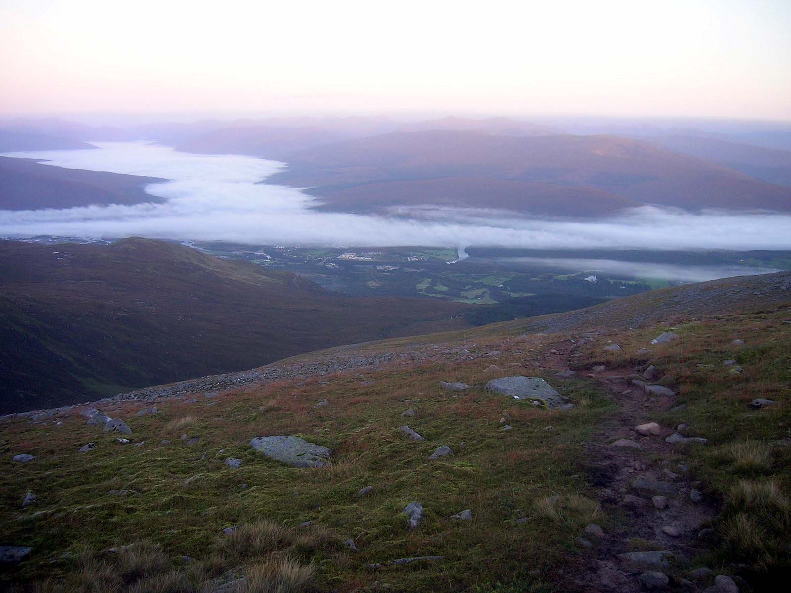
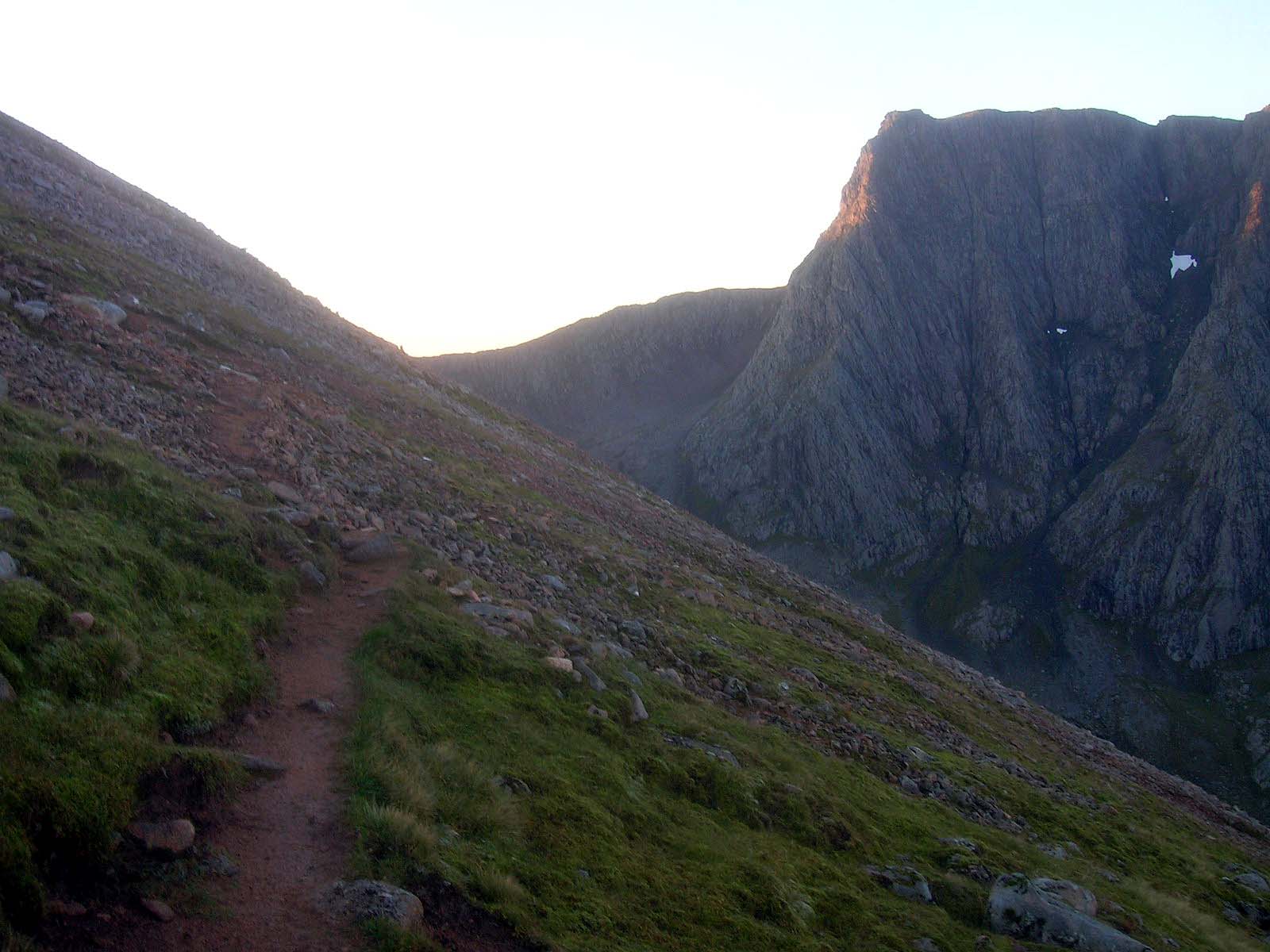
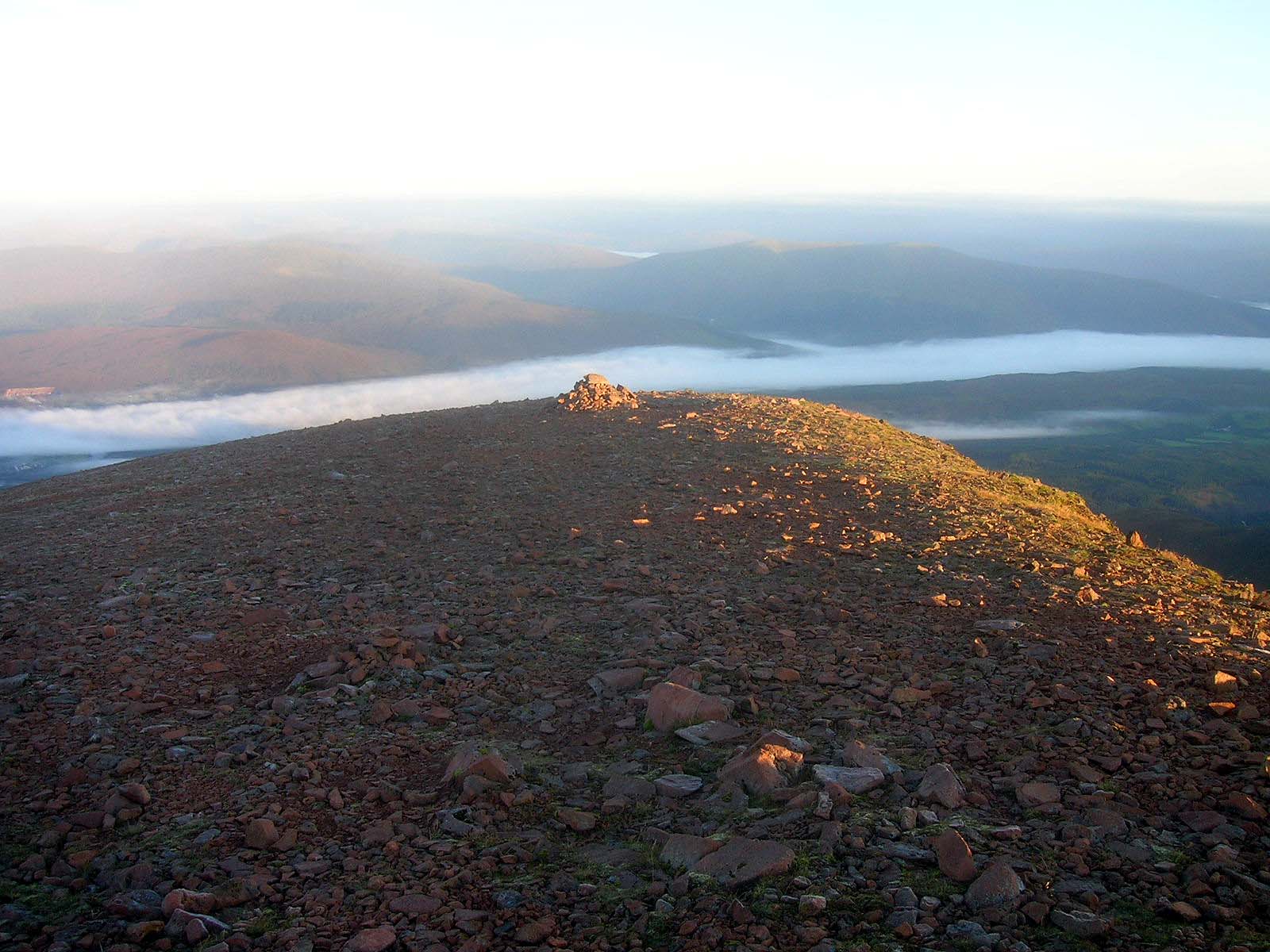
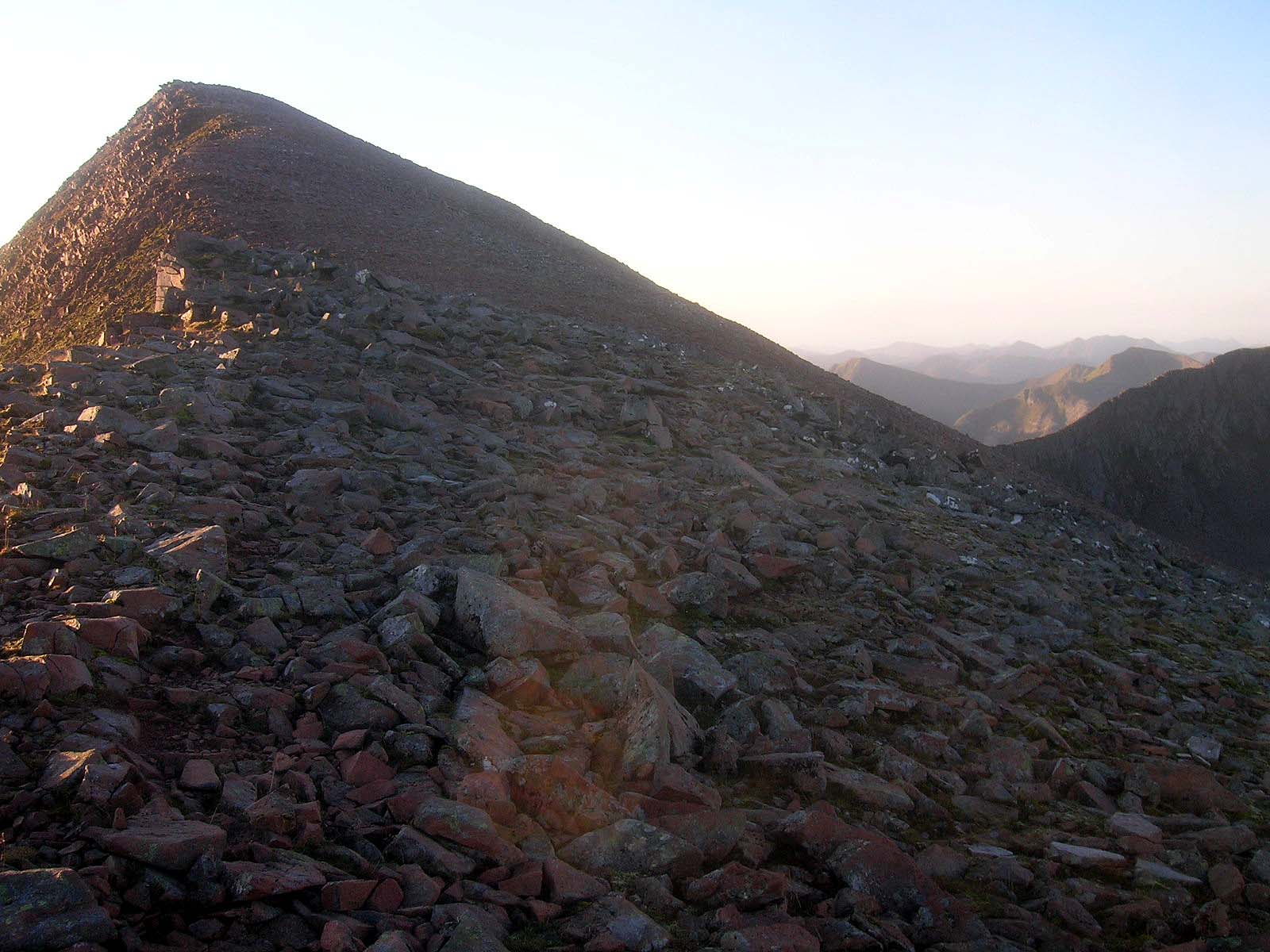
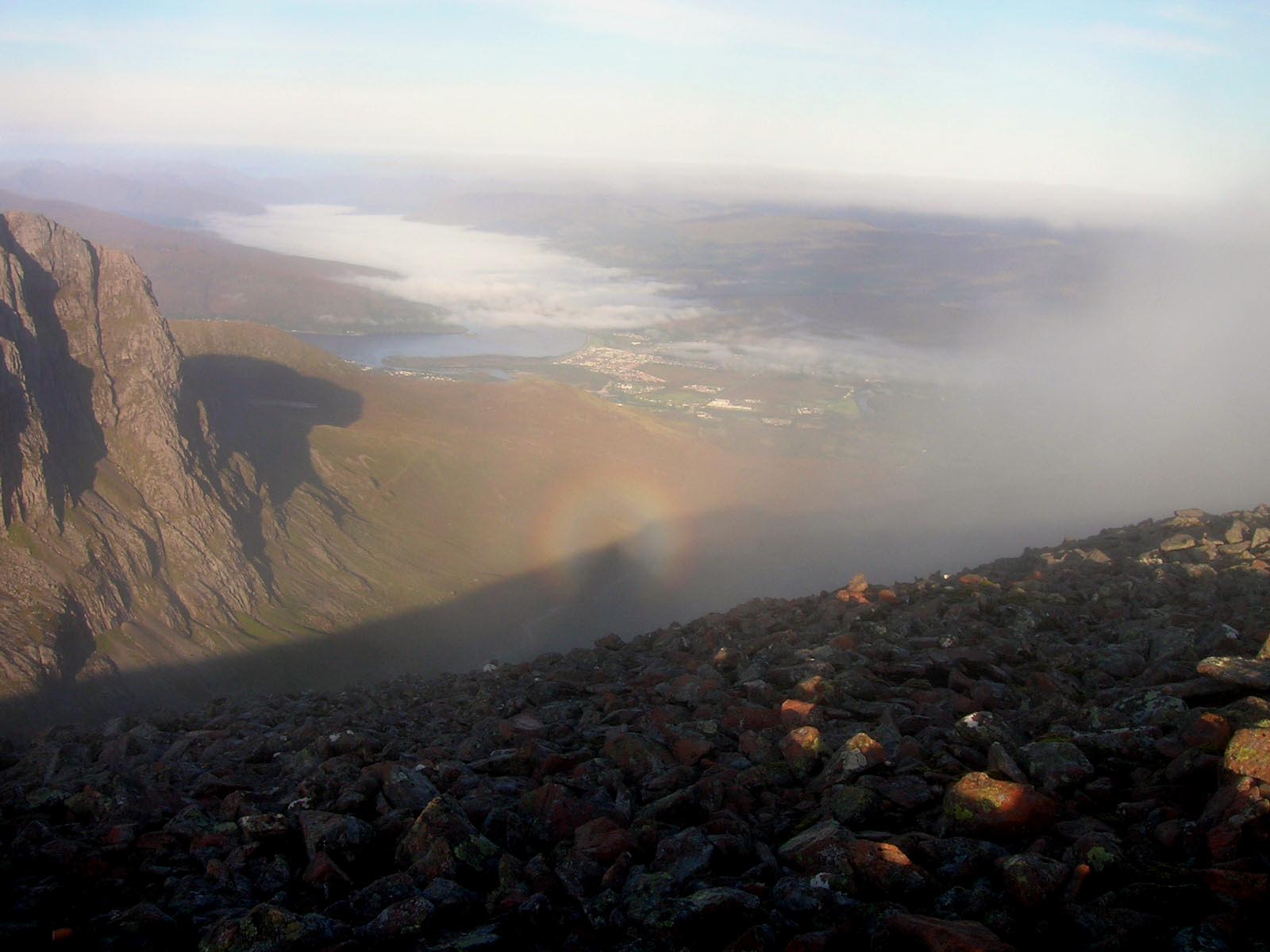
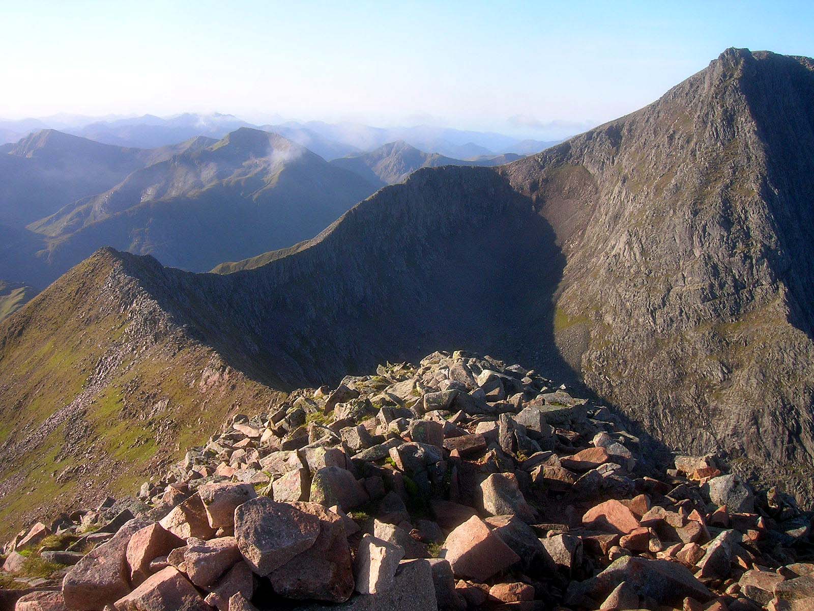
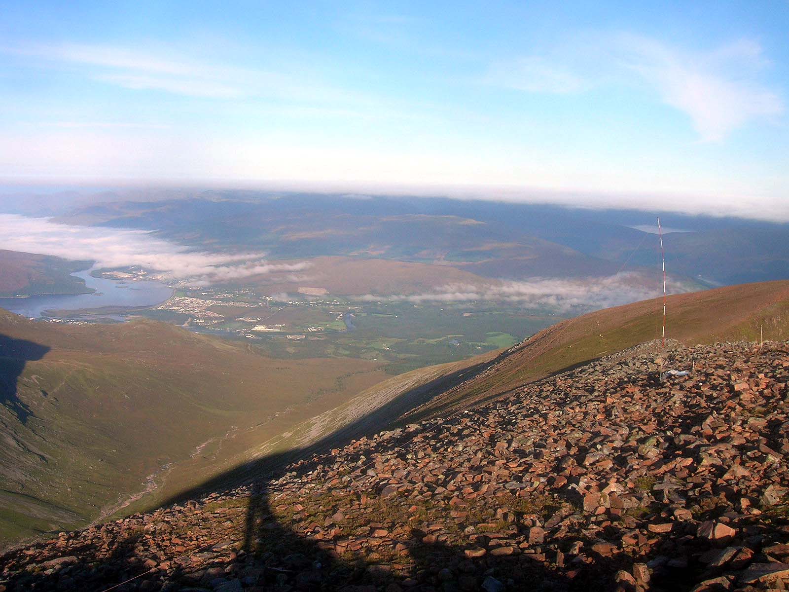
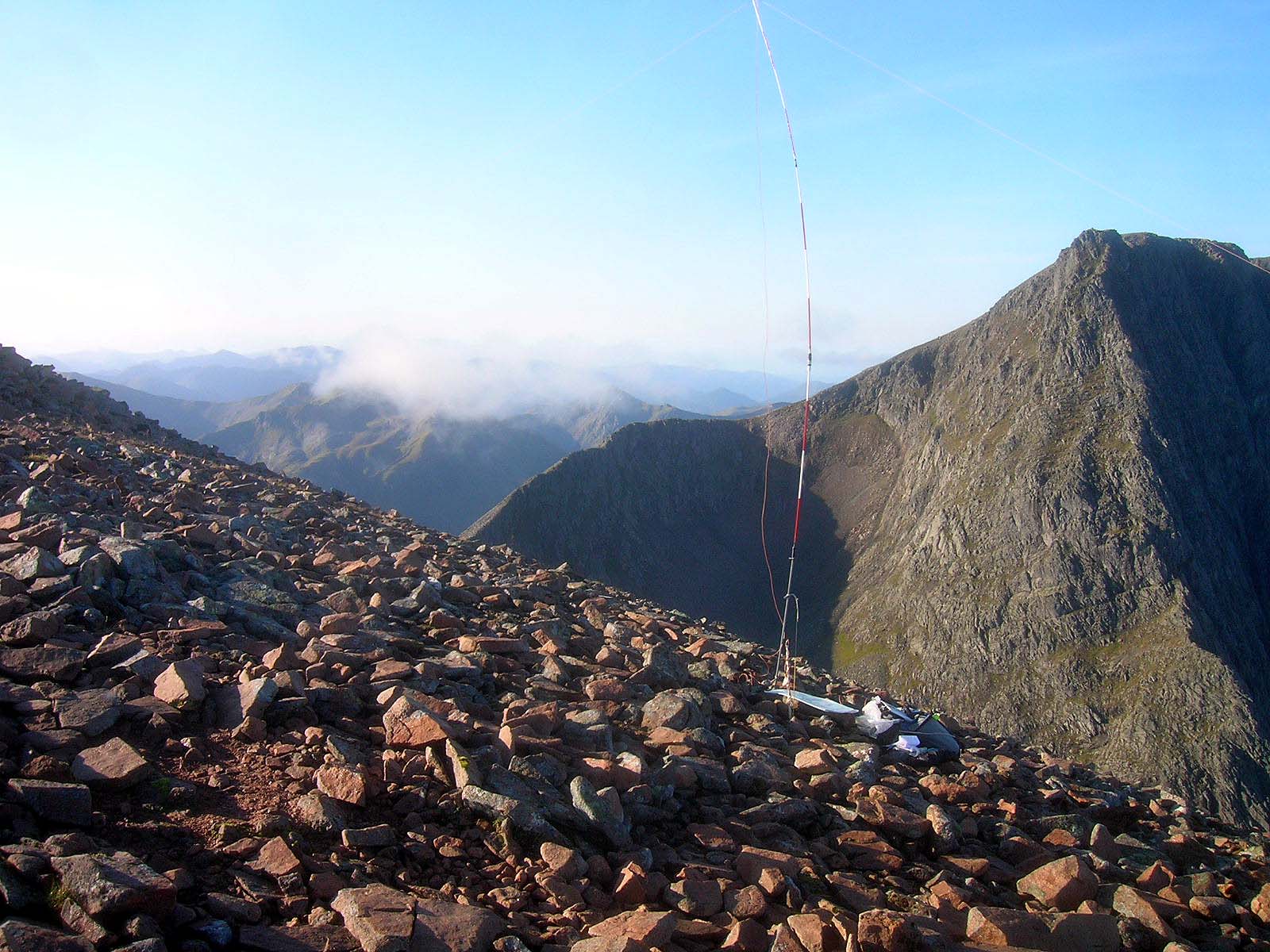
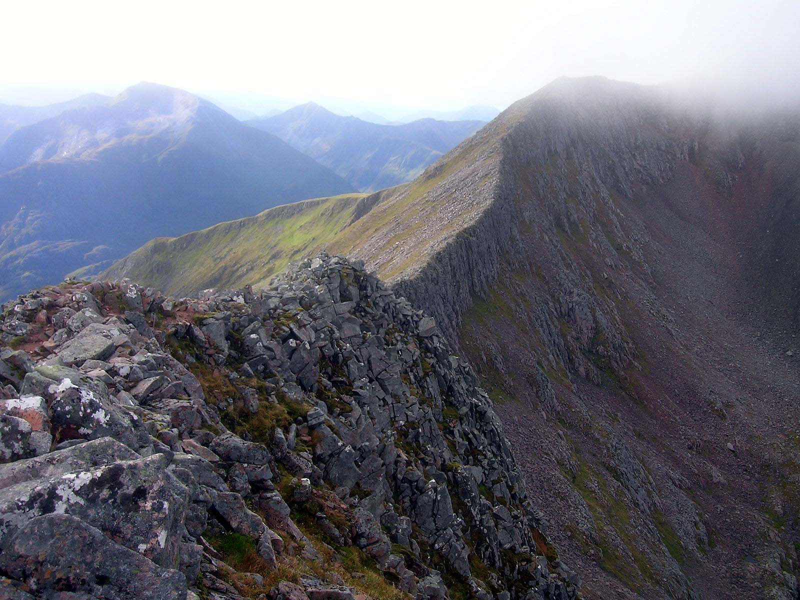
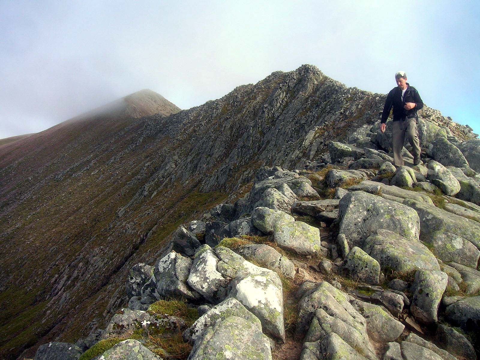
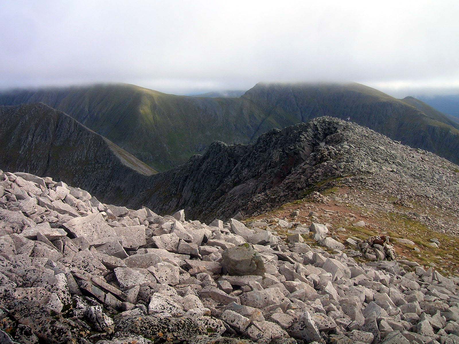
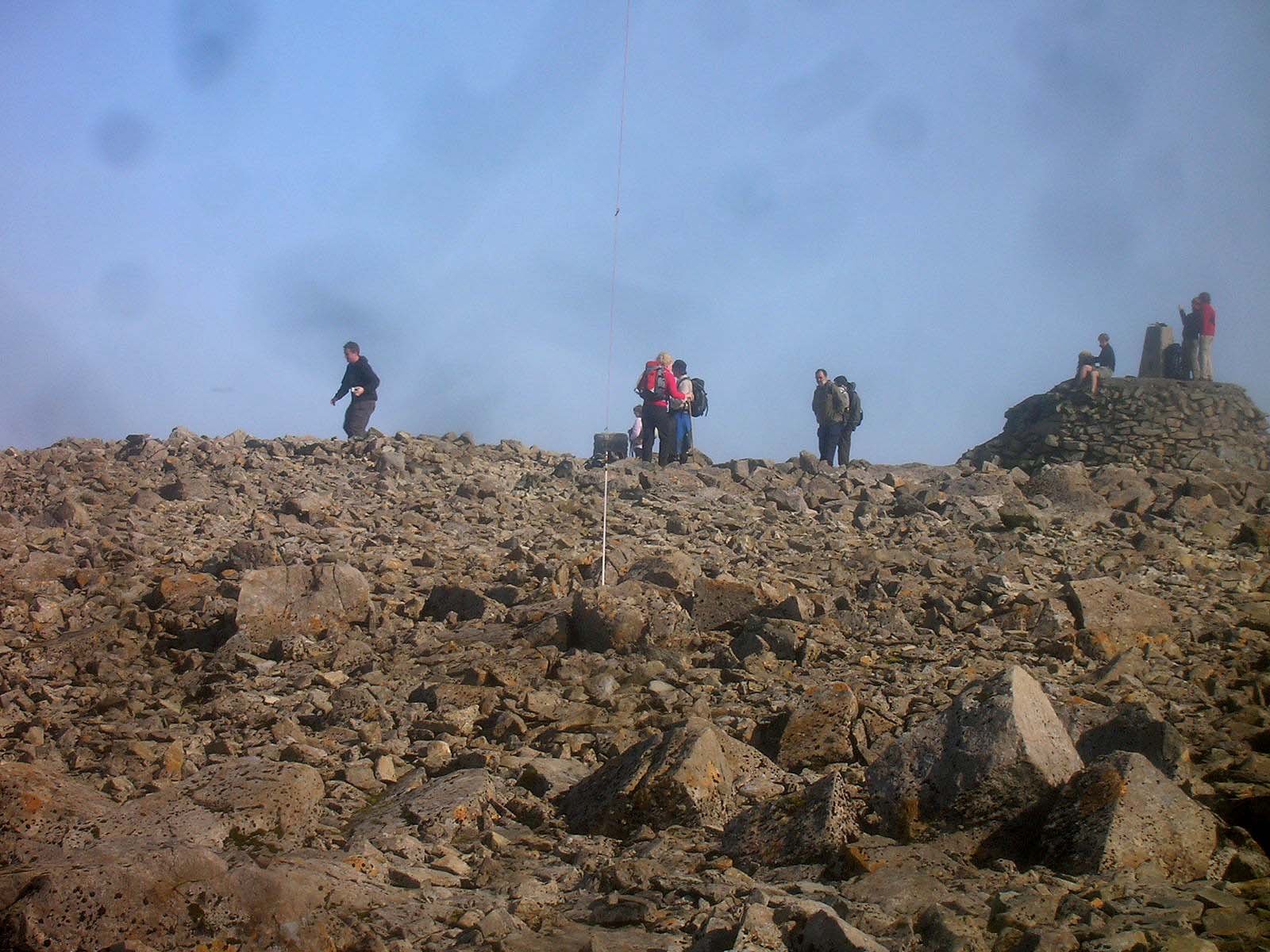
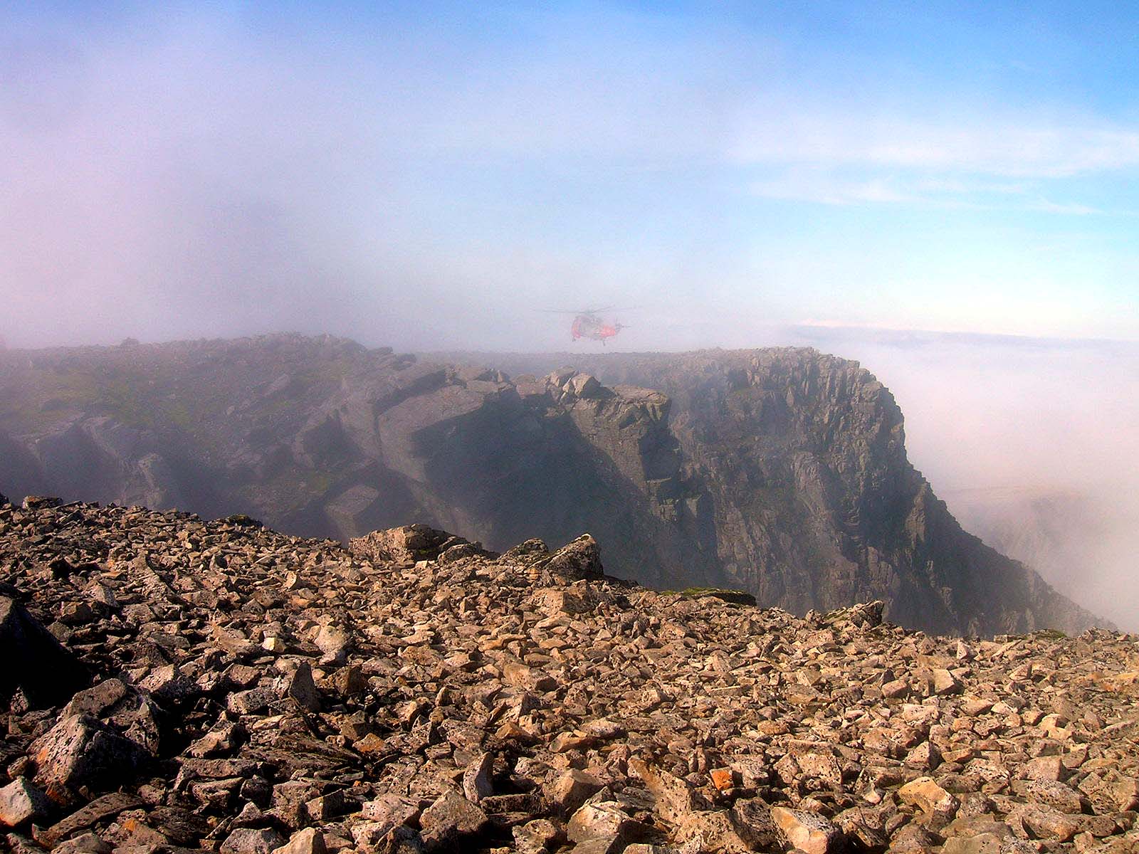
WS3, CMD, WS1 Photos 23-09-2008:
Photos: 7-11-16-21-41-43-44-45-55-59-62-72-80-97-100-125-131-137 ( all suffix ‘a’). The early ones are a bit dark as it’s quite early morning.
Above: Ben Nevis WS1 summit and helicopter hovering above north face
I hope you get around to doing one or more of these Caroline and I hope you get good WX. I still have B.E. Beag to do so I’d like to go back again. Good luck.
We ended up doing just WS-042 today which was scarier and harder work than expected due to the normal path being closed due to forestry work. We ended up with a steep ascent to the eastern ridge including a section where a large rock I was using as a handhold gave way and tumbled onto. Thankfully I only fell a short distance and only suffered a few bruises. When finally reached the ridge views were excellent and it was a lovely ridge walk to the summit.