Not scrambling in Snowdonia

Yes, we were chuffed, and looking at it later in the week from Carnedd Llewelyn and Y Garn we were still “how did we get up there?”. I’m not sure it’s given me the confidence to try one of the other “hills I’d like really to do but not sure I can” Buachaille Etive Mor (but anyway we will not be in that part of Scotland this year).

Gerald told us he had done the leap in his youth, but wasn’t going to try it now!

As seen from the main road - especially from the Kingshouse area, it looks horrendous - or inspiring depending on your mental approach! In fact from Lagangarbh Cottage up Corrie na Tulaich (Lagangarbh Gully) it is just a tedious plod, or even easier wander down Lairig Gartain and head up Coire Altruim (path) to the col between Stob Coire Altruim and Stob na Doire and its a mostly grassy walk to Stob Dearg. Perhaps next year?:grinning:

Sad news from Tryfan today.

Route finding is key on this peak to avoid getting into tricky terrain. The south ridge is definitely the easiest way up.

http://www.dailypost.co.uk/news/man-dies-after-snowdonia-mountain-13034201

Sad news and a somber reminder not to take safety for granted.

Tuesday 2nd May 2017: GW/NW-002 Carnedd Llewelyn: nothing to scare the horses

We wanted a good leg stretching walking day after the previous day’s exertions, so decided on Carnedd Llewelyn, Wales’s second highest mountain. We tossed up between the approach from Bethesda and the “walker’s route” from the NE. Wanting a less challenging day we headed for the walker’s route starting from SH731663. The scariest thing about the day was drive up from Tal-y-Bont – up a gated, steep, single track twisty road. When we got to the car parking it was looking rather full, with some of the parking blocked by a trailer full of sheep, but we managed to squeeze past the sheep to park.

It was sunny but windy as we set off along the track running NW from the east end of the car park, and then zigzagging round Clogwynyreryr. Passing through a gate where the track bent slightly right we looked for a path up the ridge and failed to find it, so headed up over the rough ground, eventually finding a path running along the ridge (on the way back we discovered that we should have headed up a slightly muddy area soon after the gate). The views were extensive as we headed up the ridge and over a flattish boggy area to pick up another path that skirted Foel Grach and up onto the flat-topped summit. There was plenty of space for antennas, but no shelter, so we looked for somewhere where the wind wasn’t too bad, somewhere in the middle of the flattish area (there being no trig point and only a shallow summit cairn). We ended up with a 2 hour activation with Caroline making 51 contacts - 11 on 70cms, 29 on 2m and 11 on 40m, and Martyn 14 on 60m, 2 on 2m SSB and one on 2m FM (an S2S with Allan GW4VPX on Mynydd Carningli also grabbed by Caroline).

Summit cairn

With activation over we retraced our steps, sometimes finding a better route. At one point our path was crossed by three wild horses running across the hill. As we headed down the Cefn Tal-llyn-Eigau ridge Caroline suddenly became very tired – maybe two different days exertion catching up with her. However, a sit down on a suitable rock and an apple soon refreshed her, and we enjoyed more views on our way back to the car. A good walk and nothing to scare the horses.

7 Likes

Wednesday 3rd May 2017: GW/NW-004 Y Garn

Another day with a forecast of sunshine and high winds. We had hoped to book a trip to Bardsey Island but the boat was fully booked, so plan B was Y Garn. Having done Tryfan with Gerald he had suggested we should be able to manage the Devil’s Kitchen route, despite it looking completely daunting. So we decided to head for the Idwal Cottage parking and after being entertained by a very friendly pair of Robins in the car park as we togged up, we headed up the motorway of a path. The views were excellent as we headed up to Llyn Idwal. Lots of people were enjoying the shoreline, and there were climbers ascending the rocks under Glyder Fawr.

We took the path on the eastern side of the lake, which probably wasn’t the best choice, but it looked to provide a more angled approach. The path was rocky and generally well defined, but it was about to provide Caroline with her scariest point of the holiday, and this was definitely a “never again” moment. The problem was a steep and rocky stream crossing with rapidly cascading water. We spent a while looking up and down the rocks for a good crossing point, and eventually decided to try a point where marks on rocks suggested that others had been crossing. After working out where to hold on Martyn was across, but Caroline struggled to get hand holds to allow her to pull herself across and ended up stuck for a while with one leg being splashed by spray as she tried to find a way over. Eventually she managed to get her hands further over and finally managed to get over, and crawled up the rocks the other side. We were definitely not going back that way, but there did look to be a steeper but less hazardous descent to the west side of Llyn Idwal.

Devil’s Kitchen: we’re going up there? really?

We continued along the angled path which became screeier and then turned left and steeper and rockier. The rocks were awkward in places, and we needed to look for “Gerald” steps, but we made our way carefully up – nothing as scary as the stream crossing! The ascent so far had been sheltered from the high winds, but as we turned a corner as the gradient eased we were suddenly hit by very strong winds funneling over the col, and at times it was hard to stand up or make any progress. Descending walkers told us they had ascended via Pinnacle Crag Ridge and that had been very windy too. We made our way slowly to the col, and the wind dropped a bit. The path became easier and views of Y Garn opened up. We passed the small lake and headed up the well-worn path to the summit (using the path furthest from the ridge to avoid the worst wind).

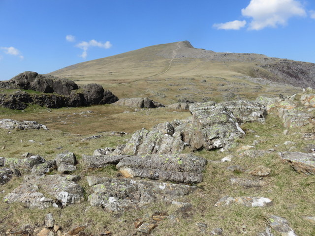
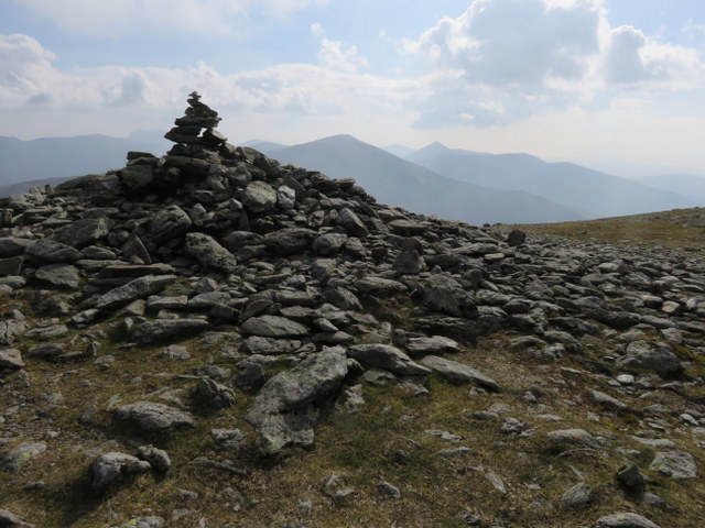
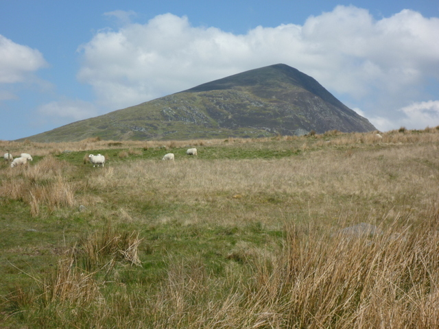
Now the going is getting easier up Y Garn

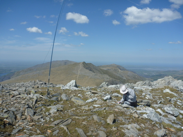
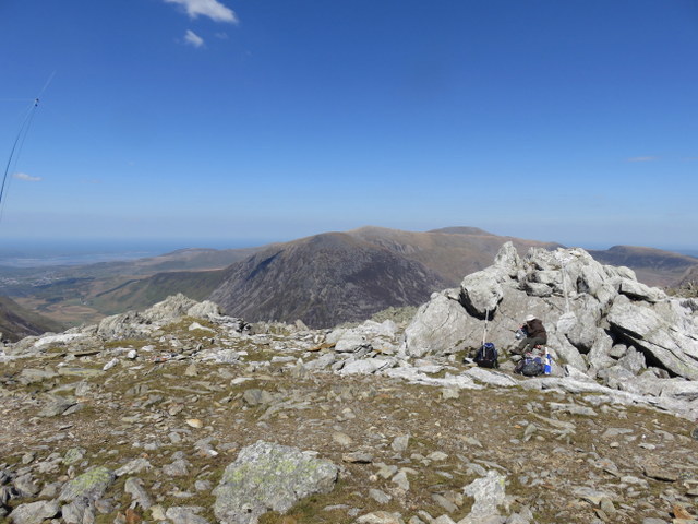
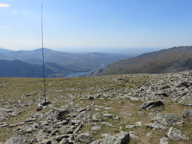
Once again there was no trig point, and we picked a spot to the south of the summit cairn as the least windy position, though the wind was blustery. Caroline concentrated on VHF/UHF, getting 7 contacts on 70cms and 18 on 2m FM, interspersed with a single 40m S2S contact. This contact led to a minor disaster: as Caroline left her station for the contact, she left her part eaten lunch tucked in the rocks by her station, when she returned the lunch box and lunch were still there, but the lid which had been loose was nowhere to be seen, presumably blown away. We searched for the lid but it was nowhere to be found: I don’t like leaving litter on hills, and had had that particular box for many years - it’s been on all my SOTA activations that have included lunch and nicely fits our standard lunch of two rolls and a piece of cake! HF wasn’t particularly good, Martyn getting 11 5MHz contacts and just 4 on 7MHz.

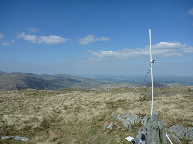
VHF station with lunch box before it lost its lid.
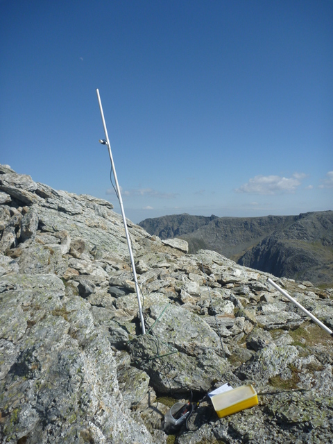
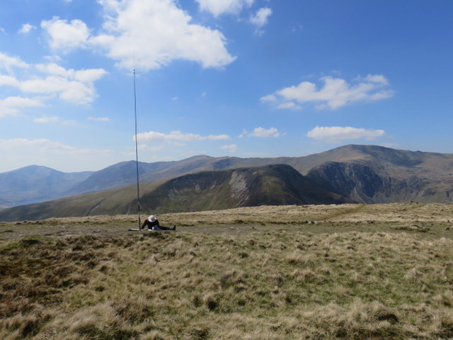
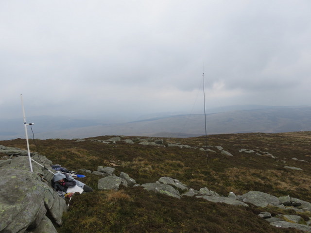
HF station

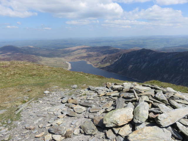
Which way to descend? We didn’t really fancy trying to get back down Devil’s Kitchen – even though there looked to be a way to avoid the “never again” stream crossing, the ascent had been sufficiently awkward and we’re less good at going down than up. However, the Pinnacle Crag ridge route would be more wind exposed, but from the summit the ridge looked reasonably wide, so we decided to try it. The top section was slightly screey, but once past that the path seemed generally good, and the ridge was wide enough that the wind wasn’t a serious problem. The views were also good and we descended to head along the north edge of Llyn Idwal. The friendly robins were still in the car park and amused us some more as we removed our boots.
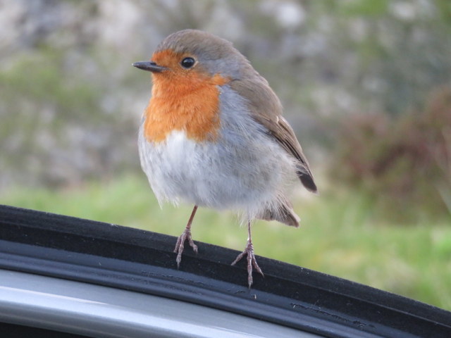
Friendly robin

A good day, despite the scare! Gerald’s comment about route finding being the key earlier in this thread seems relevant here - I think we didn’t on this occasion!

7 Likes

That small river crossing between Ideal slabs and the Devil’s Kitchen has been the scene of a good few accidents. Best on the other side of Llyn Idwal. It’s not that bad but a little tricky.

1 Like

I remember the first time I encountered that gutter, when a few friends and I were teaching ourselves mountaincraft, it seemed a real stopper. It took us some time to get across it. Later it seemed to get a lot easier and we hopped over with hardly a moments thought! This, I think, is what is happening with you, Caroline. You have scrambled up Tryfan and crossed that gutter, your body is learning that we humans are designed to be able to climb thanks to the evolution of our arboreal ancestors! Perhaps one day you might graduate to approaching GW/NW-001 via Crib Goch for pleasure - the most exhiliarating approach, I used to think it was too short, but alas! I may be too old for it now!:cry:

4 Likes

The video looks a lot scarier than when I did it in real life… that was a long time before the invention of the selfie stick though :-s

No may in my case I’m afraid…

1 Like

Yes, those selfy sticks are daft, you need both hands to go over the Crazy Pinnacles - although it seems nowadays many people traverse around them on the south side, which to me is chickening out of the best fun!

I’ll put it on my bucket list for my 80th birthday!:wink:

I’m glad that others have found that crossing difficult: the walks book I was using suggested that route rather than the west side, but made no mention of that crossing, just what it called a “scruffy scramble” up Devil’s Kitchen! I take your point about getting used to things - from personal experience I was unhappy the first time I did the St Sunday Crag to Fairfield route, but the second time couldn’t find the expected bad bit! However I don’t think I’ll ever be doing the likes of Crib Goch, Striding Edge etc. That video was scary, but they’re probably under half my age and carrying a lot less than a SOTA rucksack!

1 Like

Thursday 4th May 2017: GW/NW-003 Glyder Fawr

We had a provisional booking for the Bardsey Island boat, but evening update suggested that it might be cancelled due to forecast high winds, and to phone again at 8am to check. Since that was about the time we would need to leave the cottage to catch the boat we were up and breakfasted early. Unfortunately, the check at 8am revealed that the boat was cancelled and not likely to run again before Sunday, by which time we would be back home.

Plan B was to Glyder Fawr, and having no desire to repeat Devil’s Kitchen, we decided to take Gerald’s advice to ascend from Pen-y-pass. We parked at Nant Peris to catch the Sherpa Bus, with the idea that it gave us the option of returning direct. It was a lovely day when we arrived at Pen-y-pass, and we surprisingly noted that was room in the car park, before heading up the path (not marked on the 1:25000 OS map, but on the 1:50000). There was distant mistiness as we headed up above Llyn Cwmffynnon, and we realised that the path we were on was too low, so we headed up finding our way on mostly grassy slopes up to the ridge where we eventually located a path and the gradient eased. As expected it was windy, but clear enough that we had increasingly good views of the Snowdon range as we climbed.

The summit area is a mass of fractured rock. We found our way to the highest point (yet again no trig point) and took lots of photos before trying to find somewhere out of the worst of the wind to set up our stations. This meant dropping down a bit, but we still had good views, and it was warm in the sun, but cooler when the blustery wind changed direction. Caroline wedge the VHF antenna between rocks – not as clear of the rocks as she would have liked, but it seemed to do OK, with 26 contacts on 2m FM and 11 on 70cms, 14MHz was less good: just 5 contacts including an S2S with 2E0YYY on Gun (we had both earlier worked him on 7MHz). Martyn got 14 5MHz contacts, 19 7MHz and 6 on 18MHz.

HF with Y Garn in background

VHF with Tryfan in background

We decided that given the wind we wouldn’t risk the screeier direct route back to Nant Paris, so headed back to Pen-y-pass. Surprisingly we managed to lose the path at about the point we had found it on the way up, but after a steep descent over heathery rocks found the path again – almost wishing we hadn’t because at that point it was steep, heavily eroded and awkward, but we persisted and it improved and gave better views than out outward route. We sat at Pen-y-pass eating our apples and watching the world go by waiting for the bus. While taking our boots off back at Nant Paris the occupant of the next car returned: “Didn’t I see you on Glyder Fawr?” he said – turns out he had done the Elidir Fawr, Y Garn, Tryfan and Glyders circuit direct from Nant Paris!

3 Likes

Friday 5th May 2017: GW/NW-013 Pen Llithrig y Wrach

The forecast was for another dry and generally sunny day, but still with high winds, so that ruled out to small exposed tops of Y Lliwedd & Trum y Ddysgl, but Pen Llithrig y Wrach looked playable. We parked on rough ground by the start of a track at SH716591, and then headed east along the road, thankfully with a wide enough verge to walk on, to the start of the bridleway/track at SH719589. The track meandered past a farm and into the access land, climbing slowly. We were glad that there had been little recent rain as the track was boggy in places, with several bridges and raised wooden walkways which stopped short of where they were needed. There were some artificial water courses, presumably associated with the reservoirs, and we met some workers who were enjoying the walk and being paid for it!

After crossing a bridge over a water course the real ascent started as we headed up rough ground with occasional faint paths up the ridge, working our way between rocky outcrops mostly up grassy sections. It was windy as we headed out of the gullies and onto a ridge, but the views were worth braving the wind. We met some other walkers who were asking about the route we had taken since they weren’t happy with what they had found. It turns out they had also had trouble on Tryfan and had ended up going over the North Top instead of up Heather Terrace!

Summit cairn & Llyn Cowlyd

The summit was marked by a low but broad cairn, and after taking photos we looked for where to set up to avoid the worst of the wind: there being no shelter on the top we dropped down a little to the north-west. There was plenty of space for HF on the flattish top, and Caroline wedged the VHF antenna into some rocks. Caroline’s luck with the VHF antenna surviving the high winds finally run out, and collapses broke the main support pole and the T piece of the multi-function dipole, but she managed to get it back up at a lower level working well enough to continue, getting 28 contacts on 2m FM (including S2Ses for both of us with Gerald MW0WML and Allan GW4VPX on GW/SW-003) and 7 on 70cms FM interspersed with 7 on 40m and 2 on 20m. Martyn qualified the summit with 11 5MHz contacts, followed by 7 on 17m, 2 on 20m and just one on 2m SSB. Despite poor HF conditions we had managed between us to qualify the summit on 6 bands!

HF with Carnedd Llewelyn behind

VHF looking north

Despite the wind, it was pleasant at the summit with good all round views. We retraced our steps, heading back to cottage over the Llanberis pass. At the cottage, Martyn headed down a bluebell lined footpath into Y Felinheli to buy our traditional last day of holiday Fish and Chips from the Chinese Chippie: recommended!

1 Like

Saturday 6th May 2017: GW/NW-027 Arenig Fach

Our luck with the weather was running out, and the clouds were down on the hills as we packed up to leave the cottage. We wanted to get another summit in before we left Wales, and the forecast was for better weather coming up from the south, so a southern route was selected with Arenig Fach our target.

The weather didn’t improve as we headed south, passing through some light rain, but that desisted soon after we parked in the layby at SH816395. We crossed the road, climbed over a gate into the access area, headed through another open gate and then bent north following a boundary to another gate, here we headed north and slightly east over rough ground, until a set of sheepfolds came into sight: we found our way through them and briefly followed a track until it headed off in the wrong direction, and we left it for some hard heather bashing up the flank of Arenig Fach. Heading for the col between Arenig Fach and Y Foel we were relieved to find a narrow path with made the going easier. The summit has a solid stone build trig point, a cairn and a shelter. Thankfully the cloud level was just above the summit, but Arenig Fawr was hidden by clouds. Needing protection from the wind we inspected the shelter, but concluded that the wind was blowing straight in the open side, so we dropped down on the more sheltered side of the hill, and made our base in the rocks there.

Antennas under clouds

Caroline was using a spare support pole for the VHF antenna, but it was only a few minutes into the activation before the wind broke it too: having survived the high winds earlier in the week it was disappointing to break two pole on the last two days. VHF was a lot harder here, Caroline making just 12 2m FM contacts, and sadly only 2 on 70cms: John GW4ZPL tried very hard to make it 3, but although we could tell that each other were there we couldn’t exchange reports on 70cms. Martyn qualified the hill with 10 contacts on 5MHz, but could only get 3 on 7MHz.

During the time we had been on the summit the clouds lifted enough that we could see Arenig Fawr and Moel Llyfnant, but it was still very dull and windy. On the way down we followed the path running along the ridge to Y Foel, hoping it would provide a better route down. It was useful while it lasted, but just stopped dead on Y Foel. At that point, we hacked down the heather (which seemed even deeper than that on the ascent), making our way back round to the sheepfolds we had passed through on the way up. Through them we took a path running to the right of a wall which was a better way back to another gate where we rejoined our outbound route.

Trig with Arenig Fawr and Moel Llyfnant appearing out of the clouds

Not one I’ll be keen to repeat but it was both a unique and a complete for both of us.

1 Like

Saturday 29th April 2017: GW/NW-059 Allt y Main

Nor Snowdonia, and not scrambling, but a brief report on the first hill in our excursion.

We parked in a rough layby at SJ171150. The map showed a footpath ascending the hill almost opposite, but when we went to investigate having loaded up we could see no sign of any access route, so instead headed SW along the road to SJ169149 where to took the bridleway track heading up through trees to houses, where a narrow path headed above the houses through bluebells and round to a track which we crossed to continue heading steeply up the footpath. Where the gradient eased at around SJ166150 we cut left to a track, and followed it as it curved north. At the point where the map showed a footpath crossing the track and heading towards the ridge line there was no sign of a path on the ground, nor in the immediate vicinity, so we headed up over rough ground, which was hard work and a mistake. We emerged onto another track that was much easier going and headed along the ridge, with the trig point soon coming into view. The seat near the summit was occupied by a family, so we headed up to the trig point for photos. It was windy and cloudy but we got reasonable views. The family moved off and headed down the hill SW (not access land, but there was clearly a path used by locals, as we saw others coming up the same way – probably from parking reported to be at SJ158143) so we headed to the seat to make use of it.

Given the wind and the steep narrow ridge we decided to use the seat to support our antennas, HF centre pole at one end and VHF at the other, which seemed to work, though the seat wasn’t quite as stable as we at first thought. After the activation, we followed the track back along the ridge to find the it joined the main forestry track less than 100m after we had left it to climb over the rough ground: a much easier route. We retraced our outbound route back to the car and were back on our way a little over 4 hours after arriving.

4 Likes