I’m planning our next SOTA trip to Snowdonia, with the main aim of getting more activator uniques. Unfortunately there’s a reason that we haven’t already activated several of the hills concerned: they’re a significant challenge to someone who is short of stature, doesn’t do scrambling and dislikes exposure. So I’m looking for recommendations for the least challenging way to get up some hills. In some cases I’m guessing mild scrambles might be possible with a lighter pack than normal (hoping that the higher ones can be done as VHF/UHF only), but some might remain outside my capability.
Reading Tom, M1EYP’s, description of NW-006 Tryfan made me feel ill! I don’t do 6ft drops off slabs (and I’m not sure how I’d get up something a foot taller than me!). Is there anywhere that’s activation area on Tryfan that doesn’t involve more than trivial hand on rock?
For Carnedd Llewelyn NW-002 there looks to be a route from the east via Foel Grach that looks walkable, but I was also wondering about the route up from Bethesda via Cwm Pen llafar.
Trum y Ddysgl NW-024 is also on the list and looks to involve some scrambling if done from Rhyd-Ddu via Y Garn: is there a better route from north or south?
Glyder Fawr NW-003 & Y Garn NW-004 are also on the list. I don’t like the sound of Devil’s Kitchen: how feasible is it to do this pair from Nant Paris?
You have to bear in mind that Tom is unfortunate in that he is affected by even quite moderate exposure and therefore his descriptions are coloured by this affliction. I would not choose to follow his route on Tryfan, although there is nothing wrong with it, preferring to tackle the summit more directly from the main road. Just before the closest approach to Tryfan from the south you can see a wide grass/heather/bouldery gully slanting up rightwards to the main ridge, if you follow that to the north ridge it is only a minor scramble to the summit, in fact with a bit of zig-zagging there is only one place where you need to put hand on rock, where a sort of gully cuts across the ridge just before the summit. The summit is an airy perch but quite safe. It is traditional to leap across between the two flat topped boulders…nah, forget it!
The route up Carnedd Llewelyn from Bethesda is almost entirely on a path through grass and heather if you slant right onto Mynydd Du and go via Carnedd Dafydd, I do not remember any scrambling although there is a fair bit of rock in the col above the Black Ladders before Llewelyn. Alternatively you can slant rightwards and go up the nose of Yr Elen, a stiff climb but no unavoidable rock. There is a path if you go right up to the Black Ladders and slant left but the sombre atmosphere of the place is discouraging! The route from Foel Grach is hands-in-pocket but a long walk, longer if you take the track from Llanfairfechan to the summit of Drum but easy going.
The alternative route to Trum y Ddysgl is via Craig Cwm Silyn, following the easy (ish) ridge over Mynydd Tal y Mignedd, two for the price of one and a lovely walk, highly recommended.
Glyder Fawr and y Garn is reachable by a signposted footpath from between Gwastadnant and Beudy Mawr about half a mile up the pass from Nant Peris, no rock that I remember but a bit steep in places, and on the descent you can get a drink at the Vaynol Arms! IIRC the footpath starts by a bus stop.
Llewelyn ,from Tal y Bont up past Llyn Eigua Res and the Bothy, not many go from this side
Glyder and Y Garn from Peny y Grywd Hotel ,parking near by and access to Miners Track SH660/558
Tryfan will require some form of Scramble regardless of what route you take .but most friendly common route up from idwal cottage ogwen valley to Bwclh of Tryfan were the sty crosses the wall ,it then gets a bit hands on, take walk have look,
As for the Trum ,via Y Garn it is a Ridge walk search google for the Nantle Ridge should throw some pictures up for you . It is a great ridge walk on a nice day ,and over looked by many of snowdons tourists.
I don’t do scrambling, my wife often walks with me and doesn’t like heights or scrambling.
I spent a long time looking at routes and found you can do all of wales without scrambling.
NW-003 Glyder Fawr from Pen-y-Pass car park easy walk, navigation would be tricky in poor visibility.
NW-004 Y Garn from Idwal cottage via Pinnacle Crag decent path
NW-002 Carnedd llewelyn Eight mile walk but easy going from car park at SH731 663
NW-024 Trum y Ddysgl if done on its own is also easy walking from car park SH540492
I spent far to long thinking about Tryfan routes the more I read the more the mountain had the psychological advantage over me don’t do the same.
Tryfan does need some hands on but it wasn’t a problem for me. When i reached the top I was so worried about going back (I was on my own and in the clag), I dropped down off the top and sat about 15 feet below the summit and activated with a handheld. so no you don’t have to climb that last big slab to be in the activation zone if you don’t want to. Choose a good weather day and enjoy it.
Hello Caroline
Sounds like a walk with Winter Mountain Leader Gerald Davison MW0WML might be a good idea. And Sue his wife is a splendid person/ mountain walker too.
West Mercia scouts lent me a mountain instructor for Tryfan. We went from Idwal Cottage to Bwlch Tryfan and climbed the south ridge. True it was like a giant Lego set but very doable on dry rock. Long walking poles for lowering yourself down would make it easier. The crampon scoured marks were very interesting on the rocks from all the winter types having a bad day. Thankfully there were two extreme ironing chaps on top so my SOTA activities went unnoticed.
I went up Carnedd Llywellyn from the A5. My companion pulled me across Craig yr Ysgfa when I got stuck - otherwise uneventful.
Twll ddu / Devil’s Kitchen is a lot of stone steps ditto Glyder Fawr. More percussive knee pain than anything else. I saw lots of petite people managing OK here on the two occasions I’ve used this route.
GW4VPX’s Radio Tales from West Wales shows Allan went up Craig Cwm Silyn and Trum y Ddysgl seperately.
73
David
As a long time Snowdonia hill goer, climber, walkers and scrambler I suggest the following will avoid scrambing and exposure.
NW-002 Carnedd Llewelyn - Park at the road end in Cwn Eigiau SH 7318 6633. Follow the track NE around the ridge heading for Melynllyn. Shortly before the lake (Llyn) bear south up a short steep heathery hillside to meet the ridge. Follow this to the col between Foel Grach and Carnedd Llewelyn. Turn south to reach the summit. Worth a detour to see the emergency shelter at Foel Grach.
NW-003 Glyder Fawr - from Pen y Pass go north, up behind the YHA. Then follow the broad ridge NW, then N, then finally NE to the summit. Significant route finding challenges in bad weather. I suggest you might not like the scree slope off the summit of Glyder Fawr that goes NW to go down to Llyn y Cwm, which is why I suggest you don’t link it with Y Garn.
NW-004 is best combined in a longish day out with NW-005 Elidir Fawr, from Gwastadnant SH 6145 5761, follow the PRoW NE to Llyn y Cwn and then turn NNE to the summit of Y Garn. Continue along the ridge NW, then N, bypassing Foel Goch to contour around to the bouldery summit of Elidir Fawr. Then take the long knee jarring descent down SW to drop to the stream at a foot bridge at SH 6084 5957. Follow the PRoW down to Nant Peris.
NW-024 Trum y Ddysgl involves no difficulty if you do it on its own. Park at the road end in Cwm Pennnant SH 5403 4921. Follow the PRoW until you can reach SH 5495 5017, where you head N up this blunt ridge. Then turn NW to follow the ridge to the summit. There is only one really short narrow bit at SH 5410 5137 on the intervening ridge to Craig Cwm Silyn NW-020. My suggestion is that you go and take a look at it, if you don’t fancy it return the same way from NW-024. But it is such a lovely ridge it would be a shame to miss out on it for one small section.
Finally… Tryfan.
If I’m around I’d happily take you up. From the south is probably the easiest. There is honestly nothing to get too excited about, I’ve had all sorts of people up there over the years. When are you coming up? I have a couple of others who might be keen to make a trip of it.
Caroline, the walk from Nantperis is easy but long. I have done it at least three times (pre SOTA) and included Elidir Fawr as well as Y Garn and Glyder Fawr, but not all three on the same walk
We were sent back by driving wind and rain when we attempted Y Garn in December 2016 - nothing more unpleasant below the col. I no longer remember the terrain above the col (on either side) but don’t remember anything " memorable!" from previous visits.
I have to admit that Tryfan is the only summit that I don’t relish repeating again. I find route choice on descent bewildering.
We are planning doing the two Nantlle summits separately; obvious easy routes at each end of the ridge and avoiding the sharper bits in the middle and NE towards Rydd Ddu.
GW/NW-024 is no problem ascending from Bwlch-y-Ddwy-elor. From SH552504 follow the fence line NW up the ridge. You can reach the bwlch from either side - Gerald’s coordinates at Blaen-pennant and up the disused Prince of Wales Quarry or from Beddgelert Forest on the Rhyd Ddu side.
Take lots of tent pegs and guy lines - for yourselves as well as the gear!
MW0WML - Gerald. Can you include me in the ‘nervous’ party please? It is high in my list of ‘still to activate’ (which is very similar to Caroline’s except I’ve done Carnedd LLewelyn but not Y Lliwedd) but I get vertigo on top of a stepladder and even crossing the Mourne Wall had me feeling wobbly! Add to this tender knees and a propensity to try and slide down on my bottom when faced with an awkward step down then you might decide to be ‘unavailable’ when we are next in Snowdonia (no date fixed yet as we would like some decent weather for once)! How about a foolproof/Viki-proof route up and down Moel Hebog??
I’ve done all these hills many years ago but they seem to have got steeper and more exposed since then. I am also terrible at crossing running water and was mortified to find last October that I needed external help (ie not just Rodney) to cross the massive stepping stones high up Stickle Ghyll on the path up from the new Dungeon Ghyll to High Raise (G/LD-019). This was both going up and coming back (we had a long drive home so couldn’t choose a longer descent) and I was very lucky to find a gallant gentleman on each occasion who stood with his back to the drop so I didn’t see it. Is it time to hang up the boots and stick to tarmac?
M3ZCB Caroline The walk up from Nant Peris park and ride car park (and toilets) to the saddle between Y Garn and the Glyders is wellmarked and fairly steep (with only one awkward spot round a boulder but this can be avoided by keeping to the grass on the right as Rodney descended that way) but otherwise OK. We then turned round and descended as the weather came in and I found the same path downwards (usually my real problem) was really quite easy as there was often a grass alternative which I could zigzag down with no worry about exposure. It is in the list for another try on a better day.
Viki M6BWA
That one looks to be coming out top over the Bethesda route, even though it’s a longer drive to the start from our base which will be Y Felinheli.
I’d ruled out Pen y Pass on the grounds that we’re unlikely to be able to get up early enough to get into the car park! Curiously the 1:25000 OS map doesn’t show that path, but the 1:50000 does. I think there is a bus, but I’m not sure our antenna poles work in public transport!
I hadn’t thought of doing Elidir Fawr with Y Garn because we had already done it (it was my MG activation, so we did it on its own from the reservoirs because I wanted to put as many bands as I could on for the MG), but worth considering if we find another way of doing NW-003. Given our tendency to late bind hill decisions we could even do Y Garn first and then decide whether to do either of NW-005 or NW-003 as well.
That looks a less scary route from the map (even if it is again a longer drive to the start than Rhyd Ddu). We have done Craig Cwm Silyn from the west, but were mostly in the clouds, though what little glimpses I got of the ridge to Trum y Ddysgl didn’t look that inviting (but things can look different in clouds - though sometimes it’s an advantage not to be able to see a drop!)
Many thanks for the offer. Will PM you when I’ve worked out some of our other constraints.
We’ve still got Y Lliwedd on our list, but I was hoping that that would be doable (possibly VHF/UHF only) via the Watkin Path, though whether we go on from there to do Snowdon as well is still open, because that looks even more exposed/rough.
We did Moel Hebog from Llyn Cwmystradllyn and I don’t remember any particular problems. My recollection is mostly of it being a bit of a slog, but it was a few years ago.
Thanks for that. I think that I’m getting slightly better on exposure than I used to be, but less happy with scrambling as I get older and the combination of the two isn’t good. The second time we did the traverse between St Sunday Crag and Fairfield I ended up wondering where it was I’d been scared the first time! Still don’t like the little scramble on the Pennine Way up Pen y Ghent even though done it several times (though we found a way round it the time we discovered ourselves being the first people up after fresh snow a couple of years ago, and on that occasion descended a different way).
Second that, Gerald guided me up there originally. Once you’ve done it for the first time you will be able to scale it in your mind far better. for future climbs. Tryfan does look intimidating from a far.
Y Lliwedd isn’t that bad, just stay away from the left flank on a clear day. There is a good worn accent route into that mountain now that isn’t to hard to find coming up from the Watkin path.
Of course! As long as the dates work I’m happy to have anyone tag along (within reason - I draw the line at a party of 10 )
The slope up to Snowdon from Bwlch Saethau is mostly rather loose and in places steep scree. Of the “main paths” in Snowdonia I think this is one of the more unpleasant ones. I wouldn’t recommend it.
Lliwedd is best done from Pen y Pass (again!)
As for Pen y Pass being busy I suggest parking in the middle of Llanberis and getting the Snowdon Sherpa bus. Better to park there than Nant Peris as sometimes the busses are full by the time they reach Nant Peris. Get on at the stop opposite Joe Browns in Llanberis. You can park roadside for free at approx. SH 5760 6061, just to the east of the big bus stop.
They won’t bat an eye at any kit you carry - they have seen everything!
Ooo, just noticed that Google Streetview covers the main paths up Snowdon, which gives at least some idea of terrain. That could distract me for a while…
A few notes on our Snowdonia trip concentrating on the scrambling or not aspects, since various other commitments mean I’m not likely to produce proper activation reports soon.
GW/NW-056 Moel y Dyniewyd
We approached from the south up the very pleasant and busy Cwm Bychan path passing lots of old mining remains, crossing the stile at the col and headed along the north side of the fence. There was a faint intermittent path. There was one part where we needed to use hands on the way up, but on the way back down we managed to find a zig zag through the rocks to avoid an awkward descent. On the way up we crossed the fence at a stile and back again later – on the way back we stayed on the north side of the fence which seemed easier ground. After successfully negotiating the rocky section I managed to step awkwardly off a stile on the main path and fall backwards landing painfully on a rock, thankfully with no more damage than a very large bruise!
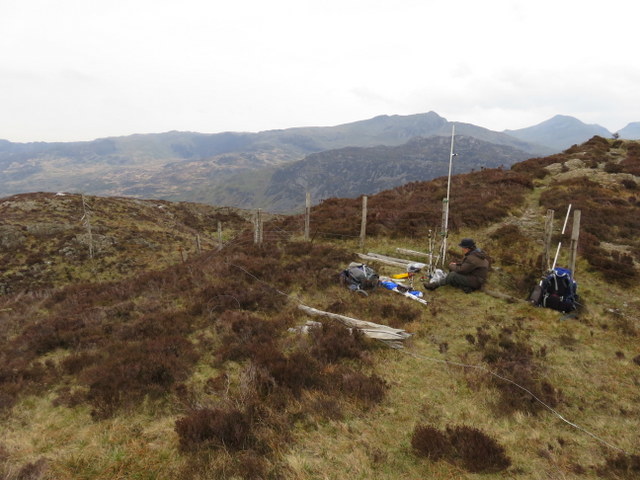
Windy summit using fence post to support antenna.
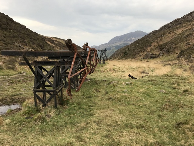
Mining remains
As the observant may have noticed Gerald successfully got us up Tryfan and more importantly safely back down again. He was an excellent guide and as well as finding the route also provided useful guidance on how to clamber round rocks, and managed to get me up steps I wouldn’t have thought I could manage (useful tip to look for footholds just behind to gain height) and to swing round rocks I wouldn’t have expected my little legs to make. I think the term “looking for a Gerald step” will become part of Martyn’s and my walking vocabulary!
Tryfan’s top was in the clouds as we started the ascent, but the forecast was for it to be dry and improve later. The ascent from Milestone Buttress car park heading south and then over Tryfan South Top wasn’t as bad as expected because the rocks are generally grippy, and there were lots of useful foot and hand holds. The scariest bit was the slab before the final summit ascent (and I suspect the activation area extends below it, though it’s all rather rocky). We were well in the clouds at this point and the lack of visibility may have helped when we got to that bit, though I accidentally looked over and wasn’t keen on what I saw. Gerald’s advice was just to crawl up the slab and I concentrated on just looking ahead and I was over the scary bit and the summit was in sight! Despite the cloud the summit was busy, so we decided to just do VHF/UHF. The summit was quieter by the time we were packing up, and just as we were about to leave the clouds started swirling away to give some views.
I still had to get down the slab, Gerald advised taking off my rucksack and easing myself down the slab on my bum, which I did with him passing my rucksack down to me once I was safely at the base. Martyn managed the bum shuffle still with his rucksack on, and we then dropped down to the col with South Peak. From here we decided to return via the Heather Terrace, which still had quite a few challenges, including one section where we needed to get under a rock which provided a challenge to my rucksack antenna, which Gerald has named the light sabre after I nearly hit him with it on the ascent.
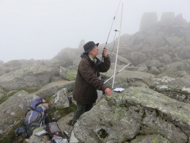
Operating 70cms next to 2m antenna
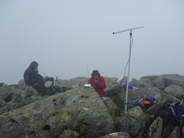
Martyn operating 2m SSB
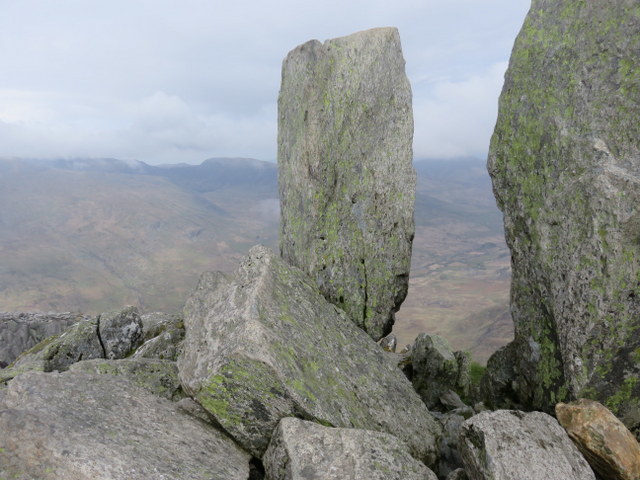
View through Adam and Eve as clouds start to clear
Descending
Descending
About to descend to Heather Terrace
I think this was the hardest walk of less than 6 miles I’ve ever done, mostly because the terrain meant that for much of the time I had to concentrate on every step, but it was worth the effort. It didn’t include the scariest aspect of the whole SOTA week (more of that in a later report), and there wasn’t anything I’d say “never again” to, though I doubt I’d want to try it again without a guide, since I’d be concerned about finding the right route through the rocks and not ending up at a dead end.
Follow the crampon scratches and the discoloured rock and you should be OK (the ryolite rock of Snowdonia and LD if heavily trodden on changes from grey and mossy or lichenous to brown or fawn and clean)
I gather that you didn’t do the traditional leap from Adam to Eve! Still, Tryfan is a high value mountain and I bet you are dead chuffed!