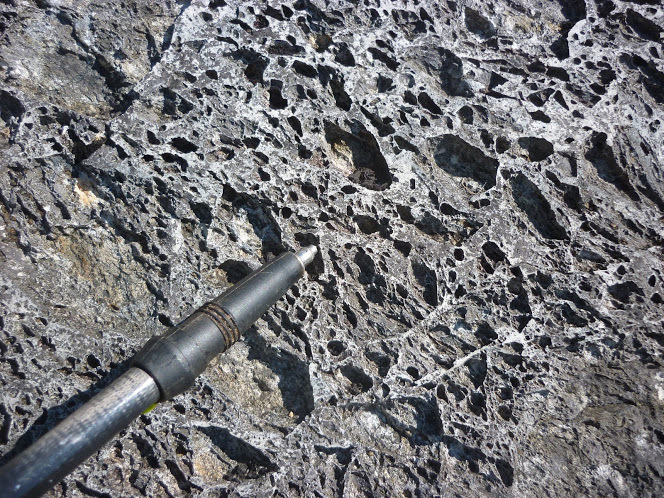
Hi, Simon, unfortunately I lost my geological map of that area and haven’t replaced it, so this is off the top of my head. The bubbly rock used to be mapped as an acidic lava called rhyolite (characteristic of the Andes) but is more likely to be an ignimbrite, a thick deposit of volcanic ash which was hot enough to weld together, ejected from the Snowdon supervolcano which had a crater several miles across which is no longer visible on the ground as it got covered. The bubbles are only on the surface, due to differential solution of the minerals by slightly acidic rainwater.
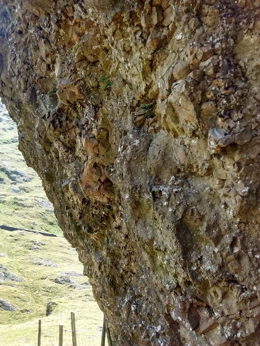
The “concretion” is interesting, I would guess that it was either deposited very close to a volcanic vent or is the infilling of a vent after eruption, a “vent agglommerate”, but I would have to go and look at it.
Thank you Brian. We certainly have a good variety of rocks around here. And much effort has be expended digging into them by generations of quarrymen and miners. It’s good to get some incite into how they came to be. Sounds like a very unhealthy place to stand, back in the day!
Richard, you may be thinking of the nearby disused cinder toffee geyser. Sadly this ceased production when the Welsh confectionery industries bubble burst.
Great report Simon and looks like a good route. The clouds over Snowdon are lenticular clouds created in the eddies that form over mountain tops. Used to see them a lot when I lived in North Scotland.
These dark whisps are contrasted on a background of cirrostratus clouds, against a blue sky they would be white.
In the report you ask about the cave. This is clearly visible from the top boundary of the Beddgelert Forest: There is a large very prominent steep rock buttress standing out in the middle of the line of crags, the cave is a horizontal slash not far below the top, reached by an airy traverse from the right hand side looking out. The back of it contains a seam of asbestos, the same seam that was trialled unsuccessfully on the summit area. The cave likely formed from the erosion of this mineral.