Thinking about a trip to the Moab Utah area over Christmas. Looks like The Knoll and Aztec Butte are easy/family friendly choices. Anyone have info on the summits in Arches national park or W7U/GR-051?
We liked The Knoll, easy peasy hike and nice view.
If you find yourself further south near Monticello, Abajo Peak (W7U/SU-014) is an easy drive-up.
A non-SOTA thing we like to do is drive on highway 279, on the west side of the Colorado River. The paved road follows a big steep rock wall for miles where you often see rock climbers doing their thing. Just take 191 north out of Moab and turn left onto 279.
Hi Chris,
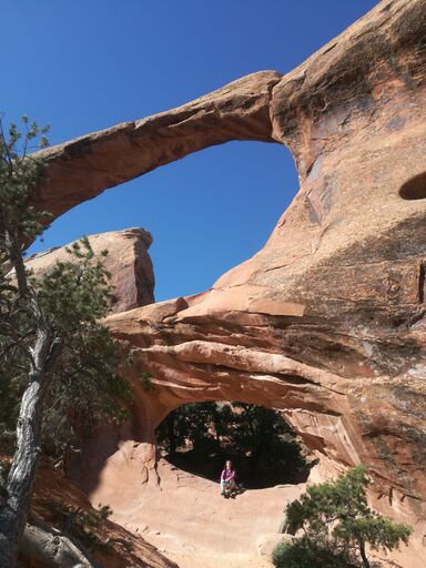
Last spring I did a 3-week tour of the Great American Southwest, and one of the absolute highlights was within the Arches National Park: W7U/GR-044 (5580). The hike was really pleasant, and the Double O arch is quite famous. The activation zone is directly behind the arch and up the hill. See details from trip reports on the summit page. My daughter and her old man made the hike without a problem, her mother opted out. But most people have no problem. Here’s a photo of my daughter sitting in the arch. We got there very early in the morning to 1. beat the heat 2. beat the crowds.
If the weather is good, and there’s little or no snow on top of the rocks, W7U/GR-044 is well worth the hike. The hike to Double O Arch is one of the most scenic routes in the National Park.
Please read my entire report on the summit page, as well as K7ODX’s report. It would be smart to use GPS to be sure you get to the right spot - see our coordinates.
If you decide to do that activation, please get up to the parking area early enough that you can be on the air when the sun is shining between the fins - this means an ETA near local noon. If you set up on the highest sand pile right below the “peak”, which may be necessary to be within the Activation Zone, you will be in the sun’s shadow in the afternoon, and it may be cold. A time of 10 or 11 AM might be more pleasant.
Hopefully you’ll have time to look at some of the other large arches out there - it’s an amazing place. Short side trips are needed to see most of these arches.
W7U/GR-051 looks interesting - point on top of a high cliff. The Google satellite image shows some kind of trail out there. You may be able to drive far enough out there, using the Kane Creek Road, on the east side of the River, that you could hike the rest of the way, several miles, but I’ve never been that far down that side of the River. Note that Highway 279 is on the WEST side, not what you need for that peak.
You will need a detailed map of the area with information on the various trails that lead up there.
You might consider contacting K0YO, Mike, the first activator. He lives out there, and that’s his territory.
The Knoll and Aztec Butte are great - both could be done together in several hours. The roads to those two are excellent paved highways. Those two peaks offer a winter bonus, so consider them! You may well earn that bonus…
We were just out in Moab in September to see all the parks and do some SOTA. Aztec Butte was a fairly easy hike with a steep part right at the end, and then a pretty easy activation. I even had cell phone service to spot. Abajo Peak was a drive up, but I took it pretty slow up and down so it took a while. I had spotty service there for spotting.
For non-SOTA things to do… After you check out the climbers on 279, keep driving. Just past the Williams Bottom campsite (we stayed here - pretty nice for a BLM campground) is the Poison Spider Mesa parking lot. If you park there, you can very easily hike to see dinosaur tracks and tons of petroglyphs on the cliffs. Unlike those at Wall Street, you can walk right up to them.
If you’re into dinosaurs, there’s also the Mill Canyon area. It’s on 191, before you get to the airport as you head out of town. I believe it’s signed on the highway, but it looks a little sketchy at first. You cross some tracks and skirt private land, but the signage says you’re okay as long as you keep driving. The first spot you come to is the dinosaur tracks near the Courthouse Rock campsite. It’s definitely worth seeing. You can also drive farther back along some increasingly sandy roads to another area where there’s fossils in the rock face.
I don’t know if they’re seasonal, but if not you definitely need to hit the quesadilla food truck in town.
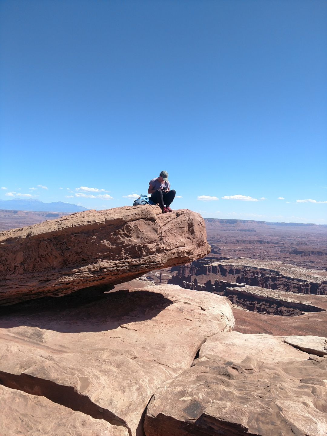
Another non-SOTA suggestion… Drive Canyonlands’ Island in the Sky scenic drive out to Grand View Point then walk the easy mile to the plateau end point. Certainly one of the most spectacular spots in the area. Probably best to check with the Island in the Sky visitor center on conditions before going. As I write this the scenic drive is open and clear all the way to Grand View but you might find a few patches of snow/ice on the shaded areas of the hike. If the hike is a problem the drive out to Grand View is well worth the effort in itself.