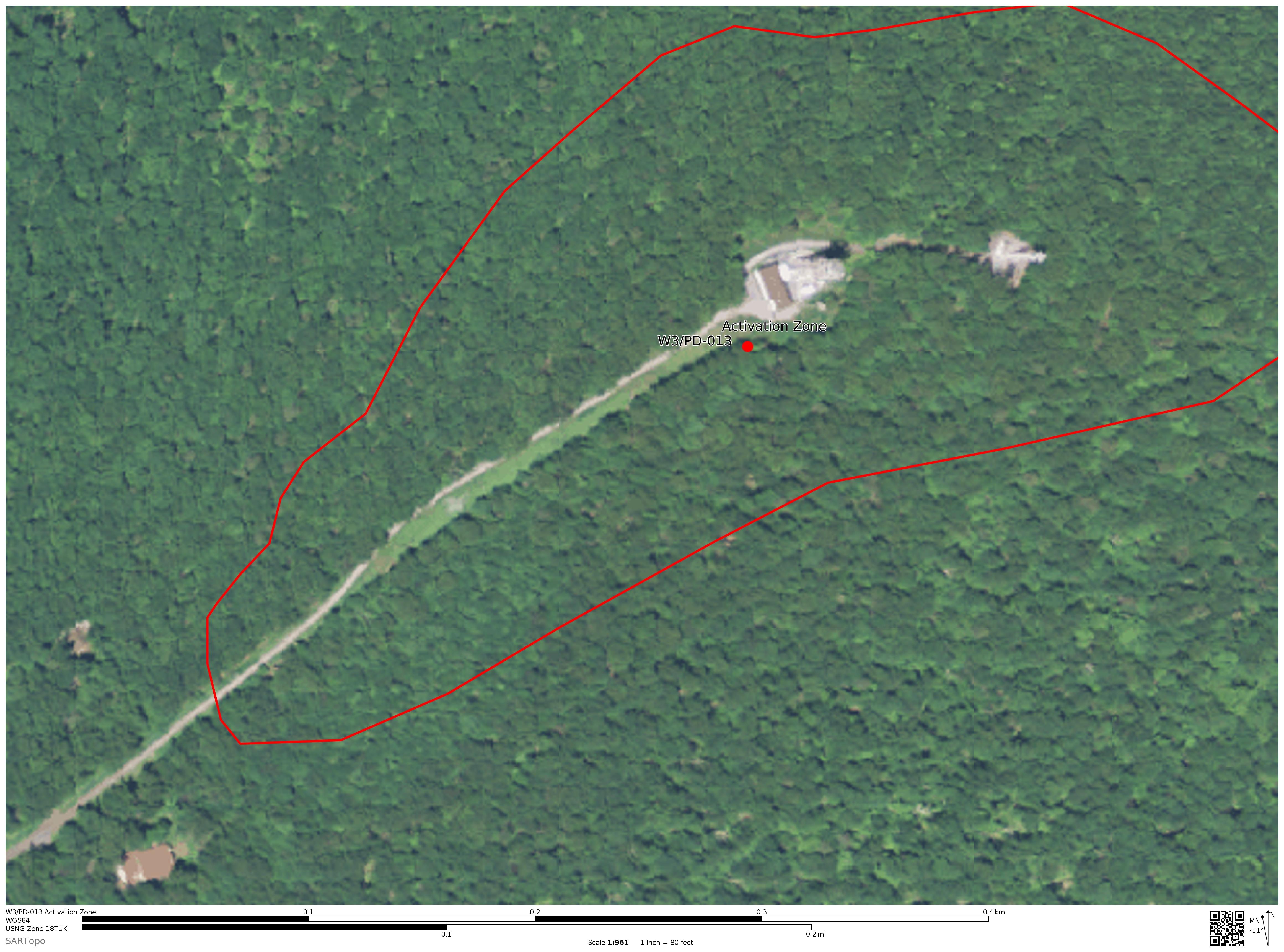
Looking at satellite imagery, I can’t see a gate along the roadway. Per section 3.7.1, paragraph 4, of the SOTA General Rules (April 2015), I used USGS topographic maps to find 25 meters down from the summit (~1480 feet) and drew a line around this contour. This should mark the activation zone for this summit (see image). Does the gate block access to within the zone?
Snowy Mtn W3/PD-007 is one of my favorites. Part of the drive is on dirt roads, but last time I was there they were in good condition. Park at a gate (39.8275, -77.5026) & take a nice easy ~3/4 mile hike up a dirt road. The summit has a nice spot to set up - a small clearing with good trees. There is a cell tower up top, but it still fairly pretty. (No views, just pretty surroundings).
Perhaps you already know, but you once you have Google Maps in satellite mode, you can click out of satellite mode and then choose the terrain option to see the topographical lines. That always helps me when I’m scouting.
Great, thanks for the insight. Seems like many people are suggesting this summit, in addition to PD-006, so I’ll add this to my list instead of PD-013.
Hoping all you guys will be chasing me over the weekend!
If you park before the Gate… you can walk the AT into the activation zone… near one of the cell towers and then wander over to the old fire tower… you’ll find the USGS marker near a large “dead” tree on the other end of the road that Jill mentioned…
Sorry, I’m back home now. I ended up in PA without any Internet connectivity so I only activated what I had information on. Also, I had the family with me and they were getting cranky so…

 so I only activated what I had information on. Also, I had the family with me and they were getting cranky so…