LIATHACH (WS43-Mullach an Rathain) on 11th September 2016
GM/WS-043-8 on 40-30m QRO & 2m-QRP
LIATHACH (Mullach an Rathain) 1,023m, the westernmost summit of the two.
(See separate report for LIATHACH (Spidean a Choire Leith) WS28 on 13-09-16)
Staying at Gairloch Hotel 9th to 19th September 2016.
Four activations: GM/WS-043; GM/WS-028; GM/WS-098 & GM/NS-001.
G(M)4YSS Unaccompanied.
SSEG Club-call GS0OOO/P & GM4YSS/P (the latter used for database).
All times BST (UTC plus 1hr, UOS)
RADIO EQUIPMENT:
HF-QRO:
FT817ND HF/VHF/UHF 5W Transceiver without internal batteries.
MX-P50M, 50 Watt HF Linear Amplifier.
Link dipole for 80-60-40-(30)-20m Bands
Loading coils for 160m (not used)
Four section x 5m home-brew CFC mast with 1m end sticks
Unitone 'D’ shape ear-cup headphones.
VHF QRP:
Baofeng UV-5R 2m/ 70cm, 5W-VHFM H/H with helical antenna (recent purchase - 200gm )
J-Pole for 2m-FM (not used)
Batteries:
One 5 Ah Li-Po (Part discharged). No spare carried
GPS:
Garmin GEKO-301
Pack weight:
9.7 kg (21.3 pounds) inc. 0.75 litre fluids, a light thermoball jacket and a black umbrella.
Introduction:
The base for this activation was the Gairloch Hotel (Bay Hotels/ Shearings) from 9th to 19th September 2016 inc.) and the stay was to contain our 41st wedding anniversary. The drive to the Torridon area (A832 - A896) is around 30 miles each way. The A832 down the side of Loch Maree is fast and straight. Despite the A896 being single track with passing places a lot of the way, it is lightly used except perhaps at weekends.
WS43 had been activated just once. The year was 2004 and ever since then it has just seven 2m band QSO’s to its name. Liathach has been in my sights for several years now. A big bulk of a mountain, it is loved by many and has two Munro sized SOTA tops; GM/WS-028 and WS-043. The pair were activated on 2m by Andy GM0ULD/P with a handful of QSO’s but they have not hitherto been offered to chasers outside the country. That fact would make them popular and unique to almost everybody.
It must have been quite an epic when Andy put both summits on in the same day way back in 2004 and I have long thought that I would be doing the same. However, when I got down to the finer points of planning it could easily be seen that a double HF multi-band operation is almost impossible to fit between hotel meals.
There were other considerations. My recent SOTA history, or rather the lack of it, had left me somewhat unfit for hill walking and either SOTA is a significant undertaking in its own right, without combining the two in one day. Owing to band conditions on HF being bad to useless all summer, I needed to carry HF equipment that would give me a reasonable signal. QRP is all you need when conditions are good but when the band is almost closed or plagued with QSB, it is never easy with 5 Watts.
Finally the route joining the two summits does not allow for a straightforward walk. There are pinnacles to negotiate and that would not sit well with the HF QRO gear to be carried. Going up one SOTA, along the intervening ridge and down the other commits you to a 2.5 km road march back to the car. The only viable alternative is a one day/ one summit strategy albeit with the requirement of making two ascents on two separate days totaling well over 2,000 metres. I planned to do the easiest first and that would be WS43 which is Liathach’s westernmost summit.
WX:
As can be expected for Scotland, the forecasts were not brilliant; in fact we were informed that they’d had a poor summer in the Northwest. The MWIS forecast warned of possible gusts of up to 60mph and rain for the first two days of the holiday. However, things can change rapidly and an opportunity for Sunday (11th) suddenly showed itself. It would still be too windy for comfort but no significant rain was expected until 6pm when a storm was set to roll in from the west.
Route and Execution:
After the hotel breakfast at 08:00, the start point was reached by 10:10. The drive takes less than 40 minutes but there were plenty of cars going down the A896 Torridon road. This being a Sunday, I was afraid that the 5-car parking spot that I’d sussed out the day before, would be full. It wasn’t; in fact mine was the only vehicle. On the bad side it was drizzling. On the plus side there was a rainbow.
Pausing for the customary litre of cold water, I was on my way but after a short distance, upon looking down, I saw ordinary shoes instead walking boots. Back to the car, rucksack off, shoes off and boots on. A second attempt at starting was made at 10:31. Idiot!
Credit goes to http://www.walkhighlands.co.uk/ for the GPS route used and I marked a few additions on the way. Today’s start point was opposite the tree-covered parking place beside the A896 at NG 91375 55387.
Initially the path is boggy and swings left at NG 9135 5545 where you might expect it to perhaps go straight on. However by the time you get a little higher, it’s easier to follow. You cross a wooden step stile over a deer fence at NG 9141 5575 and follow more rapidly uphill from there.
As is usually the case for Munro’s, there aren’t many places where you could go wrong in ‘normal’ weather but a few path waypoints are listed here: NG 9144 5598; NG 9153 5604; NG 9152 5620; NG 9161 56340; NG 9163 5668. Here the path bears left, continuing in more or less a straight line to NG 9123 5697 which was where I got some sunshine.
The character changes for the final steep few hundred feet where it is bare of vegetation with the zig-zag path consisting of loose shale, sand and rocks.
There is a minor scramble at NG 9122 5716 but it’s nothing to get excited about. After this you pass NG 9116 5745 and NG 9110 5756 until you reach a cairn at NG 9114 5765. With just 75 metres to go, the latter marks the junction between the ascent path and the summit ridge.
The truth is that I really thought I was in the wrong place. Where was the trig point I was expecting? Looking at the GPS I could see it was still trying to direct me elsewhere but more careful examination showed that was only a matter of 20 metres or so, which was due to the inaccuracy of the summit waypoint I was using.
Today I GPS’d the summit cairn at NG 91190 57673; the trig point having been removed for what looks like some years. In its place is a short stub of ‘T’ section steel sticking out of the ground. This, Bill G4WSB later informed me, was for mounting surveying instruments should they be needed. So why remove the trig I wonder?
Arrival time was 12:25. With frequent pauses to relieve aching thigh muscles, the climb had taken an hour and fifty four minutes.
LIATHACH (Mullach an Rathain), GM/WS-043, 8 pts, 12:25 to 15:56, 7 deg C, 25mph southerly wind. Overcast with occasional light drizzle. WAB-NG95 (No Trig), LOC-IO77GN. No Orange (EE) mobile phone coverage at summit or along all of the route but Vodaphone coverage most of the time.
The summit was smaller than I’d imagined with steeper sides but at least there was grass mixed with the rocks. It’s never easy to satisfactorily deploy a dipole on this kind of summit and really there were only three choices. I could erect it above the ridge path; something I avoid like the plague, or over to one side or the other. The north side was the obvious option as I would be out of the wind but it also had the steepest and longest drop.
Afraid of losing vital equipment; not only small items but possibly the entire rucksack or even the operator, I was forced to make the unenviable decision to sit in half a gale at 7 degrees C for up to four hours. The primaloft jacket I normally use in these situations had been rejected in favour of something lighter to balance the weight of radio kit required versus fitness and the height of the hill. The 400 gram protection I’d brought with me would not deal with these conditions for long so faced with the prospect of shivering my way through the activation, I settled down on a large sloping rock; more leaning than sitting. I didn’t even deploy the sit mat/ map case as it would have blown away all too easily.
Despite an included angle paralleling the paths that go on and off the summit, the dipole was already taking a beating and almost touching the ground at times. There would be little chance of satisfactorily adding 160m coils should I decide to later.
7.033 CW – 23 QSO’s:
With zero EE coverage, using the emergency phone (Vodaphone) a call to G4SSH soon had me spotted on 40m-CW but there was no sign of Roy on the band and he evidently couldn’t hear me. However, conditions were better than they had been of late and I was quickly faced with a pileup.
Working my way gradually through the callers with 50 Watts, the following entities were recorded in the log: ON; PA; HB9; G; F and DL. Many were old hands with a few I hadn’t heard of before. Reports were much better than expected, being all in the 559 – 599 region incoming and outgoing. One station reported QSB on my signal from 51 to 59 and one or two struggled, giving me 449, 339 or merely returned later when QSB allowed.
There certainly seemed like a lot of interest in working this mountain. Perhaps the thinking was, ‘If it only comes on the air every 12 years, I’d better grab it while I can.’
Eventually Roy G4SSH did work me with an exchange of 579 both ways. This couldn’t have happened up to a few days ago; conditions would have thwarted us. It took 45 minutes to work through the 23 callers but try as I may, I could not hear SP9AMH/ QRP well enough to work him. I decided that if there was sufficient time and I hadn’t frozen to death by then, I could try to add 30 metres next. In addition to Roy, Mark G0VOF helped with QSY’s. Almost half the stations worked were located in the UK, which bodes well for the return of more reliable inter-G propagation on 40m; expected any time now.
By the middle of this session I was making more sending errors than usual due to shivering.
7.128 SSB – 24 QSO’s:
I wasn’t doing enough to flatten the battery as there wouldn’t time, so retaining the 50 Watt power setting, I started by working Bill G4WSB. This is when he gave me the information about the trig point removal, which he’d gleaned from the trig pointing website.
Countries worked in SSB: G; EA; PA; HB9; GW and F/. Two thirds of stations worked were in the UK and there was QSB and also QRM at times.
Signals were mainly good; the weaker reports coming from overseas. Brian G8ADD seemed extra pleased to work a mountain with which he is personally acquainted. I worked Dave F/G6LKB on holiday in France and Tom M0RMY/M on the M42 with a really good signal for a mobile.
Mark G0VOF alerted me to the fact that I was being called by a portable station. Adjacent channel QRM at this time was very bad and regrettably, after several tries Caroline MM3ZCB/P failed to get a report over from an SS summit. Too close perhaps?
As I was QSY’ing the dipole for 30m, along came the only visitors of the day comprising a group of 6 or 7 lads who’d just come over the pinnacles. Naturally with a crosswind blowing this strongly, I asked about their experience but they seemed to play it down in comparison to the ridge around Lord Berkley’s Seat on An Teallach. I was thankful that I wouldn’t being going the way they’d come.
10.118.8 CW - 9 QSO’s:
The activity with the dipole at least delayed the onset of further shivering but my hands were still a little numb. Partly because of my failure to work the SP/ QRP station on 7 MHz CW, this session on 30m was inserted. As before, power was 50 Watts into the offset 20m/ 40m dipole.
I heard nothing of the QRP station SP9AMH, but at least this QSY gave an opportunity for ten more stations to log WS43 on 30m. Surprisingly Roy G4SSH was the first of these. There followed: DF2AR; F6EAX; G0HIO; ON6LEO; G4AFI; PA0INA (Frans); DF4FDM and PA0SKP. DF4FDM!? Just noticed, that’s our old friend Fritz who I haven’t worked for a few years. I didn’t cotton on at the time due to discomfort. Sorry Fritz!
Reports were mostly 579 to 599. Roy and Frans both gave me 339 and the frequency dried up after 15 minutes.
145.575 FM - 1 QSO:
With energy sapped from climbing my first Munro in a year and fighting the windchill, all I could do was to pack up the HF gear and whip my new Baefeng UV-5R handheld out of the rucksack side pocket. Going up to the windswept summit cairn with Ray GM3PIL in mind, I called on the Inverness simplex frequency of 145.575. Sadly Ray could just about tell I was there but little more. I changed position and he gave me ‘45’ QSL’ing my 57. At least we’d made the contact but there was no chance of a chat. I was suffering too much anyway.
I had the 160m loading coils with me but had been reticent about employing them. The way it was set on a steep slope in a high wind, the dipole would have sagged to the ground and I would have had to fight with it. I wasn’t too disappointed when Ray told me that after having some work done at the house, his Top Band vertical had not been re-erected. After saying 73, I tried a quick call on .575. Nothing was heard but I had reached my time deadline anyway.
The Descent:
After selecting three or four rock samples, a descent is most welcome when chilled to the bone but care was required on the steep, loose slope. I was back at the car for 17:15, driving away 5 minutes later and back to Gairloch in 37 minutes. It was something of a relief as I felt somewhat battered.
QSO’s:
QSO’s:
23 on 40m CW
24 on 40m SSB
9 on 30m CW
1 on 2m FM
Total: 57
Ascent & distance: 1,003m (3,291ft) – 5.8 km (3.6 miles).
Elapsed times. Walking times. Up: 1hr-54min. Down: 1hr-19min. Summit time: 3hr-31min. Gross time: 6hr-44min.
Observations:
Another fine mountain knocked off but since Liathach consists of two Munros and two SOTA summits, in reality only half a mountain.
With generally poor weather forecasts for the entire holiday, some activations have to be undertaken in less than ideal conditions. I this case wind speed was the issue, simply because there was little choice but to sit in the brisk, 7 degree C air-stream. However, I was lucky with the rain which was minimal most of the time. More determined rain associated with a storm front predicted for around 6pm started building up early in the descent at around 4pm. Drizzle at first, it got heavier before reaching the car but that was nothing compared with the evening rainfall. By then I didn’t care.
Warm-weather acclimatized as I was after the summer, the cold conditions impacted on operating fourfold. Firstly CW sending was disrupted due to shivering. The same applied to my voice in the SSB sessions. Slowing down with age as it is, my brain was further affected by wind chill. I was thinking slower and speaking slower. Finally logging was much harder. Held in a semi-numb shaking hand, the pencil was moving an inch either way making the log almost illegible at times and it didn’t help that it was blowing up off the backing board ever time my hand went away to operate. Nothing unusual I suppose but that’s how I felt.
Out of the two tops, WS43 is certainly the easier option as the path delivers you directly to the summit. The only issue was the loose ground further up but there are many mountains which are similar especially in GM and elsewhere.
Based on the recent past, band conditions were much better than could have been predicted and inter-G was not only possible but quite efficient, despite QSB. Roy G4SSH, who I work daily around home on 2m-FM, has kept me abreast of SOTA-specific band conditions all summer. From what I’ve heard, it’s amazing that he manages to get all the chaser points he does. Recently 40m has been showing a few ‘green shoots’ of recovery which I was grateful for on this activation.
After suggesting 60m as an alternative, should we be unable to make contact, I worked Roy easily on 40m and to my surprise on 30m too. As my son Phil mentioned yesterday, I was reaping the benefits of standing hundreds of miles north of my usual SOTA hunting grounds and 60m wasn’t needed.
When up in Scotland I like to finish with a 2m contact or two. Ray GM3PIL (near Nairn) had asked via email whether I would be coming up to GM this year. We had exchanged a few messages and Ray was fully briefed. Even so, his coming back within 30 seconds of a random call using my 5 Watt handie and a rubber duck 90 km distant was pretty impressive. Ray has a system that alerts him to incoming calls on 145.575. He can be in the house or in the garden. Either way he hears the call which I think is relayed on 70cm.
Along with one or two other local GM’s over the past few years, Ray and I have a history of setting up 160m QSO’s when I’m activating in northern Scotland. Ray’s antenna is down this year so no 160m operation was attempted. In this case I wasn’t concerned or disappointed due to the cold conditions when all I wanted to do was get down nearer sea level. The antenna would have sagged to the ground anyway, the minute I’d fitted the coils and re-erecting it would have eaten into time I didn’t have.
In a sentence; though by no means dire, this activation reminded me once again of how hard SOTA activating can be.
Thanks to all stations worked and to those who spotted me, namely Roy G4SSH; G0VOF; G0RQL and SP9AMH. Thanks to Roy G4SSH for telephone liaison, alerts, spots and band condition advice. Thanks to Ray GM3PIL for the sole 2m-FM QSO.
73, John G(M)4YSS,
Also using SSEG GS0OOO/P.
(This summit will be entered under GM4YSS/P for SOTA purposes)
GM/WS-028, GM/WS-098 & GM/NS-001 reports to follow in due course.
Photos: 4-8-11-18-34-46-52-67-69-76-77 (all ‘a’) &79.

Above: Start of WS43 climb from A896. (Rainbow)
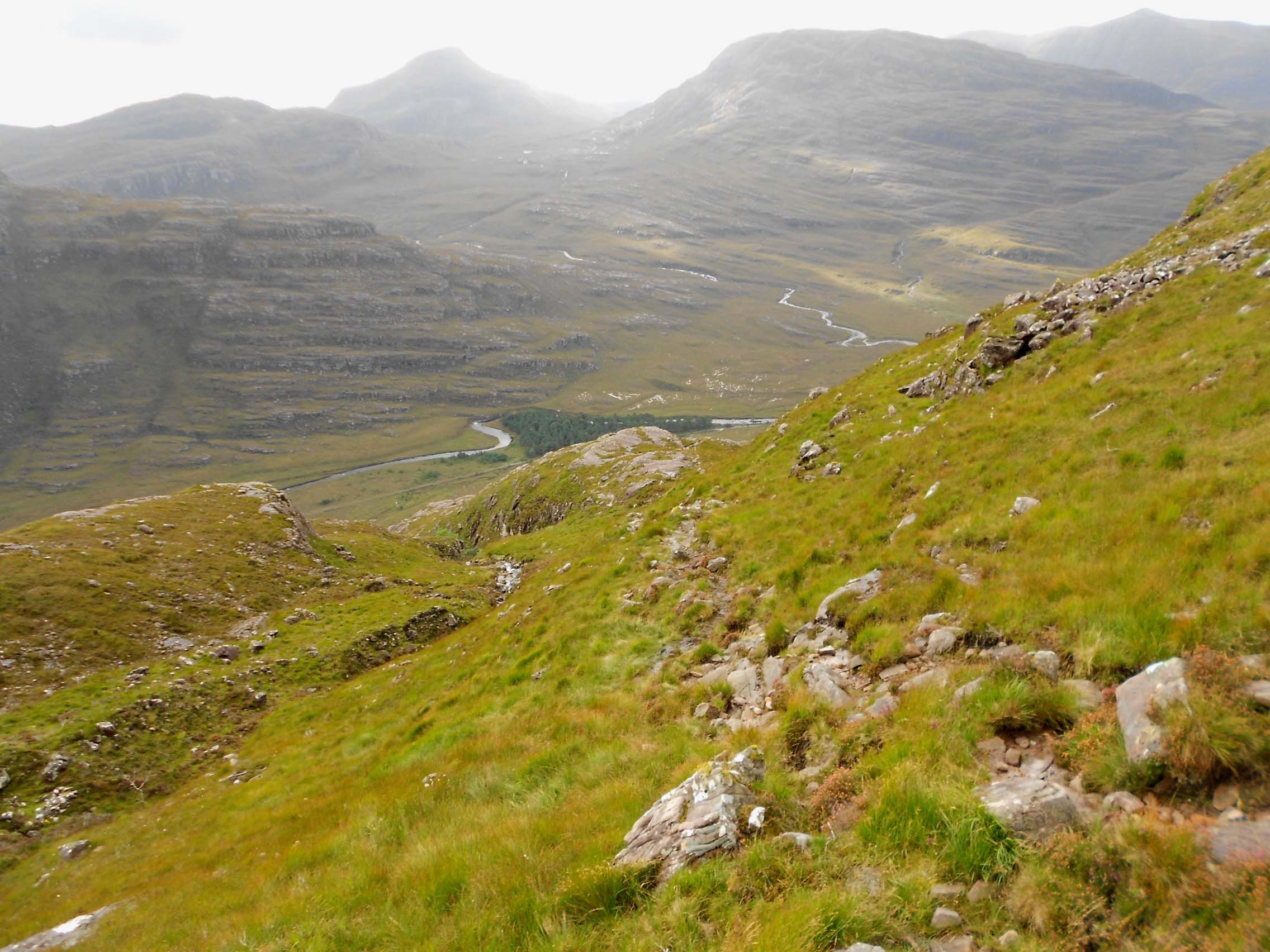
Above: Looking back to the start of the WS43 climb & the A896 road.
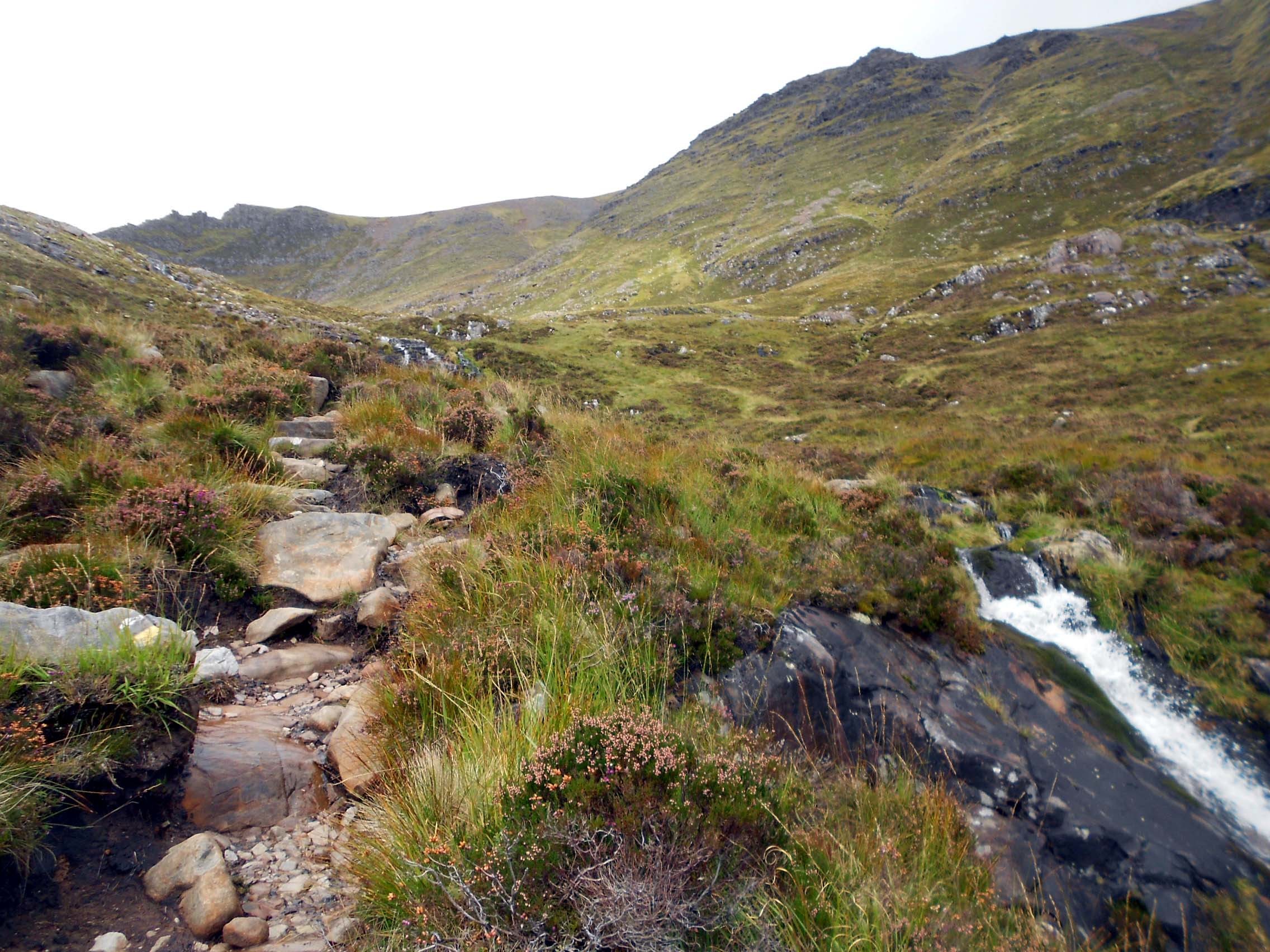
Above: Looking up the path to WS43.
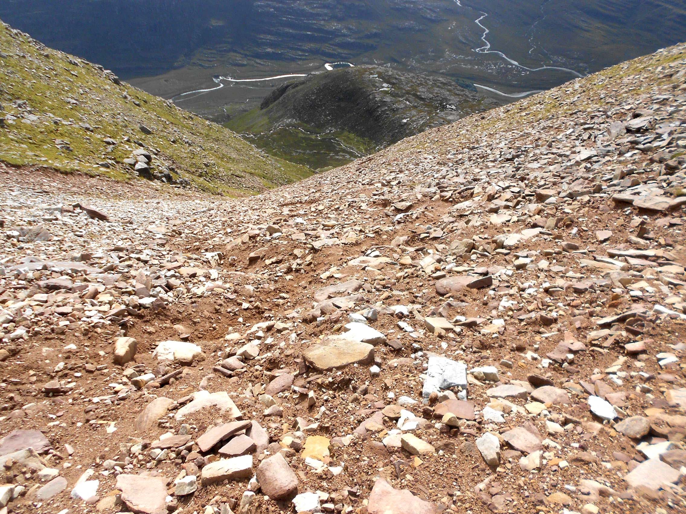
Above: The character changes further up on the way to the ridge. Looking back down the path.
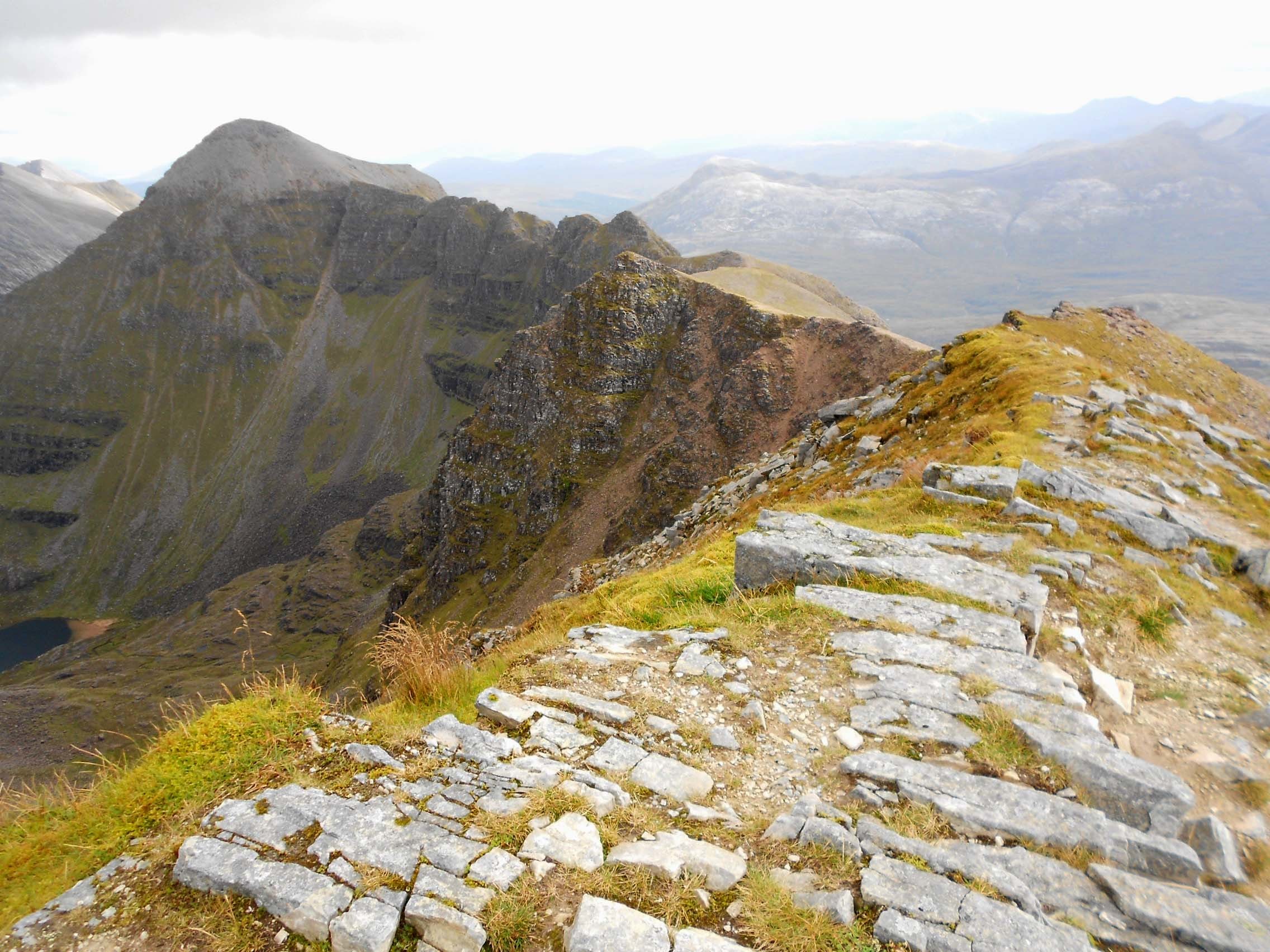
Above: At the summit of WS43 looking to WS28 (left) and the path over the intervening pinnacles. Beinn Eighe in left background.
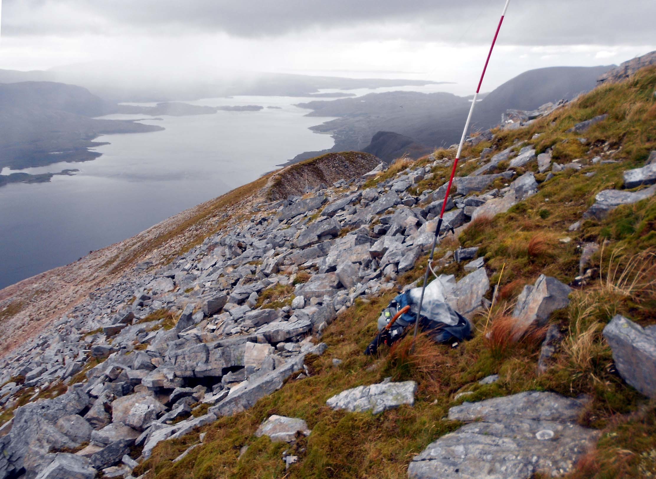
Above: Windswept WS43 activation at 7C, overlooking Loch Torridon.
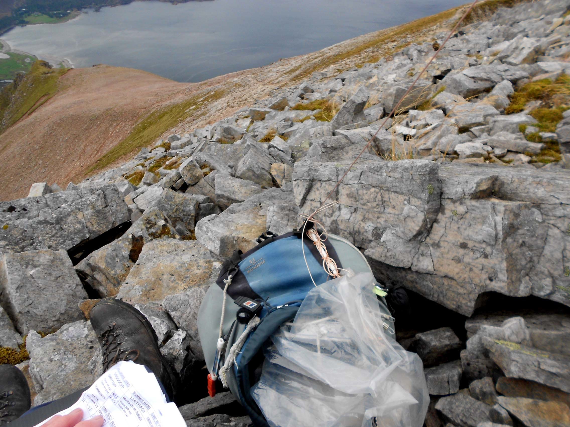
Above: Holding onto the all important log. WS43 activation overlooking Loch Torridon and some of the ascent path.
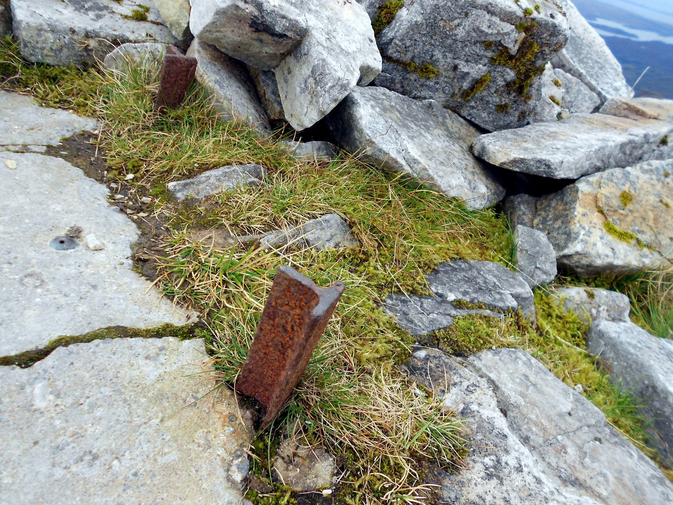
Above: Summit of WS43. As advised by Bill G4WSB, trig point has long gone. Just these two stubs of ‘T’ section steel remain.

Above: WS43 activation looking roughly SE.
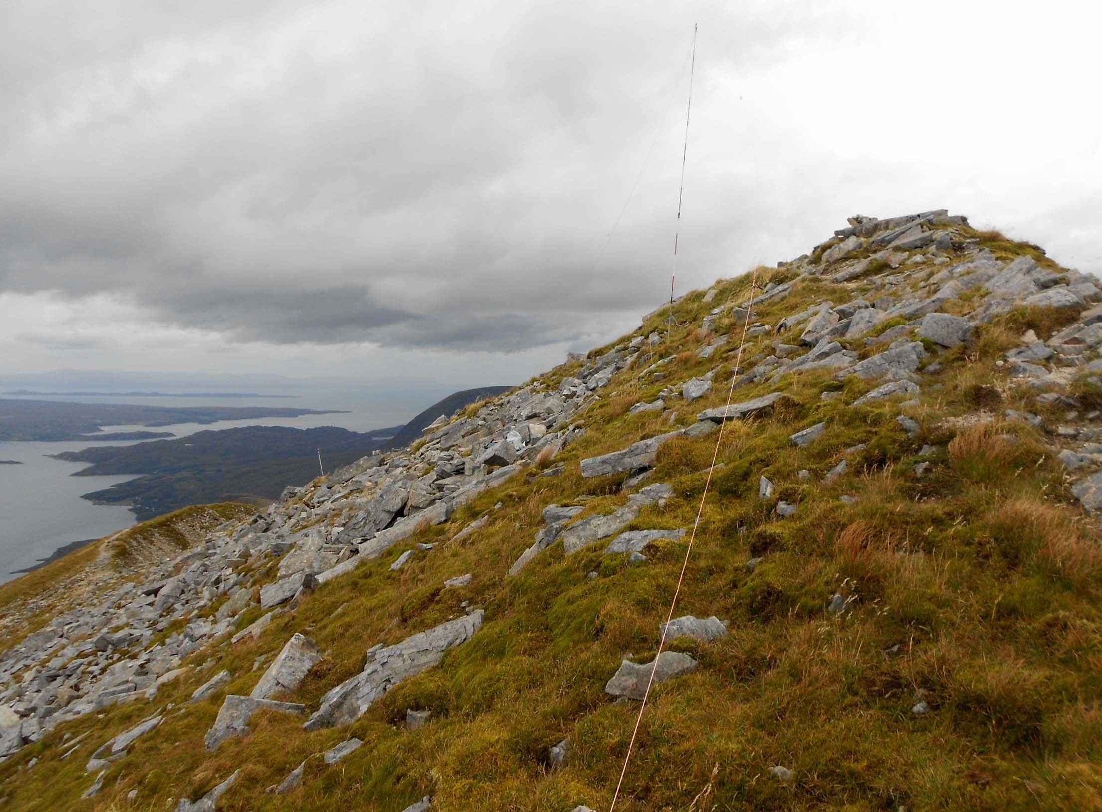
Above: WS43 activation looking roughly west.
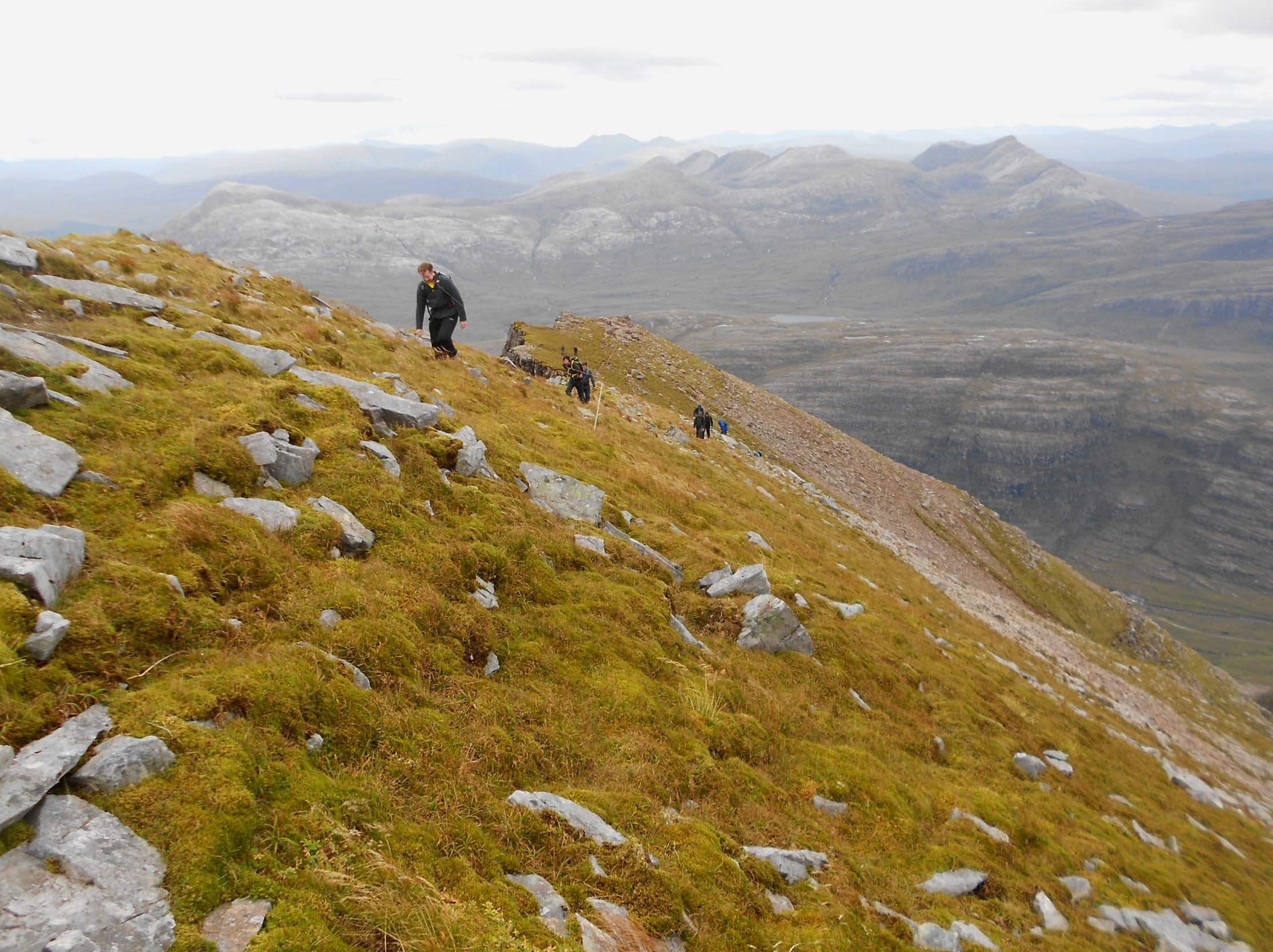
Above: WS43. Fearless visitors from over the pinnacles in high winds.

Above: WS43 activation. 10.118 to finish on HF.