Possibly a similar situation to the Hensbarrow in Cornwall. The 2 hills in question are Mynydd Machen GW/SW-030 and the nearby HuMP Mynydd y Grug. At the moment Mynydd Machen GW/SW-030 is the official Marilyn with a height of 362m and Mynydd y Grug’s official height is 355m, however the official summit of Mynydd y Grug is inaccessible as it covered with a spoil heap which increases the summit height of Mynydd y Grug to 375m which makes it higher than Mynydd Machen GW/SW-030. The OS Map even shows 360m and 370m contours lines of Mynydd y Grug. At the moment this Marilyn and HuMP won’t be changing over yet as Alan Dawson says that Mynydd y Grug is more of a slag heap then a hill so fails the test to be a Marilyn. Here is his post below.
"One I am aware of is Mynydd Machen, which is probably lower than Mynydd
y Grug near Caerphilly, a natural hill with an artificial topping.
I have not been there personally but to me it looks more like a slag
heap than a hill and therefore it does not pass the test required to be
a Marilyn. It may mature, as some things and some thoughts do.
Further thought and inspection of Mynydd y Grug will be required in
future. Mynydd Machen GW/SW-030 is higher than the inaccessible natural summit (In
Pit or In Tip) but lower than the new summit, so this is one of many
grey areas, literally:
Alan"
However there looks to be vegetation coming though the spoil heap so that is a good chance of Mynydd y Grug becoming a Marilyn in the future of Mynydd Machen GW/SW-030 getting demoted to a HuMP.
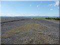
I was on Mynydd Machin a couple of years ago and it is strange activating a summit and looking up to higher ground at the same time. However, the higher ground is virtually all slag heap as witnessed by the scars created where is has been used by mountain bikers. The dispite the fact that there is some vegetation growing there, it is a long way from being a ‘natural’ part of the countryside.
I just turned out an old map and it looks like I was wrong and it was a tip for the Bedwas colliery which I think was a more recent closure. Still, as I recall it was quite a pleasant walk up from the former sidings for Nine Mile Point, where they have made it into a country park. On that score it will probably beat Mynydd Machen should it ever get promoted.
I must say that I find it odd that artificial hills are considered in the same way as natural ones, and doing this only when vegetation appears seems to be even more peculiar. There’s a 499m summit near me. A trailer load of soil and a packet of grass seed and I could have me a 2-pointer.
What we need is something to climb up. Just so long as it’s not here today and gone tomorrow. That’s why artificial features are only accepted after they are well and truly established. Ancient burial mounds fall into that category for instance. For Mynydd y Grug it’s a case of waiting to be sure they’re not going to take it away, as has happened with numerous other colliery tips. I was checking one in Estonia (I think) recently and that has been properly landscaped - big money so I’m sure they won’t change their mind. So that one would qualify.
It doesn’t work quite like that. You can green up a mature tip by spreading grass seed, but it takes quite a long time for a mature cover of vegetation to develope. The MT faced this problem some years ago with a tip in Belgium. It had been out of use for a long time and had a mature covering of vegetation which included woody shrubs. These protect against erosion so it was decided that it was a permanent feature and was accepted as a summit. Hensbarrow downs appears to have been stabilised in the same way and is accepable on our criteria even if it hadn’t received the RHB seal of approval - though of course in the case of the UK the RHB list is paramount. Your 499m summit would need a lot of soil, grass seed, shrubs, and a lot of patience!
You could carry up a trailer-load of mature shrubs & trees in containers and do a bit of creative gardening - might even get an award from the Royal Horticultural Society for your garden design