EA8/TF activity in November 2018

Me and my XYL spent last two weeks in November on Tenerife in Canary islands, as we usualy do for last few years. This time I packed my FT-817 with Windcamp battery kit and original NiMH as a spare, and a few antennas: 20m dipole, 40-10m linked EFHW with Ilertenna tuner and telescopic for V/UHF. At home I identified a few not that difficult summits that I wanted to activate, but everything really depended on the weather and my XYL. She is surprisingly supportive and as long as the hike is not too difficult, she’s with me. Even better if there are geocaches along the way and internet signal on the summit, to keep her busy with her e-books while I play radio. She even helps me set up and tear down the antennas! Yes, I’m lucky, I know.

In the first week the weather was not that great: clouds, showers and a bit chilly, we even had some snow up in the mountains. In the second week the weather improved. It stopped raining and temperatures rose to the levels that we are used to. But that’s the winter weather there, nothing unusual.

First summit that I activated was Cruz de Gala (EA8/TF-007), a 10-pointer that is very easy to reach. There is a paved road that leads to the top, but is “Solo vehiculos autorizados”. We left our car on a small parking just off the main road and hiked to the top, which took us about half an hour. On the top there is a large communications tower, but I didn’t experience any QRM. There’s more than enough space for setting up the wire antenna and even a convenient post to hold the antenna support.
The timing and conditions were right. I set up dipole for 14MHz and started with S2S QSO to HB9. After self-spot I made a lot of SOTA QSOs to both sides of Atlantic and even a couple non-SOTA to US. When pile-up cleared, I switched to EFHW for 18MHz, but nobody came back to my calls even after a spot. I was very happy with the results of this activation. On the way back we hiked around the mountain to collect some geocaches.

On the parking, summit is where the towers are in the center.

Calling CQ SOTA

Excellent view, on the horizon islands La Gomera (EA8/GO) to the left and La Palma (EA8/LP) to the right.

8 Likes

A few days later we first visited Montaña de la Atalaya (EA8/TF-013), worth only 4 points, but even easier to reach than previous summit. We parked the car at the horse farm on the ridge below the summit and walked on the track which is in part quite steep. It took us about 25 minutes. The summit itself is covered with Eucalyptus forest and on the eastern side there’s a large clearing (a field) with more than enough space to set up the antenna. There was no convenient support for the antenna pole and I had to improvise a little.
This time I started on 18MHz and made a few QSOs (one of them to US) and later switched to 14MHz to make a few more, even a S2S to S5. The total number of contacts was less than half of previous activation.

La Laguna (left) and Tenerife Norte/Los Rodeos Airport (right). Gran Canaria (EA8/GC) on horizon.

Way up (right side), horse farm/parking (center right). Pico del Teide (EA8/TF-001) center.

EFHW

Dipole

Our second summit on the same day was Montaña de Güímar (EA8/TF-018), also known as Montaña Grande or Montaña de Socorro. It’s worth only 1 point, but quite difficult to climb. There are a few geocaches on and around the mountain, so we set up for a longer hike. We left the car on the nothern corner of Puertito de Güímar and hiked over the plain below the mountain, called Malpais de Güímar. To climb the mountain, there are two main routes. As far as we know, both are almost the same. We selected the eastern one. It is quite wide and covered with deep layer of volcanic gravel, where you make two steps up an slip one step back down. Quite steep and tiresome to walk on, so we made a wider detour on more solid ground. On the other hand, with right technique you get back down very fast. I wondered why there is such a wide path leading up there and read somewhere that apparently every year there is a pilgrimage, when up to 30000 people climb the mountain. Once you reach the crater rim, the way to the top is easy. On the top there’s convenient (overturned) summit marker to fix the antenna pole to it and no vegetation to obstruct the wires.
It was already late in the day when I set up the station. I made only five QSOs on 20m, one of them to US. Still good enough. I noticed one weird thing: there was strong (S9+) periodic QRM that wiped almost entire band. After the activation we walked through Malpais and returned via coastal path. We reached the car already in the dark.

Malpais de GĂĽĂ­mar, our goal in sight.

Calling CQ

6 Likes

In a few days the weather improved enough that the temperatures up in Caldera raised and snow dissappeared everywhere but on Pico del Teide. We decided to climb Montaña del Cedro (EA8/TF-005) for 10 points. I hoped for another ten pointer (nearby EA8/TF-006) on that day. It could be possible, but we stayed in bed way too long for that. We were on vacation after all!

Climbing Montaña del Cedro is more difficult than the summits I activated previously. We made the hike even longer by visiting some of the nearby geocaches. We left our car on the nearest Mirador at the main road, to the north from the summit. It is also the trailhead of some of the official hiking trails. The approach to the mountain is part of one of the trails and at the certain point you have to leave the trail and start to climb. From this side there are two main trails that lead up the mountain: you can start climbing the northern slope as soon you reach the mountain and then follow the ridge, or you can walk another 200-300m until you reach the end of the barrier on the right side, and take the trail along the eastern slope. Both trails eventually merge on the ridge before the final ascent to the summit. We took the first option as there are some geocaches hidden along the way. Judging by the tracks on the ground the trail seems quite well visited. It is marked by blue dots. I read somewhere that these marks are unofficial, made by volunteers, and park rangers apparenty strongly disapprove them. Terrain is not that difficult but you have to watch your step because of many stones and rocks on the trail. As everywhere on the island, the climbs are quite steep. The summit is rocky. There is plenty of space for the wires and a large pile of stones to hold the antenna support (yes, I know that using the cairn may be unacceptable in some locations, but we were alone up there and I moved only a few stones and put them back as they were before). One disadvantage may be that the short path to Europe from this summit leads directly over Pico del Teide, which is about 1500m higher, with its peak only 7km away.
I deployed my dipole for 14MHz and made eight QSOs. Seven of them were to Europe, but one to US was absolute highlight of the whole trip. When the guy gave me “57 here in California” I disregarded it, thinking that I don’t hear it correctly. Only later, back in hotel when i checked his QRZ page, I realized that this was really 9400 km QSO. With only 5W! It may be trivial for you guys with amplifiers, beams and antenna farms and stuff, but for me and my equipment it’s absolutely amazing! After activation we descended from the summit, hiked around the mountain past the fire watchtower and on the marked trails back to the car, collecting a few geocaches along the way. We got back to the parking just before the sunset. There were a few busses full of tourists, who paid pretty money for a trip to Caldera to watch the sun setting into the low clouds, holding glasses of champagne in their hands.

Getting ready.

Calling CQ. Left Pico del Teide (EA8/TF-001) and Pico Viejo (both in the clouds), right on the Caldera rim El Sombrero (EA8/TF-004), Guajara (EA8/TF-002) and Roque de la Grieta (EA8/TF-003)

Montaña del Cedro (EA8/TF-005), as seen on our way back.

We couldn’t resist, neither can I now…

6 Likes

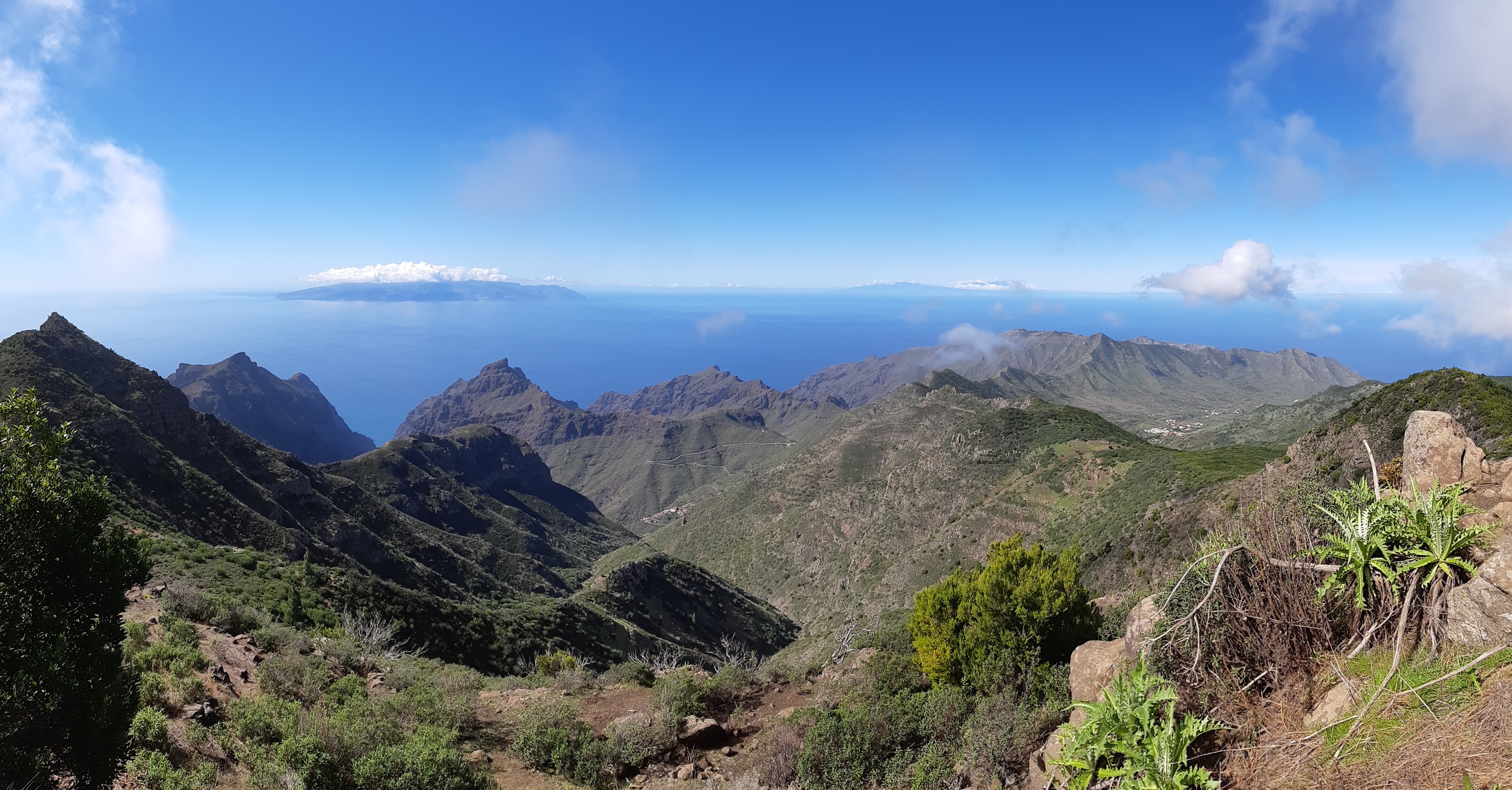
My next activations were two not that difficult summits in Anaga mountains in the north. The clouds that covered this part of the island on previous days have cleared and we decided to hike around Roque de Taborno, looking for geocaches that were hidden since our last visit.

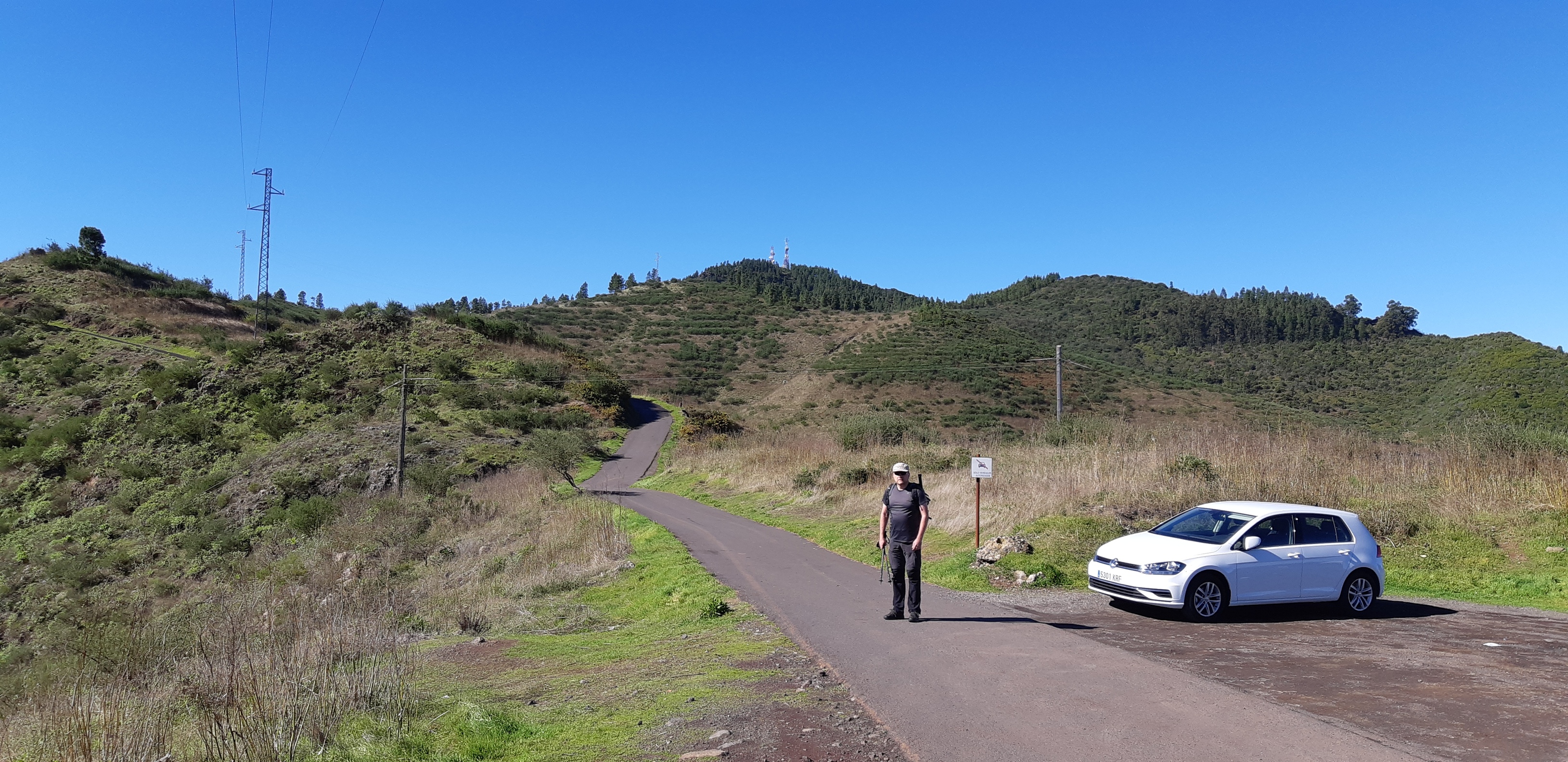
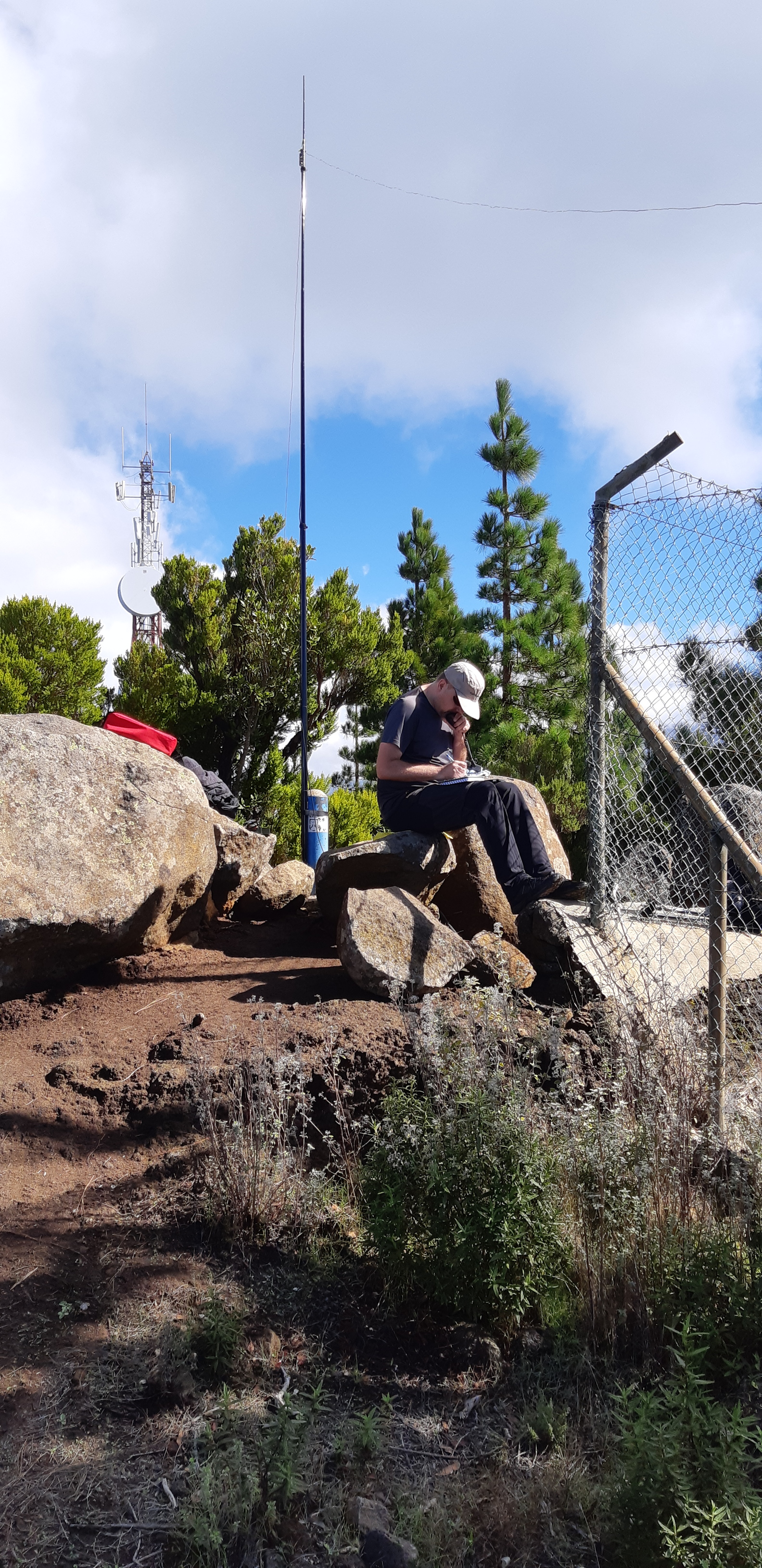
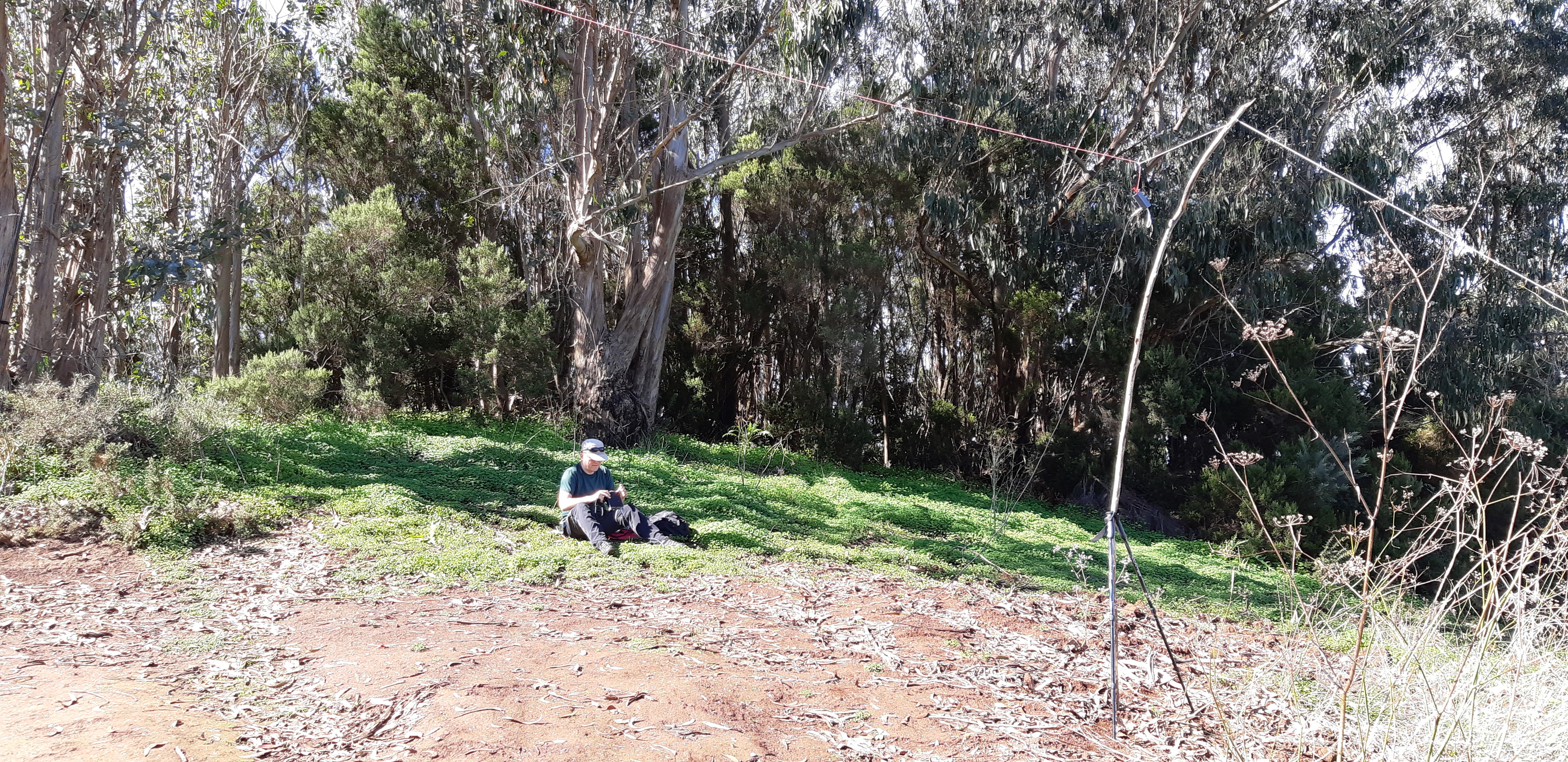
On the way there we made first stop at Cruz de Taborno (EA8/TF-008), worth 8 points. The summit is fenced off and occupied by Civil aviation authority, which has ATC radar station and radio navigation equipment there, and surrounded by dense Anaga forest. The site looked unoccupied, but under heavy surveillance. I didn’t notice any QRM from the transmitters. Short paved road leads from the closest road junction up to the gates of CAA site. There is enough space and I thought about setting my station there, just in front of the gates, but decided against it as the summit with its huge radar dome obstructed the view to the north. We tried to find the way around the CAA site to the north side, but gave up because of the dense vegetation, that is so typical for the Anaga mountains. We went back to the main road and drove a few hundred meters to the spot where official hiking trail crosses the main road. There are only a few parking possibilities along the main road and we were lucky to get one for our car. We took the path leading around the CAA site along its fence. It’s only a short hike and as soon the trail starts to descend, you get out of the AZ. I tried to find a suitable spot to extend the antenna support fully and be able to extend the dipole wires in the right direction towards EU but couldn’t find one as the trees there are short and quite dense. Eventually I settled for a place just off the trail. I could extend the pole for a few meters and stretch the dipole wires without touching the plants. This way the antenna was under the tree canopy but at least had unobscured view to the north. This was the only summit where we had problem with cell phone coverage. I had to walk along the CAA site fence where it is the lowest, hold my phone up in the air to get the signal good enough and send the spot. I made a few QSOs on 14MHz. Good enough.

Dense vegetation with low canopy. Very little space for the dipole antenna. Vertical may be easier to set up.

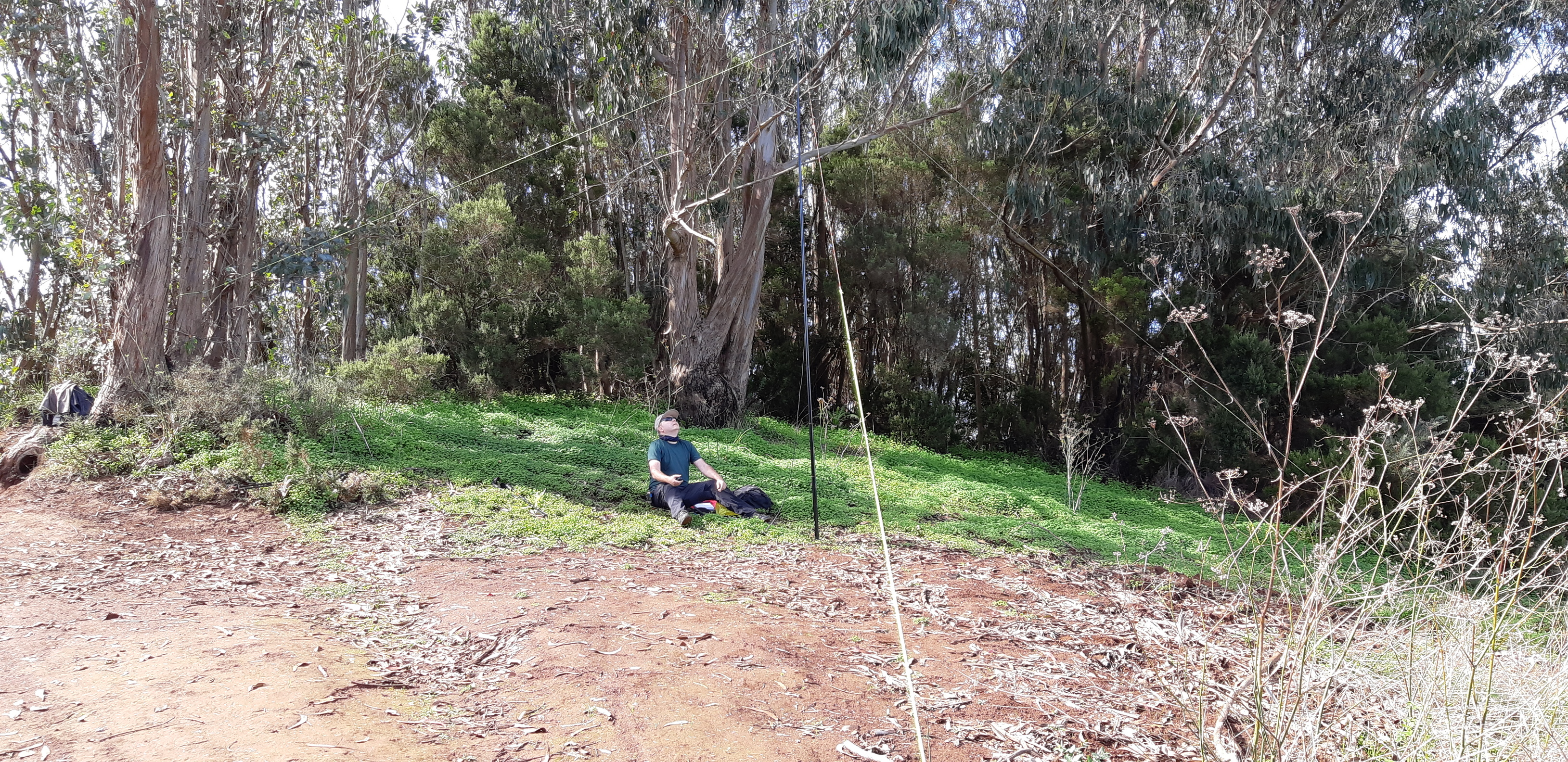
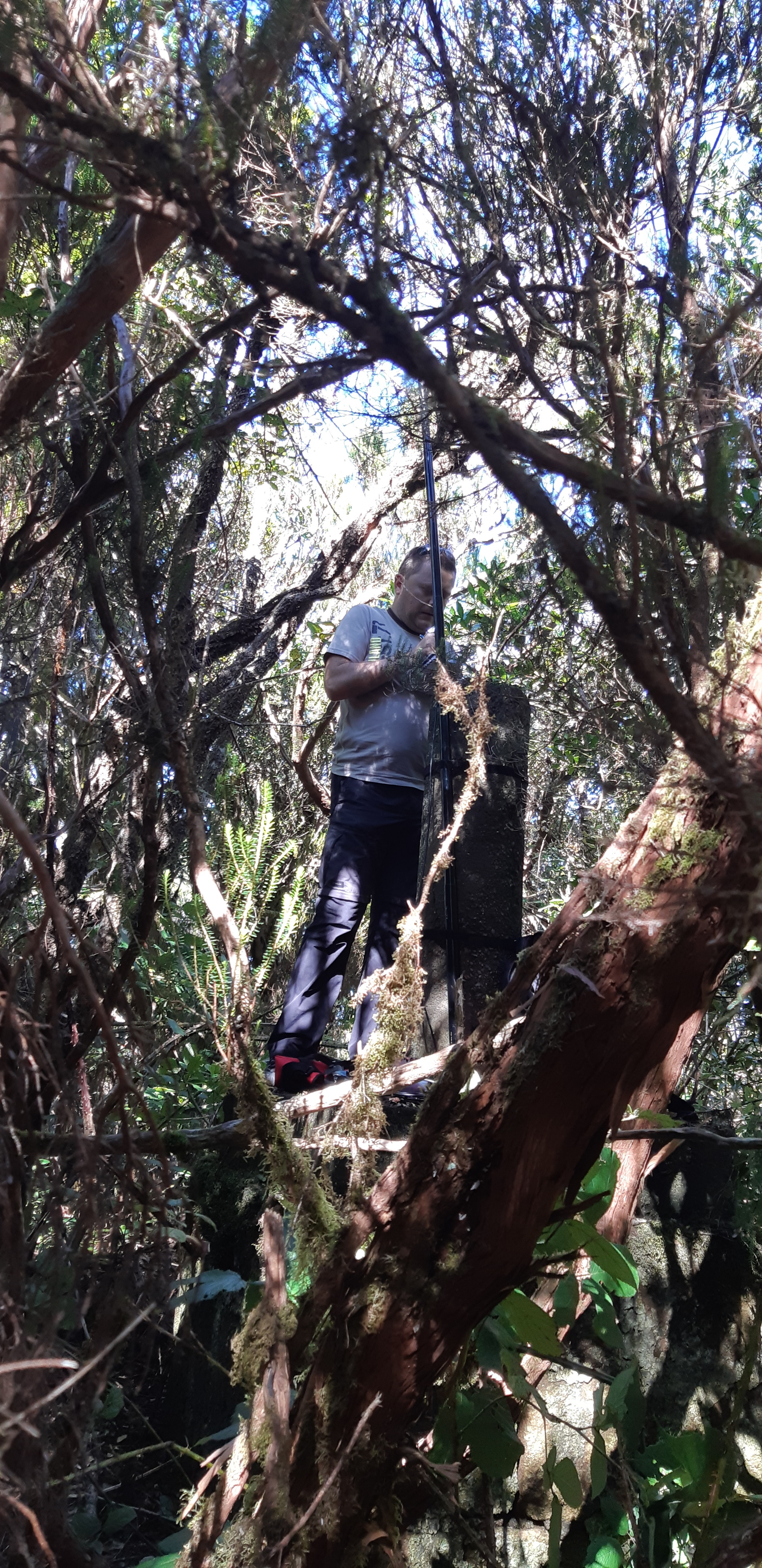
My next activation was Pico de los Pasos (EA8/TF-011), a six-pointer. We drove from previous activation to the parking at small Casa forestal, where one of official hiking trails, that crisscross the Anaga mountains, begins. The trail leads through typical Anaga forest, which covers the entire area, along the southern slope of the Pico de los Pasos and never opens to the north, at least in and near AZ. At the highest point relative to the summit we left the trail and turned uphill. This time we didn’t climb stones and rocks, but over and around short, dense and twisted tree trunks and tried to avoid what looked like blackberry stems, equiped with sharp and catchy thorns. After good ten minutes of bushwhacking we reached the summit marker.
The vegetation around the marker was so dense (thorns!) that there was really no option to extend the dipole. With our hiking poles we pushed away the blackberry stems that covered the summit marker and I climbed up. I attached the end of one leg of 14MHz dipole to the tip of my fishing pole/antenna support and extended it verticaly through dense tree canopy. I threw the other dipole leg roughly into the direction of EU hoping that it doesn’t get stuck in the bushes. I hoped that this way I created some sort of vertical antenna, which may be inefficient but good enough to get me some QSOs. As squatting on the summit marker was quite uncomfortable, I didn’t stay there much longer than necessary after the initial pileup ended. On our way back we again made a short detour to look for a few geocaches.

Not much space up there. Vertical is the only option.

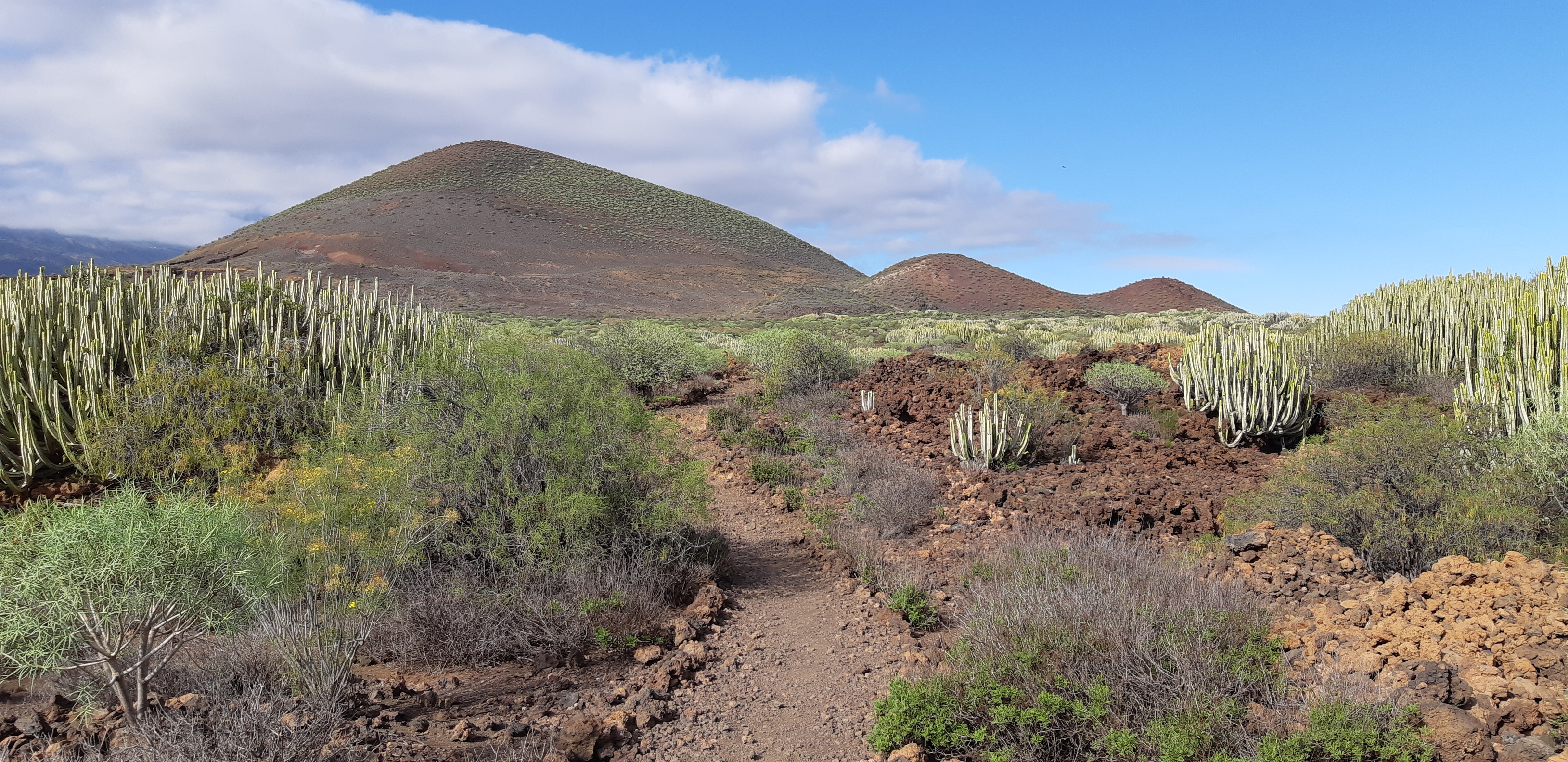
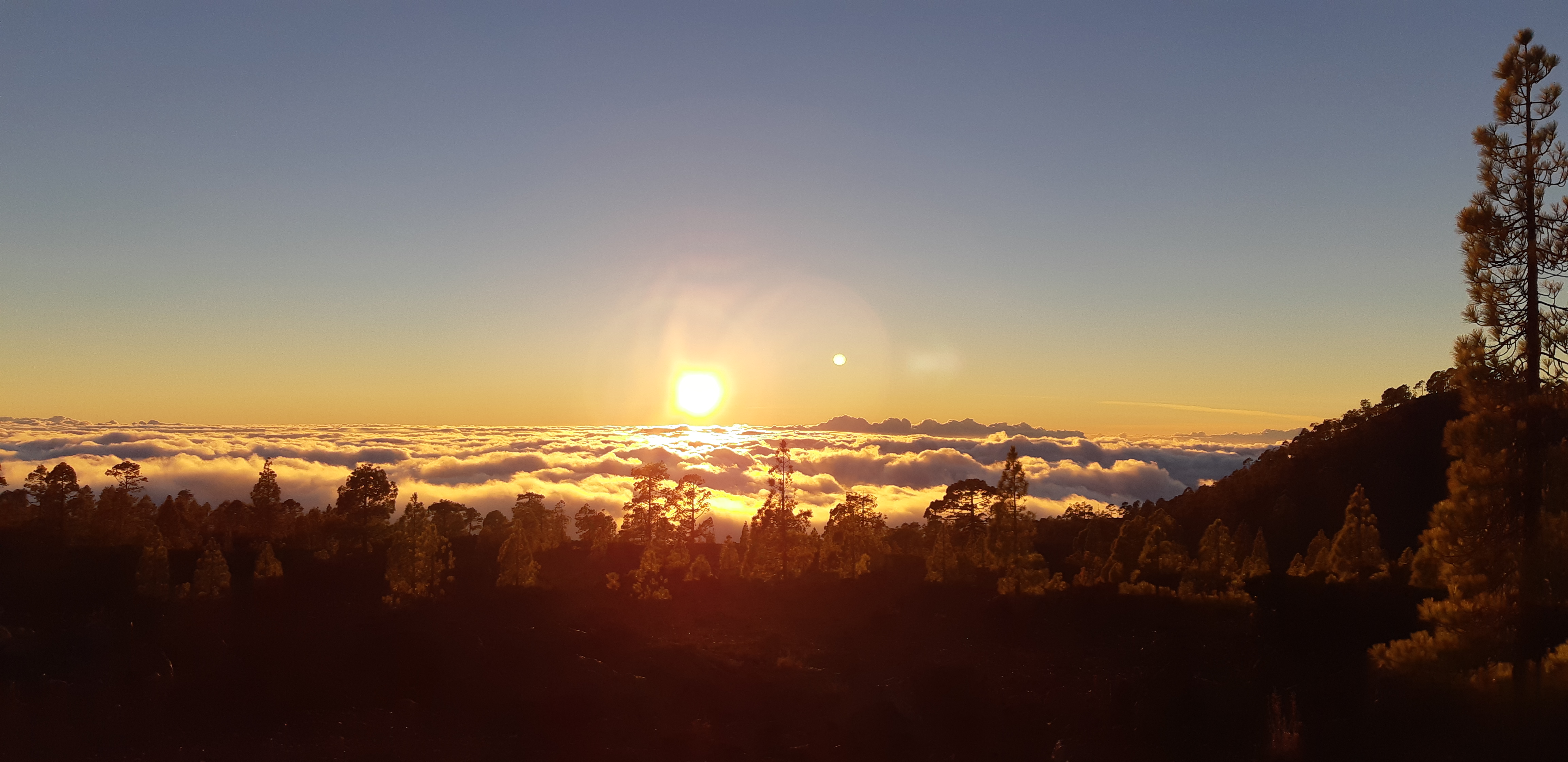
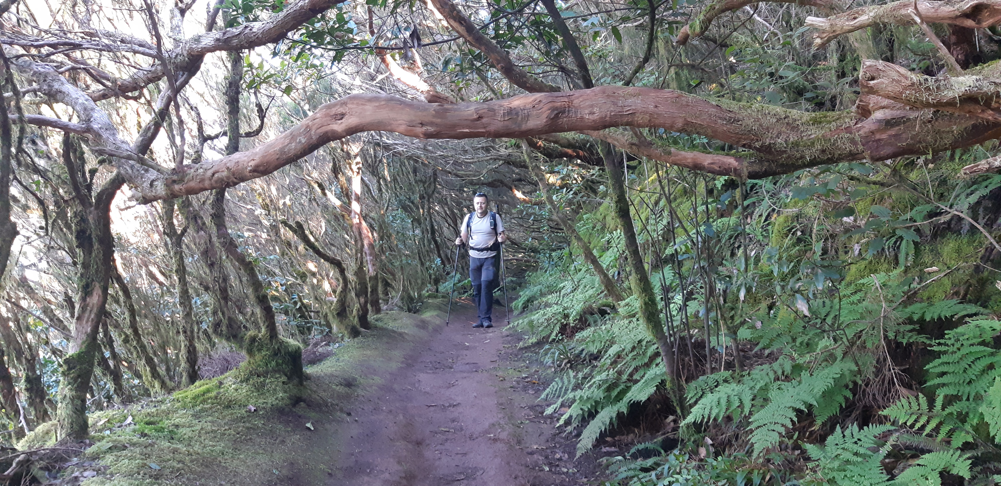
Typical Anaga forest. Great for hiking in the summer and magical in the autumn mist, but just don’try to leave the trail!

This was last of my six activations on this trip to Tenerife. Although already geocaching makes us “to boldly go where not many tourists have gone before”, SOTA provided another reason to veer off the beaten track, in one case quite literally. Thanks to all the chasers for the contact and especially my XYL for company, support and help!

6 Likes

congratulates
I recommend walking on picoTEIDE.
It is long but wonderfully scenic

5 Likes