Another OE visitor (Innsbruck)

Servus,

I’ll be staying in the Innsbruck area in the beginning of September. I got some hiking recommendations from a local and spent a night on bergfex.at, but it seems every hiking trail is as good as any other one. So, too much options to choose from.

To sort it out from the SOTA perspective, are there any recommended trails/summits or no-go areas? I don’t want to setup my station amongst hundreds of muggles and I’m not sure if a Flachlandtiroler like me can handle the difficult (high-rated) alpine trails.

And, any chances to qualify a summit on VHF during weekdays (preferably SSB)?

Ahoi
Pom

Hi Pom!
As a former local, I think I got a few tips for you :wink:
The summits around Innsbruck are, as far as I know, either not especially easy ones or have a cablecar and might be a bit crowded.

Summits I have visited and can recommend:
(Note that Tirol got two associations, TI and TL)

I am sure there are many more great summits but I did not activate a lot in Tirol yet. There are tracks on the SMP for most summits mentioned above.

VHF is not fun if you live down in between high mountains. There are usually very few VHF stations QRV in OE7, even in FM. Therefore I would not rely on VHF for the activations, especially not during the week. Anyway, you might find someone on the Patscherkofel 2m FM repeater OE7XTI (145.6125MHz -0,6) and get in touch with the locals. It is the most popular repeater in the Innsbruck region. The mobile calling frequency used is 145.500 FM as usual. I have not tried SSB there yet.

Have a great time in OE7 and good luck with your SOTA expeditions!
73 de Tom, OE9TKH

4 Likes

Hi Pom,

We are not from the Tyrol area but we did a very nice activation in June near Landeck.
Glanderspitze OE/TI-373 is a 10-pointer and requires only 360 m of ascent and 3 km from the top of Krahberg (Venetbahn). It’s an easy walk along the ridge with beautiful views into the surrounding mountains.

Good luck and enjoy the time in the Tyrol!

73, Sylvia OE5YYN

5 Likes

Hallo Pom,
es sind schon einige sehr lohnenswerte Ziele aufgeführt und ich möchte noch einige ergänzen:

Patscherkofel (mein Hausberg) OE/TI-358
Waldraster Jöchl OE/TI-505
Padauner Kogel OE/TI-642
Kragenjoch OE/TI-567
Reither Kogel OE/TI-669
Hohe Salve OE/TI-517
Nachtsöllberg OE/TL-024
Leitnerbeg OE/TI-332
Rosskopf OE/TI-538
Es sind Berge, die ich selbst gerne aktiviere und nicht schwer zu erreichen sind (zum Teil mit Aufstiegshilfe) und sonst zu Fuß, ohne dass man sich abquält.

Ich wünsche Dir einen schönen Aufenthalt in Tirol und erfolgreiche Aktivierungen.
Rudi OE7RDI

5 Likes

Hej Sylvia, Tom & Rudi,

thank you for all the information, highly appreciated! Several summits are mentioned in both lists, your SOTA recommendations and the local’s (who in fact is my YL’s lad Ulrike) advice. A good ground to start from to sort our hikes out.

requires only 360 m of ascent and 3 km

I can do that! Sounds like the scenery I’m used to. :wink:

There are some summits around that have similar ascends if you take the cable-car. I’ll activate some summits on my own when my YL’s gonna be on business and those ones are in the focus then. However, we’ll do some day trips together also and it seems there are several summits on the ridgeways.

VHF is not fun if you live down in between high mountains. There are usually very few VHF stations QRV in OE7, even in FM.

I don’t think I am willing to leave ‘my 5-Elli’ (144 MHz) at home but I got I better take the HF dipol with me. :wink:

Again, thanks for the information. Looking forward to activating this amazing scenery!

Ahoi
Pom

2 Likes

A quick update: Gschwandtkopf OE/TI-690 was a good training area, not very different from the summits at home, except I’ve never ascended on an Alm. Patscherkofel OE/TI-358 is an easy hike and was great fun. And so was the coffee at Rudi`s OE7RDI and meeting Holger OE7HPI there. Thank you for your hospitality! Saile OE/TI-285 was our first alpine adventure with amazing views. For tomorrow, Reither Spitze OE/TI-298 is on the plan. Let’s see from which summit I will appear on the band on Wednesday.

Ahoi
Pom & Ilse

3 Likes

OE/TI: Tyrol For Beginners

When comparing all the recommendations we got it soon turned out that a three kilometres hike with 400 m vertically are quite different from what we’re experienced. Hikr.org was another helpful source of tour reports but most of them either do not cross a SOTA summit or require a Klettersteig set (basic climbing gear) and skills. In addition, when arriving at the holiday home we were surprised to find free tickets for certain cable-cabs. Taking all this into consideration, we focused on four summits. Here we go!

OE/TI-690 Gschwandtkopf

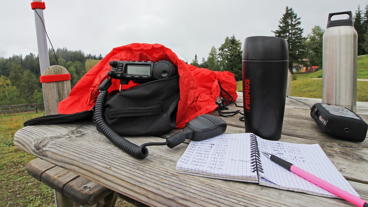
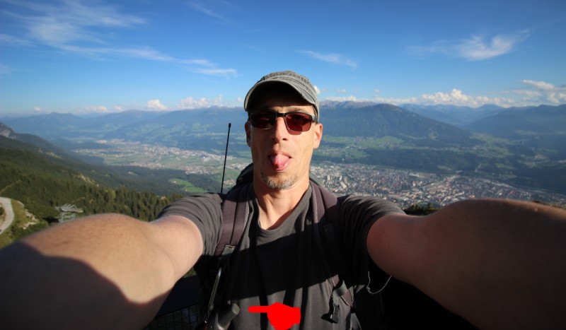
I started with one of Tom’s easy recommendations and parked the car in Seefeld at the Gschwandtkopf ski lift. A sign read ‘for ski lift passengers only’ which was good as I intended to go down by ski lift after the activation. But when I got to the summit I recognised two mechanics working on the summit station. All the way up I wondered why the lift stood still all the time and obviously maintenance was the reason. So I got free parking and saved 10 Euros for the ride. The mechanics had their radio on playing Johnny Cash, a good sound track for an activation. The weather was grey and cloudy but there were only two short and light showers. OE7FMH was my first chaser and in the qso it turned out that he had followed me on APRS and had waited for me to show up on the band, however he expected me on 2m.

40 m SSB: 16 QSOs, no s2s

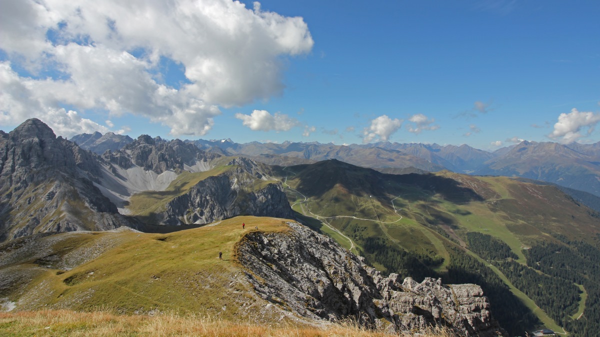
OE/TI-285 Nockspitze/Saile

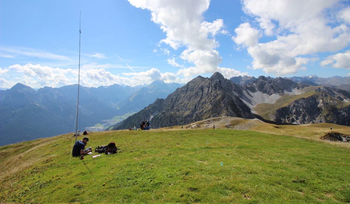
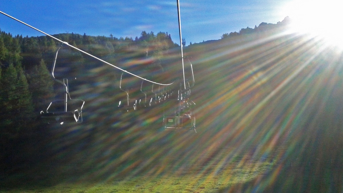
Or first hike in alpine terrain. Saile is a summit in Axamer Lizum, a popular skiing area. We took the Birgitzköpfl ski lift (free ride, yeah!) and already at the base station my set-up turned out not to perfectly fit to the Alps. With the FT-857D, the DX-wire ‘mini’ pole, antenna, battery, rain jacket, DSLR, water, milk, tea and a gas boiler, my rucksack was quite heavy and big. I didn’t had a clue how to get into the lift with it. The operator didn’t hesitate a second, took my rucksack, placed it in the gondola and told me to sit in the next one. First time I saw my radio station travelling ahead of me. When unloading my gear, the mountain station operator asked what was in the rucksack. A radio station, I said and he just shook his head.


Radio ahead!

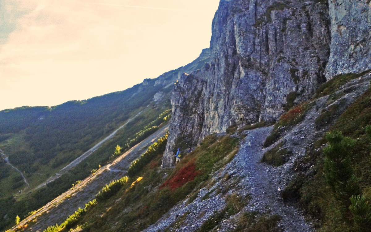
From the mountain station we took the northwestern route via Zwölferspitze. At first the trail was nice and easy but soon turned challenging and steep with a loose gravel surface. Several times I had to use my hands to climb.

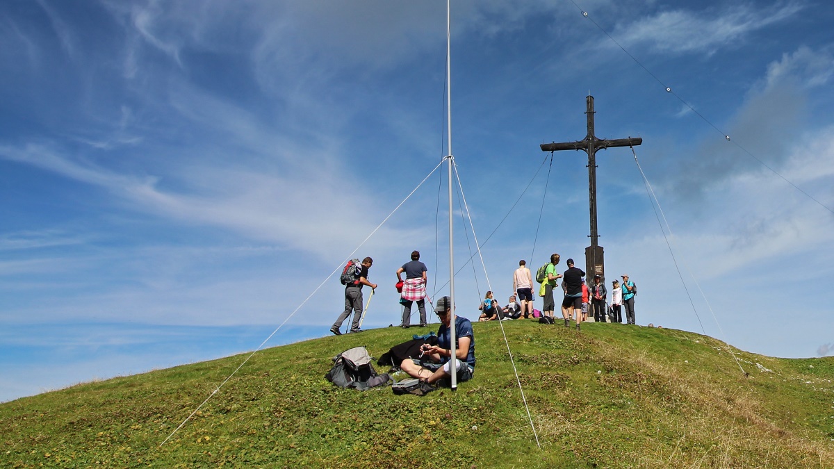
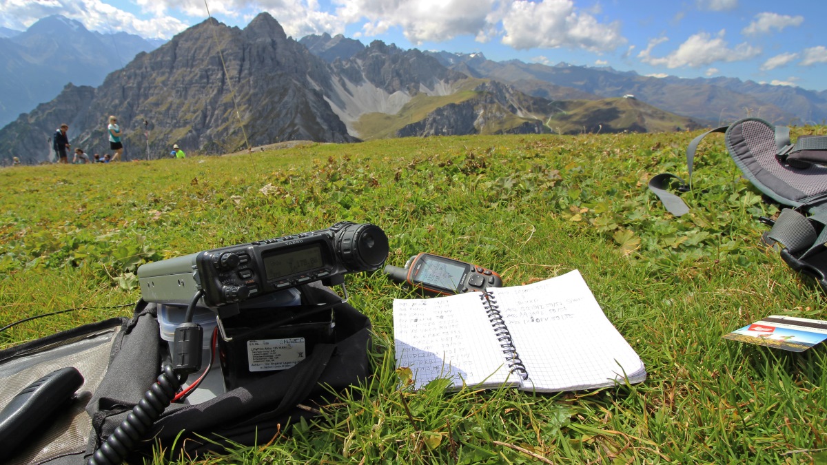
The summit has lots of space for a linked dipole and I built my shack some metres off the summit cross. Again, I used 40 m and after the first SOTA pile up I felt hungry and had a slice of bread before I wanted to change bands. I left the receiver on the the frequency and just before I finished my bread Mirko, DJ1AA called me. What a surprise! At home I often natter with Mirko on the local repeater. Seems, somehow the news spread that I was QRV. After some minutes of rag-chewing another familiar station from home showed up, Tom, DL9OBD/m. During the QSO with Tom the second round SOTA chasers gathered on the frequency and I ended the natters to work the chasers.

The weather was perfect with only a light and warm breeze and so we didn’t recognise that we spent much more time on the summit than planned. Initially, we wanted to hike past the Schneiderspitze to Hoadl and then to take the cable cab back to the valley. But we were a bit late and catching the last cab would have been quite a challenge. Instead we decided to take the short route back and had Apfelstrudel with cream at the Birgitzköpflhaus.


Ampferstein (left) and Hoadl (middle)


Again, radio ahead!

40m SSB: 25 QSOs
s2s: EA2DNO/p on EA1/CT-042, DL/IN3ADF/p on DL/MF-039

To be continued.

7 Likes

We ask for it! Fine business and beautiful pics, Pom!

73 Chris

Hi Pom

Thanks for your report – appetizing, waiting for your follow-up. :sunny:

I think it is better to have your backpack behind you than in front of you. If you plan to activate Brüggelekopf (OE/VB-505, near Bregenz) and take the chair lift from Alberschwende, they put the backpack on the next seat. This allows you to collect it by yourself. But imagine that such nostalgic chair lifts are only for people with plenty of time, hi.

Vy 73 de Markus, HB9DIZ

1 Like

Is this my rucksack, Markus? :face_with_monocle:
Deuter Gröden 35?
Where’s the GPS-thingy that used to be attached to the belt? :smile:

Ahoi
Pom

1 Like

Hi Pom

Nope, it’s mine! Deuter Futura 32. It’s made in Vietnam, so it’s red on the front side, but without the yellow star.

The thingy came to my life only later, but I really have one. The picture is from July 2017.

Vy 73 de Markus, HB9DIZ

1 Like

Unfortunately, the licence of this gem has not been renewed, so there is no chair lift at present to reach Brüggelekopf, and my rucksack can’t travel behind me any longer – désolé!

Vy 73 de Markus, HB9DIZ

I’m going to be in Innsbruck on holiday in August and am looking for similar tips. We’re staying just out of town near Hungerburg I think. We won’t have a car, so either walkable or easy bus. I’m happy to pay for a an easy ride up and hide in plain site amongst the muggles where necessary (KX2 + AX1 is reasonably discrete). The family might be up for a gentle stroll for one or two, otherwise I will be stealing a few hours away here and there to try and activate (and am reasonably fit). I’ve got no climbing skills or equipment and have never done / don’t fancy those via feratta things!

Also, recommendations for a paper map please.

1 Like

Hallo Tony,

There are some worthwhile destinations near Innsbruck that can be reached by bus or train.
OE/TI-358 Patscherkofel with direct connection to the cable car.
OE/TI-505 By train from Innsbruck to Matrei and from there by taxi about 3 km to Maria Waldrast. from there about 1 hour to the summit.
OE/TI-690 Gschwandtkopf can be reached from Innsbruck by train to Seefeld (very nice hiking area).
OE/TI-657 Brunschkopf also near Seefeld and
OE/TL-035 Hochmoos (a slightly further hike, but worthwhile).
DL/WS-058 Hoher Kranzberg, by train one stop to Seefeld further to Mittenwald and with the chairlift quite close to the summit.

Maps: Kompass Nr. 35 Innsbruck und Umgebung 1:50000, Freytag & Berndt WK 333 1:25000
Kompass.de/Wanderkarte Interaktive Onlinekarte !!

73,Rudi
OE7RDI

1 Like