First, the headlines:
- Shining Tor G/SP-004, Gun G/SP-013 and The Cloud G/SP-015 all activated in a single circular walk from my home QTH in Macclesfield.
- The three summits all activated on the same day - 14th August 2018 - with no vehicle support.
- Total of 71km walked - 91,000 steps.
- Walk completed - home QTH to home QTH, via 3 SOTA summits (5 activations), 2 overnight wild-camps and 3 pub stops - inside 48 hours.
- The traverse from Shining Tor G/SP-004 to Gun G/SP-013 is a classic walk.
- A full charge on my Yaesu FT70D is (just) enough for five activations.
- A full charge on my Petzl Activ headtorch is plenty enough for two nights of backpacking.
- A full charge on my Samsung S3 smartphone is wholly insufficient for 48 hours away from home!
And now, the news in detail:
Shining Tor G/SP-004, Gun G/SP-013 and The Cloud G/SP-015 are three of the four most activated SOTA summits in the world. They also happen to be my three local summits to me here in Macclesfield. “Treacle Town”, “Silk Town”, or plain old “Macc” also has a decent claim to being the centre of the SOTA universe. Aside from being in the vicinity of these three hugely popular summits, it is the home of one of SOTA’s founders, two former and one current MT, and the G Association Manager.
Since acquiring a decent-enough backpacking tent (Karrimor Ultralite) a few years ago, I kept wondering about an ambitious attempt to activate these three local summits, without use of a vehicle. The idea being to start, and finish at my home QTH on the west side of Macclesfield (near Broken Cross), visit and activate each summit, and wild-camp as necessary.
Monday 13th August 2018 - Shining Tor G/SP-004
I finally got around to putting the plan into action on a Monday afternoon, with a fairly sudden decision to go for it, secure the domestic pass-out and prepare kit. As such, I was a little later setting off than I would have preferred - 6.30pm - but this at least allowed me to enjoy dinner with the family first.
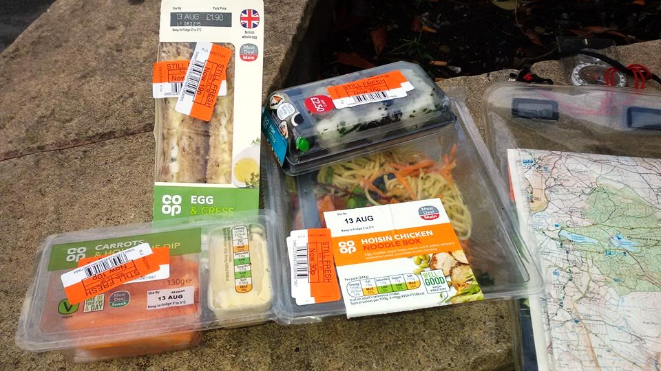
The initial walk was down Merebrook Road (where I live) and onto Chester Road to walk into town. Cumberland Street, Hibel Road and onto Hurdsfield Road accounted for the first couple of miles of my trek, and here I went into the Co-op to get some provisions. In the reduced to clear section, everything was marked down to 10% of original price. I was able to get a chicken hoisin noodle box, carrot sticks with humous, sushi and egg butties - for a total price of 74p. I loaded this into the rucksack and resumed my walk up Hurdsfield Road, into Higher Hurdsfield and then Rainow.
On Tower Hill in Rainow, I turned right on the Gritstone Trail and walked up to the dam at Lamaload Reservoir. Once at the top of the dam, I continued around the back of the wood, and onto a short section of country lane. It was now getting dim, and darkness would not be long. I was mindful that my headtorch needed to last for two nights out, so I switched it onto the lowest setting (I normally use it on the middle setting).
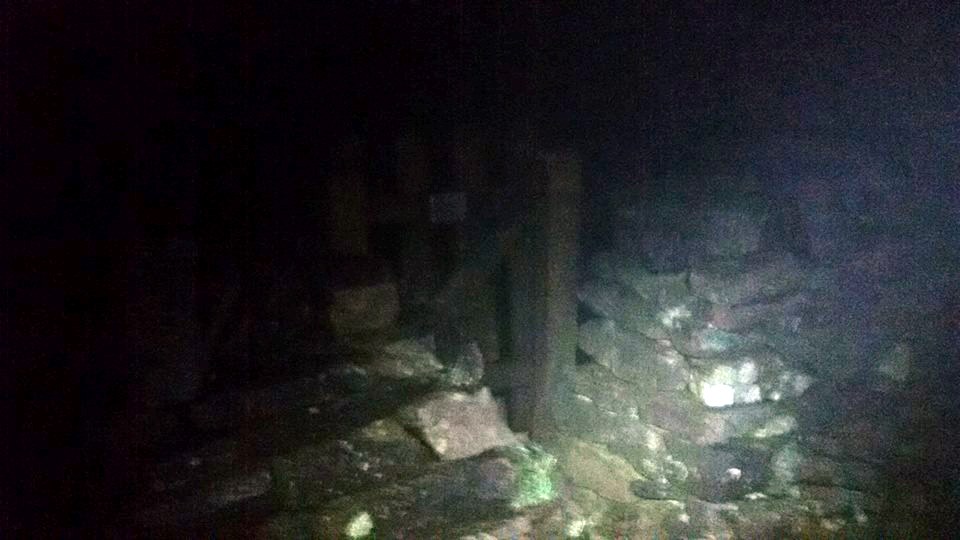
I reached the sign saying “Footpath to Burbage via Shining Tor” and struck out again into the moorland. The initial section was easy enough, as the path was clearly defined and followed the edge of a small forested area. After that though, navigation became a lot more challenging. It was now dark, very foggy - 2m visibility in all directions, and the path on the ground was very indistinct. I concentrated hard on following what appeared to be a very faint line on the ground, while trying to keep the pace up - I wanted to be on summit in time to activate in the current UTC day, and establish camp as soon as possible.

I’d only done this route once before, and that was as a descent - in broad daylight and excellent visibility. This couldn’t be more different. It was pretty unnerving when the terrain seemed to flatten out, and then gently descend for what seemed like a long time. The path on the ground still seemed to be there though - at times - and the compass was indicating that the direction was correct - although there was no way whatsoever of using it to pinpoint my location. I did not want to consult GPS on my phone as I was keeping it switched off most of the time, trying to conserve its charge for photos.

You can only imagine how delighted I was when the path started to ascend, with the wind picking up accordingly. I don’t think I’ve ever been so pleased to be climbing a steep hill! I must have been euphoric, because I remember this section as being quite a lengthy and relentless slope, but I was soon on the paved section on the ridge to the summit, and it came as a (very welcome) surprise to me.

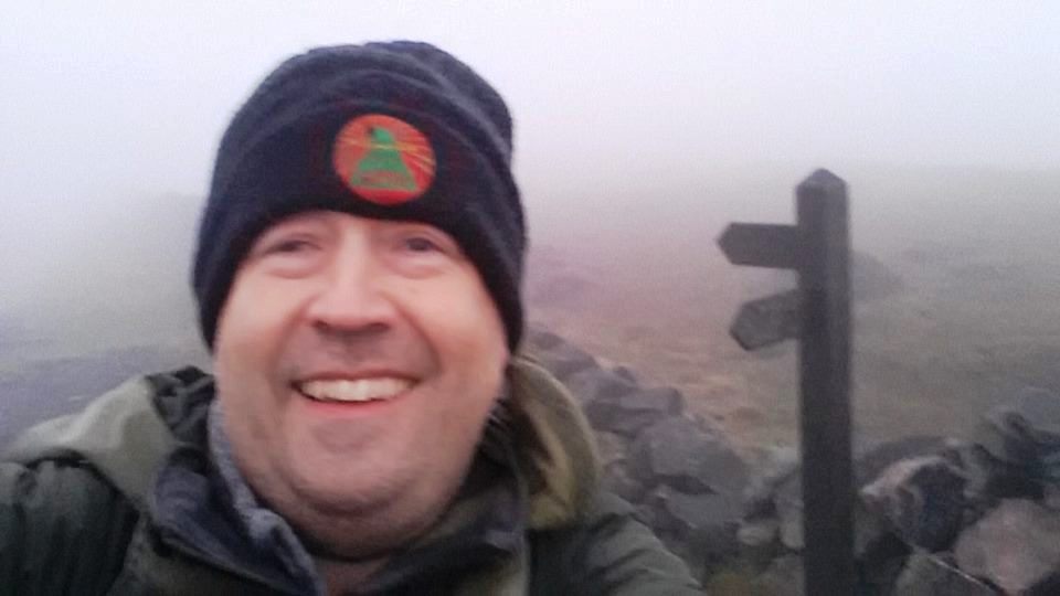
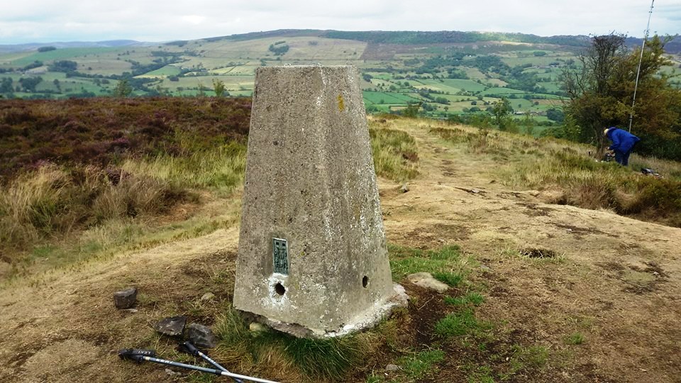
Seemingly seconds later, there was the trig point on the other side of the wall, and the famous wooden bench in the wall corner. Again, this came quicker than I was expecting - though I certainly wasn’t complaining. Good grief, I’d just walked from home to Shining Tor summit - in an evening! According to my Fitbit watch, I had covered 18,000 steps and 14km.
I decided to activate first, and then pitch the tent afterwards. The hour was late, but activity was good. Between 2215 and 2227 UTC, I made 7 QSOs on 2m FM with the handheld and rubber duck. (I’d decided to keep the radio side of things as lightweight as possible).
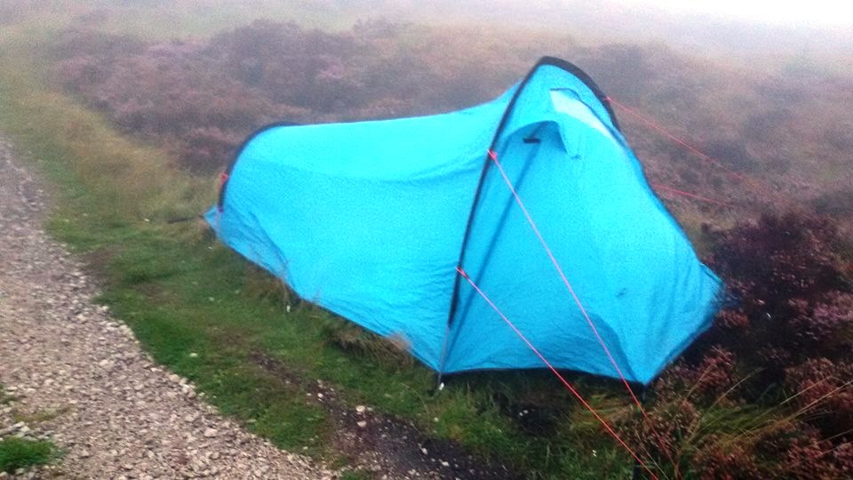
Next job was to sort my accommodation for the night. I dropped down the path in the Cat & Fiddle direction, checking areas either side for suitability. Careful prodding with the trekking poles was necessary to identify deep bogs, of which there were several! I found a patch of fairly level grass to the side of the path, just about big enough, and pitched the tent there. It would have been still within the AZ, though I didn’t do any operating from that position.
After setting out my rollmat and sleeping bag, I was pretty hungry so went to finish my supper. To my horror, I found the that chicken hoisin noodle box had burst, with the contents all over the bottom of my rucksack. It wasn’t going to waste though - I carefully used the supplied plastic fork to eat the good bits not in contact with the dirty wet panels of the rucksack. Well I tried - I did experience a few “gritty” bits in my mouth - and I hoped to be feeling well in the morning, otherwise it would be “Game Over”. I ate the rest of the items from the Co-op, except the carrot sticks with humous which I saved for breakfast, together with same Belvita breakfast biscuits I’d bought from home.
I didn’t manage to get off to sleep too well. I was reasonably sheltered from the westerly wind and comfortable on a very grassy area. I reckon I nodded off around 2am.
Tuesday 14th August 2018 - Shining Tor G/SP-004
At 5.30am I was awake. It was just getting light. 3.5 hours sleep is 50% of my usual quota, but I decided to take the positive view that in backpacking terms, 3.5 hours was still “money in the bank”, so to speak. What I did notice, to my horror, was that all my clothes were wet. Most of them I had packed into a large drybag and used as a pillow, with other items left out draped over my rucksack, or hanging from a clip in my tent, for more of an airing. Anyway, the stuff in the drybag fared slightly better overnight, and was merely unpleasantly damp in the morning. The stuff left out for airing was unpleasantly wet. The good news was that I didn’t have a tummy ache from the noodle disaster!
What to do then? Well, I noticed that inside my sleeping bag, I was feeling very pleasantly warm and dry. So I chucked all my damp and wet clothes inside of the sleeping bag with me, jiggled about a bit and hoped that my body heat might do the trick. This seemed to help and take the edge off the dampness, though it also took the edge off my comfort as you can imagine! After ten minutes of this, I decided to put most of the clothes on, and continue lying in the sleeping bag. Another ten minutes later, things were feeling bearable. Something in my instinctive plan seemed to work!

I had some breakfast then put on my boots and coat, grabbed my handheld, pencil and notepad, and wandered back up to the summit. I called CQ SOTA at 0456z, and amazingly, I’d got four contacts by 0504z! How cool is that?
I returned to pack up the tent, and set off down to the Cat & Fiddle on the very familiar route. I was hoping to see a “reopening soon” sign at the pub, but alas, no joy. I crossed over the A537 Buxton to Macclesfield road and continued over the moor. I had never walked this path before. It was nothing spectacular, but a good path over moorland, and some very sleepy grouse that only pressed the “ejector seat button” from their heather when I was very close!
As I descended towards the A54, I could see several portacabins, diggers, dumper trucks, railings, workmen on radios, workmen with surveying equipment, workmen with flasks etc. Turned out this Buxton to Congleton road was closed due to subsidence, and this was the work to fix it.
Not only the road was closed, but also the entire length of FP21 which starts and finishes on the A54 and is just a few hundred yards in length. Of more concern was the notice that the first 30 yards of FP3 was closed - between the road, and where it crosses FP21. I needed that to get to where I was going - but I could see that in reality, on the ground, only the southern half of FP21 was blocked with barriers. I asked one of the workmen if it was OK for me to enter FP3 and continue along it - and he said that was fine - it was just the barriered-off section off FP21 directly beneath the subsidence that was out-of-bounds.
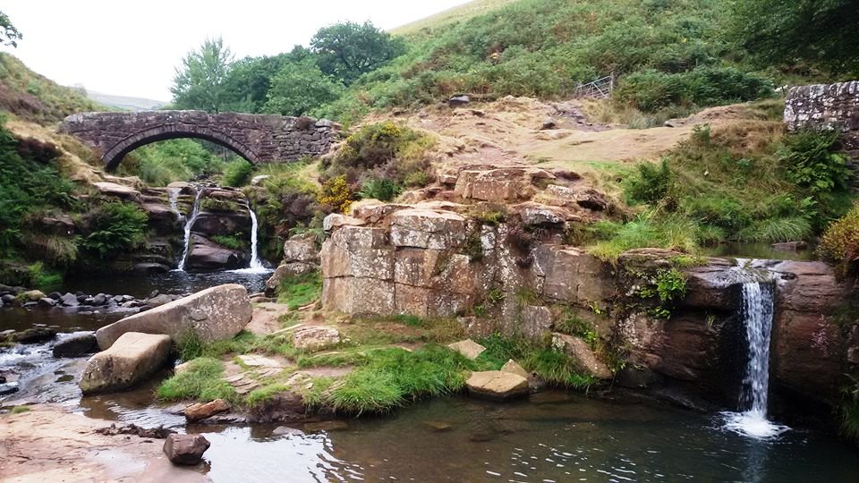
This was a super path, curling around through a narrow valley, and I really enjoyed it. This eventually reached Three Shires Head, so called because it is the point at which Cheshire, Derbyshire and Staffordshire meet. To my shame, I had never been here before, but it is such a beautiful spot, and great walk, that I’ll be back soon enough.
I was getting a little concerned that I was out of food, and there seemed to be little prospect of shops or pubs en route! The next settlement to pass through would be Gradbach though, and I knew there was a youth hostel there. I had my membership card on me, so perhaps they would sell me some chocolate and crisps from reception?
Turned out that this had not been a YHA for a number of years. However, it is now Gradbach Mill, a restaurant, cafe and accommodation provider. It was now 10am, but it didn’t open until 11am. I chatted to the very pleasant staff present, and they kindly said they’d open the cafe half-an-hour early for me at 10.30am. That was fine, I was ready for a break.
When the cafe did open, I ordered a Cumberland sausage and cheese baguette, and a bottle of Wincle Rambler ale! Yes, at 10.30am. And it went down an absolute treat. And possibly went straight to my head, for the next part of my walking day was disastrous.
Tuesday 14th August 2018 - Gun G/SP-013
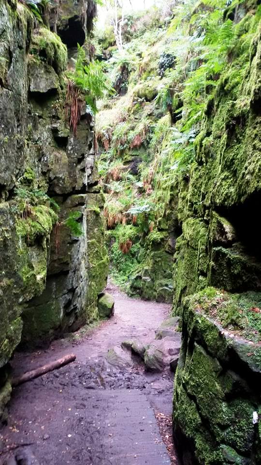
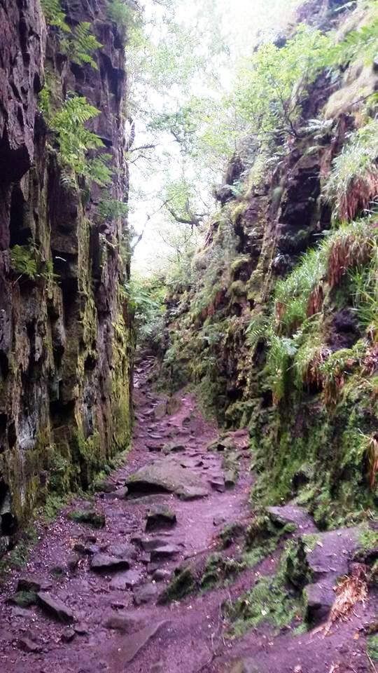
I was heading for - or intending to head for - Lud’s Church, a deep rock chasm close to The Roaches - somewhere else on my doorstep I’d never been. I followed the signs out of the former YHA grounds then got to a left-or-right T-junction - with no sign. I consulted my OS map carefully, and went left. Fail.
This took me onto increasingly vague paths on a steep wooded section. The slope of the hill seemed to be facing the wrong way to what I had anticipated. I couldn’t work out what had happened. The more I continued, the worse the route got. I should have turned back. Stupidly, I didn’t.
Next thing I had attracted a huge swarm of flies. I needed to escape them - and quickly. Well quickly was not an option bushwhacking through thick ferns that were as tall as me. I could see that the top of the wooded section was close by above, but I would have to force my way through these ferns to get there. (And yes Jimmy M0HGY, it was considerably worse than Gamallt GW/NW-065). I was nearly at the top, but for a high barbed wire fence. Off came the coat and fleece to provide some cushioning, and over I was with only two cuts.
I now had no idea where I was, so I picked up a sort of path and exited the field. I found a road and followed this, which took me into the scout camp at Gradbach. I’d been here many years earlier when Liam was at a cub camp there. I hoped to find some staff to talk to, but none were about. I had noticed an adult leading a group of children out of the camp on a lower path a few minutes earlier. I decided to avail myself of the washroom at the scout camp to wash my hands - especially my right hand which had got cut on the barbed wire fence - then went for a look on the information boards.
It seemed like the path I had seen the group leave the camp on, was the path to Lud’s Church, so I followed in their footsteps. Before long I was at the same T-junction I was at two hours earlier! This time, there were other walkers there. “Which way is Lud’s Church?” I asked. “That way” they replied, pointing right. I had gone left before. Doh!
Just 20 metres later, there was a signpost for Lud’s Church, pointing along a good path. Doh! This feature was slightly off route for me, but I was determined to see it, especially after the trauma of the previous two hours. I didn’t explore all of it, but will return soon enough for a proper look around.

From here, I was shortly onto the last part of a favourite ridge of mine, from The Roaches down to Danebridge. Shortly after the Hanging Stone though, I turned off south towards Swythamley. Swythamley Hall and Swythamley Park is all very very private, and the signs tell you very clearly at every gate that it is very very private, and that there are no public footpaths within it! Somewhat frustratingly, you have to walk around three sides of its perimeter to Swythamley Chapel - a beautiful little church - but also marked as very very private.
I followed the public footpaths down to Turner’s Pool and then beyond up to Old Hag. Another navigation error here caused me to notice unfamiliar and unexpected terrain - but this time, learning from earlier, I took decisive action to retreat and regroup. I was soon back on the right course.
Soon enough I was back on familiar territory, and the approach up Gun G/SP-013 from the back road. As I passed by the wood on my right, I could see a couple of very large masts on the summit ahead of me. As I got closer, I could see that whoever the activator was, was having trouble with what looked like either a linked or trapped dipole antenna, which was collapsing. The other antenna was the unmistakable “Mighty Antron”, so I knew it must be Mickey 2E0YYY.
Mike came up to the trig point to say hello when I arrived, and I told him I’d actually walked here from Shining Tor. I decided to grab a quick activation on the handheld while Mike was sorting out his antennas, out of respect for his more substantial activation and the fact he was there first. Three minutes operating was sufficient to get four QSOs in the logbook. Pete 2E0LKC asked me to pass his regards onto Mike, which I duly did just as I left the summit.
I now had a plan for food. The fairly recently reopened Royal Oak at Rushton Spencer is excellent for food, as well as real ale. I figured I could be down there from Gun in little more than an hour, so got into my stride. This was mainly road walking, and a bit boring and tedious, though there was a public footpath to cut the corner right at the end.
I asked in the pub if they had a Samsung charger to get some life back into my phone - but they were all iPhone people there! They did top my bladder up though, and allowed me to call Marianne and leave a message using their landline.
The food was superb. I started with the creamy garlic mushrooms, followed by the steak & Guinness pie with twice-cooked chips and mixed veg. All this washed down by two pints of real ale, one of which was from the local Wincle microbrewery. I rested for a good hour and a half at the Royal Oak, but then eventually, and somewhat reluctantly got to my feet for the next leg of the day’s epic hike.
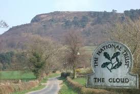
Tuesday 14th August 2018 - The Cloud G/SP-015
The idea was to follow the Gritstone Trail from Rushton Spencer up to the summit, although I wasn’t looking forward to a gruelling steep uphill slog on one particular section. Over the main A523 Leek to Macclesfield road, I crossed a stile and walked over to another I could see across the field. I was surprised not to see any Gritstone Trail waymarkers. That’s because it wasn’t the Gritstone Trail! In a mistake that dejavu tells me I have made before, I ended up in an industrial yard - but I could walk out of that and onto the narrow lanes on the eastern flanks of The Cloud.
I now realised I had gone wrong, but decided to make the best of it by approaching Cloudside using the snaking zigzagging lanes. This would add a lot more distance to the walk, but the gradients involved would be significantly eased. This seemed to be a long walk, so I was pleased to eventually make the turning at Woodhouse Green, then the Cloudside Shooting Club. I was soon on those all-too-familiar steps.
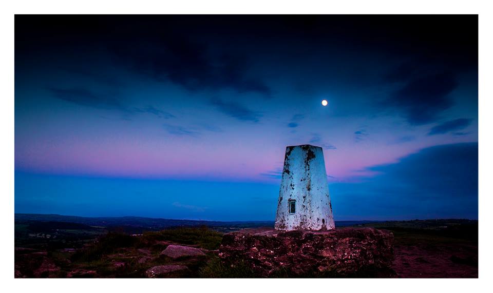
The pain eased as I homed in on “my” summit. In the reverse of 22 hours earlier, I chose to pitch the tent first, and then activate. I chose a spot fairly close to the summit, near the cliff edge. It was pretty windy, but I couldn’t be mithered hunting round for a better spot. Some lads walked up and asked if I wanted a hand. I readily accepted, and the tent was up in no time.
I set out my sleepmat and sleeping bag, and put my rucksack inside the tent. I was pleased that my headtorch still seemed to have plenty of life in it - it just needed to last a quick activation and get me back to my tent, then it wouldn’t be needed again. I took my blood pressure pills in case I forgot later, grabbed my handheld and logbook, and walked across to the trig point.
I operated for 13 minutes - 2055 to 2108z - and made 7 QSOs on 2m FM. I couldn’t wait to get into my sleeping bag. This time, I stuffed every item of my clothing into the drybag, to be placed under the hood of my sleeping bag and used as a pillow. I was confident that I would sleep well after 47,000 steps and 37km of walking in the day. I was right.
Wednesday 15th August 2018 - The Cloud G/SP-015
I awoke to bright sunlight. What time was it? I checked my watch - and it was 8.30am! I had slept, like a baby, in a backpacking tent on hard ground through a windy night - for over ten hours! I was chuffed with that - though it did add a little pressure on me to complete my circuit in under 48 hours, which I had been thinking about more and more! I was also well chuffed to find that all my clothes in the drybag were bone dry. This time, I got completely packed up before going on the radio.
Would the handheld last another activation? It was now showing depleted battery on RX, and low battery on TX. Anyway, there were no issues, and ten QSOs were completed on 2m FM in a leisurely rag-chewy half hour. I was particularly grateful to Greg M0NZO who had been spotting me - I couldn’t self-spot as my phone was out of charge, plus the spots were now the only communication I had for updating the family as to my progress!
I was now heading for the Macc Canal, but I went a long way round by descending on the Gritstone Trail towards Timbersbrook, then along the road to the north of the summit to walk down by the farms to the A54. I joined the canal here for a long walk around the towpath back to Macclesfield.
Again, I had the issue of food. I’d bought a couple of Mars bars from the Royal Oak, but these were now gone. I didn’t want to go as far out of my way as Bosley village, but with the Fool’s Nook Inn being long shut down, I might have to make it all the way to the outskirts of Macc for my next grub.
There was still a little climbing to do - up the flight of 12 locks at Bosley. At the top of these, is a boaters’ services - waste disposal, water, shower, toilet etc. A staff member from the Canals and Rivers Trust was there, so I first asked him if I could top my bladder up - no problem. I then chanced my luck and asked if he’d any food he could sell me. He replied that he wouldn’t sell me anything, but that I was welcome to have the rest of his lunch that he didn’t want - two cans of fish and two satsumas!
This was a fine result. One was Asda mackerel fillets in tomato and basil sauce, the other John West peppered mackerel fillets. Both were delicious, particularly the latter, which I may be deliberately sourcing for summit grub in the future. The satsumas were welcome refreshment too, and I got going again with a spring in my stride.
As much as I like walking across the NNR at Danes Moss, it is a bit of a long way round to home, and I always seem to upset the cows in one particular field that the PROW runs through. Instead I continued further up the canal and turned left onto a public footpath. On the map, this loops round and rejoins the canal, but local childhood knowledge, rather vaguely recollected, informed me there was a route through to the playing fields on Danes Moss, on the Congleton road.
Danes Moss is in three sections. To the south there is the NNR previously mentioned. I’ve seen lizards here. In the middle there is the council tip - er I mean recycling and waste management centre, while to the north there is some unused land, perpetually earmarked for retail, cinema, sport etc - though nothing ever happens.
I tried to remember my route through here from my teenage days. At one point, the route forked. Left or right was the choice. Guess what? I chose left again. Guess what? I was wrong again. I had to plough through some dense vegetation to get onto the playing fields. At the other side of the field I saw a lady walking her dog into the part from which the good path probably emerged!
As I reached Congleton Road, I wondered how far to the left of me the Rising Sun (known locally as the Tip Inn) pub was. 100 yards - too far for me! I continued over into the housing estate, and worked my way onto Penningtons Lane. This is a normal residential road at this point, but becomes a rough byway later on. I was nearly home.
Right onto Gawsworth Road, right onto Earlsway, and down to the shops. Here I found the first actual working public telephone on my entire walk. I found some phone boxes, but they were either empty shells with everything stripped out from inside, or the telephone had been replaced by a defibrillator. I called Jimmy M0HGY and invited him to the Weston for a pint. He readily accepted and walked up from home to join his tired dad. We downed a couple of pints of Robbie’s Unicorn ale, shot a couple of games of pool, then walked, or in my case hobbled, home.
The day’s walk was recorded as 25,360 steps, or 20km.
Thanks to all the stations that worked me one or more times:
2E0KHI
2E0LKC (2)
2E0LMD (2)
2E0YJL/M
2W0JYN
G0KNK
G0OHY (2)
G0RRX
G0UNJ
G4NTY
G4TGQ
G4UCT
M0JDK (2)
M0NZO (3)
M3HJH
M3JIV
M3LWP/M
M3TRC
M6GOX/M
M6KCI
M6LQZ/M
M6MDB
MW0ISC
MW6ISV
MW0UPH/M
MW6SHJ
Marianne had made a fabulous tea of chicken wrapped in bacon, served with roasted vegetables and salsa sauce. This was very welcome, and went down a treat, as did two big mugs of tea brewed up by Jimmy.
There you go then. I did it. Will I ever do it again? Maybe. Maybe not.
The challenge is set though. The Non-Official SOTA Cheshire* 3 Peaks Challenge.
*G/SP-004 is on the Cheshire-Derbyshire border, G/SP-013 is wholly in Staffordshire, G/SP-015 is on the Cheshire-Staffordshire border, but the vast majority of the circular route is in Cheshire.
- Must begin and end at a residential property in Macclesfield, west of the River Bollin.
- Must include qualifying activations of G/SP-004, G/SP-013 & G/SP-015.
- All travel must be on foot.
- Must be completed inside 48 hours (this is easy if you are reasonably fit, and don’t waste time by getting lost or lounging around in pubs).
- Logs must be submitted to the SOTA Database (probably rules G3CWI out).
Don’t all rush at once…